 Block
Greenwich, Connecticut
36 topographic sheets cover this place, the earliest surveyed in 1892 and the latest in 1986. It stands in Greenwich town. It lies in ZIP code area 06830. It stands on Horseneck Brook. The Survey maps it on the Glenville quadrangle. 63,518 people lived here at the 2020 count.
On record in Greenwich
Buildings and businesses the archive holds for this place. Each opens its own page, with the source record it came from.
On the National Register 12 of 34 shown
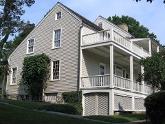 Bush-Holley HouseNational Historic Landmark · listed 1988
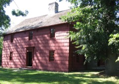 Knapp TavernNational Historic Landmark · listed 1977
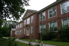 Byram Schoollisted 1990
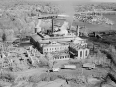 Cos Cob Power Stationlisted 1990
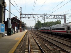 Cos Cob Railroad Stationlisted 1989
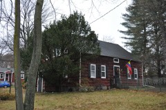 Samuel Ferris Houselisted 1989
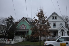 Fourth Ward Historic Districtlisted 2000
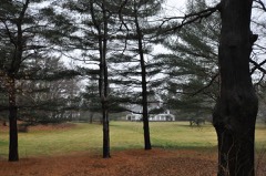 French Farmlisted 1975
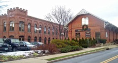 Glenville Historic Districtlisted 2007
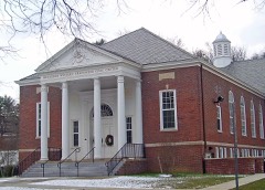 Glenville Schoollisted 2003
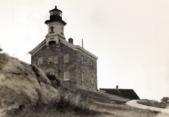 Great Captain Island Lighthouselisted 1991
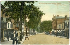 Greenwich Avenue Historic Districtlisted 1989
Topographic sheets covering this place
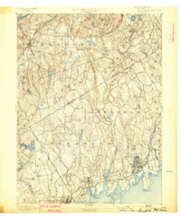
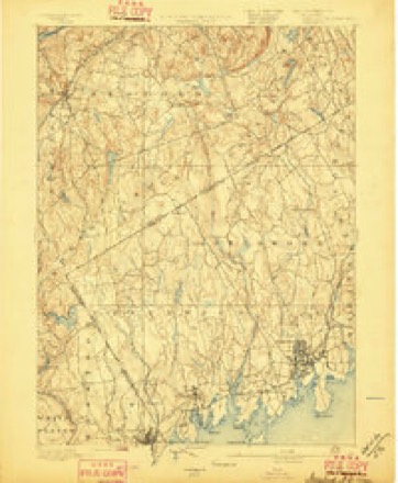
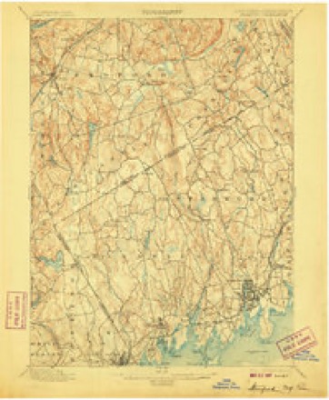
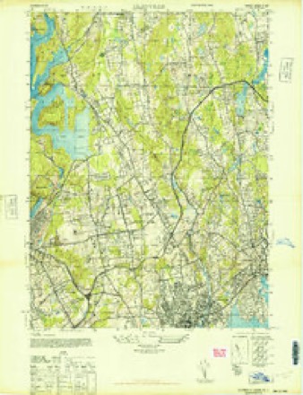
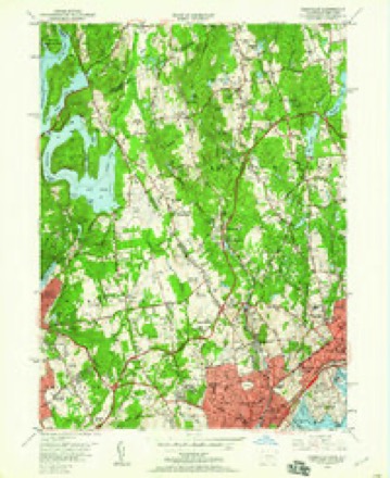
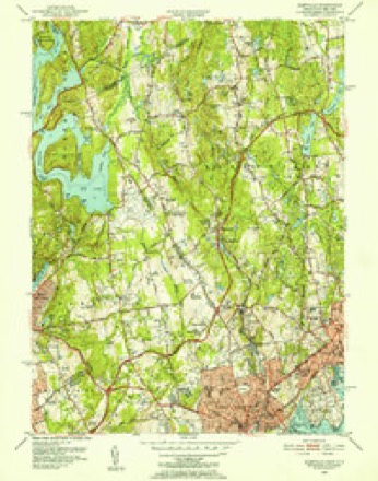
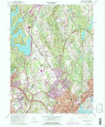
13 surveys from 36 printed sheetsMatched by testing this settlement's coordinate against the published boundary of every sheet in the United States Geological Survey's historical collection. Each opens the scanned sheet at the Survey.
- 1892 USGS Stamford quadrangle1:62500
- 1893 USGS Stamford quadrangle1:62500
- 1899 USGS Stamford quadrangle1:62500, 13 printings
- 1944 USGS Glenville quadrangle1:24000
- 1947 USGS Hartford quadrangle1:250000, 2 printings
- 1948 USGS Hartford quadrangle1:250000, 2 printings
- 1951 USGS Glenville quadrangle1:24000, 2 printings
- 1951 USGS Glenville quadrangle1:31680
- 1960 USGS Glenville quadrangle1:24000, 4 printings
- 1961 USGS Hartford quadrangle1:250000
- 1962 USGS Hartford quadrangle1:250000, 3 printings
- 1965 USGS Hartford quadrangle1:250000, 2 printings
- 1986 USGS Bridgeport quadrangle1:100000, 3 printings






What happened here
An account from the chapter on Greenwich town. The inset identifies its exact source book and publication year.
Green
For five or six years after the first settlement (1640 -46) the people of Greenwich had much trouble with their Indian neighbors, the indirect cause being rum, - "cussed fire-water," as the savage-! called it, - bought of the Dutch at New York. To begin with (1642), some Dutch traders, a drunken Indian, cheating in a bargain for furs, and a murdered Indian, all near New York.
In the county-history sources
24,517 words on this townshipHistory of Fairfield County, Connecticut : with Illustrations and Biographical Sketches of Its Prominent Men and Pioneers, published 1881 names this settlement in its chapter on Greenwich Town. These are the passages that mention it, exactly as the scans read.
This town lies in the southwest corner of the county, and is bounded as follows : On the north by Westchester Co., N. Y. ; on the east by the town of Stamford ; on the south by Long Island Sound ; and on the west by Westchester Co., N. Y. The surface of Greenwich is hilly, and the soil is very fertile.
Passage source: History of Fairfield County, Connecticut : with Illustrations and Biographical Sketches of Its Prominent Men and Pioneers, published 1881.
Greenwich at that time being under the jurisdiction of New York, the settlers called on the Dutch Governor, Keift, for help. Accordingly (January, 1644) one hundred and twenty men, in three vessels, were sent to Greenwich, where their commander was informed by Capt. Patrick of a large encampment of the enemy a short distance inland. It was nearly night, but, desiring to surprise the Indians, the Dutch at once set off", and marched all night in a mistaken direction without finding the object of their pursuit. Next day the Dutch captain met Patrick ; accused him of treachery and of purposely giving false information, and finally gave him the lie direct. The al- tercation rciultcl in Patrick'H deatli. The I>iit<-li force Hf)0.'i r(;turned to New York, liaving t-uccceded only in surjjrising a small Indian village, killing eighteen or twenty jnen, and taking a few women and children prisoners.
Passage source: History of Fairfield County, Connecticut : with Illustrations and Biographical Sketches of Its Prominent Men and Pioneers, published 1881.
Soion after, receiving fresh news of a great body of savages at Greenwich, Governor Keift (February, 1644) dispatched a second expedition in fjue<t of them. The force consisted of one hundred and thirty men, under command of Capt. John Underliill, who reached Stamford in the evening and in a heavy snowstorm, which detained him there all night. Next day he made a slow march through two feet or more of snow, and about eiglit o'clock in the evening reached the Mianus liiver, wliere he rested two hours till the moon rose. Crossing the river at, or not far aliove, the j)resent village of Mianus, and ascending the high western bank not far north of the present main road between Greenwich and Stamford, he had in front of him "Strickland's Plain," lying to the north and northwest of the present village of Cascob. On the western border of this plain, half a mile distant, he could see the lights of the " long-sought-for Petuipia- 25acn," - a village containing " more than a hundred permanent huts," partially protected by palisades, with numerous outside wigwams, the whole village lying under a low wooded rise of ground, which sheltered it from the northwest winds. The savage ' had warning of the approach of their enemies, and were prepared to give them a warm reception. Only the warriors held the village, the women and children having been sent to a place of safety.
Passage source: History of Fairfield County, Connecticut : with Illustrations and Biographical Sketches of Its Prominent Men and Pioneers, published 1881.
Machine-read from a century-old scan, so expect the errors a machine makes: misspelled names, dropped words, stray characters.
Read the whole chapter on Greenwich Town - it names this place 61 more 61 times.
Fires near this place
150 since 2000Regional context, not property-specific evidence. The federal wildfire occurrence database lists 150 fires within 5 miles of Greenwich between 2000 and 2020, burning about 94 acres in total. 7 started naturally. 17 were recorded as arson. Distance is straight-line from the map coordinates, so a fire counted here may appear on a neighbouring settlement's page as well.
| Reported cause | Fires |
|---|---|
| Missing data/not specified/undetermined | 93 |
| Arson/incendiarism | 17 |
| Recreation and ceremony | 12 |
| Smoking | 8 |
| Natural | 7 |
| Debris and open burning | 6 |
| Equipment and vehicle use | 3 |
| Misuse of fire by a minor | 3 |
| Power generation/transmission/distribution | 1 |
The most recent of them, most recent first, with the day each was reported and the service that recorded it.
| Date | Cause | Size | Reported by | Name on the report |
|---|---|---|---|---|
| 8 September 2010 | Missing data/not specified/undetermined | under an acre | Fire Department of New York | not named |
| 8 September 2005 | Arson/incendiarism | under an acre | Fire Department of New York | not named |
| 7 September 2005 | Missing data/not specified/undetermined | under an acre | Fire Department of New York | not named |
| 3 September 2008 | Debris and open burning | under an acre | Fire Department of New York | not named |
| 26 September 2016 | Equipment and vehicle use | under an acre | Fire Department of New York | N/A |
| 20 September 2009 | Missing data/not specified/undetermined | under an acre | Fire Department of New York | not named |
| 19 September 2015 | Missing data/not specified/undetermined | under an acre | Fire Department of New York | N/A |
| 18 September 2007 | Missing data/not specified/undetermined | under an acre | Fire Department of New York | not named |
Settlements close enough to share some of these fires:
Mines and quarries near this place
9 within 5 milesRegional context, not property-specific evidence. The federal mineral resources record lists 9 workings within 5 miles of Greenwich: 9 past producers. None of them still produces. What was taken out: Granite, Stone, Dimension, Stone, Sand and Gravel, Construction. Distance is straight-line from the map coordinates, so a quarry counted here may appear on a neighbouring settlement's page as well.
| Where | Site | Commodity | Status | Recorded |
|---|---|---|---|---|
| Christiano Oak Ridge Diorite Gneiss Rock Quarry | Stone | Past Producer | 1833 | |
| Dolphin Cove Pit | Sand and Gravel, Construction | Past Producer | ||
| Christiano Hamilton Avenue Diorite Gneiss Rock Quarry | Stone, Dimension | Past Producer | 1873 | |
| Ritch Diorite Gneiss Rock Quarry | Stone, Dimension | Past Producer | Unknown | |
| Voorhis Diorite Gneiss Rock Quarry | Stone, Dimension | Past Producer | ||
| Christiano Hamilton Avenue Quarry | Granite | Past Producer | ||
| Chritiano Oak Ridge Quarry | Granite | Past Producer | ||
| Ritch Quarry | Granite | Past Producer | ||
| Voorhis Quarry | Granite | Past Producer |
Storms near this place
31 since 1993Regional context, not property-specific evidence. The National Weather Service names Greenwich in 31 storm reports between 1993 and 2022: 18 thunderstorm wind, 8 flash flood, 3 lightning, 1 hail. The reports record 1 injury. Each account below is quoted exactly as the forecast office filed it, from the NOAA Storm Events Database, and each date opens the federal record of that event.
| When | Event | Place named | Harm | What the report says |
|---|---|---|---|---|
| June 2000 | Thunderstorm Wind | Greenwich | 1 hurt | no account filed |
| September 2021 | Flash Flood | North Greenwich | $5,110,000 | Heavy rain and flash flooding resulted in uninsured damages of $5,112,636 across Fairfield County. |
| July 2006 | Tornado (F1) | North Greenwich | $2,000,000 | no account filed |
| August 2012 | Thunderstorm Wind | Greenwich | $50,000 | Dozens of trees were reported down throughout the town of Greenwich, including several into homes. A combination of the downed trees and associated power lines down closed all or parts of 62 roads in the town, including 2 southbound lanes of I-95 between exits 2 and 3. One of the uprooted trees broke a gas line at the intersection of Shore Road and Nawthorne Road. Some of these trees fell across the tracks for the New Haven Line for Metro-North, resulting in the suspension of service along this line in both directions between Stamford, CT and Harrison NY. |
| July 2011 | Thunderstorm Wind | Greenwich | $40,000 | Dozens of trees were reported down, with ten roads blocked by fallen trees throughout the town of Greenwich. One home along Knollwood Drive received significant damage when a tree fell on it. |
| August 2009 | Thunderstorm Wind | Greenwich | $35,000 | At least 42 trees and large branches were downed in Greenwich. |
| August 2016 | Thunderstorm Wind | Greenwich | $5,000 | Numerous trees were reported down throughout Greenwich. |
| July 2011 | Lightning | Greenwich | $5,000 | Lightning struck a house at 27 Armstrong Court, about 1 mile southwest of Greenwich. |
| August 2009 | Lightning | Greenwich | $5,000 | Lightning strikes resulted in two fires in Greenwich. The fires were quickly put out. |
| June 2008 | Thunderstorm Wind | Greenwich | $3,000 | Multiple tree limbs and power lines were reported down throughout Greenwich. |
| July 2009 | Lightning | Greenwich | $2,000 | Lightning struck a power pole at the corner of Mason and Lewis Streets in Greenwich. |
| August 2020 | Thunderstorm Wind | Greenwich | $1,000 | A large branch reported down in Greenwich in back yard at Elm Street and Mason Street. |
| June 2008 | Thunderstorm Wind | Greenwich | $500 | In Greenwich, a lamppost was downed on Interstate 95, past Exit 2, on the northbound side. |
| July 2022 | Flash Flood | Greenwich | - | Byram Road is closed due to flooding between Henry Street and Richland Rd. |
| September 2018 | Flash Flood | Greenwich | - | Running mud and water over halfway up car tires at the intersection of Davis Avenue and Bruce Park Drive in Old Greenwich. |
| June 2009 | Flash Flood | Greenwich | - | Heavy rain caused many flooded basements and some sewage backups in the Havemeyer Park area of Greenwich. |
| August 2009 | Thunderstorm Wind | Greenwich | - | An estimated wind gust of 65 mph was reported by a trained spotter in Greenwich. |
| August 2003 | Flash Flood | Greenwich | - | As a line of showers and thunderstorms moved east, it produced torrential rains. Rainfall amounts of up to three to four inches resulted in significant street flooding in Greenwich as reported by a trained spotter. |
| August 2002 | Thunderstorm Wind | Greenwich | - | A spotter reported that severe thunderstorm winds downed trees. |
| July 1994 | Thunderstorm Wind | Greenwich | - | Several trees were reported blown down north of the Merritt Parkway. |
| August 1993 | Thunderstorm Wind | Greenwich | - | A gust to 59 mph was recorded at the Sikorsky Memorial Airport National Weather Service Office in Stratford. One small plane flipped over. Additionally, considerable tree and power line damage was reported in Greenwich and Darien by Darien Police. |
| May 2002 | Hail | Greenwich | - | no account filed |
| July 2002 | Thunderstorm Wind | Greenwich | - | no account filed |
| January 1999 | Thunderstorm Wind | Greenwich | - | no account filed |
| January 1999 | Flash Flood | Greenwich | - | no account filed |
| May 1998 | Thunderstorm Wind | North Greenwich | - | no account filed |
| August 1997 | Thunderstorm Wind | Greenwich | - | no account filed |
| June 1997 | Thunderstorm Wind | Greenwich | - | no account filed |
| June 1996 | Flash Flood | Greenwich | - | no account filed |
| June 1996 | Flash Flood | Greenwich | - | no account filed |
| June 1994 | Thunderstorm Wind | Greenwich | - | no account filed |
Nearest settlements
The eight closest, with where each one stands in the county. Distances are straight-line, computed from the Geographic Names Information System coordinates.
| Map | Place | Distance | Sheets |
|---|---|---|---|
| Rock Ridge | 1.1 miles | 36 | |
| Belle Haven | 1.2 miles | 36 | |
| Indian Field | 1.2 miles | 31 | |
| Cos Cob | 1.6 miles | 31 | |
| Pemberwick | 1.7 miles | 36 | |
| Glenville | 1.8 miles | 36 | |
| East Port Chester (historical) | 1.8 miles | 36 | |
| Byram | 2.0 miles | 36 |
Elsewhere
Matched on this settlement's Geographic Names Information System number rather than its name, so it cannot be a different place of the same name in another state.
| Wikipedia article on Greenwich | An encyclopaedic summary. Its text is share-alike, so it is linked here rather than copied. |
| Wikidata item Q49202 | The structured record the population and elevation above come from. Public domain (CC0). |
Provenance
This settlement is recorded in the Geographic Names Information System as feature 207503. The sheet list is computed by point-in-boundary test against the United States Geological Survey's historical topographic inventory. Both are works of the United States government and carry no copyright under 17 U.S.C. 105.
Wildfire. Short, Karen C. 2022. Spatial wildfire occurrence data for the United States, 1992-2020 [FPA_FOD_20221014]. 6th Edition. Fort Collins, CO: Forest Service Research Data Archive. https://doi.org/10.2737/RDS-2013-0009.6 Collected with United States Government funding and usable without additional permissions or fees.
Mines and quarries. USGS Mineral Resources Data System (MRDS) https://mrdata.usgs.gov/mrds/ A work of the United States government, no copyright under 17 U.S.C. 105.
Storms. NOAA National Centers for Environmental Information, Storm Events Database https://www.ncei.noaa.gov/stormevents/ A work of the United States government, no copyright under 17 U.S.C. 105. Narratives are quoted verbatim from the National Weather Service report and are not edited or summarised.