 Block
New Fairfield, Connecticut
31 topographic sheets cover this place, the earliest surveyed in 1892 and the latest in 1986. It stands in New Fairfield town. It lies in ZIP code area 06812. It stands on Short Woods Brook. The Survey maps it on the Danbury quadrangle.
On record in New Fairfield
Buildings and businesses the archive holds for this place. Each opens its own page, with the source record it came from.
On the National Register 2 records
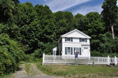 Cosier-Murphy Houselisted 1991
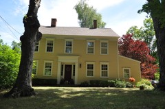 Williams Houselisted 2014
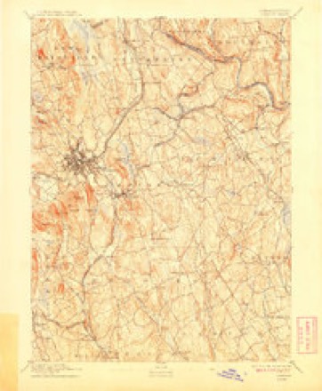
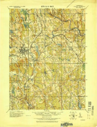
Topographic sheets covering this place
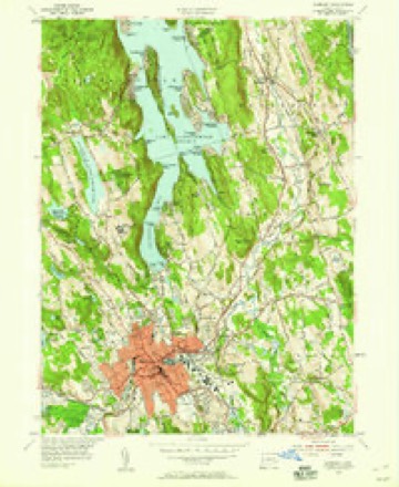
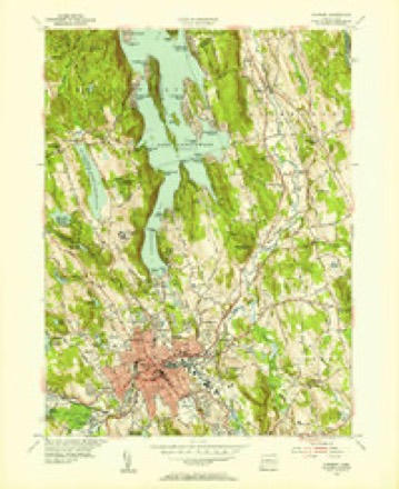
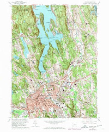
11 surveys from 31 printed sheetsMatched by testing this settlement's coordinate against the published boundary of every sheet in the United States Geological Survey's historical collection. Each opens the scanned sheet at the Survey.
- 1892 USGS Danbury quadrangle1:62500, 11 printings
- 1915 USGS Danbury quadrangle1:62500
- 1947 USGS Hartford quadrangle1:250000, 2 printings
- 1948 USGS Hartford quadrangle1:250000, 2 printings
- 1953 USGS Danbury quadrangle1:24000
- 1953 USGS Danbury quadrangle1:31680
- 1961 USGS Hartford quadrangle1:250000
- 1962 USGS Hartford quadrangle1:250000, 3 printings
- 1963 USGS Danbury quadrangle1:24000, 4 printings
- 1965 USGS Hartford quadrangle1:250000, 2 printings
- 1986 USGS Bridgeport quadrangle1:100000, 3 printings






In the county-history sources
2,749 words on this townshipHistory of Fairfield County, Connecticut, published 1881 names this settlement in its chapter on New Fairfield Town. These are the passages that mention it, exactly as the scans read.
The town of New Fairfield lies in the northern part of the county, and is bounded as follows : On the north by Sherman ; on the east by Litdifield County and the town of Brookfield ; on the south by Danbury ; and on the west by Putnam Co., N. Y. The .surface of the town is generally hilly, and the soil fertile.
Passage source: History of Fairfield County, Connecticut, published 1881.
This town was granted to twelve proprietors, who made a division and allotment of riglits and surveyed it about 173(i-.'J7. The grant comprised the present towns of New Fairfield and Slicrman, called the " Lower and the Upper Seven Miles." The choice of location in tlie allotment was won by Ebenezer Burr, of Fairfield, who, not having explored the township, chose the centre lot in the " Lower Seven Miles," which, when located and surveyed, included a large j)art of wliat is now called " Short Woods," a mountainous portion, and the least valuable of any of the townshii)s. The remains of a dwelling occupied by some of the descendants of Elienezer Burr still exist near the residence of Richard Barrett.
Passage source: History of Fairfield County, Connecticut, published 1881.
Enoch Knai)p, grandsim of .lonathan and son of Dr. Isaac Kiia|ip, was born in Greenwich, Fairfield Co., May 29, 18(15. He is of German extraction, the first of the family settling in this country early in the eighteenth century. His grandfather, Jonathan Knapp, also a native of Greenwich, wa.s a farmer by occupation. His family consisted of twelve children, - eight sons and four daughters. The fourth son was Dr. Isaac Knapp, born in Greenwich, who at about the age of twenty-five settled in New Fairfield, where he married Amy, the daughter of Amos and Hannah liriish. Their children were seven in number, five of whom are still living, - namely, Enoch, Sarah Leech, Ezra B., Dr. David A., and Euphemia H. Theresa (deceased) and Isaac H. (deceased), the latter leaving one son, - Smith H.
Passage source: History of Fairfield County, Connecticut, published 1881.
Machine-read from a century-old scan, so expect the errors a machine makes: misspelled names, dropped words, stray characters.
Read the whole chapter on New Fairfield Town - it names this place 3 more 3 times.
Fires near this place
91 since 1999Regional context, not property-specific evidence. The federal wildfire occurrence database lists 91 fires within 5 miles of New Fairfield between 1999 and 2020, burning about 108 acres in total. 6 started naturally. 11 were recorded as arson. Distance is straight-line from the map coordinates, so a fire counted here may appear on a neighbouring settlement's page as well.
| Reported cause | Fires |
|---|---|
| Missing data/not specified/undetermined | 54 |
| Arson/incendiarism | 11 |
| Smoking | 7 |
| Natural | 6 |
| Recreation and ceremony | 3 |
| Debris and open burning | 3 |
| Power generation/transmission/distribution | 2 |
| Misuse of fire by a minor | 2 |
| Equipment and vehicle use | 2 |
| Railroad operations and maintenance | 1 |
The most recent of them, most recent first, with the day each was reported and the service that recorded it.
| Date | Cause | Size | Reported by | Name on the report |
|---|---|---|---|---|
| 7 September 2015 | Natural | under an acre | Fire Department of New York | NA |
| 5 September 2015 | Missing data/not specified/undetermined | 25 acres | Connecticut Division of Forestry | not named |
| 25 September 2005 | Missing data/not specified/undetermined | under an acre | Fire Department of New York | not named |
| 23 September 2003 | Missing data/not specified/undetermined | under an acre | Fire Department of New York | not named |
| 17 September 2019 | Smoking | under an acre | New York Forest Rangers | CRANBERRY MOUNTAIN |
| 17 September 2007 | Missing data/not specified/undetermined | under an acre | Fire Department of New York | not named |
| 12 September 2012 | Missing data/not specified/undetermined | under an acre | Fire Department of New York | not named |
| 9 August 2016 | Missing data/not specified/undetermined | under an acre | Connecticut Division of Forestry | 12 ECHO ROAD SHERMAN |
Settlements close enough to share some of these fires:
Mines and quarries near this place
10 of 17 shownRegional context, not property-specific evidence. The federal mineral resources record lists 17 workings within 5 miles of New Fairfield: 11 past producers, 4 producers, 1 unknown, 1 prospect. 4 still produce. What was taken out: Sand and Gravel, Construction, Limestone, General, Stone, Crushed/Broken, Beryllium, Feldspar, Mica. Distance is straight-line from the map coordinates, so a quarry counted here may appear on a neighbouring settlement's page as well.
| Where | Site | Commodity | Status | Recorded |
|---|---|---|---|---|
| Brookfield Lead Mine | Sulfur, Zinc, Lead | Past Producer | Metamorphosed Sedimentary | |
| Brookfield Mine | Lead | Past Producer | ||
| Limestone Quarry | Limestone, Dimension | Past Producer | ||
| Pegmatite Quarry | Beryllium, Feldspar, Mica | Past Producer | ||
| Treadwell Biotite Gneiss Granite Rock Quarry | Stone, Dimension | Past Producer | 1895 | |
| Treadwell Prospect | Granite | Prospect | ||
| Calcite Marble Rock Quarry No. Fk-004 | Limestone, General | Producer | ||
| Connecticut Agstone Co. Quarries | Stone, Crushed/Broken | Past Producer | ||
| Dolomitic Marble Rock Quarries No. Fk-001 | Limestone, General | Past Producer | Unknown | |
| E. Paul Kovacs Crushed Rock Products Quarry | Stone, Crushed/Broken | Producer | 1963 |
Storms near this place
15 since 1993Regional context, not property-specific evidence. The National Weather Service names New Fairfield in 15 storm reports between 1993 and 2023: 12 thunderstorm wind, 1 lightning, 1 flash flood, 1 hail. The reports record 1 death and 1 injury. Each account below is quoted exactly as the forecast office filed it, from the NOAA Storm Events Database, and each date opens the federal record of that event.
| When | Event | Place named | Harm | What the report says |
|---|---|---|---|---|
| May 2018 | Thunderstorm Wind | New Fairfield | 1 killed, $5,000 | Tree fell on a car on Brush Hill Road, killing one person inside. |
| June 2006 | Lightning | New Fairfield | 1 hurt | Man struck by lightning. Taken to hospital. He was treated for minor injuries and released. |
| June 2011 | Thunderstorm Wind | New Fairfield | $20,000 | Approximately 20 to 30 trees were reported down throughout New Fairfield. |
| May 2018 | Thunderstorm Wind | New Fairfield | $5,000 | Numerous trees down near the intersection of Route 37 and Route 39. Also nickel sized hail reported. |
| September 2023 | Thunderstorm Wind | New Fairfield | $3,000 | Limbs and wires down in New Fairfield CT. |
| August 2009 | Flash Flood | New Fairfield | - | In Fairfield, Saw Mill Rd. was closed near Rt. 39 due to flooding. |
| June 2007 | Thunderstorm Wind | New Fairfield | - | Downed trees and power lines. |
| June 2006 | Thunderstorm Wind | New Fairfield | - | Trees and power lines downed over much of Northern Fairfield County. |
| July 2005 | Thunderstorm Wind | New Fairfield | - | Trees down. |
| July 2005 | Thunderstorm Wind | New Fairfield | - | Trees down in New Fairfield. The storms continued to move southeastward and subsequently downed trees in Bridgeport at 6:25 PM EDT. |
| August 2002 | Thunderstorm Wind | New Fairfield | - | A local newspaper reported numerous trees down in New Fairfield, 8 trees down in Brookfield, 21 city streets in Danbury affected by downed trees and power lines; and 10 trees down along with power lines in Redding. |
| August 1993 | Thunderstorm Wind | New Fairfield | - | Police report several trees down. |
| July 2014 | Hail | New Fairfield | - | no account filed |
| October 2003 | Thunderstorm Wind | New Fairfield | - | no account filed |
| July 1997 | Thunderstorm Wind | New Fairfield | - | no account filed |
Nearest settlements
The eight closest, with where each one stands in the county. Distances are straight-line, computed from the Geographic Names Information System coordinates.
| Map | Place | Distance | Sheets |
|---|---|---|---|
| Bigelow Corners | 1.1 miles | 37 | |
| Kellogg Point | 1.4 miles | 31 | |
| Margerie Manor | 1.4 miles | 31 | |
| Hollywyle Park | 1.4 miles | 31 | |
| Candlewood Knolls | 1.5 miles | 31 | |
| Candlewood Pines | 1.9 miles | 31 | |
| Ball Pond | 2.1 miles | 37 | |
| Candlewood Isle | 2.1 miles | 31 |
Provenance
This settlement is recorded in the Geographic Names Information System as feature 209228. The sheet list is computed by point-in-boundary test against the United States Geological Survey's historical topographic inventory. Both are works of the United States government and carry no copyright under 17 U.S.C. 105.
Wildfire. Short, Karen C. 2022. Spatial wildfire occurrence data for the United States, 1992-2020 [FPA_FOD_20221014]. 6th Edition. Fort Collins, CO: Forest Service Research Data Archive. https://doi.org/10.2737/RDS-2013-0009.6 Collected with United States Government funding and usable without additional permissions or fees.
Mines and quarries. USGS Mineral Resources Data System (MRDS) https://mrdata.usgs.gov/mrds/ A work of the United States government, no copyright under 17 U.S.C. 105.
Storms. NOAA National Centers for Environmental Information, Storm Events Database https://www.ncei.noaa.gov/stormevents/ A work of the United States government, no copyright under 17 U.S.C. 105. Narratives are quoted verbatim from the National Weather Service report and are not edited or summarised.