 Block
Norwich, Connecticut
30 topographic sheets cover this place, the earliest surveyed in 1892 and the latest in 1994. It stands in Norwich town. It lies in ZIP code area 06360. It stands on Shetucket River. The Survey maps it on the Norwich quadrangle. 40,125 people lived here at the 2020 count. It stands 56 feet above sea level.
Research this city
On record in Norwich
Buildings and businesses the archive holds for this place. Each opens its own page, with the source record it came from.
On the National Register 12 of 26 shown
 American Thermos Bottle Company Laurel Hill Plantlisted 1989
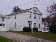 Nathaniel Backus Houselisted 1970
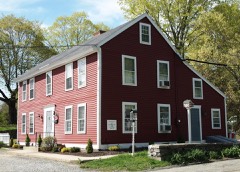 Bean Hill Historic Districtlisted 1982
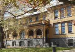 Broad Street Schoollisted 1984
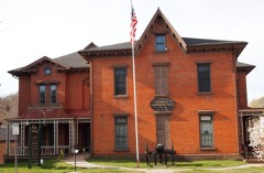 William A. Buckingham Houselisted 1982
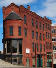 Carroll Buildinglisted 1982
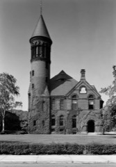 Chelsea Parade Historic Districtlisted 1989
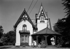 Converse House and Barnlisted 1970
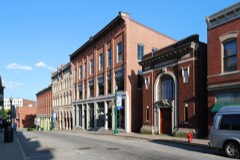 Downtown Norwich Historic Districtlisted 1985
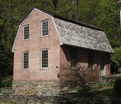 East District Schoollisted 1970
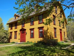 Col. Joshua Huntington Houselisted 1972
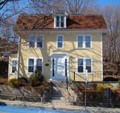 Jail Hill Historic Districtlisted 1999
Population over time
2 figuresNorwich fell from 40,493 to 40,125 between 2010 and 2020. These are the recorded population figures Wikidata holds for this place, reached through the Geographic Names Information System number this page is keyed on rather than by name, so they belong to this place and not to another of the same name. Most are census counts, but not all are: an early figure may be a founding or settlement estimate, and an estimate published within five years of a census is left out. The change column is computed, and is left blank where more than 20 years separate a figure from the one before it, because a gap that long is not a change between two counts.
| Year | People | Change |
|---|---|---|
| 2010 | 40,493 | |
| 2020 | 40,125 | -368 (-1%) |
Topographic sheets covering this place
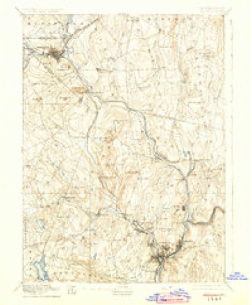
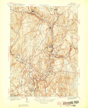
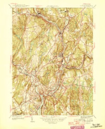
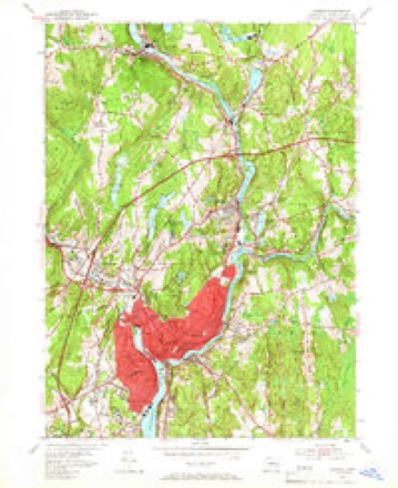
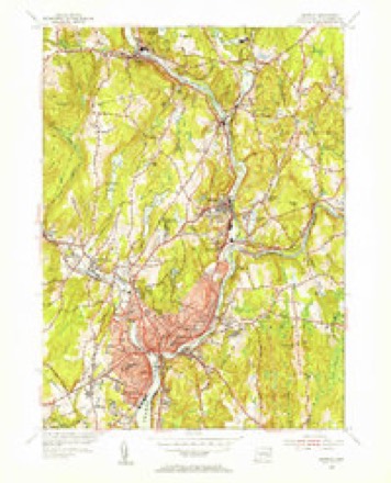
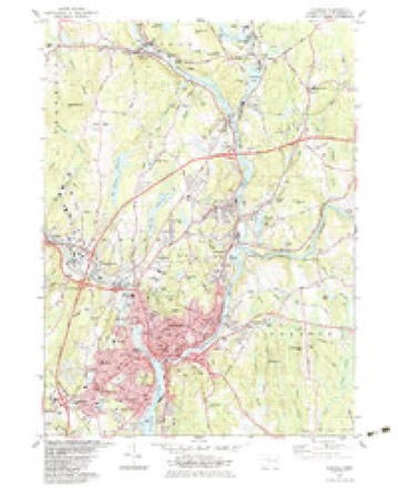
13 surveys from 30 printed sheetsMatched by testing this settlement's coordinate against the published boundary of every sheet in the United States Geological Survey's historical collection. Each opens the scanned sheet at the Survey.
- 1892 USGS Norwich quadrangle1:62500, 8 printings
- 1945 USGS Norwich quadrangle1:31680
- 1946 USGS Norwich quadrangle1:31680
- 1947 USGS Hartford quadrangle1:250000, 2 printings
- 1948 USGS Hartford quadrangle1:250000, 2 printings
- 1954 USGS Norwich quadrangle1:24000, 3 printings
- 1954 USGS Norwich quadrangle1:31680, 2 printings
- 1961 USGS Hartford quadrangle1:250000
- 1962 USGS Hartford quadrangle1:250000, 3 printings
- 1965 USGS Hartford quadrangle1:250000, 2 printings
- 1983 USGS Norwich quadrangle1:24000, 2 printings
- 1986 USGS Hartford quadrangle1:100000
- 1994 USGS Hartford quadrangle1:100000, 2 printings







In the county-history sources
37,554 words on this townshipHistory of New London County, Connecticut, with Biographical Sketches of Many of Its Pioneers and Prominent Men, published 1882 names this settlement in its chapter on Norwich Town. These are the passages that mention it, exactly as the scans read.
We find him at the same time, and for several years in succession, holding various public offices, all arduous and important. He was Indian agent, Indian umpire, and the counselor of the government in all Indian concerns; captain of the fort, justice of the peace, and empowered to hold courts as a judge; a member likewise of two deliberative bodies, the Connecticut Legislature and the Board of Commissioners of the United Colonies ; major-general of the militia at home, and the acting commander in all expeditions abroad. In 1660 he was chosen Deputy Governor, to which office he was annually re-elected for eight years, five under the old form and three under the king's charter, which united Connecticut with New Haven. The same year he was actively employed, in conjunction with Mr. Fitch and others, in effecting the settlement of Norwich, and also in purchasing of the Mohegans a large tract of land in behalf of the colony.
Passage source: History of New London County, Connecticut, with Biographical Sketches of Many of Its Pioneers and Prominent Men, published 1882.
Of the original band of Norwich purchasers. Mason was one of the earliest laid in the grave.' He died Jan. 30, 1671-72. According to Trumbull, he was in the seventy-third year of his age. His last hours were cheered by the prayers and counsels of his beloved pastor and son-in-law, Mr. Fitch. Two years before he had requested his fellow-citizens to excuse him from all further public services, on account of his age and infirmity, so that the close of his life, though overshadowed by suffering from an acute disease, was unharassed by care and responsibility. There is no coeval record that points out his burialplace, but uniform tradition and current belief in the neighborhood from generation to generation leave no reason to doubt that he was interred where other inhabitants of that generation were laid, - that is, in the Post and Gager burial-ground, or first cemetery of Norwich.
Passage source: History of New London County, Connecticut, with Biographical Sketches of Many of Its Pioneers and Prominent Men, published 1882.
He had been for twelve years an inhabitant of Norwich. It was his chosen home, and no urgent motive can be assigned for his interment elsewhere. Moreover, it was midwinter, when a traveling procession in a new country, with the imperfect accommodations of that period, would have been almost impracticable. Had he been removed under such circumstances to any other place for interment (to Saybrook or Windsor, for example) the event would have been of public notoriety throughout the colony, and must inevitably have been recorded somewhere in the annals of the day.
Passage source: History of New London County, Connecticut, with Biographical Sketches of Many of Its Pioneers and Prominent Men, published 1882.
Machine-read from a century-old scan, so expect the errors a machine makes: misspelled names, dropped words, stray characters.
Read the whole chapter on Norwich Town - it names this place 165 more 165 times.
Fires near this place
52 since 1992Regional context, not property-specific evidence. The federal wildfire occurrence database lists 52 fires within 5 miles of Norwich between 1992 and 2020, burning about 131 acres in total. None started naturally. 3 were recorded as arson. Distance is straight-line from the map coordinates, so a fire counted here may appear on a neighbouring settlement's page as well.
| Reported cause | Fires |
|---|---|
| Missing data/not specified/undetermined | 28 |
| Debris and open burning | 5 |
| Misuse of fire by a minor | 5 |
| Recreation and ceremony | 4 |
| Smoking | 4 |
| Arson/incendiarism | 3 |
| Equipment and vehicle use | 1 |
| Railroad operations and maintenance | 1 |
| Power generation/transmission/distribution | 1 |
The most recent of them, most recent first, with the day each was reported and the service that recorded it.
| Date | Cause | Size | Reported by | Name on the report |
|---|---|---|---|---|
| 27 August 2017 | Missing data/not specified/undetermined | under an acre | Connecticut Division of Forestry | STODDARD HILL STATE PARK |
| 1 August 1999 | Misuse of fire by a minor | 3.0 acres | Connecticut Division of Forestry | not named |
| 5 July 2002 | Smoking | under an acre | Connecticut Division of Forestry | not named |
| 21 July 2016 | Missing data/not specified/undetermined | under an acre | Connecticut Division of Forestry | I 395 SB EXIT 18, LISBON CT |
| 26 June 2020 | Power generation/transmission/distribution | 1.0 acres | Connecticut Division of Forestry | 57 ROUTE 32 |
| 25 June 2020 | Missing data/not specified/undetermined | under an acre | Connecticut Division of Forestry | BROWNING RD/ GAGER RD |
| 9 May 2001 | Equipment and vehicle use | 5.0 acres | Connecticut Division of Forestry | not named |
| 7 May 1992 | Missing data/not specified/undetermined | under an acre | Connecticut Division of Forestry | not named |
Settlements close enough to share some of these fires:
Mines and quarries near this place
10 of 20 shownRegional context, not property-specific evidence. The federal mineral resources record lists 20 workings within 5 miles of Norwich: 17 past producers, 2 producers, 1 plant. 3 still produce. What was taken out: Stone, Dimension, Sand and Gravel, Construction, Stone, Stone, Crushed/Broken. Distance is straight-line from the map coordinates, so a quarry counted here may appear on a neighbouring settlement's page as well.
| Where | Site | Commodity | Status | Recorded |
|---|---|---|---|---|
| Gold Mine | Gold | Past Producer | ||
| Kaolin Mine | Kaolin | Past Producer | ||
| Alaskite Gneiss Rock Quarry No. Ak-002 | Stone, Crushed/Broken | Past Producer | ||
| Alaskite Gneiss Rock Quarry No. Ak-003 | Stone, Crushed/Broken | Past Producer | ||
| Biotite Muscovite Schist Rock Quarry No. Aj-018 | Stone | Past Producer | ||
| Gneiss Rock Quarry No. Ak-001 | Stone | Past Producer | Gneiss | |
| Quartz Monzonite Rock Quarry No. Aj-016 | Stone | Past Producer | Unknown | |
| Johnson Sand and Gravel Pit | Sand and Gravel, Construction | Producer | ||
| Leffingwell Leffngwell Pit | Sand and Gravel, Construction | Producer | ||
| Leffngwell Pit | Sand and Gravel, Construction | Past Producer | Sedimentary |
Storms near this place
29 since 1993Regional context, not property-specific evidence. The National Weather Service names Norwich in 29 storm reports between 1993 and 2021: 10 thunderstorm wind, 7 hail, 5 flash flood, 5 lightning. The reports record 2 injuries. Each account below is quoted exactly as the forecast office filed it, from the NOAA Storm Events Database, and each date opens the federal record of that event.
| When | Event | Place named | Harm | What the report says |
|---|---|---|---|---|
| July 2008 | Lightning | Norwich | 1 hurt | A contractor at Norwich Housing Authority was struck by lightning. The unidentified man was outside behind a building when he or something near him was struck. The man was treated at the scene but not transported to the hospital. |
| August 1997 | Lightning | Norwich | 1 hurt | no account filed |
| June 2002 | Lightning | Norwich | $10,000 | no account filed |
| May 2010 | Lightning | Norwich | $4,000 | Lightning struck a transformer in Norwich. Five thousand people lost power as a result. |
| July 2008 | Thunderstorm Wind | Norwich | $1,000 | A few trees were downed on Dunham Street. |
| July 2008 | Hail | Norwich | $500 | Quarter to half dollar size hail damaged small plants in Norwich along Dunham Street. |
| September 2021 | Flash Flood | Norwich | - | Power had to be turned off to numerous homes throughout Norwich for safety due to flooded basements. In addition, the Comfort Inn and Suites on Otrobando Avenue had to be evacuated due to more than 5 feet of water in the basement of the hotel. Three apartments in Mohegan Commons on East Baltic Street were flooded and uninhabitable. |
| May 2009 | Hail | Norwich | - | Nickel size hail was reported by a trained spotter. |
| December 2008 | Flood | Norwich | - | Major flooding was realized in the towns of Yantic, Greeneville, Norwichtown, and parts of East Great Plain from the Yantic River reaching moderate and then cresting at major flood stage. Many businesses experienced flooding and were forced to close while they pumped water out of their storefronts. Several roads, such as West Town Street in Yantic Flats, were also closed. Total rainfall amounts ranged from 3.25 inches to 4.5 inches in New London County. The Yantic River at Yantic exceeded its flood stage of 9.0 ft. at 6:30 am on Dec 12th. The river exceeded moderate flood stage of 9.5 ft. at 7:15 am and major flood stage of 11.5 ft. at 10:30 am before cresting at 11.82 ft. at 11:45 am. The river remained above flood stage through the day and finally receded back within its banks at 11:45 pm on Dec 12th. |
| May 2006 | Hail | Norwich | - | Penny size hail in Lisbon. |
| October 2006 | Flash Flood | Norwich | - | Side roads along I-395 closed due to flash flooding. |
| August 2004 | Thunderstorm Wind | Norwich | - | Trees were downed. |
| April 1995 | Thunderstorm Wind | Norwich | - | Trees and power lines were downed. Numerous structures received various amounts of damage. |
| April 1995 | Thunderstorm Wind | Norwich | - | A squall line moving across the region produced an enormous amount of damage during the afternoon hours. Powerful winds, the result of several microbursts, downed thousands of trees and power lines. Numerous structures received various degrees of damage. A significant amount of this damage occurred to the roofs. In Stamford, a driver was injured when a tree fell on her car. |
| August 1993 | Thunderstorm Wind | Norwich | - | Large limbs were downed, signs were blown over near Elmwood Avenue, Broadway Street and Route 2 in and near Norwich. Lightning struck a tree in Lebanon, traveled down the trunk then scorched the ground as it traveled 50 feet to a house on Ryan Terrace and blew off the back wall. As pieces of the wall flew 50 feet into the air, the lightning continued to the roof line where it started a small fire in the attic. Meanwhile, two houses in the Great Neck Road region of Waterford were struck by lightning with siding blown off one of the homes. |
| July 2012 | Hail | Norwich | - | no account filed |
| July 2006 | Thunderstorm Wind | Norwich | - | no account filed |
| July 2004 | Hail | Norwich | - | no account filed |
| July 2004 | Hail | Norwich | - | no account filed |
| June 2002 | Lightning | Norwich | - | no account filed |
| June 2001 | Thunderstorm Wind | Norwich | - | no account filed |
| August 2001 | Flood | Norwich | - | no account filed |
| June 2000 | Thunderstorm Wind | Norwich | - | no account filed |
| August 1999 | Hail | Norwich | - | no account filed |
| January 1999 | Flash Flood | Norwich | - | no account filed |
| August 1999 | Flash Flood | Norwich | - | no account filed |
| September 1998 | Thunderstorm Wind | Norwich | - | no account filed |
| June 1997 | Thunderstorm Wind | Norwich | - | no account filed |
| August 1997 | Flash Flood | Norwich | - | no account filed |
Nearest settlements
The eight closest, with where each one stands in the county. Distances are straight-line, computed from the Geographic Names Information System coordinates.
| Map | Place | Distance | Sheets |
|---|---|---|---|
| Waterman Point (historical) | 0.4 miles | 30 | |
| Sunnyside (historical) | 0.7 miles | 30 | |
| Thamesville | 1.2 miles | 30 | |
| Greenville | 1.2 miles | 30 | |
| Backus Corner | 1.7 miles | 30 | |
| Norwichtown | 2.5 miles | 30 | |
| Showtucket (historical) | 2.8 miles | 30 | |
| Hallville | 3.1 miles | 33 |
Elsewhere
Matched on this settlement's Geographic Names Information System number rather than its name, so it cannot be a different place of the same name in another state.
| Wikipedia article on Norwich | An encyclopaedic summary. Its text is share-alike, so it is linked here rather than copied. |
| Wikidata item Q631402 | The structured record the population and elevation above come from. Public domain (CC0). |
Provenance
This settlement is recorded in the Geographic Names Information System as feature 209410. The sheet list is computed by point-in-boundary test against the United States Geological Survey's historical topographic inventory. Both are works of the United States government and carry no copyright under 17 U.S.C. 105.
Wildfire. Short, Karen C. 2022. Spatial wildfire occurrence data for the United States, 1992-2020 [FPA_FOD_20221014]. 6th Edition. Fort Collins, CO: Forest Service Research Data Archive. https://doi.org/10.2737/RDS-2013-0009.6 Collected with United States Government funding and usable without additional permissions or fees.
Mines and quarries. USGS Mineral Resources Data System (MRDS) https://mrdata.usgs.gov/mrds/ A work of the United States government, no copyright under 17 U.S.C. 105.
Storms. NOAA National Centers for Environmental Information, Storm Events Database https://www.ncei.noaa.gov/stormevents/ A work of the United States government, no copyright under 17 U.S.C. 105. Narratives are quoted verbatim from the National Weather Service report and are not edited or summarised.