 Block
Selleck Four Corners, Connecticut
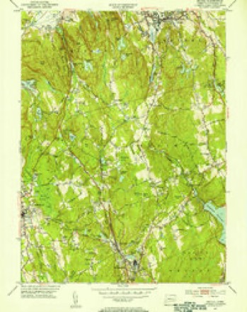
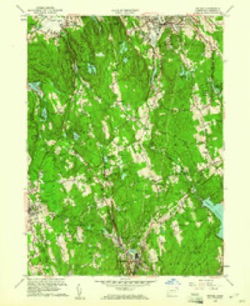
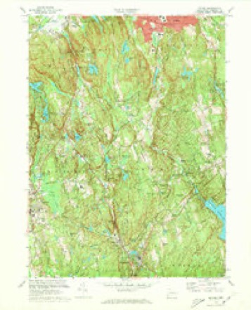
32 topographic sheets cover this place, the earliest surveyed in 1892 and the latest in 1986. It stands in Redding town. It lies in ZIP code area 06896. It stands on Nob Crook Brook. The Survey maps it on the Bethel quadrangle. The federal gazetteer marks this settlement historical: it is no longer a populated place, though the surveys that recorded it still are.
On record in Selleck Four Corners
Buildings and businesses the archive holds for this place. Each opens its own page, with the source record it came from.
On the National Register within a mile 1 record
The National Register names another town for these. They stand within one mile of this settlement's coordinate.
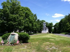 Redding Center Historic Districtlisted 1992 · 0.9 miles away
Topographic sheets covering this place
12 surveys from 32 printed sheetsMatched by testing this settlement's coordinate against the published boundary of every sheet in the United States Geological Survey's historical collection. Each opens the scanned sheet at the Survey.
- 1892 USGS Danbury quadrangle1:62500, 11 printings
- 1915 USGS Danbury quadrangle1:62500
- 1947 USGS Hartford quadrangle1:250000, 2 printings
- 1948 USGS Hartford quadrangle1:250000, 2 printings
- 1951 USGS Bethel quadrangle1:24000
- 1951 USGS Bethel quadrangle1:31680
- 1959 USGS Bethel quadrangle1:24000, 2 printings
- 1961 USGS Hartford quadrangle1:250000
- 1962 USGS Hartford quadrangle1:250000, 3 printings
- 1965 USGS Hartford quadrangle1:250000, 2 printings
- 1970 USGS Bethel quadrangle1:24000, 3 printings
- 1986 USGS Bridgeport quadrangle1:100000, 3 printings






Fires near this place
19 since 1992Regional context, not property-specific evidence. The federal wildfire occurrence database lists 19 fires within 5 miles of Selleck Four Corners (historical) between 1992 and 2017, burning about 89 acres in total. None started naturally. 3 were recorded as arson. Distance is straight-line from the map coordinates, so a fire counted here may appear on a neighbouring settlement's page as well.
| Reported cause | Fires |
|---|---|
| Missing data/not specified/undetermined | 10 |
| Arson/incendiarism | 3 |
| Smoking | 2 |
| Debris and open burning | 2 |
| Recreation and ceremony | 2 |
The most recent of them, most recent first, with the day each was reported and the service that recorded it.
| Date | Cause | Size | Reported by | Name on the report |
|---|---|---|---|---|
| 22 July 1993 | Smoking | under an acre | Connecticut Division of Forestry | not named |
| 17 July 1993 | Arson/incendiarism | 2.0 acres | Connecticut Division of Forestry | not named |
| 7 May 1995 | Debris and open burning | 50 acres | Connecticut Division of Forestry | not named |
| 3 May 2015 | Smoking | 2.5 acres | Connecticut Division of Forestry | not named |
| 12 May 2015 | Missing data/not specified/undetermined | 3.0 acres | Connecticut Division of Forestry | not named |
| 11 May 1993 | Debris and open burning | under an acre | Connecticut Division of Forestry | not named |
| 1 May 2001 | Arson/incendiarism | 8.0 acres | Connecticut Division of Forestry | not named |
| 6 April 2015 | Missing data/not specified/undetermined | 1.0 acres | Connecticut Division of Forestry | not named |
Settlements close enough to share some of these fires:
Mines and quarries near this place
10 of 17 shownRegional context, not property-specific evidence. The federal mineral resources record lists 17 workings within 5 miles of Selleck Four Corners (historical): 15 past producers, 2 occurrences. None of them still produces. What was taken out: Stone, Marble, Dimension, Iron, Garnet. Distance is straight-line from the map coordinates, so a quarry counted here may appear on a neighbouring settlement's page as well.
| Where | Site | Commodity | Status | Recorded |
|---|---|---|---|---|
| Bethel Feldspar Pegmatite Quarry | Feldspar, Quartz | Past Producer | Feldspar | |
| Branchville Mica Mine | Niobium (Columbium), Tantalum, Quartz, Feldspar, Mica | Past Producer | Pegmatite Dike | |
| Branchville Mica Mine | Beryllium, Feldspar, Mica, Silica, Tantalum | Past Producer | ||
| Granite Quarry | Granite | Past Producer | ||
| Topstone Hill Granite Quarry | Stone, Dimension | Past Producer | Granite | |
| Wilton Silver and Galena Chalcopyrite Mine | Silver | Past Producer | Metamorphosed Sedimentary | |
| Magnetite Mine | Iron | Past Producer | ||
| Marble Quarry | Marble, Dimension | Past Producer | ||
| Redding Marble Co. Quarry | Marble, Dimension | Past Producer | ||
| Unnamed Magnetite Occurrence | Iron | Occurrence | Magnetite |
Nearest settlements
The eight closest, with where each one stands in the county. Distances are straight-line, computed from the Geographic Names Information System coordinates.
| Map | Place | Distance | Sheets |
|---|---|---|---|
| Redding | 0.8 miles | 32 | |
| Boston | 1.3 miles | 32 | |
| Sanfordtown | 1.8 miles | 35 | |
| Lonetown | 2.0 miles | 32 | |
| Redding Ridge | 2.7 miles | 35 | |
| Five Points | 2.8 miles | 35 | |
| Topstone | 2.8 miles | 32 | |
| West Redding | 3.0 miles | 32 |
Provenance
This settlement is recorded in the Geographic Names Information System as feature 1942911. The sheet list is computed by point-in-boundary test against the United States Geological Survey's historical topographic inventory. Both are works of the United States government and carry no copyright under 17 U.S.C. 105.
Wildfire. Short, Karen C. 2022. Spatial wildfire occurrence data for the United States, 1992-2020 [FPA_FOD_20221014]. 6th Edition. Fort Collins, CO: Forest Service Research Data Archive. https://doi.org/10.2737/RDS-2013-0009.6 Collected with United States Government funding and usable without additional permissions or fees.
Mines and quarries. USGS Mineral Resources Data System (MRDS) https://mrdata.usgs.gov/mrds/ A work of the United States government, no copyright under 17 U.S.C. 105.