 Block
Tariffville, Connecticut
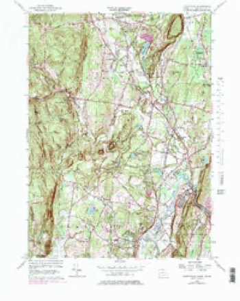
31 topographic sheets cover this place, the earliest surveyed in 1892 and the latest in 1994. It stands in Simsbury town. It lies near Laurel Hill. The Survey maps it on the Tariffville quadrangle. 1,324 people lived here at the 2020 count. It stands 200 feet above sea level.
On record in Tariffville
Buildings and businesses the archive holds for this place. Each opens its own page, with the source record it came from.
On the National Register within a mile 2 records
The National Register names another town for these. They stand within one mile of this settlement's coordinate.
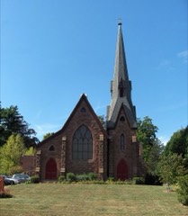 Tariffville Historic Districtlisted 1993 · 0.3 miles away
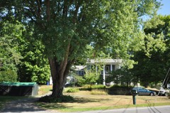 Whitfield Cowles Houselisted 2014 · 0.9 miles away
Population over time
2 figuresTariffville grew from 1,324 to 1,324 between 2010 and 2020. These are the recorded population figures Wikidata holds for this place, reached through the Geographic Names Information System number this page is keyed on rather than by name, so they belong to this place and not to another of the same name. Most are census counts, but not all are: an early figure may be a founding or settlement estimate, and an estimate published within five years of a census is left out. The change column is computed, and is left blank where more than 20 years separate a figure from the one before it, because a gap that long is not a change between two counts.
| Year | People | Change |
|---|---|---|
| 2010 | 1,324 | |
| 2020 | 1,324 | 0 (0%) |
Topographic sheets covering this place
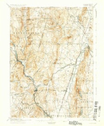
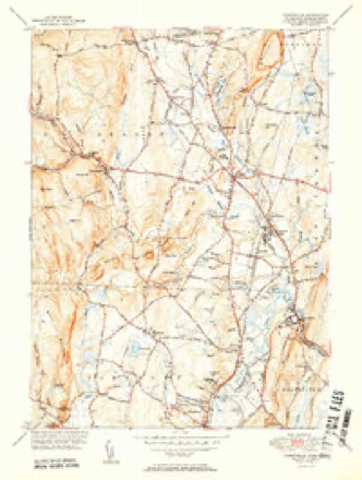
11 surveys from 31 printed sheetsMatched by testing this settlement's coordinate against the published boundary of every sheet in the United States Geological Survey's historical collection. Each opens the scanned sheet at the Survey.
- 1892 USGS Granby quadrangle1:62500, 8 printings
- 1906 USGS Farmington quadrangle1:125000, 2 printings
- 1947 USGS Hartford quadrangle1:250000, 2 printings
- 1948 USGS Hartford quadrangle1:250000, 2 printings
- 1951 USGS Tariffville quadrangle1:31680, 2 printings
- 1956 USGS Tariffville quadrangle1:24000, 6 printings
- 1961 USGS Hartford quadrangle1:250000
- 1962 USGS Hartford quadrangle1:250000, 3 printings
- 1965 USGS Hartford quadrangle1:250000, 2 printings
- 1986 USGS Hartford quadrangle1:100000
- 1994 USGS Hartford quadrangle1:100000, 2 printings








In the county-history sources
9,008 words on this townshipThe Memorial History of Hartford County, Connecticut, 1633-1884;, published 1886 names this settlement in its chapter on Simsbury Town. These are the passages that mention it, exactly as the scans read.
The Baptist Church of Tariffville was organized May 31, 1833, with a membership of thirteen persons. The following named pastors have successively officiated : The Rev's Charles Willet, William Reid, Asahel Chapin, R. H. Maine, R. H. BoUes, Charles F. Holbrook, Joseph Burnett, Mr. Lovell, William Goodwin, and Mr. Nichols. The first church was burned in 1876. A new one was built in the spring of that year, and dedicated in September.
Passage source: The Memorial History of Hartford County, Connecticut, 1633-1884;, published 1886.
During and in consequence of the controversy in regard to the location and building of the old meeting-h(juse, a few individuals withdrew from the old society in 1740, and organized an Episcopal church in Scotland, then in Simsbury. In 1743 their number was largely increased. The parish took the uame of St. Andrew's, and is one of the oldest in the State. In 1868 an offshoot of this church sprang up in Tariffville, which has nearly supplanted the old stock ; many members of the old society of St. Andrew's, uniting, have formed a new society and erected a beautiful church edifice at that place, at a cost of about 122,000.
Passage source: The Memorial History of Hartford County, Connecticut, 1633-1884;, published 1886.
priate and work them for their own use ; and that before any division of the copper, refined or w^rought, should be made, " the tenth part of it shall be taken from it, for pious uses ; viz. two thirds of it shall be to the maintaining an able schoolmaster here in Simsbury ; the other third part shall be given to the use of the Collegiate School erected within the Colony, to be improved as the trustees of said school shall see good." Probably neither the college nor the schoolmaster received any great pecuniary benefit from this source ; but the act is a manifestation of the interest felt by the men of that generation in the cause of education. For many years there have been twelve school districts in the town, where schools have been maintained most of the year in comfortable and convenient school-houses. In 1865 the three districts of the village of Tariffville were consolidated, and a union schoolhouse erected, at an expense of more than $13,000, where a graded school of three departments was established. It has since that time been permanently and successfully conducted by teachers of ability and experience, and is an ornament to the village and an honor to those who were active in its establishment. At the centre of the town Mr. J. B. McLean has established the Simsbury Academy, a boarding and day school for boys and girls. The school is now (1884) in its fifth year of successful operation. In addition to the ordinary means of education, it may not be amiss to mention the Simsbury Free Lil^rary, established and opened to all the inhabitants of Simsbury, through the munificent gift of 13,000 by Amos R. Eno, Esq., whose other noble acts of beneficence to the church and the town have been previously mentioned. The library contains a choice selection of books, which from time to time is added to as new works are published.
Passage source: The Memorial History of Hartford County, Connecticut, 1633-1884;, published 1886.
Machine-read from a century-old scan, so expect the errors a machine makes: misspelled names, dropped words, stray characters.
Read the whole chapter on Simsbury Town - it names this place 1 more 1 time.
Fires near this place
50 since 1993Regional context, not property-specific evidence. The federal wildfire occurrence database lists 50 fires within 5 miles of Tariffville between 1993 and 2020, burning about 57 acres in total. 2 started naturally. 5 were recorded as arson. Distance is straight-line from the map coordinates, so a fire counted here may appear on a neighbouring settlement's page as well.
| Reported cause | Fires |
|---|---|
| Missing data/not specified/undetermined | 26 |
| Debris and open burning | 9 |
| Recreation and ceremony | 6 |
| Arson/incendiarism | 5 |
| Natural | 2 |
| Misuse of fire by a minor | 1 |
| Fireworks | 1 |
The most recent of them, most recent first, with the day each was reported and the service that recorded it.
| Date | Cause | Size | Reported by | Name on the report |
|---|---|---|---|---|
| 9 September 2007 | Missing data/not specified/undetermined | under an acre | Connecticut Division of Forestry | not named |
| 23 September 2020 | Fireworks | 1.0 acres | Connecticut Division of Forestry | RT187 AND SPOONVILLE ROAD |
| 9 August 2001 | Missing data/not specified/undetermined | 2.0 acres | Connecticut Division of Forestry | not named |
| 17 August 2008 | Debris and open burning | under an acre | Connecticut Division of Forestry | not named |
| 14 August 2010 | Recreation and ceremony | under an acre | Connecticut Division of Forestry | not named |
| 12 August 2006 | Missing data/not specified/undetermined | under an acre | Connecticut Division of Forestry | not named |
| 25 July 2016 | Missing data/not specified/undetermined | under an acre | Connecticut Division of Forestry | STRATTON BROOK STATE PARK |
| 25 July 2000 | Missing data/not specified/undetermined | under an acre | Connecticut Division of Forestry | not named |
Settlements close enough to share some of these fires:
Mines and quarries near this place
10 of 23 shownRegional context, not property-specific evidence. The federal mineral resources record lists 23 workings within 5 miles of Tariffville: 20 past producers, 3 producers. 3 still produce. What was taken out: Copper, Stone, Dimension, Stone, Crushed/Broken, Sulfur. Distance is straight-line from the map coordinates, so a quarry counted here may appear on a neighbouring settlement's page as well.
| Where | Site | Commodity | Status | Recorded |
|---|---|---|---|---|
| Sandstone Quarry | Flagstone | Past Producer | ||
| Sandstone Quarry #Di-005 | Flagstone | Past Producer | ||
| Granby Pit | Sand and Gravel, Construction | Past Producer | ||
| Higley Copper Mine | Copper, Sulfur | Past Producer | Breccia Filling And Replacement | |
| Simsbury Copper Mine | Copper, Sulfur | Past Producer | Void Filling And Replacement | |
| Simsbury Newgate Prison Copper Mine | Copper, Sulfur | Past Producer | 1707 | |
| Vincent Pit | Sand and Gravel, Construction | Past Producer | Sedimentary | |
| Vincent Pit | Sand and Gravel, Construction | Past Producer | ||
| Basalt Rock Quarry No. Di-004 | Stone, Crushed/Broken | Past Producer | Basalt | |
| Diabase Rock Quarry No. Di-003 | Stone, Crushed/Broken | Past Producer | Diabase |
Nearest settlements
The eight closest, with where each one stands in the county. Distances are straight-line, computed from the Geographic Names Information System coordinates.
| Map | Place | Distance | Sheets |
|---|---|---|---|
| Tariffville Center | 0.9 miles | 31 | |
| Spoonville (historical) | 1.0 miles | 32 | |
| Spoonville | 1.2 miles | 32 | |
| Carroll Corners | 1.3 miles | 31 | |
| Hoskins | 1.5 miles | 31 | |
| North Bloomfield | 1.7 miles | 32 | |
| Floydville | 1.7 miles | 31 | |
| Granbrook Park | 2.0 miles | 31 |
Elsewhere
Matched on this settlement's Geographic Names Information System number rather than its name, so it cannot be a different place of the same name in another state.
| Wikipedia article on Tariffville | An encyclopaedic summary. Its text is share-alike, so it is linked here rather than copied. |
| Wikidata item Q928225 | The structured record the population and elevation above come from. Public domain (CC0). |
Provenance
This settlement is recorded in the Geographic Names Information System as feature 211359. The sheet list is computed by point-in-boundary test against the United States Geological Survey's historical topographic inventory. Both are works of the United States government and carry no copyright under 17 U.S.C. 105.
Wildfire. Short, Karen C. 2022. Spatial wildfire occurrence data for the United States, 1992-2020 [FPA_FOD_20221014]. 6th Edition. Fort Collins, CO: Forest Service Research Data Archive. https://doi.org/10.2737/RDS-2013-0009.6 Collected with United States Government funding and usable without additional permissions or fees.
Mines and quarries. USGS Mineral Resources Data System (MRDS) https://mrdata.usgs.gov/mrds/ A work of the United States government, no copyright under 17 U.S.C. 105.