 Block
Thomaston, Connecticut
34 topographic sheets cover this place, the earliest surveyed in 1893 and the latest in 1993. It stands in Thomaston town. It lies in ZIP code area 06787. It stands on Northfield Brook. The Survey maps it on the Thomaston quadrangle. 1,928 people lived here at the 2020 count.
On record in Thomaston
Buildings and businesses the archive holds for this place. Each opens its own page, with the source record it came from.
On the National Register 4 records
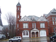 Hose and Hook and Ladder Truck Buildinglisted 1982
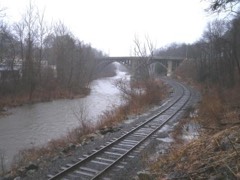 Reynolds Bridgelisted 2004
 Thomaston Opera Houselisted 1972
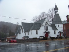 Trinity Churchlisted 1984
Population over time
2 figuresThomaston grew from 1,910 to 1,928 between 2010 and 2020. These are the recorded population figures Wikidata holds for this place, reached through the Geographic Names Information System number this page is keyed on rather than by name, so they belong to this place and not to another of the same name. Most are census counts, but not all are: an early figure may be a founding or settlement estimate, and an estimate published within five years of a census is left out. The change column is computed, and is left blank where more than 20 years separate a figure from the one before it, because a gap that long is not a change between two counts.
| Year | People | Change |
|---|---|---|
| 2010 | 1,910 | |
| 2020 | 1,928 | +18 (+1%) |
Topographic sheets covering this place
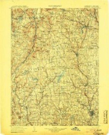
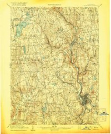
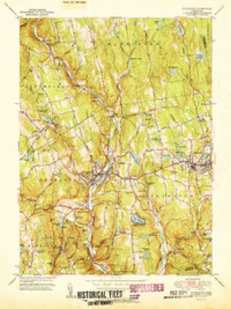
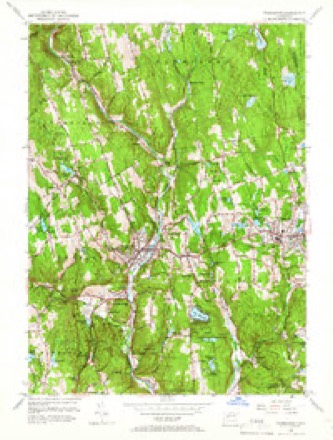
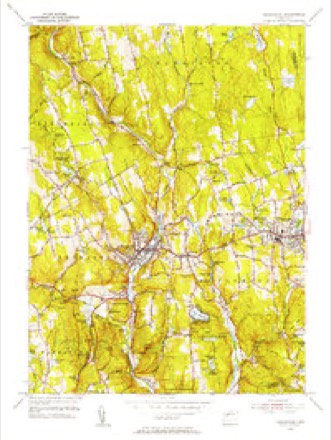
13 surveys from 34 printed sheetsMatched by testing this settlement's coordinate against the published boundary of every sheet in the United States Geological Survey's historical collection. Each opens the scanned sheet at the Survey.
- 1893 USGS Waterbury quadrangle1:62500, 2 printings
- 1904 USGS Litchfield quadrangle1:125000, 3 printings
- 1904 USGS Waterbury quadrangle1:62500, 8 printings
- 1947 USGS Hartford quadrangle1:250000, 2 printings
- 1948 USGS Hartford quadrangle1:250000, 2 printings
- 1951 USGS Thomaston quadrangle1:31680, 2 printings
- 1956 USGS Thomaston quadrangle1:24000, 6 printings
- 1956 USGS Thomaston quadrangle1:31680
- 1961 USGS Hartford quadrangle1:250000
- 1962 USGS Hartford quadrangle1:250000, 3 printings
- 1965 USGS Hartford quadrangle1:250000, 2 printings
- 1985 USGS Waterbury quadrangle1:100000
- 1993 USGS Waterbury quadrangle1:100000
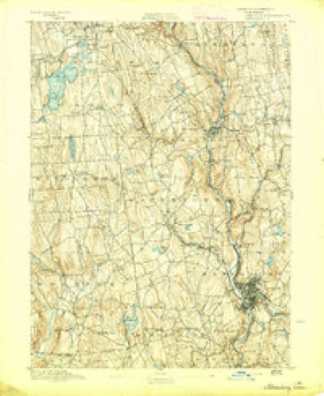





In the county-history sources
10,002 words on this townshipHistory of Litchfield County, Connecticut, published 1881 names this settlement in its chapter on Thomaston Town. These are the passages that mention it, exactly as the scans read.
The town of Thomaston, the youngest town in the county, is located in tiie southeastern part of Litchfield County, and is bounded as follows : on the north by Litchfield and Harwinton, on the east by Plymouth, on the south by Watertown and Now Haven County, and on the west by Watertown and Litchfield. The surface of the town is hilly, and soil generally fertile. The early history of the town has been given in detail in the history of Plymouth, of which this town formed a part until 1875. Names of the early settlers, proprietors' meetings, early rules and regulations, etc., will be found in the historj' of the mother-town.
Passage source: History of Litchfield County, Connecticut, published 1881.
The section occupied by the village of Thomaston was originally known as Plymouth Hollow, and fiftyfive years ago consisted of about thirteen dwellings, located as follows : Ou East Main Street, on the site of the Plume & Atwood office, stood a dwelling occupied by Lyman Fenn, and on the premises now occupied by John H. Wood was also a house, but its occupant is unknown. There was a house standing on North Main Street, where Dr. B. W. Pease now resides, and Junius Blakesley lived in a dwelling which stood near the present residence of Henry R. Warner. On the property now owned by Miles Morse, on Main Street, stood a hotel. Bela Blakesley lived on the premises now occupied by the Bradstreet Block and the widow of Edward Thomas, and the property now owned by Aaron Thomas was in the possession of the Ford family. The premises now occupied by T. J. Bradstreet and Mrs. Blakesley were owned by Mica Blakesley, and on the place now occupied by Mrs. George Reynolds was a tannery. The next location on the north side of the street belonged to Seth Thomas, and was occupied by him a number of years ; it is now covered by the clock-shop. The next place below has been occupied by the Blakesley family a long time. One of the oldest buildings in the village stood on Centre Street, and was occupied by Levi Castle. The " farm-house" of Seth Thomas, so called, was also standing at the time of which we are writing.
Passage source: History of Litchfield County, Connecticut, published 1881.
But all this is changed. The quiet little hamlet of less than a score of buildings has grown to one of the loveliest manufacturing towns in Connecticut, and is due chiefly to the enterprise of one family, Seth Thomas and sons. Seth Thomas, Sr., commenced the manufacture of clocks in 1809, in company with Eli Terry and Silas Hoadley, at what is now Hancock Station, on the New York and New England Railroad. Here he remained until 1813, when he came to Plymouth Hollow, now Thomaston, and purchased the site where the case-shop is now located, and commenced the manufacture of clocks.* He gradually increased the business, and in 1853 the Seth Thomas Clock Company was organized under the joint-stock laws of Connecticut. At the beginning of business about twenty persons were employed, and the annual product amounted to about ten thousand dollars. The manufacture rapidly increased, until now the corporation employs about nine hundred workmen, with a monthly pay-roll of over thirty thousand dollars, and a yearly production of about one million dollars. About four hundred thousand clocks are manufactured annually, and one hundred and seventy different styles. The most expensive clock was manufactured in 1876 for Independence Hall, Philadelphia, costing six thousand dollars. The building covers about twenty acres. The Seth Thomas clocks have obtained
Passage source: History of Litchfield County, Connecticut, published 1881.
Machine-read from a century-old scan, so expect the errors a machine makes: misspelled names, dropped words, stray characters.
Read the whole chapter on Thomaston Town - it names this place 26 more 26 times.
Fires near this place
113 since 1994Regional context, not property-specific evidence. The federal wildfire occurrence database lists 113 fires within 5 miles of Thomaston between 1994 and 2020, burning about 702 acres in total. None started naturally. 12 were recorded as arson. Distance is straight-line from the map coordinates, so a fire counted here may appear on a neighbouring settlement's page as well.
| Reported cause | Fires |
|---|---|
| Missing data/not specified/undetermined | 64 |
| Debris and open burning | 18 |
| Arson/incendiarism | 12 |
| Recreation and ceremony | 9 |
| Misuse of fire by a minor | 8 |
| Smoking | 1 |
| Equipment and vehicle use | 1 |
The most recent of them, most recent first, with the day each was reported and the service that recorded it.
| Date | Cause | Size | Reported by | Name on the report |
|---|---|---|---|---|
| 26 September 2007 | Missing data/not specified/undetermined | under an acre | Connecticut Division of Forestry | not named |
| 23 September 2015 | Missing data/not specified/undetermined | under an acre | Connecticut Division of Forestry | not named |
| 16 September 2020 | Missing data/not specified/undetermined | under an acre | Connecticut Division of Forestry | PINE VIEW CT |
| 12 September 1998 | Missing data/not specified/undetermined | 2.0 acres | Connecticut Division of Forestry | not named |
| 10 September 2005 | Recreation and ceremony | 1.0 acres | Connecticut Division of Forestry | not named |
| 4 August 2016 | Missing data/not specified/undetermined | under an acre | Connecticut Division of Forestry | 321 MARSH ROAD LITCHFIELD |
| 31 August 2012 | Missing data/not specified/undetermined | under an acre | Connecticut Division of Forestry | not named |
| 26 August 2020 | Missing data/not specified/undetermined | under an acre | Connecticut Division of Forestry | 26 EMMETT STREET |
Settlements close enough to share some of these fires:
Mines and quarries near this place
10 of 15 shownRegional context, not property-specific evidence. The federal mineral resources record lists 15 workings within 5 miles of Thomaston: 12 past producers, 2 producers, 1 occurrence. 2 still produce. What was taken out: Sand and Gravel, Construction, Stone, Dimension, Stone, Iron, Fluorine-Fluorite, Lead. Distance is straight-line from the map coordinates, so a quarry counted here may appear on a neighbouring settlement's page as well.
| Where | Site | Commodity | Status | Recorded |
|---|---|---|---|---|
| Granitic Rock Quarry No. Ej-003 | Stone | Past Producer | Unknown | |
| Marble Quarry | Marble, Dimension | Past Producer | ||
| Plymouth Quarry | Granite | Past Producer | ||
| Soapstone Quarry | Talc-Soapstone | Past Producer | ||
| Thomaston Fluorite and Sulfide Occurrence | Iron, Fluorine-Fluorite, Lead | Occurrence | Metamorphosed Sedimentary | |
| Plymouth Granitic Rock Quarry | Stone, Dimension | Past Producer | 1884 | |
| Schist Quarry | Stone, Dimension | Past Producer | ||
| Da Pa Pit | Sand and Gravel, Construction | Producer | ||
| Lucian Pit | Sand and Gravel, Construction | Past Producer | ||
| O & G Dredging Operation | Sand and Gravel, Construction | Past Producer |
Storms near this place
11 since 1997Regional context, not property-specific evidence. The National Weather Service names Thomaston in 11 storm reports between 1997 and 2025: 6 thunderstorm wind, 3 hail, 2 tornado. No death or injury is recorded in these reports. Each account below is quoted exactly as the forecast office filed it, from the NOAA Storm Events Database, and each date opens the federal record of that event.
| When | Event | Place named | Harm | What the report says |
|---|---|---|---|---|
| May 2002 | Hail | Thomaston | $10,000 | no account filed |
| July 1997 | Thunderstorm Wind | Thomaston | $5,000 | no account filed |
| September 2025 | Thunderstorm Wind | Thomaston | - | Trees were downed along Route 222, Hill Road, in the Town of Harwinton. |
| July 2022 | Thunderstorm Wind | Thomaston | - | A tree was downed in Thomaston. |
| July 2012 | Hail | Thomaston | - | Penny size (measured) hail was reported during a thunderstorm in Thomaston. |
| July 2010 | Tornado (EF1) | Thomaston | - | A supercell that moved across Litchfield County during the afternoon hours produced a tornado that made brief touchdowns in East Litchfield, Thomaston and Terryville with damage mainly to hardwood and softwood trees. There was little evidence of direct structural damage.||In Thomaston, tornadic damage occurred near D Welton Way. |
| July 2010 | Tornado (EF1) | Thomaston | - | A supercell that moved across Litchfield County during the afternoon hours produced a tornado that made brief touchdowns in East Litchfield, Thomaston and Terryville with damage mainly to hardwood and softwood trees. There was little evidence of direct structural damage.||In Thomaston, tornadic damage occurred just west of Fenn Road. |
| July 2010 | Thunderstorm Wind | Thomaston | - | Trees and wires were reported down in Thomaston due to strong thunderstorm winds. Some wires were down on cars. Also, fires were reported. |
| June 2008 | Hail | Thomaston | - | Penny size hail was reported in Thomaston during a thunderstorm. |
| July 2007 | Thunderstorm Wind | Thomaston | - | A large tree fell on a house in Thomaston due to strong thunderstorm winds, causing some structural damage. |
| July 2007 | Thunderstorm Wind | Thomaston | - | Trees were reported down in Thomaston due to strong thunderstorm winds. |
Nearest settlements
The eight closest, with where each one stands in the county. Distances are straight-line, computed from the Geographic Names Information System coordinates.
| Map | Place | Distance | Sheets |
|---|---|---|---|
| Plymouth | 1.1 miles | 34 | |
| Reynolds Bridge | 1.2 miles | 34 | |
| Northfield | 2.5 miles | 34 | |
| Terryville | 3.3 miles | 34 | |
| Hancock | 3.7 miles | 34 | |
| Tolles | 3.9 miles | 34 | |
| Greystone | 4.2 miles | 33 | |
| East Plymouth | 4.2 miles | 34 |
Elsewhere
Matched on this settlement's Geographic Names Information System number rather than its name, so it cannot be a different place of the same name in another state.
| Wikipedia article on Thomaston | An encyclopaedic summary. Its text is share-alike, so it is linked here rather than copied. |
| Wikidata item Q6146124 | The structured record the population and elevation above come from. Public domain (CC0). |
Provenance
This settlement is recorded in the Geographic Names Information System as feature 211445. The sheet list is computed by point-in-boundary test against the United States Geological Survey's historical topographic inventory. Both are works of the United States government and carry no copyright under 17 U.S.C. 105.
Wildfire. Short, Karen C. 2022. Spatial wildfire occurrence data for the United States, 1992-2020 [FPA_FOD_20221014]. 6th Edition. Fort Collins, CO: Forest Service Research Data Archive. https://doi.org/10.2737/RDS-2013-0009.6 Collected with United States Government funding and usable without additional permissions or fees.
Mines and quarries. USGS Mineral Resources Data System (MRDS) https://mrdata.usgs.gov/mrds/ A work of the United States government, no copyright under 17 U.S.C. 105.
Storms. NOAA National Centers for Environmental Information, Storm Events Database https://www.ncei.noaa.gov/stormevents/ A work of the United States government, no copyright under 17 U.S.C. 105. Narratives are quoted verbatim from the National Weather Service report and are not edited or summarised.