 Block
Woodmont, Connecticut
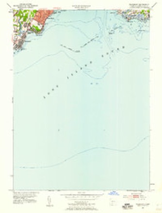
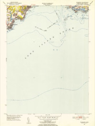
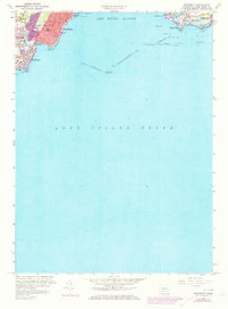
17 topographic sheets cover this place, the earliest surveyed in 1947 and the latest in 1983. It stands in Milford town. It lies in ZIP code area 06460. It stands on Oyster River. The Survey maps it on the Woodmont quadrangle. 1,488 people lived here at the 2010 count. It stands 39 feet above sea level.
Topographic sheets covering this place
9 surveys from 17 printed sheetsMatched by testing this settlement's coordinate against the published boundary of every sheet in the United States Geological Survey's historical collection. Each opens the scanned sheet at the Survey.
- 1947 USGS Hartford quadrangle1:250000, 2 printings
- 1948 USGS Hartford quadrangle1:250000, 2 printings
- 1951 USGS Woodmont quadrangle1:24000
- 1951 USGS Woodmont quadrangle1:31680
- 1960 USGS Woodmont quadrangle1:24000, 3 printings
- 1961 USGS Hartford quadrangle1:250000
- 1962 USGS Hartford quadrangle1:250000, 3 printings
- 1965 USGS Hartford quadrangle1:250000, 2 printings
- 1983 USGS New Haven quadrangle1:100000, 2 printings






In the county-history sources
34,124 words on this townshipHistory of New Haven County, Connecticut, published 1892 names this settlement in its chapter on Milford Town. These are the passages that mention it, exactly as the scans read.
East of the harbor are Indian Neck and Welch's Point, so named for Thomas Welch, an early owner. This has a good beach, and fine summer residences have been erected on the high lands overlooking the sound. Next eastward is Pond Point, named for Charles Pond, the owner of a large tract of land in that locality; and Merwin's Point, still further to the eastward, took its name from Miles Merwin, the original settler. Burwell's Farm, or the newly developed section of Woodmont Beach, is the last point of land in the town, which has become a favorite resort on account of its bathing priv- ileges afforded by this shore. All along the sound to Indian Neck are a number of sightly places, some of which have been improved for beautiful homes.
Passage source: History of New Haven County, Connecticut, published 1892.
Woodmont is a post office and station on the New Haven railroad in the eastern part of the town, near the Long Island sound. Extending to the beach and along the shore, a village of several hundred inhabitants, most of them summer residents only, has lately sprung up; but the improvements lately begun and projected will not only make this an attractive place of resort, but will also invite a settled population. In the past year some handsome residences were erected and the roads much improved.
Passage source: History of New Haven County, Connecticut, published 1892.
Machine-read from a century-old scan, so expect the errors a machine makes: misspelled names, dropped words, stray characters.
Fires near this place
12 since 1993Regional context, not property-specific evidence. The federal wildfire occurrence database lists 12 fires within 5 miles of Woodmont between 1993 and 2018, burning about 213 acres in total. None started naturally. 5 were recorded as arson. Distance is straight-line from the map coordinates, so a fire counted here may appear on a neighbouring settlement's page as well.
| Reported cause | Fires |
|---|---|
| Missing data/not specified/undetermined | 6 |
| Arson/incendiarism | 5 |
| Equipment and vehicle use | 1 |
The most recent of them, most recent first, with the day each was reported and the service that recorded it.
| Date | Cause | Size | Reported by | Name on the report |
|---|---|---|---|---|
| 5 July 1993 | Missing data/not specified/undetermined | 2.0 acres | Connecticut Division of Forestry | not named |
| 26 July 1999 | Arson/incendiarism | 100 acres | Connecticut Division of Forestry | not named |
| 23 July 1993 | Equipment and vehicle use | 1.0 acres | Connecticut Division of Forestry | not named |
| 19 July 1993 | Arson/incendiarism | under an acre | Connecticut Division of Forestry | not named |
| 11 July 1999 | Arson/incendiarism | under an acre | Connecticut Division of Forestry | not named |
| 4 May 1994 | Arson/incendiarism | 1.5 acres | Connecticut Division of Forestry | not named |
| 9 April 2012 | Missing data/not specified/undetermined | 50 acres | Connecticut Division of Forestry | MILFORD |
| 6 April 2016 | Missing data/not specified/undetermined | under an acre | Connecticut Division of Forestry | 160 WAMPUS LANE |
Settlements close enough to share some of these fires:
Mines and quarries near this place
6 within 5 milesRegional context, not property-specific evidence. The federal mineral resources record lists 6 workings within 5 miles of Woodmont: 5 past producers, 1 plant. 1 still produces. What was taken out: Stone, Iron, Marble, Dimension, Stone, Dimension. Distance is straight-line from the map coordinates, so a quarry counted here may appear on a neighbouring settlement's page as well.
| Where | Site | Commodity | Status | Recorded |
|---|---|---|---|---|
| Bridgeport Steel/ Milford, Ct. | Iron | Plant | ||
| Gold Mine | Gold | Past Producer | ||
| Milford Green Marble Quarry | Marble, Dimension | Past Producer | ||
| Quarries | Stone, Dimension | Past Producer | ||
| Gneiss Rock Quarries No. Ek-033 | Stone | Past Producer | Gneiss, Schist | |
| Limestone Rock Quarry No. El-002 | Stone | Past Producer | Unknown |
Nearest settlements
The eight closest, with where each one stands in the county. Distances are straight-line, computed from the Geographic Names Information System coordinates.
| Map | Place | Distance | Sheets |
|---|---|---|---|
| Milford Lawns | 0.9 miles | 31 | |
| Morningside | 1.4 miles | 31 | |
| West Shore | 1.5 miles | 17 | |
| Point Beach | 2.1 miles | 31 | |
| Sea Bluff | 2.3 miles | 39 | |
| Bayview | 2.3 miles | 31 | |
| Forest Heights | 2.9 miles | 31 | |
| Savin Rock | 3.3 miles | 39 |
Elsewhere
Matched on this settlement's Geographic Names Information System number rather than its name, so it cannot be a different place of the same name in another state.
| Wikipedia article on Woodmont | An encyclopaedic summary. Its text is share-alike, so it is linked here rather than copied. |
| Wikidata item Q753310 | The structured record the population and elevation above come from. Public domain (CC0). |
Provenance
This settlement is recorded in the Geographic Names Information System as feature 212247. The sheet list is computed by point-in-boundary test against the United States Geological Survey's historical topographic inventory. Both are works of the United States government and carry no copyright under 17 U.S.C. 105.
Wildfire. Short, Karen C. 2022. Spatial wildfire occurrence data for the United States, 1992-2020 [FPA_FOD_20221014]. 6th Edition. Fort Collins, CO: Forest Service Research Data Archive. https://doi.org/10.2737/RDS-2013-0009.6 Collected with United States Government funding and usable without additional permissions or fees.
Mines and quarries. USGS Mineral Resources Data System (MRDS) https://mrdata.usgs.gov/mrds/ A work of the United States government, no copyright under 17 U.S.C. 105.