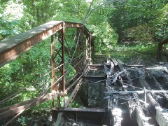
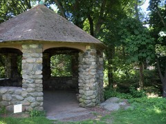
Listed on the National Register of Historic Places in 2000.
From the record
“Wolcott Green Historic District a historic district in the New England town of Wolcott, Connecticut. The district encompasses the town green and the surrounding buildings.”
Wikipedia article Wolcott Green Historic District, CC BY-SA 4.0.
One of 272 National Register listings published here for New Haven County · listed in 2000 · category: District.
National Register reference number.00000297- the number the National Park Service assigned this property when it was listed, and the key its nomination file is catalogued under at the National Archives.
What happened here
An account from the chapter on Wolcott town. The inset identifies its exact
source book and publication year.
Samuel M. Bailey, born in Wolcott, in 1831, is a son of Luther and grandson of James Bailey, who served in the war of the revolution and held a lieutenant's commission. He was twice married, his second wife being Phebe Pomeroy. Their son, Luther, married for his first wife, Henrietta Brockett. They had three children: Samuel M., Sarah and Hobart L., who enlisted in the 7th Connecticut Volunteers and was killed at the battle of the Wilderness.
THE town of Wolcott is in the extreme northern part of the county and on the line separating New Haven county from the towns of Bristol and Southington in Hartford county, and the town of Plymouth, in Litchfield county. South and west is the town of Waterbury. The average length of Wolcott, from north to south, is about six miles; the breadth is a little more than three miles. The general surface is hilly and mountainous. In all the territory there is only one distinct valley - the one extending from Waterbury, on the west, along Mad river. Along that stream and in the northwestern part of the town, is the elevation called Spindle hill, whose highest point is known as Clinton hill. It is claimed that this is one of the highest points of land in this part of the state. From its summit may be seen Long Island, some parts of Massachusetts, and nearly a dozen villages and cities in the surrounding towns. Many other hills in the town approximate Clinton hill in height. Pike's hill in the northeastern part, a point on the Southington mountain, is but a little lower. The Southington mountain extends from the southeastern part of the town along the east line, northward for more than two miles. On the summit the land is comparatively level and some good farms had been opened, but most of them have been abandoned. It takes its name from its location relative to Southington. Some of the other hills were named for those who first lived upon them.
The land in Wolcott, being originally in the towns of Waterbury and Farmington, was " taken up " or owned by the people of those towns a number of years before any one came here to live as an actual settler. The Waterbury part, by reason of its greater accessibility, the old Farmington path leading through the upper part, was first settled. In 1731 John Alcock or Alcox,* at that time an energetic young man of 26 years, came from New Haven and settled on a tract of land, of 117^ acres, in the western part of Wolcott. He increased his purchase until he owned more than 1,000 acres, and was for a number of years the principal as well as the first settler of the town. At the time of his removal here he had been married about 15 months to Deborah Blakeslee, of North Haven, who thus became the queen bride of Wolcott. Their eldest son, Captain John Alcox, was born December 28th, 1731, and was the first child born in the limits of the town. Eleven more children came to bless their home, and their descendants became numerous and influential. In direct line of descent were Amos Bronson Alcott and Doctor William A. Alcott, who were honored beyond the measure allotted to most men on account of the useful lives they led. The daughters of Bronson Alcott, Louisa A. and May, have been among the most beloved of American women. John Alcox died January 6th, 1777, nearly 72 years of age, but his wife survived him until January 7th, 1789.
Regional context, not property-specific
evidence. The
federal wildfire occurrence database
lists 89 fires within 5 miles of Wolcott Green Historic District
between 1992 and 2020, burning about 442 acres in total. None started naturally. 20 were recorded as arson.
Distance is straight-line from the map coordinates, so a fire counted
here may appear on a neighbouring settlement's page as well.
Reported cause
Fires
Missing data/not specified/undetermined
37
Arson/incendiarism
20
Misuse of fire by a minor
14
Debris and open burning
9
Recreation and ceremony
7
Equipment and vehicle use
1
Smoking
1
The most recent of
them, most recent first, with the day each was reported and the service
that recorded it.
Regional context, not property-specific
evidence. The federal mineral resources record lists
23 workings within 5 miles of Wolcott Green Historic District: 13 past producers, 8 producers, 2 unknowns.
8 still produce. What was taken out: Sand and Gravel, Construction, Stone, Dimension, Granite, Barium-Barite. Distance is straight-line from the
map coordinates, so a quarry counted here may appear on a neighbouring
settlement's page as well.
Regional context, not property-specific
evidence. The National Weather Service names
Wolcott, the town this property stands in, in 22 storm reports between 1995 and 2023: 9 thunderstorm wind, 6 flash flood, 3 hail, 3 lightning.
No death or injury is recorded in these reports. Each account below is quoted exactly as the forecast office
filed it, from the NOAA Storm Events Database, and each date
opens the federal record of that event.
A weak EF-0 tornado touched down in Wolcott CT Sunday morning. The path began near the intersection of Minor Road and Center Street where a tree was uprooted and facing west. Convergent, intermittent tree damage continued along a path to the northeast to Wolcott High School. Large fixed sports equipment was thrown across a field and a fence line was blown down to the west. Several trees were also topped. Further to the northeast on Kalko Drive several trees were downed by the tornado and a large tree fell on a trailer. The tornado lifted around Stagecoach Lane where a tree was uprooted and fell to the west onto a home.
Lightning struck a tree at 84 Greystone Road, passed through rock and stone retaining wall, then struck the home at 92 Greystone Road in Waterbury, causing a minor fire, electrical damage, and some cosmetic damage to the exterior. The force of the strike also caused the dishes to come out of a cabinet at 85 Greystone Road.
No historic map-sheet match is published
for this property yet. That does not mean no map exists. This record needs
a coordinate-quality review before it can be joined to a sheet boundary.
Browse the county's mapped places while that work is
pending.
Listed places nearby
6 within 8 miles
Other National Register properties close
enough to walk or drive between, ordered by distance from this one. Both
positions come from the same geocoding pass that matched these properties
to their map sheets.
Listing record. National Park Service National Register of Historic Places, listed-properties dataset, current to 2026-05-22.
Map join. Address geocoded through the United States Census geocoder, then tested against the published boundary of every sheet in the USGS Historical Topographic Map Collection.
How this page is made. Listing fields come from federal records; map-sheet coverage is a labelled coordinate-to-boundary calculation, not a source-field claim.
Wildfire. Short, Karen C. 2022. Spatial wildfire occurrence data for the United States, 1992-2020 [FPA_FOD_20221014]. 6th Edition. Fort Collins, CO: Forest Service Research Data Archive. https://doi.org/10.2737/RDS-2013-0009.6 Collected with United States Government funding and usable without additional permissions or fees.
Mines and quarries. USGS Mineral Resources Data System (MRDS) https://mrdata.usgs.gov/mrds/ A work of the United States government, no copyright under 17 U.S.C. 105.
Storms. NOAA National Centers for Environmental Information, Storm Events Database https://www.ncei.noaa.gov/stormevents/ A work of the United States government, no copyright under 17 U.S.C. 105. Narratives are quoted verbatim from the National Weather Service report and are not edited or summarised.
 Block