 Block
From the record
One of 82 National Register listings published here for Windham County · listed in 2003 · category: District.
Sources: the case file at the National Archives · the National Register database, National Park Service
Listed on the National Register of Historic Places in 2003.
One of 82 National Register listings published here for Windham County · listed in 2003 · category: District.
Sources: the case file at the National Archives · the National Register database, National Park Service
The chapter on Canterbury Town in History of Windham County, Connecticut .., published 1889 names Canterbury. This is what it says, exactly as the scans read.
The first inhabitants west of the Quinebaug were probably the tenants of Peagscomsuck. Rowland Jones, who purchased in 1691 four hundred acres of land on what is still Rowland's brook, was one of the first settlers here. Thomas Brooks and Obadiah Johnson also settled west of the Quinebaug, but little progress was made till 1697, when Major Fitch, with his family removed thither, digging the first cellar and erecting the first permanent habitation in what is now the township of Canterbury. With hundreds of farms and many thousand acres at his disposal, he selected for his residence a neck of land partially enclosed by a bend in the Quinebaug river, below the river island Peag.scomsuck, which gave its name to the settlement. At the time of his removal hither Major Fitch was a little past middle age, and had been for many years one of the most prominent men in Connecticut. From early manhood he had been actively employed in civil and military affairs - helped to re-establish colonial government after the revolution of 1689; was appointed assistant in 1690; was appointed sergeant major of New London county in 1696; served as boundary commissioner and land reviser; led military expeditions, manned forts, guarded the frontier, and exercised jurisdiction over the Mohegans and all their lands and interests. After the death of his first wife - a daughter of Captain John Mason - he married Alice Bradford, widow of Reverend William Adams, of Dedham, and mother of Mrs. Whiting, of Windham. Nine sons and daughters accompanied him to his new home here, and soon the Indian " neck " became an attractive family seat. The social position of Major Fitch, and his wide business relations, drew many people around him, and his plantation at once became a place of no small consequence - a rendezvous for land traders, civil and military officials and hordes of idle Indians. Here courts were held, military expeditions organized, and many thousand acres of land bartered away. It was the first, and long the only, settlement between Norwich and Woodstock, extending its hospitalities and accommodations to many aweary traveler. The expedition that marched to the relief of Woodstock in 1699 passed the night, both in going and returning, " at Major Fitch's farm in Peagscomsuck." A road was soon laid out from Windham to this noted establishment, and connecting with Greenwich path, formed the great thoroughfare to Providence. Kent was the name given by the major to his plantation, but the Indian appellation persistently adhered to it.
Passage source: History of Windham County, Connecticut .., published 1889.
A conflict of land claims soon arose between Major Fitch and Fitz John Winthrop and others. Winthrop having been elected governor of Connecticut in 1698, secured a patent of confirmation of his title to certain lands which he had bought of the Indians. The patent to the town of Plainfield also aroused some opposition, and the ownership of land in this neighborhood was uncertain until the early part of 1703, when it was mutuallyagreed that a new town should be formed on the west side of the Quinebaug, to be called Canterbury, and the assembly being thus petitioned, granted a charter for the said new town. The line agreed upon and observed in the charter, as dividing the towns of Canterbury and Plainfield, followed the river down from the northern boundary of the town "to the center of Peagscomsuck island and from the center of that island due east a quarter of a mile - thence a line run straight to the south bounds of town a mile eastward from Quinebaug River." This jog into Plainfield in the southeast corner of Canterbury was made to allow the Canterbury people a share of the rich "plain "lands upon which they had been in the habit of planting in the common cornfields before the town was divided. The settlers whose names appear to the agreement to make the described line the division between Canterbury and Plainfield were James Fitch Samuel Cleveland, Obadiah Johnson, Robert Green, Josiah Cleveland, Elisha Paine, Richard Adams, Thomas Brooks, Benjamin Rood and Isaac Cleveland.
Passage source: History of Windham County, Connecticut .., published 1889.
Machine-read from a century-old scan, so expect the errors a machine makes: misspelled names, dropped words, stray characters.
Read the whole chapter on Canterbury Town - 23,574 words on its settlement, mills, schools and churches.
Regional context, not property-specific evidence. The federal wildfire occurrence database lists 117 fires within 5 miles of March Route of Rochambeau's Army: Manship Road-Barstow Road between 1993 and 2020, burning about 138 acres in total. 1 started naturally. 7 were recorded as arson. Distance is straight-line from the map coordinates, so a fire counted here may appear on a neighbouring settlement's page as well.
| Reported cause | Fires |
|---|---|
| Missing data/not specified/undetermined | 79 |
| Recreation and ceremony | 10 |
| Arson/incendiarism | 7 |
| Misuse of fire by a minor | 6 |
| Smoking | 5 |
| Debris and open burning | 5 |
| Equipment and vehicle use | 2 |
| Natural | 1 |
| Railroad operations and maintenance | 1 |
| Power generation/transmission/distribution | 1 |
The most recent of them, most recent first, with the day each was reported and the service that recorded it.
| Date | Cause | Size | Reported by | Name on the report |
|---|---|---|---|---|
| 5 September 2016 | Missing data/not specified/undetermined | under an acre | Connecticut Division of Forestry | 257 WATER ST, CANTERBURY CT |
| 9 August 1998 | Recreation and ceremony | 1.0 acres | Connecticut Division of Forestry | not named |
| 8 August 2016 | Missing data/not specified/undetermined | under an acre | Connecticut Division of Forestry | 229 S CANTERBURY RD, CANTERBURY CT |
| 10 August 2020 | Debris and open burning | under an acre | Connecticut Division of Forestry | 6 FINN ROAD |
| 4 July 1997 | Equipment and vehicle use | 2.0 acres | Connecticut Division of Forestry | not named |
| 25 July 2016 | Missing data/not specified/undetermined | under an acre | Connecticut Division of Forestry | RAILROAD AVE / PACKERVILLE RD, PLAINFIELD |
| 25 June 1999 | Misuse of fire by a minor | 5.0 acres | Connecticut Division of Forestry | not named |
| 9 May 2007 | Missing data/not specified/undetermined | under an acre | Connecticut Division of Forestry | not named |
Regional context, not property-specific evidence. The federal mineral resources record lists 5 workings within 5 miles of March Route of Rochambeau's Army: Manship Road-Barstow Road: 4 past producers, 1 producer. 1 still produces. What was taken out: Sand and Gravel, Construction, Stone. Distance is straight-line from the map coordinates, so a quarry counted here may appear on a neighbouring settlement's page as well.
| Where | Site | Commodity | Status | Recorded |
|---|---|---|---|---|
| Granitic Gneiss Rock Quarry No. Aj-013 | Stone | Past Producer | Gneiss | |
| Canterbury Pit | Sand and Gravel, Construction | Past Producer | Sedimentary | |
| Canterbury Pit | Sand and Gravel, Construction | Past Producer | ||
| Waskiewicz Pit | Sand and Gravel, Construction | Past Producer | Sedimentary | |
| Waskiewicz Pit | Sand and Gravel, Construction | Producer |
Regional context, not property-specific evidence. The National Weather Service names Canterbury, the town this property stands in, in 5 storm reports between 1999 and 2024: 4 thunderstorm wind, 1 hail. No death or injury is recorded in these reports. Each account below is quoted exactly as the forecast office filed it, from the NOAA Storm Events Database, and each date opens the federal record of that event.
| When | Event | Place named | Harm | What the report says |
|---|---|---|---|---|
| June 2012 | Thunderstorm Wind | Canterbury | $30,000 | Multiple trees and wires on Route 14 were downed by thunderstorm winds. |
| August 2016 | Thunderstorm Wind | Canterbury | $15,000 | Trees and wires along Canterbury Road were downed by thunderstorm winds. |
| June 2024 | Thunderstorm Wind | Canterbury | $800 | In Canterbury, a tree was down on wires. |
| June 2009 | Hail | Canterbury | - | Nickel size hail fell in Canterbury along Route 14 just west of the center of town. Visibility was reduced to nothing in heavy rain and hail. |
| July 1999 | Thunderstorm Wind | Canterbury | - | no account filed |
No historic map-sheet match is published for this property yet. That does not mean no map exists. This record needs a coordinate-quality review before it can be joined to a sheet boundary. Browse the county's mapped places while that work is pending.
Other National Register properties close enough to walk or drive between, ordered by distance from this one. Both positions come from the same geocoding pass that matched these properties to their map sheets.
| Photograph | Property | Distance | Listed |
|---|---|---|---|
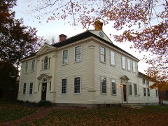 | Canterbury Center Historic District | 1.6 miles | 1998 |
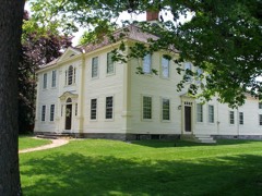 | Prudence Crandall House | 1.7 miles | 1970 |
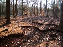 | Quinebaug River Prehistoric Archeological District | 2.3 miles | 2009 |
| March Route of Rochambeau's Army: Old Canterbury Road | 2.9 miles | 2003 | |
| March Route of Rochambeau's Army: Palmer Road | 3.0 miles | 2003 | |
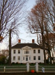 | Capt. John Clark House | 3.1 miles | 1970 |
| National Archives record | The nomination case file for reference 02001678 in Record Group 79. |
| Windham County | All 82 listed properties in this county. |