BlockBefore

Windham County, Connecticut

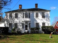
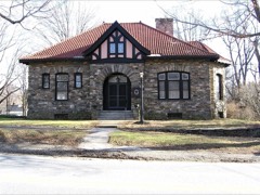
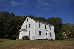
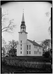
208 topographic sheets cover 83 settlements here, and 82 properties are on the National Register of Historic Places.

Research this county

From the record

82 National Register listings published here, 3 of them National Historic Landmarks · the county-history sources name 16 people · people the book names include Artotvpe, E. 6Iersta0T (Plainfield Town, 1889) · Dr. A. Dorrance Ayer (Scotland Town, 1920) (machine-read).

Sources: the county history on the Internet Archive · the National Register database, National Park Service

Connecticut within the United States
Windham County within Connecticut

What the record shows

  • 2,442 topographic sheet readings cover the county's settlements.
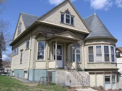
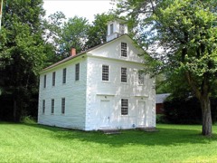
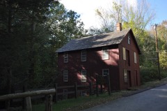
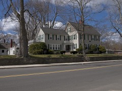
  • 82 properties here are on the National Register of Historic Places: 44 buildings, 31 districts, 5 structures and 2 sites.
  • 16 of the 82 listings were added during the 1970s.
  • The Geographic Names Information System records 83 populated places in this county; 83 are covered by at least one topographic sheet.
  • 4 public-domain county histories, 1880 to 1920, supply 474,600 words of narrative reproduced here.

Places on the National Register

82

Every property in this county listed on the National Register of Historic Places, with the year it was listed and the federal nomination document.

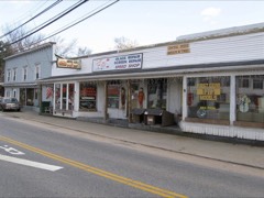
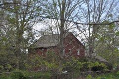
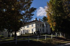
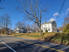
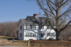
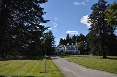
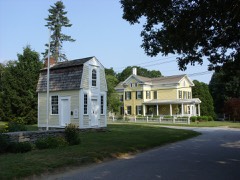
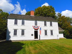
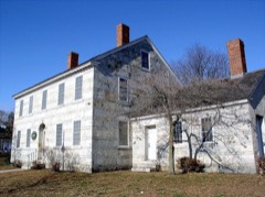
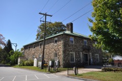
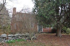
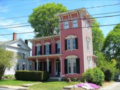
Photograph PropertyType ListedReference
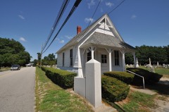
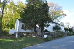
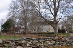
Abington Congregational Churchbuilding197777001413
Aldrich Free Public Librarybuilding199494000768
American Thread Companydistrict201414000434
Ashford Academybuilding198888002649
Benjamin Bosworth Housebuilding197878002857
Henry C. Bowen Housebuilding197777001414
Mathew Bowen Homesteadbuilding198787000859
Brayton Grist Millbuilding198686001257
Broad Street-Davis Park Historic Districtdistrict199898001556
Brooklyn Green Historic Districtdistrict198282004401
Bush Hill Historic Districtdistrict198787000012
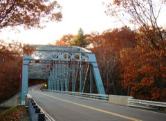
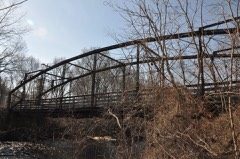
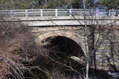
Butts Bridgestructure201010000272
Cady-Copp Housebuilding200101000939
Canterbury Center Historic Districtdistrict199897001446
Cargill Falls Mill (Wilkinson Mill)district201414000435
Central Village Historic Districtdistrict199191000949
Capt. Seth Chandler Housebuilding199393001380
Chaplin Historic Districtdistrict197878002856
Church Farmbuilding198888002650
Capt. John Clark Housebuilding197070000699
Prudence Crandall Housebuilding197070000696
Danielson Main Street Historic Districtdistrict199292000265
Dayville Historic Districtdistrict198888001422
Dorrance Innbuilding200202000867
Elliottville Lower Millbuilding198282004406
First Congregational Church of Plainfieldbuilding198686002116
Glen Falls Bridgestructure199999000408
Gwyn Caregbuilding199494000336
Hampton Hill Historic Districtdistrict198282004408
Dr. Chester Hunt Officebuilding197070000708
Samuel Huntington Birthplacebuilding197171001009
Isaac and Sarah Upham Housebuilding2025100012114
Israel Putnam Schoolbuilding198484000788
William Jillson Stone Housebuilding197171000912
Killingly High School, Oldbuilding199292000266
Knowlton Memorial Hallbuilding199494000252
Lawton Mills Historic Districtdistrict199696000028
Main Street Historic Districtdistrict198282004410
Main Street Historic District (Boundary Increase)district199292000902
March Route of Rochambeau's Army: Manship Road-Barstow Roaddistrict200302001678
March Route of Rochambeau's Army: Old Canterbury Roaddistrict200303000310
March Route of Rochambeau's Army: Palmer Roaddistrict200303000311
March Route of Rochambeau's Army: Plainfield Pikedistrict200303000312
March Route of Rochambeau's Army: Scotland Roaddistrict200303000314
Mixer Tavernbuilding199494000253
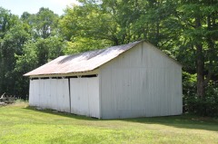
Natchaug Forest Lumber Shedbuilding198686001732
George Pickering Nichols Housebuilding199191000990
North Grosvenordale Mill Historic Disrictdistrict199393000288
Old Westfield Cemeterysite201010000578
Packerville Bridgestructure199292001565
Plainfield Street Historic Districtdistrict199191000350
Plainfield Woolen Company Millbuilding198585001919
Pomfret Street Historic Districtdistrict199898000372
Pomfret Town Housebuilding198988003221
Prospect Hill Historic Districtdistrict200303000814
Putnam Farmbuilding198282004399
Putnam High Schoolbuilding199393001343
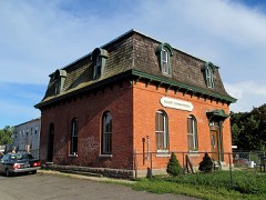
Putnam Railroad Stationbuilding200707000742
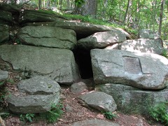
Israel Putnam Wolf Densite198585000949
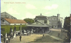
Quinebaug Mill-Quebec Square Historic Districtdistrict198585001921
Quinebaug River Prehistoric Archeological Districtdistrict200909000696
Sterling Hill Historic Districtdistrict198686000152
Sumner-Carpenter Housebuilding199191001854
Taylor's Cornerbuilding198988003220
Temple Beth Israelbuilding201313000162
Thompson Hill Historic Districtdistrict198787002186
Trinity Churchbuilding197070000703
Union Society of Phoenixville Housebuilding200707001247
Unitarian Meetinghousebuilding197272001335
Wauregan Historic Districtdistrict197979003789
Jonathan Wheeler Housebuilding198282004405
Willimantic Armorybuilding198585002310
Willimantic Elks Clubbuilding200505001045
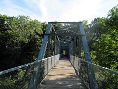
Willimantic Footbridgestructure197979002654
Willimantic Freight House and Officebuilding198282004414
Windham Center Historic Districtdistrict197979002655
Witter Housebuilding197070000704
Woodstock Academy Classroom Buildingbuilding198484001176
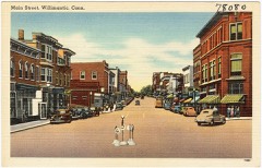
Woodstock Hill Historic Districtdistrict199998001578
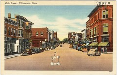
Wylie Schoolbuilding199191001742

Wildfire, 1992 to 2020

728 fires

Every wildfire the federal occurrence database records inside this county: 728 of them, burning about 1,175 acres. 4 started naturally and 54 were recorded as arson. Each settlement page carries the fires within five miles of it.

Reported cause Fires
Missing data/not specified/undetermined473
Recreation and ceremony67
Debris and open burning57
Arson/incendiarism54
Misuse of fire by a minor37
Smoking20
Equipment and vehicle use8
Natural4
Railroad operations and maintenance4
Power generation/transmission/distribution4

The five largest, by the area the report gives. Three of them were set deliberately.

DateCause SizeReported by Name on the report
16 September 2020Recreation and ceremony94 acresConnecticut Division of ForestryAIRLINE TRAIL
20 April 2005Arson/incendiarism42 acresConnecticut Division of Forestrynot named
20 April 2008Misuse of fire by a minor40 acresConnecticut Division of Forestrynot named
8 May 2001Debris and open burning35 acresConnecticut Division of Forestrynot named
8 April 2000Arson/incendiarism30 acresConnecticut Division of Forestrynot named
24 April 2010Missing data/not specified/undetermined30 acresConnecticut Division of Forestrynot named
1 May 1999Missing data/not specified/undetermined30 acresConnecticut Division of Forestrynot named
1 May 1999Arson/incendiarism30 acresConnecticut Division of Forestrynot named

Every settlement page carries the fires within five miles of it - see the settlement index below.

Storms, 1956 to 2025

60 of 291 shown

The NOAA Storm Events Database holds 291 reports for this county, causing no deaths, 2 injuries and about $3,926,100 in recorded property damage. Each settlement page carries the reports that name it.

Kind of event Reports
Thunderstorm Wind182
Hail49
Flash Flood19
Flood17
Tornado9
Lightning8
Heavy Rain7

The most serious of them, by death, then injury, then recorded damage. The accounts are quoted exactly as the forecast office filed them.

WhenEvent Place namedHarm What the report says
August 2004LightningWoodstock2 hurtno account filed
June 1985Tornado (F1)not stated$2,500,000no account filed
August 2016Flash FloodPomfret Center$100,000In Killingly, the intersection of Mechanic Street and Westfield Avenue was flooded and impassable. Two cars were stuck in flood waters at the Interstate 395 and Route 6 interchange. The Interstate 395 connector (Governor John Davis Lodge Turnpike) from Route 6 on the CT/RI border was closed due to flooding. Several cars became stuck on the turnpike because of the closure. In Danielson, an apartment complex on Cottage Street was flooded, resulting in an evacuation of all residents. Finally, five cars were stuck in flood waters on West Road or Route 97 in Pomfret.

July 2011Thunderstorm WindWillimantic$75,000Numerous trees and wires in the Pleasant Street area were downed by thunderstorm winds. A few of these trees fell on houses. Trees and branches also were reported down on Route 6 and Riverside Drive. A rubber membrane roof was blown off an apartment house landing on Bridge Street. A tree fell onto a minivan on Windham Center Road. No one was injured, but one passenger was taken to the hospital for evaluation.
July 2006Thunderstorm WindAshford$50,000no account filed
September 2018FloodWillimantic$45,000At 8:58 PM EST, Ash Street in Willimantic, near the Kingswood Apartments, was flooded, impassable, and had a road washout.
July 2023Thunderstorm WindChaplin$40,000In Chaplin, two cars were crushed by a falling 24-inch oak tree, which was uprooted. Multiple roads were closed in the area from fallen trees.
September 2018FloodWillimantic$40,000At 7:15 PM EST, Main Street in Willimantic was flooded and impassable. A laundromat on Main Street reported water coming into the store.
September 2018FloodWindham$40,000At 8:00 PM EST, Jennings Lane in Windham was flooded, impassable, and closed due to a possible washout.
August 2016Thunderstorm WindPutnam$40,000Numerous trees and wires were downed throughout eastern Putnam by thunderstorm winds.
August 2023Tornado (EF1)Scotland$30,000A tornado caused damage in the town of Scotland, located in|Windham County, CT. The tornado touched down on Bass Road and continued along Route 14 (Huntington Road) and crossed Pinch Street before it eventually|lifted near Brook Road. While there wasn't much in the way of structural damage observed, other than gutter damage to two homes, there was significant tree|damage. It was estimated that well over one hundred trees were|either downed or sheared off at their tops.
July 2018Tornado (EF0)Ashford$30,000At 3 PM EST, an EF-0 tornado touched down west of Ashford Lake and moved generally east for about one minute. Damage was confined to a narrow area bounded by North Road to the west and Ashford Lake to the east, and by Birchwood drive to the north and Westview Drive to the south. Numerous large trees were uprooted in this area. While the tornado was over the lake, a local resident observed water from the lake was lifted fifty to sixty feet into the air. The tornado then lifted off the surface over the east end of Ashford Lake. Overall, the tornado had maximum winds of 85 MPH. Numerous trees were uprooted by the tornado along its path. Path length was 0.4 miles and width was 225 yards.
August 2016Thunderstorm WindWoodstock$30,000A tree on Sprucedale Road was downed onto wires by thunderstorm winds. Trees and a utility pole were downed on East Quasset Road.
June 2012Thunderstorm WindCanterbury$30,000Multiple trees and wires on Route 14 were downed by thunderstorm winds.
June 2012Thunderstorm WindScotland$30,000Trees and wires on Pudding Hill Road, Brook Road, and Route 97 were downed by thunderstorm winds.
July 2011Thunderstorm WindWindham$30,000Many trees in South Windham were downed by thunderstorm winds. Also, a large branch was downed onto the steps of town hall.
June 2009Flash FloodWindham$30,000Many roads were impassable across Mansfield and Willimantic. A store on Storrs Road in Mansfield was flooded and a house on Jackson Street in Willimantic was flooded.
November 2021Tornado (EF0)Almyville$25,000Based on definitive radar confirmation of a tornado debris signature and video footage from our media partners, we confirmed that an EF-0 tornado touched down in Plainfield, CT at approximately 4:48 PM EST on Saturday, November 13. Maximum wind speed was estimated at 80 mph and the maximum path width was estimated at 100 yards. The tornado was in contact with the ground for a total of 6.13 miles....approximately 4.7 miles in CT and 1.4 miles in RI. Several hardwood trees were uprooted on a hilltop on Sterling Hill Road near Goshen Road. A tree was reported down on a house on Main Street in Sterling. Also in Sterling, the Fire Department reported trees and wires down on River Road and a transformer fire at the intersection of Gibson Hill Road and Snake Meadow Hill Road. The tornado then tracked northeastward into Rhode Island and ended at the Cucumber Hill Farm in Foster at approximately 5:02 PM EST. Sheared trees and downed hardwood trees were observed on the farm. A heavy, large red trailer also was moved approximately 50 feet.
July 2022Thunderstorm WindWillimantic$23,000A microburst occurred in Willimantic. The 911 Call Center in Willimantic reported that a chimney fell into a roof on West Main Street at 608 PM EDT (508 PM EST). Police reported that the top of a utility pole was snapped off at the intersection of Pleasant Street and Lebanon Avenue. A tree and wires were down on Pleasant Street. A tree and wires also were down on West Avenue, South Street at Oxbow Drive, and Southridge Drive. Reports were relayed to NWS via amateur radio operators.
May 2018Thunderstorm WindPhoenixville$20,000At 4:40 PM EST, trees were reported down on State Route 244 at the Route 97 intersection near Pomfret. Trees were down at the Pomfret School at Pomfret Street and Paradise Road, at the junction of Paradise Road and Deerfield Road, and at the intersection of North Road and Hampton Road. A tree was down across the road at U.S. Route 44 and Firetower Road.
February 2008FloodWindham$20,000In Windham, Routes 6 and 32 were flooded. Several streets and yards were flooded with six inches of water in Putnam. In the Moosup area of Plainfield, several yards were flooded. Freedley Road in Pomfret was closed due to flooding.
August 2021Tornado (EF0)North Grosvenor Dale$15,000A weak tornado touched town in the town of |Thompson in northern Windham County, Connecticut. A NWS |meteorologist conducted a storm survey following tips from amateur |radio operators and local broadcast meteorologists. The following |information summarizes all of the reports. ||The tornado touched down near a red barn near the intersection of |Quinebaug Road (Route 131) and Riverside Drive (Route 12). It was |reported to be about 50 yards wide and tracked northeastward in a |discontinuous path, impacting areas just south of Ryler Court at |Riverside Drive, Wilsonville Road, Wagher Road, and Denis Drive at |Labby Road. It then crossed the Massachusetts/Connecticut state |line and ended as a waterspout in Lake Chaubunagungamaug. Although |discontinuous, the total path length was 4.7 miles. The approximate |path width was 50 yards. Damage photos led to estimates of maximum |wind speeds of 80 to 85 mph, which puts this on the upper end of |the EF0 category of the Enhanced Fujita Scale. The time, based on |radar and eyewitness accounts, was from 1015 AM to 1024 AM EDT. ||More specifically, when the tornado touched down near Backwater |Brook, it snapped several trees in half in a convergent fashion. |It caused minor backyard damage at a nearby property before felling |numerous trees and power lines near the intersection of Riverside |Drive and Ryler Court. Tree damage was also reported at Wilsonville |Road and several trees were snapped in the backyard of a house near |Wagher Road and Forest Hill Drive. A tree was partially snapped near |Denis Drive at Labby Road before causing minor damage near Woods |Grove. Finally, multiple residents witnessed a waterspout over Lake |Chaubunagungamaug before dissipating near Killdeer Island.
February 2016Thunderstorm WindWoodstock$15,000Multiple trees on Route 171 in Woodstock were downed by thunderstorm winds.
August 2016LightningPutnam$15,000Lightning struck a house on Munyan Road, setting it on fire.
August 2016Thunderstorm WindPomfret$15,000Trees and wires on Quasset Road were downed by thunderstorm winds.
August 2016Thunderstorm WindPomfret$15,000Trees and wires on Day Road were downed by thunderstorm winds.
August 2016LightningPomfret$15,000Lightning struck a house on Hampton Road, starting a fire.
August 2016Thunderstorm WindPomfret$15,000Trees and wires were downed on Day Road and Wright's Crossing Road by thunderstorm winds.
August 2016Thunderstorm WindCanterbury$15,000Trees and wires along Canterbury Road were downed by thunderstorm winds.
July 2016Thunderstorm WindAttawaugan$15,000Trees and wires on Route 101 were downed by thunderstorm winds.
July 2016Thunderstorm WindPomfret$15,000Trees and wires on Hampton Road were downed by thunderstorm winds.
July 2014Thunderstorm WindEastford$15,000Trees and wires were downed in Eastford and Thompson.
June 2013Flash FloodWest Woodstock$15,000A house on Spring Hill Road has eighteen inches of water in the basement with water still rising.
June 2012Thunderstorm WindWindham$15,000Trees and wires near the new school in Windham were downed by thunderstorm winds.
June 2010Thunderstorm WindPlainfield$15,000Trees on Major Drive, Forest Street, and Gendron Road were downed by thunderstorm winds.
June 2006Thunderstorm WindWoodstock$15,000no account filed
July 2006Thunderstorm WindWindham$15,000no account filed
July 2021Flash FloodWest Ashford$10,000In Ashford, a bridge on Cushman Road, over Knowlton Brook, which is a tributary of the Mt. Hope River, was washed out due to rapid, heavy rainfall. Rainfall totals by early evening included 4.95 inches in Pomfret, 4.75 inches in 2.5 hours in Ashford, and 3.42 inches in Woodstock.
May 2018Thunderstorm WindAbington$10,000At 4:45 PM EST trees and wires were reported down on State Route 97 in Abington.
February 2016Thunderstorm WindAshford$10,000Trees and wires were downed by severe thunderstorm winds.
August 2016Thunderstorm WindKillingly Center$10,000A tree was downed onto a truck on Interstate 395 southbound between exits 91 and 92.
June 2013Thunderstorm WindWillimantic$10,000Trees were downed by thunderstorm winds.
July 2013Thunderstorm WindPomfret$10,000Trees and wires on Mashamoquet and Hampton Roads were downed by thunderstorm winds.
July 2013Thunderstorm WindKillingly Center$10,000Trees and wires on Putnam Pike and Lake Road were downed by thunderstorm winds.
July 2013Thunderstorm WindBrooklyn$10,000Wires on South Street were downed by thunderstorm winds.
July 2013Thunderstorm WindSouth Killingly$10,000Trees and wires on Mashentuck Road were downed by thunderstorm winds.
August 2012Thunderstorm WindWindham$10,000Trees and wires on Washington Street were downed by thunderstorm winds.
December 2011Thunderstorm WindAshford$10,000Trees and wires on Route 74 and Graham Road were downed by thunderstorm winds.
December 2011Thunderstorm WindSterling$10,000Trees and wires along Gibson Hill Road were downed by thunderstorm winds.
June 2010Thunderstorm WindEastford$10,000Trees and power lines were downed by thunderstorm winds.
July 2010LightningPomfret$10,000A house was struck by lightning on Valentine Road.
July 2010Thunderstorm WindPomfret$10,000Thunderstorm winds downed a tree and wires on Pomfret Street.
July 2010Thunderstorm WindNorth Grosvenor Dale$10,000Several trees were downed by thunderstorm winds, including one on Pompeo Road and another on Bully Hill Road.
June 2009Thunderstorm WindWillimantic$10,000Trees on Ash Street and large limbs on Prospect Street were downed by thunderstorm winds.
August 2006Thunderstorm WindKillingly Center$10,000no account filed
May 2018Thunderstorm WindKlondike$8,000At 4:45 PM EST, multiple trees were down in Putnam on Mechanics Street, Groveland Avenue, and at the intersection of U.S. Route 44 and State Route 21.
May 2006Thunderstorm WindWindham$8,000no account filed
June 2023LightningSouth Chaplin$7,000In Mansfield, lightning caused a house fire on Hickory Lane.
September 2008Thunderstorm WindThompson$7,000Numerous trees were downed by thunderstorm winds.
September 2023Tornado (EF0)South Killingly$6,000An EF-1 with maximum winds of 100 mph began on Bailey Hill Road |in the town of Killingly, CT between Cranberry Road and Ledge |Road, here the tornado removed shingles from a two story home and |either snapped or uprooted healthy and mature trees. The tornado |moved northeast towards Ledge Road causing similar tree damage |before dissipating on Shippie Schoolhouse Road in the town of |Foster, RI. Tree damage along the path was consistent with wind |speeds between 90 and 100 mph, resulting an EF-1 rating on the |Enhanced Fujita Scale.

Mines and quarries

75 recorded

The Survey's mineral resources record lists 75 workings inside this county. 18 still produce and 57 are closed or unrecorded. Each settlement page carries the workings within five miles of it.

Commodity Workings
Sand and Gravel, Construction31
Stone, Dimension14
Granite12
Stone11
Stone, Crushed/Broken5
Iron1
Graphite1
Flagstone1

The least common of them first, because a county's hundredth gravel pit says nothing its first ten did not.

Where SiteCommodity StatusRecorded
Bog Iron MineIronPast Producer
Lead Hill Mine Graphite DepositsGraphitePast Producer
Strouse Brothers QuarryFlagstonePast Producer
Connecticut FlatStone, Crushed/BrokenPast Producer
Hughes Stone CompanyStone, Crushed/BrokenPast Producer
New Haven Traprock Co. QuarryStone, Crushed/BrokenPast Producer
Strouse Brothers QuarryStone, Crushed/BrokenPast ProducerSedimentary
Wauregan Pit and QuarryStone, Crushed/Broken, Sand and Gravel, ConstructionProducer
Alaskite Or Quartz Monzonite Gneiss Rock Quarry No. Aj-002StoneProducer
Alaskite Or Quartz Monzonite Gneiss Rock Quarry No. Aj-007StoneProducer
Gneiss Rock Quarry No. Aj-012StoneProducer
Gneiss Rock Quarry No. Aj-003StonePast Producer
Gneiss Rock Quarry No. Aj-004StonePast ProducerUnknown
Gneiss Rock Quarry No. Aj-006StonePast Producer
Gneiss Rock Quarry No. Aj-008StonePast Producer
Gneiss Rock Quarry No. Aj-009StonePast Producer
Gneiss Rock Quarry No. Aj-010StonePast Producer
Granitic Gneiss Rock Quarry No. Aj-013StonePast ProducerGneiss
Granitic Rock Quarry No. Aj-011StonePast Producer
Bennett QuarriesGranitePast Producer
Granite QuarriesGranitePast Producer
Granite QuarryGranitePast Producer
Larrabee QuarryGranitePast Producer
Oneco QuarryGranitePast Producer
R.B. Marriot and Son QuarryGranitePast ProducerGranite
R.B. Marriott and Sons QuarryGraniteProducer
Sterling QuarryGranitePast Producer
Wauregan QuarryGranitePast ProducerGranite
Connecticut Flatstone QuarryStone, DimensionProducer
Hughes QuarryStone, DimensionProducer
Larrabee Felsic Biotite Gneiss Rock QuarryStone, DimensionPast Producer1878
QuarryStone, DimensionPast Producer
Canterbury PitSand and Gravel, ConstructionPast ProducerSedimentary
Canterbury PitSand and Gravel, ConstructionPast Producer
Danielson MineSand and Gravel, ConstructionProducer
Danielson PitSand and Gravel, ConstructionUnknown
Garvey PitSand and Gravel, ConstructionPast ProducerSedimentary
Garvey PitSand and Gravel, ConstructionProducer
Hain Sand & GravelSand and Gravel, ConstructionUnknown
Hain Sand and Gravel PitSand and Gravel, ConstructionProducer
Janeczek PitSand and Gravel, ConstructionPast ProducerSedimentary
Janeczek PitSand and Gravel, ConstructionPast Producer
Kappys Gravel PitSand and Gravel, ConstructionPast Producer
Kaprys Gravel PitSand and Gravel, ConstructionPast ProducerSedimentary
King Trucking PitSand and Gravel, ConstructionProducer
Latham PitSand and Gravel, ConstructionPast Producer
Minarik PitSand and Gravel, ConstructionPast ProducerSedimentary
Minarik PitSand and Gravel, ConstructionPast Producer
Munyon Road PitSand and Gravel, ConstructionProducer
Plains Road PitSand and Gravel, ConstructionProducer
R.A. Rawson Sand & Gravel, Inc.Sand and Gravel, ConstructionUnknown
Route 205 PitSand and Gravel, ConstructionProducer
South Windham PitSand and Gravel, ConstructionPast ProducerSedimentary
South Windham PitSand and Gravel, ConstructionProducer
Thompson PitSand and Gravel, ConstructionPast ProducerSedimentary
Thompson PitSand and Gravel, ConstructionPast Producer
Townfarm Road PitSand and Gravel, ConstructionProducer
Waskiewicz PitSand and Gravel, ConstructionPast ProducerSedimentary
Waskiewicz PitSand and Gravel, ConstructionProducer
Windham Sand and Stone, Inc. PitSand and Gravel, ConstructionPast ProducerSedimentary
Windham Sand and Stone, Inc. PitSand and Gravel, ConstructionProducer

The townships, in 1889

474,600 words

History of Windham County, Connecticut .. devotes a chapter to each township: its boundaries and streams, who settled it and when, the mills, the schools and the churches. All 15 are reproduced here in full. Each row shows the township's own shape and where it lies in the county, drawn from the Census Bureau's boundary. Which settlements belong to which township is computed from that same boundary, not taken from the book.

Shape and position in the county TownshipSettlements in it LengthSections
Ashford TownAshford, Lake Chaffee, Warrenville, West Ashford, Westford25,487 words14
Brooklyn TownBrooklyn, East Brooklyn, Quebec, Stetson Corner, West Wauregan29,833 words16
Canterbury TownCanterbury, Packer, Westminster23,574 words6
Chaplin TownBedlam Corner, Chaplin, Natchaug, Sherman Corner, South Chaplin14,679 words6
Eastford TownEastford, North Ashford, Phoenixville16,344 words5
Hampton TownClarks Corner, Hampton, Hamptonville, Rawson17,178 words13
Killingly TownAcquidaneck, Attawaugan, Ballouville, Danielson, Dayville, East Killingly, Elliotville, Elmville, Killingly Center, Pineville, Rogers, South Killingly42,294 words6
Plainfield TownAlmyville, Central Village, Moosup, Plainfield, Wauregan, Wauregan Station31,302 words7
Pomfret TownAbington, Elliotts, Massomuck, Pomfret, Pomfret Center, Pomfret Landing30,088 words6
Putnam TownEast Putnam, Putnam, Putnam Heights43,471 words7
Scotland TownScotland23,866 words16
Sterling TownEkonk, Oneco, Sterling14,025 words6
Thompson TownEast Thompson, Fabyan, Grosvenor Dale, Mechanicsville, North Grosvenor Dale, Quaddick, Quinebaug, Thompson, West Thompson, Wilsonville62,001 words9
Windham TownJohnson Park, North Windham, South Windham, Willimantic, Windham50,220 words32
Woodstock TownEast Woodstock, Harrisville, Kenyonville, Lake Bungee, North Woodstock, Quasset Lake, Roseland Park, South Woodstock, West Woodstock, Witches Woods, Woodstock, Woodstock Valley50,238 words17

The county's history books

1,273,524 words

4 books written about this county, cut here where the book itself is cut, at its printed chapters: 42 chapters in all. Every chapter is public domain, machine-read from the scan and reproduced complete. A chapter already given under one of the county's towns is not repeated in this list.

History of Windham County, Connecticut (1880)

ChapterLength
The whole text268,858 words in 17 parts

History of Windham County, Connecticut .. (1889)

A Modern History of Windham County, Connecticut (1920)

A Modern History of Windham County, Connecticut : a Windham County Treasure Book (1920)

The people it describes

16 named

Everyone History of Windham County, Connecticut .. stops to write about, with the section that describes them. Among them are the men who founded the place and governed the Territory. Each name opens the passage itself, in the words of 1889.

Every populated place in the county

83

Named settlements recorded in the Geographic Names Information System, each with the topographic sheets covering it. Villages, hamlets and abandoned places alike. Each is shown with the nearest named watercourse or landform and the survey quadrangle it falls on.

The vanished settlements of Windham County: the places named above that are no longer on the map.

Provenance

  • Topographic sheets. USGS Historical Topographic Map Collection, county index, measured from the bulk metadata.
  • Fire insurance maps. Library of Congress Sanborn collection, faceted to this county.
  • Photographs. Each place queried individually against the Library of Congress Prints and Photographs search.
  • Wildfire. Short, Karen C. 2022. Spatial wildfire occurrence data for the United States, 1992-2020 [FPA_FOD_20221014]. 6th Edition. Fort Collins, CO: Forest Service Research Data Archive. https://doi.org/10.2737/RDS-2013-0009.6 Collected with United States Government funding and usable without additional permissions or fees.
  • Mines and quarries. USGS Mineral Resources Data System (MRDS) https://mrdata.usgs.gov/mrds/ A work of the United States government, no copyright under 17 U.S.C. 105.
  • Storms. NOAA National Centers for Environmental Information, Storm Events Database https://www.ncei.noaa.gov/stormevents/ A work of the United States government, no copyright under 17 U.S.C. 105. Narratives are quoted verbatim from the National Weather Service report and are not edited or summarised.