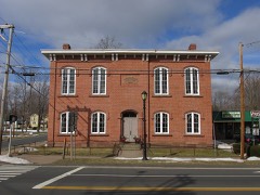
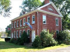
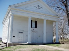
Listed on the National Register of Historic Places in 2003.
From the record
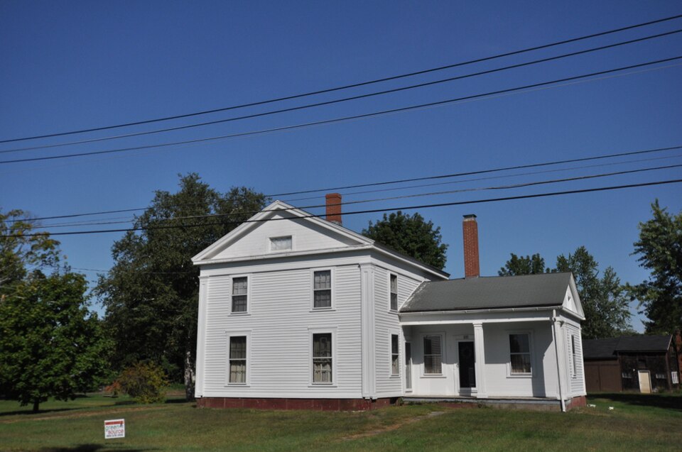
“Thompson Farmstead is a historic farm property at 215 and 219 Melrose Road in East Windsor, Connecticut. It includes a 19th-century farmhouse built by a member of one of the community's oldest families, and exhibits changing trends in agriculture uses over a 150-year period.”
Wikipedia article William H. Thompson Farmstead, CC BY-SA 4.0.
One of 451 National Register listings published here for Hartford County · listed in 2003 · category: Building.
National Register reference number.03000234- the number the National Park Service assigned this property when it was listed, and the key its nomination file is catalogued under at the National Archives.
Timothy Edwards was the son of Richard Edwards, of Hartford. He was born May 14, 1669, and was graduated at Harvard College in the class of 1691, witli a very high rank as a scholar. His father built for him a dwelling-house which was unusually costly and substantial for that period, and which was standing in the early years of the present century. This house stood less than a mile south of what is known as East Windsor Hill. The families to which ^,^--^- ^^ Mr. Edwards ministered were scattered upon ^J^^tYLr' ri^tJo^j'^ one long winding path a little way back ' *~^ from the Connecticut meadows, which reached from the Hartford town line, four miles below his home, to a nearly equal distance above. This road, which at the first was only a rude bridle-path, was gradually enlarged and improved, as the years passed on, until it came to be known as The Street, - a name which still continues in common use, and which distinguishes this from all other roads in the vicinity.
At length, however, the time was fully ripe, by the consent of all parties, for the division of the ancient town and the formation of a new township embracing all the Windsor territory upon the east side of the river. In the years just before this event there were voters in the town of Windsor who had to make a journey of ten or twelve miles, over the roughest roads, and across a broad river often swollen with floods, to reach the place of voting. Wlien it was fully decided that the town should be divided, the river itself constituted the natural line of separation, and there was no occasion for disputes about boundaries. The following extract from the Colony records shows the action whereby the town of East Windsor was constituted, in 1768 : -
Regional context, not property-specific
evidence. The
federal wildfire occurrence database
lists 91 fires within 5 miles of William H. Thompson Farmstead
between 1992 and 2020, burning about 74 acres in total. None started naturally. 2 were recorded as arson.
Distance is straight-line from the map coordinates, so a fire counted
here may appear on a neighbouring settlement's page as well.
Reported cause
Fires
Missing data/not specified/undetermined
59
Debris and open burning
14
Smoking
9
Recreation and ceremony
5
Arson/incendiarism
2
Misuse of fire by a minor
1
Fireworks
1
The most recent of
them, most recent first, with the day each was reported and the service
that recorded it.
Regional context, not property-specific
evidence. The federal mineral resources record lists
16 workings within 5 miles of William H. Thompson Farmstead: 11 past producers, 5 producers.
5 still produce. What was taken out: Sand and Gravel, Construction, Stone, Dimension, Stone, Crushed/Broken, Flagstone. Distance is straight-line from the
map coordinates, so a quarry counted here may appear on a neighbouring
settlement's page as well.
No historic map-sheet match is published
for this property yet. That does not mean no map exists. This record needs
a coordinate-quality review before it can be joined to a sheet boundary.
Browse the county's mapped places while that work is
pending.
Listed places nearby
6 within 8 miles
Other National Register properties close
enough to walk or drive between, ordered by distance from this one. Both
positions come from the same geocoding pass that matched these properties
to their map sheets.
Listing record. National Park Service National Register of Historic Places, listed-properties dataset, current to 2026-05-22.
Map join. Address geocoded through the United States Census geocoder, then tested against the published boundary of every sheet in the USGS Historical Topographic Map Collection.
How this page is made. Listing fields come from federal records; map-sheet coverage is a labelled coordinate-to-boundary calculation, not a source-field claim.
Wildfire. Short, Karen C. 2022. Spatial wildfire occurrence data for the United States, 1992-2020 [FPA_FOD_20221014]. 6th Edition. Fort Collins, CO: Forest Service Research Data Archive. https://doi.org/10.2737/RDS-2013-0009.6 Collected with United States Government funding and usable without additional permissions or fees.
Mines and quarries. USGS Mineral Resources Data System (MRDS) https://mrdata.usgs.gov/mrds/ A work of the United States government, no copyright under 17 U.S.C. 105.
 Block