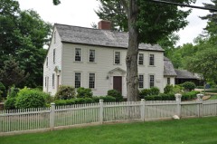
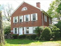
Listed on the National Register of Historic Places in 2005.
From the record
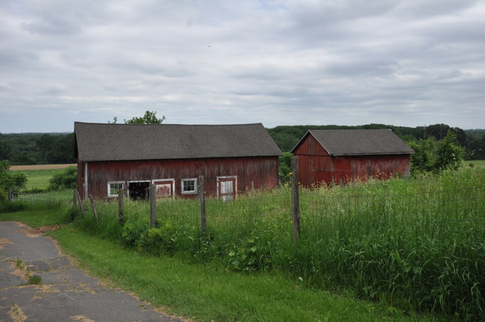
“Hilltop Farm is a historic country estate and gentleman's farm on Mapleton Avenue in northern Suffield, Connecticut. Hendee, one of the founders of the Indian Motorcycle Manufacturing Company, one of the nation's first motorcycle makers.”
Wikipedia article Hilltop Farm, CC BY-SA 4.0.
One of 451 National Register listings published here for Hartford County · listed in 2005 · category: District.
National Register reference number.04001463- the number the National Park Service assigned this property when it was listed, and the key its nomination file is catalogued under at the National Archives.
Windsor, by the Connecticut General Court in 1641, and by his will it was returned in 1644 " for the use of the country." In 1681 the Massachusetts General Court gave it to John Pynchon. He died in 1703, and the Island was a part of his Suffield estate, inventoried at ten pounds. In 1717 liis heirs sold it to John and Ebenezer Devotion and Joshua Leavitt, all of Suffield, for ,£130 current money. In 1736 Joseph Kellogg, of Suffield, bought John Devotion's right. In 1755 General Phineas Lyman bought the whole island, and sold it in 1774 to Roger Enos, of Windsor, for £200. Since that time its many owners are found in Suffield land records to 1806, and since that date at Enfield. The isolated position and consequent little value of this beautiful island render its jurisdiction of slight importance. Mr. Terry, who now owns the larger part, is probably the first permanent white resident. It has borne the successive names of " Great Island," " Lvman's," " Copper," " King's," and " Terry's."
Notwithstanding boundary disputes for two centuries, these are town lines to-day, with this exception : The south line interfered with the Simslniry grant at five miles from the Great River. The north line varies but little from the correct State line, being only ninety rods too far south at the river, and eight rods too far north at the Westfield line (now Rising's Notch). Ancient Westfield (the top of the mountain) bounded about two miles of our west border. The Simsbury line was in dispute and unsettled until 1713. The Suffield grant by Massachusetts, in 1670, revived the colonial boundary question, which after forty years' strife was decided to be wholly within the Connecticut patent. The cause for these boundary troubles must be largely attributed to the erratic colony line of 1642 by Woodward and Saffery, which appears to have been ordered by Massachusetts to establish its jurisdiction over Warronoco and Si)ringfield. In 1713 the colony line was adjusted by commissioners appointed by each colony. Massachusetts retained the jurisdiction of the towns it had planted, with their original bounds intact. The boundary line of Suffield on Windsor and Siniiibury, as then established, was the colony line until the revolt. Massachusetts had " planted " 105,793 Connecticut acres, recompensing it with an equal quantity of wild land in the present towns of Pelham, Belchcrtown, and Ware, Mass. Connecticut sold these lands in 1716 for X683 (a little more than two cents an acre), and gave X500 of it to Yale College.
Regional context, not property-specific
evidence. The
federal wildfire occurrence database
lists 143 fires within 5 miles of Hilltop Farm
between 2002 and 2020, burning about 77 acres in total. 5 started naturally. 1 was recorded as arson.
Distance is straight-line from the map coordinates, so a fire counted
here may appear on a neighbouring settlement's page as well.
Reported cause
Fires
Missing data/not specified/undetermined
75
Equipment and vehicle use
35
Recreation and ceremony
13
Debris and open burning
8
Smoking
5
Natural
5
Misuse of fire by a minor
1
Arson/incendiarism
1
The most recent of
them, most recent first, with the day each was reported and the service
that recorded it.
Regional context, not property-specific
evidence. The federal mineral resources record lists
10 workings within 5 miles of Hilltop Farm: 5 past producers, 4 producers, 1 unknown.
4 still produce. What was taken out: Sand and Gravel, Construction, Brick Clay, Clay, Stone, Crushed/Broken. Distance is straight-line from the
map coordinates, so a quarry counted here may appear on a neighbouring
settlement's page as well.
Regional context, not property-specific
evidence. The National Weather Service names
Suffield, the town this property stands in, in 24 storm reports between 1997 and 2025: 15 thunderstorm wind, 6 hail, 3 flash flood.
No death or injury is recorded in these reports. Each account below is quoted exactly as the forecast office
filed it, from the NOAA Storm Events Database, and each date
opens the federal record of that event.
Numerous trees and wires were downed throughout Suffield and Windsor Locks. Several trees were downed onto houses on School Street and North Street in Windsor Locks. The Automated Surface Observing Station at Bradley International Airport (KBDL) recorded a wind gust of 60 mph.
No historic map-sheet match is published
for this property yet. That does not mean no map exists. This record needs
a coordinate-quality review before it can be joined to a sheet boundary.
Browse the county's mapped places while that work is
pending.
Listed places nearby
6 within 8 miles
Other National Register properties close
enough to walk or drive between, ordered by distance from this one. Both
positions come from the same geocoding pass that matched these properties
to their map sheets.
Listing record. National Park Service National Register of Historic Places, listed-properties dataset, current to 2026-05-22.
Map join. Address geocoded through the United States Census geocoder, then tested against the published boundary of every sheet in the USGS Historical Topographic Map Collection.
How this page is made. Listing fields come from federal records; map-sheet coverage is a labelled coordinate-to-boundary calculation, not a source-field claim.
Wildfire. Short, Karen C. 2022. Spatial wildfire occurrence data for the United States, 1992-2020 [FPA_FOD_20221014]. 6th Edition. Fort Collins, CO: Forest Service Research Data Archive. https://doi.org/10.2737/RDS-2013-0009.6 Collected with United States Government funding and usable without additional permissions or fees.
Mines and quarries. USGS Mineral Resources Data System (MRDS) https://mrdata.usgs.gov/mrds/ A work of the United States government, no copyright under 17 U.S.C. 105.
Storms. NOAA National Centers for Environmental Information, Storm Events Database https://www.ncei.noaa.gov/stormevents/ A work of the United States government, no copyright under 17 U.S.C. 105. Narratives are quoted verbatim from the National Weather Service report and are not edited or summarised.
 Block