
BlockBefore
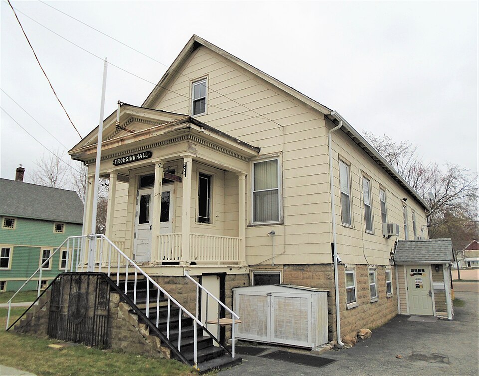
Photograph of Rossie Velvet Mill Historic District
Photograph by Beyond My Ken, CC BY-SA 4.0. Via Wikimedia Commons.

Rossie Velvet Mill Historic District

Listed on the National Register of Historic Places in 2007.

From the record

“The Rossie Velvet Mill Historic District is located in the village of Mystic in Stonington, Connecticut. Its main focus is the former Rossie Velvet Mill, a large brick industrial facility on the east side of Greenmanville Avenue that is now a research center for the nearby Mystic Seaport Museum.”

Wikipedia article Rossie Velvet Mill Historic District, CC BY-SA 4.0.

One of 197 National Register listings published here for New London County · listed in 2007 · category: District.

Sources: the Wikipedia article · the case file at the National Archives · the National Register database, National Park Service

The listing

Storms near this property

14 since 1995

Regional context, not property-specific evidence. The National Weather Service names Stonington, the town this property stands in, in 14 storm reports between 1995 and 2024: 7 thunderstorm wind, 4 lightning, 2 flash flood, 1 hail. The reports record 3 injuries. Each account below is quoted exactly as the forecast office filed it, from the NOAA Storm Events Database, and each date opens the federal record of that event.

WhenEvent Place namedHarm What the report says
July 2017LightningNorth Stonington1 hurtA man was struck by lightning near the cattle barn at the North Stonington Fairgrounds.
June 2005LightningStonington1 hurtA 48 year old man was struck by lightning as a thunderstorm moved through Stonington. He was working outside when the lightning strike occurred. The man was taken to a hopital in critical condition. It is unknown if the man ulimately survived.
May 2005LightningStonington1 hurtno account filed
July 2009LightningStonington$10,000Several houses in Stonington were struck by lightning, causing some minor house fires.
August 2024Thunderstorm WindNorth Stonington$3,000Tree and power lines down.
November 2021Thunderstorm WindNorth Stonington$2,000Multiple trees down in town. Large sticks/branches got blown up to 150 feet away from nearest tree.
June 2008Thunderstorm WindNorth Stonington$2,000Numerous trees were reported down in North Stonington.
June 2024Thunderstorm WindNorth Stonington$500Tree down, six inches in diameter, on Al Harvey Road near the intersection of Route 201.
August 2019Flash FloodNorth Stonington-Neighborhood street flooding in North Stonington with water over the top of car tires.
August 2015Thunderstorm WindStonington-A 61 mph wind gust was measured by the Stonington Outer Breakwater Mesonet Location.
May 2010HailNorth Stonington-Quarter size hail was reported at the Stonington Country Club.
September 2008Flash FloodNorth Stonington-Route 2 in North Stonington was closed due to flooding.
August 1995Thunderstorm WindStonington-Severe thunderstorms moving across eastern Connecticut caused a variety of weather problems. A few homes sustained considerable damage after being struck by lightning. A couple of men were lucky to be alive after being struck by lightning. Golf ball-size hail was reported in New London, but apparently did little, if any, damage. In Windham County numerous large trees were reported down in Plainfield. More than 9,000 electric customers lost power statewide.
June 1998Thunderstorm WindNorth Stonington-no account filed

Every storm recorded in New London County

Map coverage status

No historic map-sheet match is published for this property yet. That does not mean no map exists. This record needs a coordinate-quality review before it can be joined to a sheet boundary. Browse the county's mapped places while that work is pending.

Sources for this property

National Archives recordThe nomination case file for reference 07000110 in Record Group 79.
Wikipedia articleCommunity-written account of this property, licensed CC BY-SA.
New London CountyAll 197 listed properties in this county.

Provenance

  • Listing record. National Park Service National Register of Historic Places, listed-properties dataset, current to 2026-05-22.
  • Map join. Address geocoded through the United States Census geocoder, then tested against the published boundary of every sheet in the USGS Historical Topographic Map Collection.
  • How this page is made. Listing fields come from federal records; map-sheet coverage is a labelled coordinate-to-boundary calculation, not a source-field claim.
  • Storms. NOAA National Centers for Environmental Information, Storm Events Database https://www.ncei.noaa.gov/stormevents/ A work of the United States government, no copyright under 17 U.S.C. 105. Narratives are quoted verbatim from the National Weather Service report and are not edited or summarised.