BlockBefore
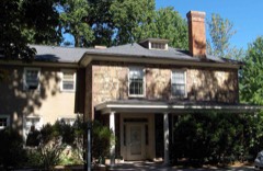
Photograph of Connecticut General Life Insurance Company Headquarters
Photograph by Sphilbrick, CC BY-SA 3.0. Via Wikimedia Commons.

Connecticut General Life Insurance Company Headquarters

Listed on the National Register of Historic Places in 2010.

From the record

“The Connecticut General Life Insurance Company Headquarters is a commercial office complex at 900 Cottage Grove Road in Bloomfield, Connecticut. It was listed on the National Register of Historic Places on January 27, 2010.”

Wikipedia article Connecticut General Life Insurance Company Headquarters, CC BY-SA 4.0.

One of 451 National Register listings published here for Hartford County · listed in 2010 · category: Building.

Sources: the Wikipedia article · the case file at the National Archives · the National Register database, National Park Service
The listing

  • Address. 900 Cottage Grove Rd., Bloomfield, 06002
  • When was it listed? January 2010
  • Category. building
  • Town. Bloomfield town
  • Architectural style. International Style
  • National Register reference number. 09000324 - the number the National Park Service assigned this property when it was listed, and the key its nomination file is catalogued under at the National Archives.

The ground it stands on

4,787 words

The chapter on Bloomfield Town in The Memorial History of Hartford County, Connecticut, 1633-1884;, published 1886 names Bloomfield. This is what it says, exactly as the scans read.

BLOO^IFIELD was incorporated in 1835, and consisted of Wintonbiiry Parish and a portion of Poquonnock Society in Windsor. In 1840 the town received an addition of a part of Simsburv known as Scotland Parish. As now constituted, it is bounded on the north and east by Windsor, on the south by Hartford, and on the west by Simsbury and Avon, and averages four miles in length and in breadth. On the cast border a forest a mile and a half broad extends the whole length of the township from north to south, and on the west is the range of hills called Talcott Mountain. Tlirough this broad, gently undulating valley run three large brooks, which unite in the south part to form Woods River ; and this, meeting another small river in the southwest part of Hartford, forms Park River, which flows through the city and empties into the Connecticut. These three Bloomfield streams are all of slow current, and overflow their banks several times a year, thus greatly enriching the soil.

Passage source: The Memorial History of Hartford County, Connecticut, 1633-1884;, published 1886.

Another fact favorable to Bloomfield as an agricultural town is that the climate is naturally warm for so high a latitude. Beyond the mountain there is often snow, when only rain falls here. Between these streams lie cultivated fields and orchards, with large intervals of excellent mowing-ground. It is a singular fact that on the opposite sides of these brooks in many places there is an entire difference of soil.

Passage source: The Memorial History of Hartford County, Connecticut, 1633-1884;, published 1886.

Machine-read from a century-old scan, so expect the errors a machine makes: misspelled names, dropped words, stray characters.

Read the whole chapter on Bloomfield Town - 4,787 words on its settlement, mills, schools and churches.

Fires near this property

21 since 1992

Regional context, not property-specific evidence. The federal wildfire occurrence database lists 21 fires within 5 miles of Connecticut General Life Insurance Company Headquarters between 1992 and 2017, burning about 122 acres in total. None started naturally. 2 were recorded as arson. Distance is straight-line from the map coordinates, so a fire counted here may appear on a neighbouring settlement's page as well.

Reported cause Fires
Missing data/not specified/undetermined9
Recreation and ceremony4
Debris and open burning3
Arson/incendiarism2
Misuse of fire by a minor2
Equipment and vehicle use1

The most recent of them, most recent first, with the day each was reported and the service that recorded it.

DateCause SizeReported by Name on the report
2 August 1997Misuse of fire by a minorunder an acreConnecticut Division of Forestrynot named
12 June 2012Misuse of fire by a minorunder an acreConnecticut Division of ForestryBLOOMFIELD
7 May 1992Arson/incendiarism1.5 acresConnecticut Division of Forestrynot named
13 May 2012Missing data/not specified/undeterminedunder an acreConnecticut Division of ForestryBLOOMFIELD
8 April 2000Equipment and vehicle use6.0 acresConnecticut Division of Forestrynot named
8 April 2000Missing data/not specified/undetermined30 acresConnecticut Division of Forestrynot named
5 April 2015Missing data/not specified/undeterminedunder an acreConnecticut Division of Forestrynot named
30 April 1992Arson/incendiarism50 acresConnecticut Division of Forestrynot named

Every fire recorded in Hartford County

Mines and quarries near this property

10 of 14 shown

Regional context, not property-specific evidence. The federal mineral resources record lists 14 workings within 5 miles of Connecticut General Life Insurance Company Headquarters: 11 past producers, 3 plants. 3 still produce. What was taken out: Sand and Gravel, Construction, Stone, Crushed/Broken, Stone, Dimension, Iron. Distance is straight-line from the map coordinates, so a quarry counted here may appear on a neighbouring settlement's page as well.

Where SiteCommodity StatusRecorded
Abbott Ball Co/ Hartford, Ct.CorundumPlant
American Steel & Aluminum/HartfordIronPlant
Sandstone QuarryFlagstonePast Producer
Basalt Rock Quarry No. Cj-063Stone, Crushed/BrokenPast ProducerBasalt
Basalt Rock Quarry No. Di-010Stone, Crushed/BrokenPast ProducerBasalt
Basalt Rock Quarry No. Di-011Stone, Crushed/BrokenPast ProducerBasalt
Sandstone Rock Quarry No. Di-009Stone, DimensionPast ProducerSandstone
Traprock QuarriesStone, DimensionPast Producer
Traprock QuarryStone, DimensionPast Producer
Avon PlantSand and Gravel, ConstructionPlant

Every working recorded in Hartford County

Storms near this property

11 since 1995

Regional context, not property-specific evidence. The National Weather Service names Bloomfield, the town this property stands in, in 11 storm reports between 1995 and 2020: 7 thunderstorm wind, 3 flash flood, 1 hail. No death or injury is recorded in these reports. Each account below is quoted exactly as the forecast office filed it, from the NOAA Storm Events Database, and each date opens the federal record of that event.

WhenEvent Place namedHarm What the report says
September 2011Flash FloodBloomfield$100,000Dozens of cars in Parking Lot E of the University of Hartford were floating after the north branch of the Park River overflowed its banks into the parking lot. University officials said it was only the second time in the past 15 years that flooding had been this bad. In addition, several mainstem rivers experienced flooding, including: the Farmington River at Simsbury and Unionville and the Connecticut River at Thompsonville and Hartford. No damage associated with this flooding was reported.
May 2005Thunderstorm WindBloomfield$20,000no account filed
May 2003Flash FloodBloomfield$20,000no account filed
July 2009Thunderstorm WindBloomfield$15,000Trees on Mountain Road were downed by thunderstorm winds.
June 2008Thunderstorm WindBloomfield$7,000Numerous trees and wires down on Karkham Road and Route 23. A tree on Route 23 blocked the road.
May 2018Thunderstorm WindNorth Bloomfield$5,000At 3:45 PM EST trees were reported down on both Duncaster Road and Hopkins Road in Bloomfield.
May 2010Thunderstorm WindBloomfield$1,000Five inch diameter tree limbs were downed by thunderstorm winds.
November 2020Thunderstorm WindBloomfield$500In Bloomfield, a tree was down on Tyler Street.
August 2018Flash FloodNorth Bloomfield-At 8:50 PM EST, three feet of water was reported on Walts Hill road in North Bloomfield.
April 1995Thunderstorm WindBloomfield-Five pine trees one foot in diameter were blown down. A TV meteorologist recorded a wind gust to 74 mph.
July 2004HailBloomfield-no account filed

Every storm recorded in Hartford County

Map coverage status

No historic map-sheet match is published for this property yet. That does not mean no map exists. This record needs a coordinate-quality review before it can be joined to a sheet boundary. Browse the county's mapped places while that work is pending.

Listed places nearby

6 within 8 miles

Other National Register properties close enough to walk or drive between, ordered by distance from this one. Both positions come from the same geocoding pass that matched these properties to their map sheets.

Photograph PropertyDistance Listed
Francis Gillette House0.5 miles1982
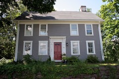
Beardsley-Mix House0.7 miles1986
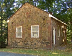
Southwest District School1.1 miles1992
House at 847 Main Street, North1.7 miles1986
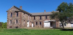
Capt. Oliver Filley House1.8 miles2007
Hartford Golf Club Historic District1.8 miles1986

Sources for this property

National Archives recordThe nomination case file for reference 09000324 in Record Group 79.
Wikipedia articleCommunity-written account of this property, licensed CC BY-SA.
Hartford CountyAll 451 listed properties in this county.

Provenance

  • Listing record. National Park Service National Register of Historic Places, listed-properties dataset, current to 2026-05-22.
  • Map join. Address geocoded through the United States Census geocoder, then tested against the published boundary of every sheet in the USGS Historical Topographic Map Collection.
  • How this page is made. Listing fields come from federal records; map-sheet coverage is a labelled coordinate-to-boundary calculation, not a source-field claim.
  • Wildfire. Short, Karen C. 2022. Spatial wildfire occurrence data for the United States, 1992-2020 [FPA_FOD_20221014]. 6th Edition. Fort Collins, CO: Forest Service Research Data Archive. https://doi.org/10.2737/RDS-2013-0009.6 Collected with United States Government funding and usable without additional permissions or fees.
  • Mines and quarries. USGS Mineral Resources Data System (MRDS) https://mrdata.usgs.gov/mrds/ A work of the United States government, no copyright under 17 U.S.C. 105.
  • Storms. NOAA National Centers for Environmental Information, Storm Events Database https://www.ncei.noaa.gov/stormevents/ A work of the United States government, no copyright under 17 U.S.C. 105. Narratives are quoted verbatim from the National Weather Service report and are not edited or summarised.