 Block
From the record
One of 451 National Register listings published here for Hartford County · listed in 2022 · category: District.
Sources: the National Register database, National Park Service
Listed on the National Register of Historic Places in 2022.
One of 451 National Register listings published here for Hartford County · listed in 2022 · category: District.
Sources: the National Register database, National Park Service
The chapter on New Britain Town in The Memorial History of Hartford County, Connecticut, 1633-1884;, published 1886 names New Britain. This is what it says, exactly as the scans read.
New Britain forms a water-shed, - one of its streams discharging its waters into the Quinnipiac at Plainville and thus passing into the Sound at New Haven ; another forming an important branch of the Mattabesett, joining the waters of the Connecticut at Middletown ; and a third flowing northeasterly, uniting with the Connecticut at Hartford. Numerous springs and small streams furnish ti supply of water for agricultural purposes, but produce little motive-power for mills or manufactories.
Passage source: The Memorial History of Hartford County, Connecticut, 1633-1884;, published 1886.
At the time New Britain was first settled, few or no Indians resided there. The Tunxis Indians, from the valley of the Farmington River, occupied a portion of the northern part of the place, - Dead Swamp and vicinity being a favorite hunting-ground. The Wangunks of the Connecticut vallev extended their incursions within the limits of Berlin and New Britain, and the Mattabesetts, a])parently a division of the Wangunks, had a lodge near Christian Lane, and perhaps another at Kensington. The Quinnipiacs upon the shore of Long Island Sound had extended their dominion as far north as Meriden, and thev claimed the right to hunt in a portion of the territory since included in Berlin
Passage source: The Memorial History of Hartford County, Connecticut, 1633-1884;, published 1886.
Machine-read from a century-old scan, so expect the errors a machine makes: misspelled names, dropped words, stray characters.
Read the whole chapter on New Britain Town - 18,954 words on its settlement, mills, schools and churches.
Regional context, not property-specific evidence. The federal wildfire occurrence database lists 47 fires within 5 miles of Landers, Frary and Clark Ellis Street Plant Historic District between 1993 and 2016, burning about 63 acres in total. None started naturally. 5 were recorded as arson. Distance is straight-line from the map coordinates, so a fire counted here may appear on a neighbouring settlement's page as well.
| Reported cause | Fires |
|---|---|
| Missing data/not specified/undetermined | 25 |
| Recreation and ceremony | 5 |
| Arson/incendiarism | 5 |
| Debris and open burning | 4 |
| Smoking | 3 |
| Misuse of fire by a minor | 3 |
| Equipment and vehicle use | 2 |
The most recent of them, most recent first, with the day each was reported and the service that recorded it.
| Date | Cause | Size | Reported by | Name on the report |
|---|---|---|---|---|
| 4 August 1999 | Recreation and ceremony | 6.0 acres | Connecticut Division of Forestry | not named |
| 22 August 1995 | Smoking | under an acre | Connecticut Division of Forestry | not named |
| 14 August 2006 | Recreation and ceremony | under an acre | Connecticut Division of Forestry | not named |
| 25 July 2016 | Recreation and ceremony | 1.2 acres | Connecticut Division of Forestry | RAGGED MOUNTAIN |
| 19 July 2016 | Missing data/not specified/undetermined | 1.0 acres | Connecticut Division of Forestry | ROUTE 9 SOUTHBOUND |
| 26 June 1999 | Missing data/not specified/undetermined | under an acre | Connecticut Division of Forestry | not named |
| 1 June 1999 | Arson/incendiarism | under an acre | Connecticut Division of Forestry | not named |
| 7 May 2006 | Recreation and ceremony | 3.0 acres | Connecticut Division of Forestry | not named |
Regional context, not property-specific evidence. The federal mineral resources record lists 51 workings within 5 miles of Landers, Frary and Clark Ellis Street Plant Historic District: 39 past producers, 8 producers, 3 occurrences, 1 unknown. 8 still produce. What was taken out: Stone, Crushed/Broken, Stone, Dimension, Sand and Gravel, Construction, Barium-Barite. Distance is straight-line from the map coordinates, so a quarry counted here may appear on a neighbouring settlement's page as well.
| Where | Site | Commodity | Status | Recorded |
|---|---|---|---|---|
| Aiudi Stone Pit and Quarry | Stone | Producer | ||
| Amethyst, Bitumen Vein Quartz Occurrence No. Dj-036 | Gemstone, Rock Asphalt | Occurrence | Amethyst, Calcite, Quartz | |
| Barite Occurrences No. Cj-070 | Barium-Barite, Calcium, Quartz | Occurrence | Void Fill | |
| Charles Genoni Pit | Clay | Past Producer | ||
| Limestone Quarry No. Dj-002 | Limestone, General, Fluorine-Fluorite | Past Producer | Limestone | |
| Mattabesset River Lead Mine | Lead, Zinc, Iron, Sulfur, Barium-Barite | Past Producer | Barite, Galena, Pyrite, Sphalerite | |
| Sphalerite Vein Quartz Occurrence No. Dj-023 | Zinc, Sulfur | Occurrence | Calcite, Prehnite, Quartz, Sphalerite | |
| Lead Mine | Lead | Past Producer | ||
| Basalt Rock Quarry and Barite Occurrence No. Dj-026 | Stone, Crushed/Broken, Barium-Barite | Producer | Basalt, Prehnite, Quartz | |
| Berlin Moore's Mill Barite Mine | Barium-Barite | Past Producer | Breccia Fill Along Fault |
Regional context, not property-specific evidence. The National Weather Service names New Britain, the town this property stands in, in 29 storm reports between 1995 and 2025: 11 hail, 9 thunderstorm wind, 6 flood, 2 lightning. No death or injury is recorded in these reports. Each account below is quoted exactly as the forecast office filed it, from the NOAA Storm Events Database, and each date opens the federal record of that event.
| When | Event | Place named | Harm | What the report says |
|---|---|---|---|---|
| June 2009 | Thunderstorm Wind | New Britain | $40,000 | Several trees near a golf course were downed by thunderstorm winds. |
| July 2016 | Thunderstorm Wind | New Britain | $30,000 | A tree was downed onto a house on Chestnut Street. Also on Chestnut Street, a section of siding was ripped off of a house by thunderstorm winds. An amateur radio operator reported a 62 mph wind gust from their home weather station. |
| September 2025 | Thunderstorm Wind | New Britain | $15,000 | In New Britain, power lines and a tree were down through a house. |
| October 2018 | Flood | New Britain | $15,000 | At 4:58 PM EST, the intersection of Stanley Street and Eddy Glover Blvd was closed due to flooding. Several cars were trapped in the flooding. The intersection is adjacent to the campus of Central Connecticut University. |
| July 2012 | Flood | New Britain | $10,000 | Farmington Avenue and Barube Street were flooded with several cars stuck in floodwaters or stalled out. West Main Street between Norton and Corbin Streets was flooded with 4 to 8 inches of water. |
| May 2010 | Thunderstorm Wind | New Britain | $10,000 | Trees and limbs on Brooklawn Street and Pierremount Avenue were downed by thunderstorm winds. |
| July 1998 | Lightning | New Britain | $8,000 | no account filed |
| September 2013 | Flood | New Britain | $5,000 | Several streets were flooded with four to eight inches of water. A car was stuck in flood waters on Golden Hill Street. |
| September 2012 | Thunderstorm Wind | New Britain | $5,000 | Trees and wires on Kelsey Street were downed by thunderstorm winds. |
| July 2010 | Thunderstorm Wind | New Britain | $5,000 | A tree on Stanley Street was downed by thunderstorm winds as well as two eight to ten inch diameter branches that were downed on Kenyon Circle. |
| July 2018 | Thunderstorm Wind | New Britain | $2,000 | At 2:10 PM EST, a thunderstorm moving over New Britain brought a tree down on wires on Slater Road. |
| February 2016 | Thunderstorm Wind | New Britain | $2,000 | Several tree limbs were downed by severe thunderstorm winds. |
| August 2019 | Lightning | New Britain | $1,000 | In New Britain, lightning started a house fire at Oak and Putnam Streets. |
| August 2024 | Hail | New Britain | - | In New Britain, quarter sized hail fell. |
| July 2023 | Flash Flood | New Britain | - | In New Britain, there was 2 feet of water on Corbin Ave. |
| June 2017 | Hail | New Britain | - | At 305 PM EST, penny size hail fell on New Britain. |
| June 2017 | Hail | New Britain | - | At 521 PM EST, penny size hail fell on Corbin Avenue and West Main Street in New Britain. |
| June 2017 | Hail | New Britain | - | At 522 PM EST, nickel size hail fell on the southeast part of New Britain. |
| September 2012 | Flood | New Britain | - | Street flooding occurred at the intersection of Clinton Street and Albany Avenue as well as at the intersection of Lincoln Street and West Main Street. |
| August 2012 | Flood | New Britain | - | Minor street flooding at the intersections of Corbin and Osgood Avenues and Biruta Street and Farmington Avenue. |
| July 2012 | Hail | New Britain | - | Pea to nickel size hail fell in New Britain. |
| July 2010 | Flood | New Britain | - | Twelve to eighteen inches of water moved over Corbin Avenue. |
| July 2010 | Hail | New Britain | - | no account filed |
| June 2009 | Hail | New Britain | - | no account filed |
| July 1999 | Thunderstorm Wind | New Britain | - | no account filed |
| July 1999 | Hail | New Britain | - | no account filed |
| May 1997 | Hail | New Britain | - | no account filed |
| July 1995 | Hail | New Britain | - | no account filed |
| July 1995 | Hail | New Britain | - | no account filed |
No historic map-sheet match is published for this property yet. That does not mean no map exists. This record needs a coordinate-quality review before it can be joined to a sheet boundary. Browse the county's mapped places while that work is pending.
Other National Register properties close enough to walk or drive between, ordered by distance from this one. Both positions come from the same geocoding pass that matched these properties to their map sheets.
| Photograph | Property | Distance | Listed |
|---|---|---|---|
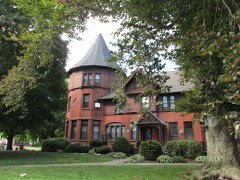 | Erwin Home for Worthy and Indigent Women | 0.5 miles | 2002 |
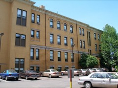 | New Britain Public High School Campus | 0.5 miles | 2015 |
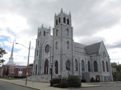 | First Lutheran Church of the Reformation | 0.6 miles | 2010 |
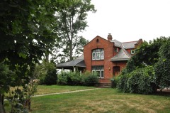 | Francis H. Holmes House | 0.6 miles | 1984 |
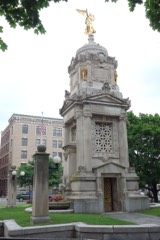 | Downtown New Britain | 0.8 miles | 2016 |
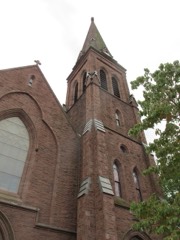 | South Congregational Church | 0.8 miles | 1990 |
| National Archives record | The nomination case file for reference 100007948 in Record Group 79. |
| Hartford County | All 451 listed properties in this county. |