 Block
From the record
One of 272 National Register listings published here for New Haven County · listed in 2023 · category: District.
Sources: the National Register database, National Park Service
Listed on the National Register of Historic Places in 2023.
One of 272 National Register listings published here for New Haven County · listed in 2023 · category: District.
Sources: the National Register database, National Park Service
An account from the chapter on Guilford town. The inset identifies its exact source book and publication year.
Griffinr^ until 1808, when he was succeeded by Solomon Stone. During the early years of the century a vessel was wrecked on Goose Island and its crew of seven men perished from cold. The island was several times visited by boats from English men-of-war during the War of 1812, but no harm was done to the people or property, as a good light was kept burning.
The chapter on Guilford Town in History of New Haven County, Connecticut, published 1892 names Guilford. This is what it says, exactly as the scans read.
THE original town of Guilford included the present town and Madison, which was set off in 1826. It stretched along the shore of Long Island sound from Branford to Killingworth, a distance of nearly ten miles, and was nearly eleven miles long from south to north. At the north end the width was not quite five miles, and at other points it was irregular. The boundary between Branford and Guilford was a straight line from the mouth of Stony creek to the center of Pistapaug pond, upon which cornered the towns of Wallingford, Branford, Guilford and Durham. The pond is a mile long from north to south, and half a mile wide. From this common center a line, extending northeast to the western branch of the Hammonassett river, formed the northern boundary, and separated Guilford from Durham. The eastern boundary was down that stream to the Hammonassett proper, thence down the middle of the river to Dudley's creek, thence down to West rock, on the sound. This separated the town from Killingworth. In this territory were for many years four Congregational societies, viz.: Guilford First Society, North Guilford, East Guilford (now Madison), and North Bristol (now North Madison). The latter two and a narrow strip, two miles long from the sound north, of the First Society, were constituted the town of Madison, thus leaving Guilford with a mean length of eleven miles and an average width of four miles, the town of Madison forming the eastern boundary, and having the East river in part as the dividing line.
Passage source: History of New Haven County, Connecticut, published 1892.
That stream, called by the Indians Ruttawoo, has its source in several brooks, or branches, in the northern part of the old town, which unite at Nut Plains. Then it takes a southwesterly course, and empties its waters into Guilford harbor, east of Guilford Point. For some distance it is a tidal stream, and is navigable for sloops to East River bridge, where are several wharves, in the town of Madison. Near its mouth are Sawpits, Quarry and the Farmers' wharves. The other principal stream of the town is the Menuncatuc, or West river, which is the outlet of Quinnebaug or Quonepaug pond, in North Guilford. This pond or lake is two miles long from north to south, and a little more than a fourth of a mile wide. Its waters are very deep, and the environing scenery is attractive. Southwest is a smaller sheet of water called West pond, whose small outlet flows into West river. The latter stream has a southerly course to the west of Guilford, borough, and empties into the harbor west of the point. It is also a tidal stream as high as the village, where small wharves have been constructed. East creek is a small stream occupying an intermediate position between the above streams, and also emptying near the neck or mouth of East river.
Passage source: History of New Haven County, Connecticut, published 1892.
Machine-read from a century-old scan, so expect the errors a machine makes: misspelled names, dropped words, stray characters.
Read the whole chapter on Guilford Town - 233,810 words on its settlement, mills, schools and churches.
Regional context, not property-specific evidence. The federal wildfire occurrence database lists 5 fires within 5 miles of Dudley Farm Historic District between 1998 and 2017, burning about 34 acres in total. None started naturally. None was recorded as arson. Distance is straight-line from the map coordinates, so a fire counted here may appear on a neighbouring settlement's page as well.
| Reported cause | Fires |
|---|---|
| Missing data/not specified/undetermined | 3 |
| Misuse of fire by a minor | 1 |
| Debris and open burning | 1 |
The most recent of them, most recent first, with the day each was reported and the service that recorded it.
| Date | Cause | Size | Reported by | Name on the report |
|---|---|---|---|---|
| 25 April 2008 | Debris and open burning | 25 acres | Connecticut Division of Forestry | not named |
| 14 April 1998 | Misuse of fire by a minor | 2.0 acres | Connecticut Division of Forestry | not named |
| 18 March 2012 | Missing data/not specified/undetermined | under an acre | Connecticut Division of Forestry | NORTH BRANFORD |
| 10 March 2017 | Missing data/not specified/undetermined | 2.0 acres | Connecticut Division of Forestry | QUEACH RD BRANDFORD CT BRANDFORD LAND TRUST |
| 13 November 2001 | Missing data/not specified/undetermined | 5.0 acres | Connecticut Division of Forestry | not named |
Regional context, not property-specific evidence. The federal mineral resources record lists 11 workings within 5 miles of Dudley Farm Historic District: 9 past producers, 1 unknown, 1 producer. 1 still produces. What was taken out: Stone, Crushed/Broken, Stone, Dimension, Granite, Stone. Distance is straight-line from the map coordinates, so a quarry counted here may appear on a neighbouring settlement's page as well.
| Where | Site | Commodity | Status | Recorded |
|---|---|---|---|---|
| Gneissic Rock Or Feldspar Pegmatite Quarry No. Ck-009 | Stone | Past Producer | ||
| Norcross Granite Gneiss Rock Quarries | Stone, Dimension | Past Producer | 1887 | |
| Norcross Quarry | Granite | Past Producer | ||
| Old Stony Creek Quarry | Granite | Past Producer | ||
| Quarry | Stone, Dimension | Past Producer | ||
| Stony Creek Granite Gneiss Quarries | Stone, Dimension | Past Producer | 1876 | |
| Stony Creek Granite Gneiss Quarries | Granite | Past Producer | ||
| Basalt Rock Quarry No. Dk-011 | Stone, Crushed/Broken | Past Producer | Basalt | |
| Coe Lime Co. Quarry | Stone, Crushed/Broken | Past Producer | ||
| North Branford Plant Number 7 | Stone, Crushed/Broken | Producer |
Regional context, not property-specific evidence. The National Weather Service names Guilford, the town this property stands in, in 16 storm reports between 1998 and 2025: 12 thunderstorm wind, 1 hail, 1 flood, 1 lightning. No death or injury is recorded in these reports. Each account below is quoted exactly as the forecast office filed it, from the NOAA Storm Events Database, and each date opens the federal record of that event.
| When | Event | Place named | Harm | What the report says |
|---|---|---|---|---|
| July 2009 | Thunderstorm Wind | Guilford | $12,500 | Numerous trees were reported down in Guilford, including one which fell on a car. |
| June 2021 | Thunderstorm Wind | Guilford | $10,000 | Multiple trees reported down in Guilford with time estimated by radar. |
| August 2012 | Thunderstorm Wind | Guilford | $10,000 | Several trees and numerous tree limbs were reported down throughout the town. This included one tree down on a house and three large trees, over one foot in diameter, down onto power lines near U.S. Route 1. |
| March 2010 | Flood | Guilford | $10,000 | Long Hill Rd. in Guilford was closed with moderate flooding occurring. Over a dozen basements at the Wharton Brook Dr. and Louis Circle were flooded in Wallingford.||Total rainfall amounts received across New Haven County ranged from 4.15 inches at Tweed New Haven Regional Airport in New Haven to 5.75 inches in Wallingford. |
| July 2025 | Thunderstorm Wind | Guilford | $8,000 | Multiple streets closed due to downed trees and wires throughout town including Durham Road, Nortontown Road, Moose Hill Road, and South Fair Street. |
| June 2011 | Thunderstorm Wind | Guilford | $7,500 | Numerous trees were reported down in Guilford. |
| June 2021 | Thunderstorm Wind | Guilford | $7,000 | Report from mPing, 3 inch tree limbs broken and power lines broken. |
| May 2018 | Thunderstorm Wind | North Guilford | $7,000 | Numerous trees down. |
| September 2018 | Flash Flood | Guilford | - | Route 146 between the towns of Madison and Guilford was closed due to flooding. |
| August 2012 | Thunderstorm Wind | Guilford | - | Large branches were reported down on power lines. |
| July 2010 | Lightning | Guilford | - | A woman was indirectly struck by lightning resulting in minor burns on her leg. |
| May 2002 | Thunderstorm Wind | Guilford | - | As a line of severe thunderstorms moved southeast, it produced high winds that downed trees and power lines in Guilford. |
| July 2001 | Thunderstorm Wind | Guilford | - | no account filed |
| May 2000 | Hail | Guilford | - | no account filed |
| June 2000 | Thunderstorm Wind | Guilford | - | no account filed |
| September 1998 | Thunderstorm Wind | Guilford | - | no account filed |
No historic map-sheet match is published for this property yet. That does not mean no map exists. This record needs a coordinate-quality review before it can be joined to a sheet boundary. Browse the county's mapped places while that work is pending.
Other National Register properties close enough to walk or drive between, ordered by distance from this one. Both positions come from the same geocoding pass that matched these properties to their map sheets.
| Photograph | Property | Distance | Listed |
|---|---|---|---|
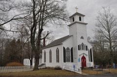 | Meeting House Hill Historic District | 1.0 miles | 1987 |
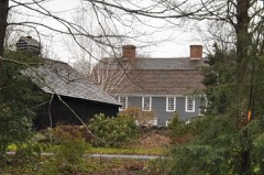 | Elisha Pitkin House | 2.8 miles | 1979 |
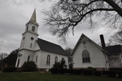 | North Branford Center Historic District | 3.0 miles | 1999 |
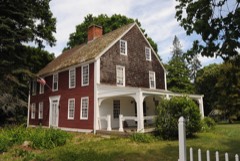 | Edward Frisbie House | 4.0 miles | 1988 |
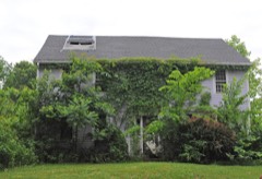 | Eliphalet Howd House | 4.1 miles | 1988 |
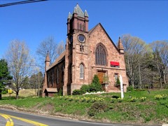 | Northford Center | 4.5 miles | 2002 |
| National Archives record | The nomination case file for reference 100008609 in Record Group 79. |
| New Haven County | All 272 listed properties in this county. |