 Block
From the record
One of 124 National Register listings published here for Middlesex County · listed in 2024 · category: District.
Sources: the National Register database, National Park Service
Listed on the National Register of Historic Places in 2024.
One of 124 National Register listings published here for Middlesex County · listed in 2024 · category: District.
Sources: the National Register database, National Park Service
The chapter on Haddam Town in History of Middlesex County, Connecticut, with Biographical Sketches of Its Prominent Men, published 1884 names Haddam. This is what it says, exactly as the scans read.
The town contains four railroad stations, on the Connecticut Valley Railroad, viz.: Higganum, Haddam, Arnold's and Goodspeeds; four post ofifices: Haddam, Higganum, Haddam Neck, and Tylerville; eight churches; and fourteen school districts.
Passage source: History of Middlesex County, Connecticut, with Biographical Sketches of Its Prominent Men, published 1884.
Extensive flats of natural meadow of apparently exhaustless fertility skirt the river at Haddam, on the west side, and opposite Shailerville and Higganum on the east side. The town contains about 30,000 acres. That part of it lying on the west side of the river was formerly cal'ed Haddam Society, that on the east side Haddam Neck, and a section in the northwest part, which has since been joined to Durham, Haddam Quarter.
Passage source: History of Middlesex County, Connecticut, with Biographical Sketches of Its Prominent Men, published 1884.
Machine-read from a century-old scan, so expect the errors a machine makes: misspelled names, dropped words, stray characters.
Read the whole chapter on Haddam Town - 46,128 words on its settlement, mills, schools and churches.
Regional context, not property-specific evidence. The federal wildfire occurrence database lists 127 fires within 5 miles of D & H Scovil Industrial Historic District between 1993 and 2020, burning about 133 acres in total. 1 started naturally. 3 were recorded as arson. Distance is straight-line from the map coordinates, so a fire counted here may appear on a neighbouring settlement's page as well.
| Reported cause | Fires |
|---|---|
| Missing data/not specified/undetermined | 71 |
| Debris and open burning | 18 |
| Recreation and ceremony | 17 |
| Misuse of fire by a minor | 8 |
| Equipment and vehicle use | 4 |
| Arson/incendiarism | 3 |
| Power generation/transmission/distribution | 3 |
| Smoking | 2 |
| Natural | 1 |
The most recent of them, most recent first, with the day each was reported and the service that recorded it.
| Date | Cause | Size | Reported by | Name on the report |
|---|---|---|---|---|
| 8 September 2015 | Arson/incendiarism | 10 acres | Connecticut Division of Forestry | not named |
| 6 September 2015 | Recreation and ceremony | 1.0 acres | Connecticut Division of Forestry | not named |
| 26 September 2017 | Missing data/not specified/undetermined | under an acre | Connecticut Division of Forestry | 810 SAYBROOK RD. |
| 20 September 2015 | Missing data/not specified/undetermined | under an acre | Connecticut Division of Forestry | not named |
| 16 September 2017 | Debris and open burning | under an acre | Connecticut Division of Forestry | 10 PONSETT RD. |
| 10 September 2016 | Recreation and ceremony | under an acre | Connecticut Division of Forestry | 573 KILLINGWORTH ROAD HADDAM |
| 8 August 2020 | Power generation/transmission/distribution | under an acre | Connecticut Division of Forestry | OXBOW RIDGE ROAD/OXBOW ROAD |
| 6 August 2016 | Missing data/not specified/undetermined | under an acre | Connecticut Division of Forestry | 41 WHITE BIRCH TRAIL HADDAM |
Regional context, not property-specific evidence. The federal mineral resources record lists 71 workings within 5 miles of D & H Scovil Industrial Historic District: 57 past producers, 6 prospects, 5 producers, 2 occurrences. 6 still produce. What was taken out: Feldspar, Mica, Stone, Dimension, Beryllium, Mica. Distance is straight-line from the map coordinates, so a quarry counted here may appear on a neighbouring settlement's page as well.
| Where | Site | Commodity | Status | Recorded |
|---|---|---|---|---|
| Anderson Mica Mines and Swanson Lithia Mine | Mica, Lithium | Past Producer | Pegmatite Dike | |
| Anderson No. 1 Mica Mine | Mica, Feldspar, Lithium | Past Producer | ||
| Arnold Pegmatite Quarry | Feldspar, Quartz | Producer | ||
| East Selden Mica, Beryl, Feldspar Quarry | Mica, Feldspar, Tantalum, Niobium (Columbium), Beryllium | Past Producer | Pegmatite Dike | |
| Garnet Mine | Garnet | Past Producer | ||
| Gillette Gem Tourmaline, Mineral Specimens, Mica, Feldspar Mine (Also | Gemstone, Mica, Feldspar | Past Producer | 1896 | |
| Gillette Quarry | Tin, Feldspar, Semiprecious Gemstone, Mica | Past Producer | 1896 | |
| Halberg Quarries | Mica, Beryllium, Feldspar | Past Producer | ||
| Middletown Mine | Barium-Barite, Lead, Zinc | Past Producer | ||
| Roadmetal Quarry | Stone, Crushed/Broken | Past Producer |
Regional context, not property-specific evidence. The National Weather Service names Haddam, the town this property stands in, in 8 storm reports between 1995 and 2021: 6 thunderstorm wind, 1 lightning, 1 hail. No death or injury is recorded in these reports. Each account below is quoted exactly as the forecast office filed it, from the NOAA Storm Events Database, and each date opens the federal record of that event.
| When | Event | Place named | Harm | What the report says |
|---|---|---|---|---|
| November 2021 | Thunderstorm Wind | Haddam | $5,000 | Trees snapped and downed in backyard in Haddam Neck. |
| May 2010 | Thunderstorm Wind | Haddam | $500 | Large tree branches were downed in Haddam. |
| July 2008 | Thunderstorm Wind | Haddam | - | Trees and wires were downed on Meeting House Road. |
| July 2007 | Thunderstorm Wind | Haddam | - | A severe thunderstorm produced high winds that downed a large tree in Haddam. |
| June 1995 | Thunderstorm Wind | Haddam | - | A cold front moving across the area generated severe thunderstorms which produced large hail and gusty winds. Baseball-size hail lasted for up to 20 minutes in Deep River causing hundreds of thousands of dollars in damage. The hailstones broke hundreds of windows in buildings and automobiles, tore holes in roofs, dented siding and automobiles, and ruined gardens. Some automobiles were totalled. In one historic building, the hail broke 25 windows, including a 100-year curved window. Thirty-two windows were smashed in an elementary school and its roof was damaged. Most of the damage was covered by insurance. |
| July 2004 | Hail | East Haddam | - | no account filed |
| June 1998 | Lightning | East Haddam | - | no account filed |
| June 1997 | Thunderstorm Wind | Haddam | - | no account filed |
No historic map-sheet match is published for this property yet. That does not mean no map exists. This record needs a coordinate-quality review before it can be joined to a sheet boundary. Browse the county's mapped places while that work is pending.
Other National Register properties close enough to walk or drive between, ordered by distance from this one. Both positions come from the same geocoding pass that matched these properties to their map sheets.
| Photograph | Property | Distance | Listed |
|---|---|---|---|
| Higganum Landing Historic District | 1.5 miles | 2018 | |
 | Haddam Center Historic District | 3.0 miles | 1989 |
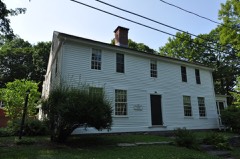 | James Hazelton House | 3.1 miles | 1988 |
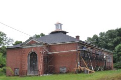 | Middle Haddam School | 4.5 miles | 2019 |
| William and Mary Ward House | 4.5 miles | 2021 | |
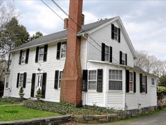 | Middle Haddam Historic District | 4.5 miles | 1984 |
| National Archives record | The nomination case file for reference 100010491 in Record Group 79. |
| Middlesex County | All 124 listed properties in this county. |