 Block
From the record
One of 298 National Register listings published here for Fairfield County · listed in 2026 · category: District.
Sources: the National Register database, National Park Service
Listed on the National Register of Historic Places in 2026.
One of 298 National Register listings published here for Fairfield County · listed in 2026 · category: District.
Sources: the National Register database, National Park Service
The chapter on New Canaan Town in History of Fairfield County, Connecticut : with Illustrations and Biographical Sketches of Its Prominent Men and Pioneers, published 1881 names New Canaan. This is what it says, exactly as the scans read.
New Canaan is first noticed in the Stamford records as a distinct parish Dec. 8, 1730, when John Bouton and others ask liberty of moving out of town to join with a part of Norwalk in order to be a society. The permission, however, was not granted ; yet in the following year, under date December 14th, Ebenezer Seeley and Nathaniel Bouton are apj^ointed tythingmen for the new society. In the following year, 1702, Ebenezer Seeley and John Bouton are chosen tythingmen for " Canaan Parish."
Passage source: History of Fairfield County, Connecticut : with Illustrations and Biographical Sketches of Its Prominent Men and Pioneers, published 1881.
The first meeting of the New Canaan society was held July 1, 1731, with John Bouton moderator and John Betts, Sr., clerk. The following is a list of the Stamford settlers in New Canaan as ai)pcar in 1732 : John, Nathaniel, Daniel, Eleazer, and John Bouton, Jr., John Davenport, John Finch, Nathaniel Green, James Hoyt, Job Hoyt, Joshua Hoyt, Eliphalet Slason, Eliphalet and Ebenezer Seeley, Thos. Talmadge, David Stevens, and David Waterbury.
Passage source: History of Fairfield County, Connecticut : with Illustrations and Biographical Sketches of Its Prominent Men and Pioneers, published 1881.
Machine-read from a century-old scan, so expect the errors a machine makes: misspelled names, dropped words, stray characters.
Read the whole chapter on New Canaan Town - 3,776 words on its settlement, mills, schools and churches.
Regional context, not property-specific evidence. The federal wildfire occurrence database lists 48 fires within 5 miles of Chichester Road Historic District between 2000 and 2020, burning about 20 acres in total. 11 started naturally. 9 were recorded as arson. Distance is straight-line from the map coordinates, so a fire counted here may appear on a neighbouring settlement's page as well.
| Reported cause | Fires |
|---|---|
| Missing data/not specified/undetermined | 14 |
| Natural | 11 |
| Arson/incendiarism | 9 |
| Equipment and vehicle use | 6 |
| Power generation/transmission/distribution | 5 |
| Smoking | 3 |
The most recent of them, most recent first, with the day each was reported and the service that recorded it.
| Date | Cause | Size | Reported by | Name on the report |
|---|---|---|---|---|
| 27 September 2015 | Missing data/not specified/undetermined | under an acre | Fire Department of New York | NA |
| 9 August 2019 | Natural | under an acre | Fire Department of New York | N/A |
| 24 August 2004 | Arson/incendiarism | under an acre | Fire Department of New York | not named |
| 11 August 2012 | Arson/incendiarism | under an acre | Fire Department of New York | not named |
| 5 July 2010 | Missing data/not specified/undetermined | under an acre | Fire Department of New York | not named |
| 4 June 2002 | Missing data/not specified/undetermined | under an acre | Fire Department of New York | not named |
| 22 June 2018 | Arson/incendiarism | under an acre | Fire Department of New York | N/A |
| 7 May 2015 | Equipment and vehicle use | under an acre | Fire Department of New York | NA |
Regional context, not property-specific evidence. The federal mineral resources record lists 1 working within 5 miles of Chichester Road Historic District: 1 past producer. None of them still produces. What was taken out: Lead. Distance is straight-line from the map coordinates, so a quarry counted here may appear on a neighbouring settlement's page as well.
| Where | Site | Commodity | Status | Recorded |
|---|---|---|---|---|
| Wilton Lead Mine | Lead | Past Producer |
Regional context, not property-specific evidence. The National Weather Service names New Canaan, the town this property stands in, in 20 storm reports between 1994 and 2025: 11 thunderstorm wind, 3 flash flood, 3 hail, 1 lightning. No death or injury is recorded in these reports. Each account below is quoted exactly as the forecast office filed it, from the NOAA Storm Events Database, and each date opens the federal record of that event.
| When | Event | Place named | Harm | What the report says |
|---|---|---|---|---|
| May 1994 | Thunderstorm Wind | New Canaan | $500,000 | A severe thunderstorm moved through Fairfield County in southwest Connecticut, producing damaging winds. The wind damage was discontinuous and caused by very strong downburst winds. The most severe damage was in New Canaan. The path extended some 30 miles and was one of a "skipping" character. In New Canaan, trees were reported blown down all over town and many had their tops clipped off. Nineteen roadways were closed due to fallen trees. Power was knocked out to the entire town. A tree fell on a car during the height of the storm and shortly after the storm had ended, a 73-year-old man suffered head injuries when a damaged tree limb fell on his car. |
| October 2018 | Tornado (EF1) | New Canaan | $50,000 | A National Weather Service (NWS) Storm Survey of damage was conducted with|Connecticut Emergency Management and Homeland Security and the New Canaan|and Norwalk Offices of Emergency Management in the area from New Canaan to Norwalk. Based on the results of this survey and NWS Doppler Radar data the following information has been determined. The tornado began near the intersection of Weed Street and Marshall Ridge Road in New Canaan and lifted near the intersection of Scribner Avenue and Orlando Road in Norwalk. Extensive tree damage was observed, and some of the trees fell on parked cars. The most significant damage was in New Canaan, where multiple trees were both uprooted and snapped. This damage is consistent with maximum wind speeds of around 100 mph, making this an EF-1 tornado. The tornado had a maximum path width of around 100 yards and was on the ground for around three and three-quarter miles. |
| July 2010 | Thunderstorm Wind | New Canaan | $15,000 | Multiple trees were reported down throughout New Canaan, including two onto cars. |
| June 2011 | Thunderstorm Wind | New Canaan | $7,500 | Numerous trees were reported down in New Canaan. |
| November 2009 | Heavy Rain | New Canaan | $6,500 | Heavy rain caused a vehicle to hydroplane on a road bank on Brushy Ridge in New Canaan, CT. The vehicle over turned, and the driver was taken to Norwalk Hospital for treatment. ||A large tree fell down in Waveny Park in New Canaan due to a combination of heavy rain and gusty winds. |
| July 2025 | Thunderstorm Wind | New Canaan | $2,000 | Trees down on power lines and blocking South Avenue, Nursery Road, and Buttery Road. |
| July 2019 | Thunderstorm Wind | New Canaan | $1,000 | Tree down on Frogtown Road between Welles Lane and Frogtown Lane. |
| September 2016 | Thunderstorm Wind | New Canaan | $1,000 | A tree was snapped and downed near the railroad crossing at Talmadge Hill Station. |
| August 2024 | Flash Flood | New Canaan | - | Substantial river flooding Five Mile river at River St. Several roads closed in town due to debris or flooding. |
| June 2006 | Thunderstorm Wind | New Canaan | - | Trees and power lines downed. |
| June 2005 | Flash Flood | New Canaan | - | Very heavy thunderstorm rains caused flash flooding of streets and neighborhoods. |
| June 2005 | Thunderstorm Wind | New Canaan | - | Numerous trees felled by thunderstorm wind gusts. |
| August 2005 | Flash Flood | New Canaan | - | Flash flooding occurred along the Five Mile River. Under normal circumstances, the river is just a few feet wide. Rainfall rates of 2 to 3 inches per hour allowed this river to expand to several hundred feet in width. Homes and property were threatened. |
| July 2002 | Thunderstorm Wind | New Canaan | - | Local police reported numerous trees down as a result of strong winds during a severe thunderstorm. |
| August 2002 | Thunderstorm Wind | New Canaan | - | A spotter observed that severe thunderstorm winds downed trees. |
| October 2018 | Hail | New Canaan | - | no account filed |
| June 2007 | Hail | New Canaan | - | no account filed |
| July 2006 | Hail | New Canaan | - | no account filed |
| August 1999 | Thunderstorm Wind | New Canaan | - | no account filed |
| May 1998 | Lightning | New Canaan | - | no account filed |
No historic map-sheet match is published for this property yet. That does not mean no map exists. This record needs a coordinate-quality review before it can be joined to a sheet boundary. Browse the county's mapped places while that work is pending.
Other National Register properties close enough to walk or drive between, ordered by distance from this one. Both positions come from the same geocoding pass that matched these properties to their map sheets.
| Photograph | Property | Distance | Listed |
|---|---|---|---|
| System House | 0.1 miles | 2010 | |
 | David Jr. and Sarah Webb House | 0.3 miles | 2011 |
 | Beaven W. Mills House | 0.4 miles | 2010 |
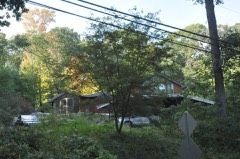 | James Swallen House | 0.4 miles | 2010 |
 | Richard and Geraldine Hodgson House | 0.6 miles | 2005 |
 | Mills, Willis N, House | 0.7 miles | 2010 |
| National Archives record | The nomination case file for reference 100012774 in Record Group 79. |
| Fairfield County | All 298 listed properties in this county. |