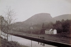
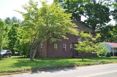
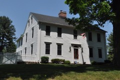
Listed on the National Register of Historic Places in 2012.
From the record
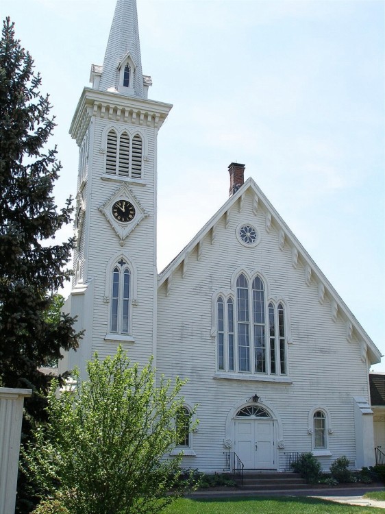
“The Congregational Church of Plainville is a historic church building at 130 West Main Street in Plainville, Connecticut. Built in 1850, it is one Connecticut architect Henry Austin's significant church designs, exhibiting a mix of Carpenter Gothic and Romanesque features.”
Wikipedia article Congregational Church of Plainville, CC BY-SA 4.0.
One of 451 National Register listings published here for Hartford County · listed in 2012 · category: Building.
National Register reference number.12000358- the number the National Park Service assigned this property when it was listed, and the key its nomination file is catalogued under at the National Archives.
IN 1869 Plainville was set off from Farmington, where it had been earlier known as the Great Plain, and was incorporated as a town. It is bounded north by Farmington, east by New Britain, south by Southington, west by Bristol, and contains about twelve square miles. The village proper is only about four and a half miles from the business centre of Farmington ; but its history and business interests liad been so separate from those of the town to which it was attached that the legislature of 1869 granted its incorporation, although the place was not even represented in that body as a voting district. The petition was signed by every legal voter, and the division was effected without discord.
Plainville is probably the most level township in the State. Nearly all of its area is in the broad open plain lying between the mountain ranges which run north from New Haven harbor to Vermont. Plainville is distant twenty-seven miles from the Sound coast, and twentyfive miles from the Massachusetts line. The whole plain is composed of drift, and seems to be of comparatively recent origin. The shallow, sandy loam of the surface rests on gravel and sand, with here and there a stratum of clay, and the red sandstone lies under all and occasionally crops out. Water is abundant at from six to twenty feet below the surface. The Pequabuck River flows northward from Plainville into the Farmington River just opposite Farmington village, furnishing in its course the water-power for Terry ville, Bristol, and Plainville. On the east side of the plain, about a mile from the Pequabuck valley, is Hamlin's Pond, known in the old records as Big Pond. It is fed by small streams from the north and east, and itself is the source of Quinniitiac River, which flows due south through Southington, Meriden, Wallingford, and North Haven, to New Haven Bay. Thus Plainville rests upon a dividing ridge of water-shed, and is the highest bottom-land along the valley. Its measured altitude is 186 feet above tide-water. It is a current geological belief that the Connecticut River formerly flowed through this valley and was at a comparatively late day diverted by some convulsion near Mount Tom, in Massachusetts.
Regional context, not property-specific
evidence. The
federal wildfire occurrence database
lists 55 fires within 5 miles of Congregational Church of Plainville
between 1993 and 2020, burning about 176 acres in total. None started naturally. 10 were recorded as arson.
Distance is straight-line from the map coordinates, so a fire counted
here may appear on a neighbouring settlement's page as well.
Reported cause
Fires
Missing data/not specified/undetermined
29
Misuse of fire by a minor
12
Arson/incendiarism
10
Recreation and ceremony
2
Smoking
1
Debris and open burning
1
The most recent of
them, most recent first, with the day each was reported and the service
that recorded it.
Regional context, not property-specific
evidence. The federal mineral resources record lists
40 workings within 5 miles of Congregational Church of Plainville: 25 past producers, 12 producers, 1 unknown, 1 occurrence.
13 still produce. What was taken out: Sand and Gravel, Construction, Stone, Crushed/Broken, Stone, Dimension, Granite. Distance is straight-line from the
map coordinates, so a quarry counted here may appear on a neighbouring
settlement's page as well.
Regional context, not property-specific
evidence. The National Weather Service names
Plainville, the town this property stands in, in 1 storm report in 2007: 1 thunderstorm wind.
No death or injury is recorded in these reports. Each account below is quoted exactly as the forecast office
filed it, from the NOAA Storm Events Database, and each date
opens the federal record of that event.
No historic map-sheet match is published
for this property yet. That does not mean no map exists. This record needs
a coordinate-quality review before it can be joined to a sheet boundary.
Browse the county's mapped places while that work is
pending.
Listed places nearby
6 within 8 miles
Other National Register properties close
enough to walk or drive between, ordered by distance from this one. Both
positions come from the same geocoding pass that matched these properties
to their map sheets.
Listing record. National Park Service National Register of Historic Places, listed-properties dataset, current to 2026-05-22.
Map join. Address geocoded through the United States Census geocoder, then tested against the published boundary of every sheet in the USGS Historical Topographic Map Collection.
How this page is made. Listing fields come from federal records; map-sheet coverage is a labelled coordinate-to-boundary calculation, not a source-field claim.
Wildfire. Short, Karen C. 2022. Spatial wildfire occurrence data for the United States, 1992-2020 [FPA_FOD_20221014]. 6th Edition. Fort Collins, CO: Forest Service Research Data Archive. https://doi.org/10.2737/RDS-2013-0009.6 Collected with United States Government funding and usable without additional permissions or fees.
Mines and quarries. USGS Mineral Resources Data System (MRDS) https://mrdata.usgs.gov/mrds/ A work of the United States government, no copyright under 17 U.S.C. 105.
Storms. NOAA National Centers for Environmental Information, Storm Events Database https://www.ncei.noaa.gov/stormevents/ A work of the United States government, no copyright under 17 U.S.C. 105. Narratives are quoted verbatim from the National Weather Service report and are not edited or summarised.
 Block