BlockBefore
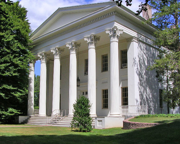
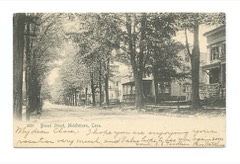
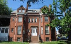
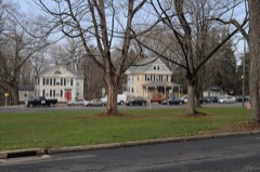
Photograph of Samuel Wadsworth Russell House
Photograph by Original uploader was Phmalo at en.wikipedia, CC BY 2.0. Via Wikimedia Commons.

Samuel Wadsworth Russell House

A National Historic Landmark. Listed on the National Register of Historic Places in 1970.

From the record

“The Samuel Russell House is a neoclassical house at 350 High Street in Middletown, Connecticut, built in 1828 to a design by architect Ithiel Town. Many architectural historians consider it to be one of the finest Greek Revival mansions in the northeastern United States.”

Wikipedia article Samuel Wadsworth Russell House, CC BY-SA 4.0.

One of 124 National Register listings published here for Middlesex County · listed in 1970 · category: Building · a National Historic Landmark.

Sources: the Wikipedia article · the case file at the National Archives · the National Register database, National Park Service

The listing

  • Listed as. Russell, Samuel Wadsworth, House - the National Register files a house under its owner's surname.
  • Address. 350 High St., Middletown, 06457
  • When was it listed? October 1970
  • Category. building
  • Town. Middletown town
  • Architectural style. Greek Revival architecture
  • Architect. David Hoadley, Ithiel Town
  • National Register reference number. 70000688 - the number the National Park Service assigned this property when it was listed, and the key its nomination file is catalogued under at the National Archives.

The ground it stands on

26,473 words

The chapter on Middletown Town in History of Middlesex County, Connecticut, with Biographical Sketches of Its Prominent Men, published 1884 names Middletown. This is what it says, exactly as the scans read.

McDonough House. - In May 185 1, a number of the citizens of Middletown organized the "McDonough Hotel Co.," and in December df that year purchased the old " Central Hotel," removed the buildings, and erected on that site, the present brick edifice, which was named for Commodore Thomas McDonough, the hero of Lake Champlain, whose residence was a few feet north, on Main street, and whose portrait hangs in the office of the hotel. From the time of its erection, this has been the leading house of its kind in this city.

Passage source: History of Middlesex County, Connecticut, with Biographical Sketches of Its Prominent Men, published 1884.

The Daily Herald, in connection with a daily paper in New Britain, was first published in this city, October 19th 1883, by C. E. Woodruff. November ist of that year, the firm name was changed to the Woodruff Publishing Company, and, March sth 1884, the office became the property of its present owners, " The Middletown Publishing Company."

Passage source: History of Middlesex County, Connecticut, with Biographical Sketches of Its Prominent Men, published 1884.

Machine-read from a century-old scan, so expect the errors a machine makes: misspelled names, dropped words, stray characters.

Read the whole chapter on Middletown Town - 26,473 words on its settlement, mills, schools and churches.

Fires near this property

87 since 1992

Regional context, not property-specific evidence. The federal wildfire occurrence database lists 87 fires within 5 miles of Samuel Wadsworth Russell House between 1992 and 2020, burning about 114 acres in total. None started naturally. 6 were recorded as arson. Distance is straight-line from the map coordinates, so a fire counted here may appear on a neighbouring settlement's page as well.

Reported cause Fires
Missing data/not specified/undetermined44
Debris and open burning16
Recreation and ceremony11
Smoking6
Arson/incendiarism6
Equipment and vehicle use2
Misuse of fire by a minor1
Other causes1

The most recent of them, most recent first, with the day each was reported and the service that recorded it.

DateCause SizeReported by Name on the report
30 September 2007Debris and open burningunder an acreConnecticut Division of Forestrynot named
26 September 2017Missing data/not specified/undeterminedunder an acreConnecticut Division of Forestry810 SAYBROOK RD.
17 September 2017Missing data/not specified/undeterminedunder an acreConnecticut Division of Forestry600 MERIDEN RD.
5 August 2007Missing data/not specified/undetermined1.0 acresConnecticut Division of Forestrynot named
31 August 1995Recreation and ceremonyunder an acreConnecticut Division of Forestrynot named
30 August 1995Recreation and ceremonyunder an acreConnecticut Division of Forestrynot named
3 August 2015Other causesunder an acreConnecticut Division of Forestrynot named
28 August 1995Smokingunder an acreConnecticut Division of Forestrynot named

Every fire recorded in Middlesex County

Mines and quarries near this property

10 of 47 shown

Regional context, not property-specific evidence. The federal mineral resources record lists 47 workings within 5 miles of Samuel Wadsworth Russell House: 38 past producers, 5 producers, 2 prospects, 1 occurrence. 6 still produce. What was taken out: Feldspar, Stone, Dimension, Beryllium, Mica, Stone. Distance is straight-line from the map coordinates, so a quarry counted here may appear on a neighbouring settlement's page as well.

Where SiteCommodity StatusRecorded
Hale-Walker Beryl Prospect and Feldspar MineBeryllium, Tantalum, Niobium (Columbium), FeldsparPast Producer1932
Middletown Lead-Silver MineSilver, LeadPast Producer1776
Middletown Lead-Silver MineLead, StonePast Producer
Middletown MineBarium-Barite, Lead, ZincPast Producer
Strickland-Cramer Feldspar-Mica QuarriesTantalum, Niobium (Columbium), Beryllium, Mica, REE, FeldsparPast Producer1907
Strickland-Cramer QuarryMica, Feldspar, TinPast Producer1900
Tollgate Mica-Feldspar MineNiobium (Columbium), Feldspar, Mica, TantalumPast ProducerPegmatite Dike
Tollgate Mica-Feldspar MineFeldspar, MicaProspect
Basalt Rock Quarry No. Cj-071Stone, Crushed/BrokenPast ProducerBasalt
Benvenue QuarriesGranitePast Producer

Every working recorded in Middlesex County

Storms near this property

33 since 1995

Regional context, not property-specific evidence. The National Weather Service names Middletown, the town this property stands in, in 33 storm reports between 1995 and 2018: 13 thunderstorm wind, 7 hail, 5 lightning, 5 flash flood. The reports record 1 death. Each account below is quoted exactly as the forecast office filed it, from the NOAA Storm Events Database, and each date opens the federal record of that event.

WhenEvent Place namedHarm What the report says
May 2000LightningMiddletown1 killedno account filed
August 2016LightningMiddletown$10,000A few buildings in Middletown were struck by lightning, including the Canoe Club Restaurant.
August 2016Thunderstorm WindMiddletown$10,000A half dozen trees and multiple power lines were reported down throughout Middletown.
August 2013Thunderstorm WindMiddletown$10,000Trees were reported down throughout the town.
March 2010FloodMiddletown$5,000A mudslide at the Newfield St. apartment complex in Middletown left the concrete foundation of one of the buildings exposed with a sheer drop to the Coginchaug River below.||Total rainfall amounts received across Middlesex County ranged from 5.14 inches in Portland to 5.67 inches in Clinton.
February 2016Thunderstorm WindMiddletown$4,000Multiple tree limbs and power lines were reported down across the Town of Middletown.
July 2013LightningMiddletown$3,000Lightning struck a house, causing two small fires.
September 2013Thunderstorm WindMiddletown$3,000Numerous trees reported down around the town.
September 2018Flash FloodMiddletown-All lanes were closed on Route 9 southbound between Exit 16 and Exit 1 in Middletown due to flooding.
May 2015HailMiddletown-Nickel size hail was reported from Middletown to Cromwell.
May 2014Thunderstorm WindMiddletown-Multiple trees were reported down across the town.
June 2011HailMiddletown-A trained spotter reported nickel sized hail for about two minutes in Middletown.
June 2011Thunderstorm WindMiddletown-Two trees were reported down on Randolph Road in Middletown.
July 2011Flash FloodMiddletown-Stoneycrest Rd. was closed at the intersection of Rt. 3 in Middletown with local authorities performing water rescues.
July 2010HailMiddletown-Quarter size hail was reported in Middletown.
July 2009Flash FloodMiddletown-In Middletown, Poplar Rd. and Rt. 66 between Old Mill St and West St. were closed due to flooding.
March 2007Flash FloodMiddletown-Multiple roads closed in Middletown.
May 2007Thunderstorm WindMiddletown-Trees down with an estimated 60-70 mph wind gusts.
June 2006Flash FloodMiddletown-Flash Flooding of Route 9.
August 2006Thunderstorm WindMiddletown-no account filed
June 2001Thunderstorm WindMiddletown-no account filed
June 2001LightningMiddletown-no account filed
August 2001Thunderstorm WindMiddletown-no account filed
August 2001FloodMiddletown-no account filed
May 2000HailMiddletown-no account filed
June 2000Thunderstorm WindMiddletown-no account filed
February 1999Heavy RainMiddletown-no account filed
June 1998LightningMiddletown-no account filed
August 1997HailMiddletown-no account filed
August 1997Thunderstorm WindMiddletown-no account filed
May 1996Thunderstorm WindMiddletown-no account filed
May 1995HailMiddletown-no account filed

Every storm recorded in Middlesex County

Map coverage status

No historic map-sheet match is published for this property yet. That does not mean no map exists. This record needs a coordinate-quality review before it can be joined to a sheet boundary. Browse the county's mapped places while that work is pending.

Listed places nearby

6 within 8 miles

Other National Register properties close enough to walk or drive between, ordered by distance from this one. Both positions come from the same geocoding pass that matched these properties to their map sheets.

Sources for this property

National Archives recordThe nomination case file for reference 70000688 in Record Group 79.
Wikipedia articleCommunity-written account of this property, licensed CC BY-SA.
Middlesex CountyAll 124 listed properties in this county.

Provenance

  • Listing record. National Park Service National Register of Historic Places, listed-properties dataset, current to 2026-05-22.
  • Map join. Address geocoded through the United States Census geocoder, then tested against the published boundary of every sheet in the USGS Historical Topographic Map Collection.
  • How this page is made. Listing fields come from federal records; map-sheet coverage is a labelled coordinate-to-boundary calculation, not a source-field claim.
  • Wildfire. Short, Karen C. 2022. Spatial wildfire occurrence data for the United States, 1992-2020 [FPA_FOD_20221014]. 6th Edition. Fort Collins, CO: Forest Service Research Data Archive. https://doi.org/10.2737/RDS-2013-0009.6 Collected with United States Government funding and usable without additional permissions or fees.
  • Mines and quarries. USGS Mineral Resources Data System (MRDS) https://mrdata.usgs.gov/mrds/ A work of the United States government, no copyright under 17 U.S.C. 105.
  • Storms. NOAA National Centers for Environmental Information, Storm Events Database https://www.ncei.noaa.gov/stormevents/ A work of the United States government, no copyright under 17 U.S.C. 105. Narratives are quoted verbatim from the National Weather Service report and are not edited or summarised.