BlockBefore
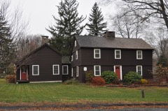
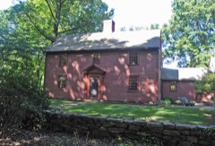
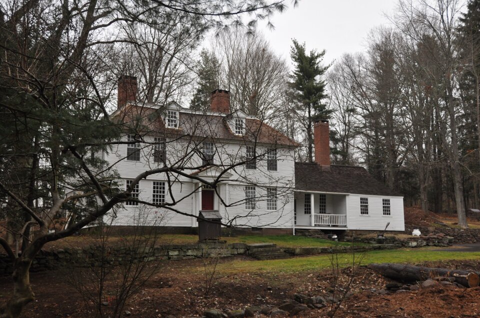
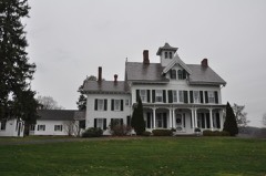
Photograph of Thomas Lyman House
Photograph by Magicpiano, CC BY-SA 3.0. Via Wikimedia Commons.

Thomas Lyman House

Listed on the National Register of Historic Places in 1975.

From the record

“The Thomas Lyman House is a historic house at 105 Middlefield Road in Durham, Connecticut. Built about 1774, it is a well-preserved example of late Colonial architecture, regionally unusual for its hip roof.”

Wikipedia article Thomas Lyman House, CC BY-SA 4.0.

One of 124 National Register listings published here for Middlesex County · listed in 1975 · category: Building.

Sources: the Wikipedia article · the case file at the National Archives · the National Register database, National Park Service
The listing

  • What is counted as historic. The nomination lists 1 building as contributing to the listing.
  • Listed as. Lyman, Thomas, House - the National Register files a house under its owner's surname.
  • Address. Middlefield Rd., Durham, 06422
  • When was it listed? November 1975
  • Category. building
  • Town. Durham town
  • National Register reference number. 75001921 - the number the National Park Service assigned this property when it was listed, and the key its nomination file is catalogued under at the National Archives.

The ground it stands on

15,218 words

The chapter on Durham Town in History of Middlesex County, Connecticut, with Biographical Sketches of Its Prominent Men, published 1884 names Durham. This is what it says, exactly as the scans read.

The western part of the town was shut in between the swamp on one side and the mountain on the other; the passes at Reed's Gap and at the southwest corner of the town were the only ways of communication between it and Wallingford. There was no thought that the east erly and westerly parts of the town could be united, for an impassable and almost impenetrable morass, thickly studded with swamp maple and underbrush lay between. The then indispensable privileges of preaching and public worship would have been unattainable to occupants of almost any part of the town. The western part, called the West Side, was the most easily accessible to Guilford, and seems to have been considered in some sense as belonging to it. Many of the inhabitants of Guilford owned land in Durham. The first recorded meeting of proprietors of Durham was held in Guilford.

Passage source: History of Middlesex County, Connecticut, with Biographical Sketches of Its Prominent Men, published 1884.

From many points nearly the whole township of Durham can be brought wiihin visual range, and to the eye of a geologist its hills and valleys present an impressive illustration of the wonderful changes which have been wrought in the countless ages of the past.

Passage source: History of Middlesex County, Connecticut, with Biographical Sketches of Its Prominent Men, published 1884.

Machine-read from a century-old scan, so expect the errors a machine makes: misspelled names, dropped words, stray characters.

Read the whole chapter on Durham Town - 15,218 words on its settlement, mills, schools and churches.

Fires near this property

144 since 1992

Regional context, not property-specific evidence. The federal wildfire occurrence database lists 144 fires within 5 miles of Thomas Lyman House between 1992 and 2020, burning about 130 acres in total. 2 started naturally. 5 were recorded as arson. Distance is straight-line from the map coordinates, so a fire counted here may appear on a neighbouring settlement's page as well.

Reported cause Fires
Missing data/not specified/undetermined62
Debris and open burning33
Recreation and ceremony19
Smoking11
Power generation/transmission/distribution5
Arson/incendiarism5
Fireworks2
Misuse of fire by a minor2
Natural2
Equipment and vehicle use2
Other causes1

The most recent of them, most recent first, with the day each was reported and the service that recorded it.

DateCause SizeReported by Name on the report
20 September 2015Missing data/not specified/undeterminedunder an acreConnecticut Division of Forestrynot named
17 September 2017Missing data/not specified/undeterminedunder an acreConnecticut Division of Forestry600 MERIDEN RD.
8 August 2020Power generation/transmission/distributionunder an acreConnecticut Division of ForestryWALLINGFORD ROAD/PENT ROAD
8 August 2020Power generation/transmission/distributionunder an acreConnecticut Division of ForestryOXBOW RIDGE ROAD/OXBOW ROAD
5 August 2015Debris and open burningunder an acreConnecticut Division of Forestrynot named
31 August 1995Recreation and ceremonyunder an acreConnecticut Division of Forestrynot named
30 August 2019Recreation and ceremonyunder an acreConnecticut Division of Forestrynot named
30 August 1995Recreation and ceremonyunder an acreConnecticut Division of Forestrynot named

Every fire recorded in Middlesex County

Mines and quarries near this property

10 of 14 shown

Regional context, not property-specific evidence. The federal mineral resources record lists 14 workings within 5 miles of Thomas Lyman House: 11 past producers, 2 producers, 1 prospect. 2 still produce. What was taken out: Stone, Crushed/Broken, Stone, Dimension, Feldspar, Mica, Limestone, General. Distance is straight-line from the map coordinates, so a quarry counted here may appear on a neighbouring settlement's page as well.

Where SiteCommodity StatusRecorded
Brownstone QuarriesFlagstonePast Producer
Limestone Quarry No. Ck-008Limestone, GeneralPast ProducerSedimentary Beds
Roberts Mica ProspectFeldspar, MicaPast ProducerMuscovite, Plagioclase, Quartz
Roberts Mica ProspectFeldspar, MicaProspect
Stove Street PitSand and Gravel, ConstructionPast Producer
Basalt Rock Quarry No. Ck-006.Stone, DimensionPast Producer
Brownstone Sandstone Quarries No. Ck-004Stone, DimensionPast ProducerSandstone
Reed Gap Traprock QuarriesStone, DimensionPast Producer
Traprock QuarriesStone, DimensionPast Producer
Basalt Rock Quarries No. Ck-006Stone, Crushed/BrokenPast ProducerBasalt

Every working recorded in Middlesex County

Storms near this property

13 since 2001

Regional context, not property-specific evidence. The National Weather Service names Durham, the town this property stands in, in 13 storm reports between 2001 and 2021: 10 thunderstorm wind, 1 lightning, 1 flood, 1 hail. No death or injury is recorded in these reports. Each account below is quoted exactly as the forecast office filed it, from the NOAA Storm Events Database, and each date opens the federal record of that event.

WhenEvent Place namedHarm What the report says
June 2015Thunderstorm WindDurham$15,000Numerous trees and power lines were reported down throughout the entire town.
February 2016Thunderstorm WindDurham$7,500Multiple trees and power lines were reported down throughout Durham.
November 2020Thunderstorm WindDurham$5,000Large tree blocking the road on Route 17.
May 2018Thunderstorm WindDurham$5,000Numerous trees down.
June 2021Thunderstorm WindDurham$3,000Report from mPING, 1 inch tree limbs broken and shingles blown off.
October 2013Thunderstorm WindDurham$3,000Wires were reported down along Route 68 at Pent Road.
June 2021Thunderstorm WindDurham$2,000Tree and branches reported down in front of 15 Foot Hills Road just past Milbrook Road.
June 2019Thunderstorm WindDurham$1,000Downed tree on Stage Coach Road in Durham.
July 2009Thunderstorm WindDurham$500Thunderstorm winds downed a tree in Durham.
July 2009HailDurham-Penny size hail stripped the leaves off of trees at the intersection of Mountain Road and Route 68.
December 2008FloodDurham-Flooding forced the closure of both ends of Pickett Lane, blocking access to Coginchaug High School and Korn School from both Maiden Lane and Main Street in Durham.
July 2006Thunderstorm WindDurham-no account filed
August 2001LightningDurham-no account filed

Every storm recorded in Middlesex County

Map coverage status

No historic map-sheet match is published for this property yet. That does not mean no map exists. This record needs a coordinate-quality review before it can be joined to a sheet boundary. Browse the county's mapped places while that work is pending.

Listed places nearby

6 within 8 miles

Other National Register properties close enough to walk or drive between, ordered by distance from this one. Both positions come from the same geocoding pass that matched these properties to their map sheets.

Photograph PropertyDistance Listed
Main Street Historic District0.7 miles1986
David Lyman II House1.7 miles1986
William and Mary Ward House2.7 miles2021
William Ward Jr. House2.8 miles1988
Wadsworth Estate Historic District3.6 miles1996
Nehemiah Hubbard House3.8 miles1982

Sources for this property

National Archives recordThe nomination case file for reference 75001921 in Record Group 79.
Wikipedia articleCommunity-written account of this property, licensed CC BY-SA.
Middlesex CountyAll 124 listed properties in this county.

Provenance

  • Listing record. National Park Service National Register of Historic Places, listed-properties dataset, current to 2026-05-22.
  • Map join. Address geocoded through the United States Census geocoder, then tested against the published boundary of every sheet in the USGS Historical Topographic Map Collection.
  • How this page is made. Listing fields come from federal records; map-sheet coverage is a labelled coordinate-to-boundary calculation, not a source-field claim.
  • Wildfire. Short, Karen C. 2022. Spatial wildfire occurrence data for the United States, 1992-2020 [FPA_FOD_20221014]. 6th Edition. Fort Collins, CO: Forest Service Research Data Archive. https://doi.org/10.2737/RDS-2013-0009.6 Collected with United States Government funding and usable without additional permissions or fees.
  • Mines and quarries. USGS Mineral Resources Data System (MRDS) https://mrdata.usgs.gov/mrds/ A work of the United States government, no copyright under 17 U.S.C. 105.
  • Storms. NOAA National Centers for Environmental Information, Storm Events Database https://www.ncei.noaa.gov/stormevents/ A work of the United States government, no copyright under 17 U.S.C. 105. Narratives are quoted verbatim from the National Weather Service report and are not edited or summarised.