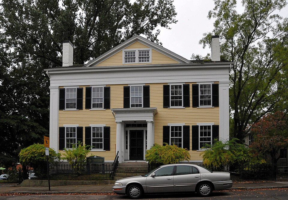
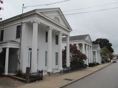
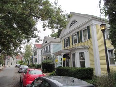
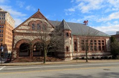
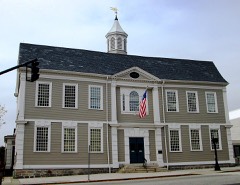
Built in 1837 (Greek Revival architecture). Listed on the National Register of Historic Places in 1976.
From the record
“The Acors Barns House is located at 68 Federal Street at the corner of Meridian Street in New London, Connecticut. Barns was a wealthy merchant in the whaling industry whose company became one of the largest whaling firms in the city.”
Wikipedia article Acors Barns House, CC BY-SA 4.0.
One of 197 National Register listings published here for New London County · listed in 1976 · category: Building · built in 1837, Greek Revival architecture.
National Register reference number.76001992- the number the National Park Service assigned this property when it was listed, and the key its nomination file is catalogued under at the National Archives.
Island was abandoned by the Genius of Liberty, and the British rule was spread over It far and wide. From that moment the two coasts were hostile, and an inveterate system of smuggling, marauding, plundering, and kidnapping took place on both sides, in comparison with which a common state of honorable warfare might be taken for peace and good neighborhood. Sheep, cattle, effects, and people were seized and carried off by either party. On the Connecticut side this was done under the covert of secrecy. Goods stolen from the island were carefully secreted, and if discovered by honest persons were advertised, and the owners desired to come and take possession. This condition of affairs was fraught with mischief, misrule, and villany. There was no end to the strays and the thieves. Akin to this marauding system \vas the contraband trade, an illicit dealing with the enemy, and furnishing them with supplies for the sake of their gold and their goods. This was not often carried on by the Tories, the professed friends of the British, for they too narrowly watched to allow of the risk, but by men who were patriots in pretension, but yet lovers of money rather than lovers of their country. This trade was entered into by many people who were otherwise considered fair and honorable in all their dealings, but if discovered by their countrymen they were marked for opprobrium and insult. A more odious occupation could not be mentioned, nor could anything be said of a man better calculated to hold him up to public indignation than to call him a Long Island trader. The republican authorities were rigorous in their watch upon thia trade.' Many houses were searched and men imprisoned, yet the contraband trade flourished. Goods that were bought for country produce might be sold cheap, and the temptation to buy was great. Fine Holland shirts, ready made, could be procured for half a Spanish dollar. Sloops and boats laden with provisions for the New York market were occasionally intercepted by the State cruisers, and the sad history of the day was often enlivened by ludicrous anecdotes that would gain currency respecting these night-traders. Thus a story was told of two men from the Great Neck shore of New London who put off one night in a whale-boat with a large fat ox on board. The animal got loose from its fastenings and became so unmanageable that the men, in danger of sinking, were glad to make towards a country sloop near by and meekly surrender their ox to confiscation and themselves to imprisonment.
Bay, was bound to New York; that a part of the other fleet had gone on a plundering expedition to the Vineyard Sound and Falmouth (now Portland, in Maine), and that on the opposite coast of Long Island, from whence the invading army was expected to embark, all was quiet and peaceful. No flat-bottomed boats were there, nor had been. The only force collected on that side of the island consisted of five hundred foot and fifty horse at Southold, and one hundred men with two field-pieces at Sag Harbor, which was a stationary arrangement to guard and assist the English vessels in taking 05" wood and hay. It is a little singular that the troops at Southampton had been assembled in consequence of unfounded reports of a similar nature that had been flying through the British lines. It was confidently aflBrnied in New York that Gen. Parsons was at New London with a body of four thousand men, making hasty but secret preparations for a descent upon Long Island. In consequence of this report. Gen. Clinton had hastened from New York with a flying force, to prepare a reception for the expected invader. In this manner rumor flew from side to side imagining evil, asserting its existence, and actually causing it to exist. False report, though but a breath of air, has a mighty agency in aggravating the calamities of war.
Regional context, not property-specific
evidence. The
federal wildfire occurrence database
lists 16 fires within 5 miles of Acors Barns House
between 1992 and 2020, burning about 90 acres in total. None started naturally. None was recorded as arson.
Distance is straight-line from the map coordinates, so a fire counted
here may appear on a neighbouring settlement's page as well.
Reported cause
Fires
Missing data/not specified/undetermined
10
Recreation and ceremony
3
Debris and open burning
2
Power generation/transmission/distribution
1
The most recent of
them, most recent first, with the day each was reported and the service
that recorded it.
Regional context, not property-specific
evidence. The federal mineral resources record lists
69 workings within 5 miles of Acors Barns House: 62 past producers, 5 producers, 1 occurrence, 1 prospect.
5 still produce. What was taken out: Stone, Dimension, Granite, Sand and Gravel, Construction, Stone. Distance is straight-line from the
map coordinates, so a quarry counted here may appear on a neighbouring
settlement's page as well.
Regional context, not property-specific
evidence. The National Weather Service names
New London, the town this property stands in, in 21 storm reports between 1995 and 2023: 16 flash flood, 3 hail, 1 thunderstorm wind, 1 flood.
No death or injury is recorded in these reports. Each account below is quoted exactly as the forecast office
filed it, from the NOAA Storm Events Database, and each date
opens the federal record of that event.
Several roads are closed in urban areas of New London including Broad St, Bank St, Garfield Ave, and Shaw St. Spotter reports 2 inches of rain in 2 hours.
Several roads were closed due to flooding in New London including Broad Street at Ledyard Street, Bank Street between Howard Street and Tilley Street, Bank Street at Truman Street, Pequot Avenu at Green Harbor Beach, and Garfield Avenue at Elm Street.
Torrential rains caused flash flooding of streets in New London. Flash flooding of State Street poured into businesses. The torrential rains were caused by the interaction of offshore Tropical Storm Ophelia and a cold front to the west of CT.
No historic map-sheet match is published
for this property yet. That does not mean no map exists. This record needs
a coordinate-quality review before it can be joined to a sheet boundary.
Browse the county's mapped places while that work is
pending.
Listed places nearby
6 within 8 miles
Other National Register properties close
enough to walk or drive between, ordered by distance from this one. Both
positions come from the same geocoding pass that matched these properties
to their map sheets.
Listing record. National Park Service National Register of Historic Places, listed-properties dataset, current to 2026-05-22.
Map join. Address geocoded through the United States Census geocoder, then tested against the published boundary of every sheet in the USGS Historical Topographic Map Collection.
How this page is made. Listing fields come from federal records; map-sheet coverage is a labelled coordinate-to-boundary calculation, not a source-field claim.
Wildfire. Short, Karen C. 2022. Spatial wildfire occurrence data for the United States, 1992-2020 [FPA_FOD_20221014]. 6th Edition. Fort Collins, CO: Forest Service Research Data Archive. https://doi.org/10.2737/RDS-2013-0009.6 Collected with United States Government funding and usable without additional permissions or fees.
Mines and quarries. USGS Mineral Resources Data System (MRDS) https://mrdata.usgs.gov/mrds/ A work of the United States government, no copyright under 17 U.S.C. 105.
Storms. NOAA National Centers for Environmental Information, Storm Events Database https://www.ncei.noaa.gov/stormevents/ A work of the United States government, no copyright under 17 U.S.C. 105. Narratives are quoted verbatim from the National Weather Service report and are not edited or summarised.
 Block