 Block
From the record
One of 451 National Register listings published here for Hartford County · listed in 1976 · category: District.
Sources: the case file at the National Archives · the National Register database, National Park Service
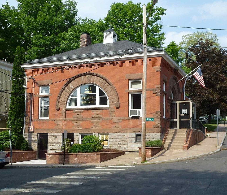
Listed on the National Register of Historic Places in 1976.
One of 451 National Register listings published here for Hartford County · listed in 1976 · category: District.
Sources: the case file at the National Archives · the National Register database, National Park Service
The chapter on Canton Town in The Memorial History of Hartford County, Connecticut, 1633-1884;, published 1886 names Collinsville. This is what it says, exactly as the scans read.
Benjamin Dyer, a schoolmate of Dr. Franklin, came from Boston to West Simsbury about 1741. He had five sons and two daughters. He resided one mile northeasterly from Collinsville. The house built by him is said to be the oldest in town.
Passage source: The Memorial History of Hartford County, Connecticut, 1633-1884;, published 1886.
The people of West Simsbury began holding Sunday services in private houses about 1741. In September, 1746, at the house of Richard Case, they organized an ecclesiastical society ; and at the May session, 1750, the legislature created West Simsbury a distinct parish and the First Congregational Church was formed. Between 1747 and 1750 there was preaching liy the Rev's Adonijah Bidwell and Timothy Pitkin. When the church was formed, the Rev. Evander Morrison was called, at a salary of <£250, "old tenor," and thirty cords of wood, - the church to build him a house if he would furnish nails and glass. As the result of a quarrel he was dismissed in eleven months, and the house was not built. Succeeding pastors have been the Rev's Gideon Mills, 1759 to 1772, when he died ; Seth Sage, 1774, to his dismissal in 1778 ; Jeremiah Hallock, 1785, to his death, after forty-one years' pastorate, in 1826 ; Jairus Burt, 1826, to his death in 1857 ; and since then, the Rev's W. C. Fisk, Charles N. Lyman, A. Gardner, and David B. Hubbard. There was a secession from the church in 1778, led by the Rev. Mr. Sage. Meetings were held in private houses in the north part of the town for some years, and in 1783 a meeting-house was built on the Granby road, half a mile north of the present North Canton Methodist church. The organization was scattered at Mr. Sage's death. In 1783 another schism occurred, when the " Separatists " left the church ; and in 1785 these again separated, and the Baptist society was then established. Their first pastor was Elder Jared Mills. Their church was moved and rebuilt in 1839. A Methodist church was built in North Canton in 1871, and one in Collins ville in 1868 ; but this was closed in 1878. As early as 1751 there was a movement into the Episcopal church, but the withdrawing members joined the church in Scotland (Bloomfield). It was not until 1875 that a society was organized here. The Episcopal church was built in 1876. The Roman Catholic church in Collinsville was built in 1852.
Passage source: The Memorial History of Hartford County, Connecticut, 1633-1884;, published 1886.
Machine-read from a century-old scan, so expect the errors a machine makes: misspelled names, dropped words, stray characters.
Read the whole chapter on Canton Town - 3,778 words on its settlement, mills, schools and churches.
Regional context, not property-specific evidence. The federal wildfire occurrence database lists 83 fires within 5 miles of Collinsville Historic District between 1992 and 2020, burning about 421 acres in total. None started naturally. 12 were recorded as arson. Distance is straight-line from the map coordinates, so a fire counted here may appear on a neighbouring settlement's page as well.
| Reported cause | Fires |
|---|---|
| Missing data/not specified/undetermined | 54 |
| Arson/incendiarism | 12 |
| Recreation and ceremony | 8 |
| Misuse of fire by a minor | 4 |
| Debris and open burning | 3 |
| Equipment and vehicle use | 1 |
| Railroad operations and maintenance | 1 |
The most recent of them, most recent first, with the day each was reported and the service that recorded it.
| Date | Cause | Size | Reported by | Name on the report |
|---|---|---|---|---|
| 25 September 2011 | Missing data/not specified/undetermined | under an acre | Connecticut Division of Forestry | NEW HARTFORD |
| 23 September 2020 | Missing data/not specified/undetermined | 1.0 acres | Connecticut Division of Forestry | 2 INDIAN HILL ROAD |
| 2 September 2001 | Missing data/not specified/undetermined | 2.0 acres | Connecticut Division of Forestry | not named |
| 19 September 2020 | Recreation and ceremony | under an acre | Connecticut Division of Forestry | 124 LAIR ROAD |
| 1 September 2020 | Missing data/not specified/undetermined | under an acre | Connecticut Division of Forestry | LITCHFIELD TPKE |
| 22 August 2020 | Railroad operations and maintenance | under an acre | Connecticut Division of Forestry | 7 RIDGEVIEW TERRANCE |
| 2 August 2001 | Recreation and ceremony | 2.0 acres | Connecticut Division of Forestry | not named |
| 2 August 1997 | Misuse of fire by a minor | under an acre | Connecticut Division of Forestry | not named |
Regional context, not property-specific evidence. The federal mineral resources record lists 17 workings within 5 miles of Collinsville Historic District: 14 past producers, 1 prospect, 1 producer, 1 plant. 2 still produce. What was taken out: Sand and Gravel, Construction, Stone, Dimension, Flagstone, Mica. Distance is straight-line from the map coordinates, so a quarry counted here may appear on a neighbouring settlement's page as well.
| Where | Site | Commodity | Status | Recorded |
|---|---|---|---|---|
| Asbestos Mine | Asbestos | Past Producer | ||
| Copper Mine No. Di-008 | Sulfur, Copper | Past Producer | Metamorphosed Sedimentary | |
| Knapp Mica Prospect | Mica, Feldspar | Past Producer | Muscovite, Plagioclase, Quartz | |
| Knapp Mica Prospect | Feldspar, Mica | Prospect | ||
| Lead Mine | Lead | Past Producer | ||
| Sandstone Quarry #Di-012 | Flagstone | Past Producer | ||
| Soapstone Mine | Talc-Soapstone | Past Producer | ||
| Avon Plant | Sand and Gravel, Construction | Plant | ||
| Bradford Estate | Sand and Gravel, Construction | Past Producer | ||
| Burlington Pit | Sand and Gravel, Construction | Past Producer |
Regional context, not property-specific evidence. The National Weather Service names Collinsville, the town this property stands in, in 2 storm reports between 2024 and 2025: 2 thunderstorm wind. No death or injury is recorded in these reports. Each account below is quoted exactly as the forecast office filed it, from the NOAA Storm Events Database, and each date opens the federal record of that event.
| When | Event | Place named | Harm | What the report says |
|---|---|---|---|---|
| June 2024 | Thunderstorm Wind | Collinsville | $500 | In Burlington, a tree was down on Barberry Dr. |
| September 2025 | Thunderstorm Wind | Collinsville | - | In Burlington, two trees were down blocking Sand Bank Hill Rd. |
No historic map-sheet match is published for this property yet. That does not mean no map exists. This record needs a coordinate-quality review before it can be joined to a sheet boundary. Browse the county's mapped places while that work is pending.
Other National Register properties close enough to walk or drive between, ordered by distance from this one. Both positions come from the same geocoding pass that matched these properties to their map sheets.
| Photograph | Property | Distance | Listed |
|---|---|---|---|
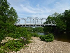 | Town Bridge | 0.9 miles | 1999 |
| Hitchcock-Schwarzmann Mill | 2.9 miles | 1977 | |
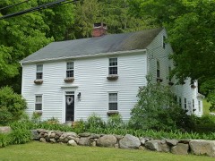 | Canton Center Historic District | 3.2 miles | 1997 |
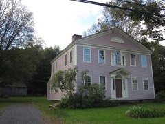 | Brown Tavern | 3.8 miles | 1972 |
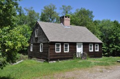 | John Wiard House | 3.9 miles | 1982 |
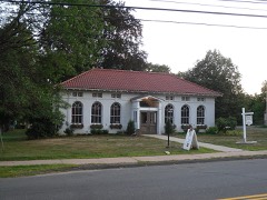 | West End Library | 4.2 miles | 2000 |
| National Archives record | The nomination case file for reference 76001994 in Record Group 79. |
| Hartford County | All 451 listed properties in this county. |