BlockBefore
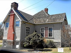
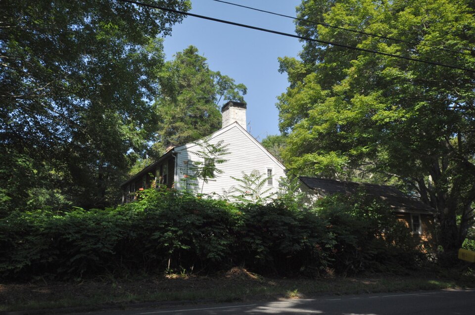
Photograph of Lay-Pritchett House
Photograph by Magicpiano, CC BY-SA 3.0. Via Wikimedia Commons.

Lay-Pritchett House

Listed on the National Register of Historic Places in 1978.

From the record

“The Lay-Pritchett House is a historic house on Stevenstown Road in Westbrook, Connecticut. Built about 1737 and enlarged several times since, it is distinctive for retaining its core elements in their original configuration and without significant alteration.”

Wikipedia article Lay-Pritchett House, CC BY-SA 4.0.

One of 124 National Register listings published here for Middlesex County · listed in 1978 · category: Building.

Sources: the Wikipedia article · the case file at the National Archives · the National Register database, National Park Service
The listing

  • What is counted as historic. The nomination lists 1 building as contributing to the listing.
  • Address. N of Westbrook on CT 145, Westbrook, 06498
  • When was it listed? October 1978
  • Category. building
  • Town. Westbrook town
  • National Register reference number. 78002854 - the number the National Park Service assigned this property when it was listed, and the key its nomination file is catalogued under at the National Archives.

The ground it stands on

17,478 words

The chapter on Westbrook Town in History of Middlesex County, Connecticut, with Biographical Sketches of Its Prominent Men, published 1884 names Westbrook. This is what it says, exactly as the scans read.

The unsurpassed fishing and bathing of its bay have drawn to Westbrook a new population, which, during the summer months, nearly doubles its census. The sound front is being rapidly covered with cottages,which now number about 100, erected and occupied during the summer months by families from abroad.

Passage source: History of Middlesex County, Connecticut, with Biographical Sketches of Its Prominent Men, published 1884.

The territory within the bounds and limits of Westbrook was a portion of the domain of the Mohegan chief, Uncas, his claim covering all the land lying between Connecticut River and Guilford and 12 miles north on the river. The title to this he assumed by right of conquest from the Pequots. To his complaint to the General Court in 1665 respecting his squaws' rights at " Homowoset " (Clinton), the committee replied that " Uncas had alienated all of it [his claim] to Mr.'Fenwick and the inhabitants of Saybrook and Guilford, except only six acres in Homonoset." George Fenwick quitclaimed his interest, with a small reservation to the colony, and the Colonial Legislature confirmed all previous titles by a grant in 1704.

Passage source: History of Middlesex County, Connecticut, with Biographical Sketches of Its Prominent Men, published 1884.

Machine-read from a century-old scan, so expect the errors a machine makes: misspelled names, dropped words, stray characters.

Read the whole chapter on Westbrook Town - 17,478 words on its settlement, mills, schools and churches.

Fires near this property

164 since 1992

Regional context, not property-specific evidence. The federal wildfire occurrence database lists 164 fires within 5 miles of Lay-Pritchett House between 1992 and 2020, burning about 212 acres in total. 1 started naturally. 2 were recorded as arson. Distance is straight-line from the map coordinates, so a fire counted here may appear on a neighbouring settlement's page as well.

Reported cause Fires
Missing data/not specified/undetermined78
Debris and open burning32
Recreation and ceremony24
Misuse of fire by a minor9
Power generation/transmission/distribution7
Smoking6
Railroad operations and maintenance4
Arson/incendiarism2
Equipment and vehicle use1
Natural1

The most recent of them, most recent first, with the day each was reported and the service that recorded it.

DateCause SizeReported by Name on the report
8 September 2020Missing data/not specified/undetermined1.5 acresConnecticut Division of Forestry546 STEVENSTOWN ROAD
25 September 2010Missing data/not specified/undetermined1.0 acresConnecticut Division of Forestrynot named
22 September 2020Missing data/not specified/undeterminedunder an acreConnecticut Division of Forestry1238 BOSTON POST ROAD
22 September 2019Missing data/not specified/undeterminedunder an acreConnecticut Division of Forestrynot named
18 September 2020Missing data/not specified/undeterminedunder an acreConnecticut Division of Forestry34 WOODLAND TRAIL
18 September 2017Missing data/not specified/undeterminedunder an acreConnecticut Division of Forestry216 RIVER RD.
15 September 2015Recreation and ceremony1.0 acresConnecticut Division of Forestrynot named
12 September 2016Debris and open burningunder an acreConnecticut Division of Forestry76 LAUREL RIDGE TRAIL KILLINGWORTH

Every fire recorded in Middlesex County

Mines and quarries near this property

4 within 5 miles

Regional context, not property-specific evidence. The federal mineral resources record lists 4 workings within 5 miles of Lay-Pritchett House: 2 past producers, 2 producers. 2 still produce. What was taken out: Sand and Gravel, Construction. Distance is straight-line from the map coordinates, so a quarry counted here may appear on a neighbouring settlement's page as well.

Where SiteCommodity StatusRecorded
Deep River Sand and Gravel PitSand and Gravel, ConstructionPast Producer
Madison Mine and PlantSand and Gravel, ConstructionProducer
Shore Line Concrete Sand PitSand and Gravel, ConstructionPast ProducerSedimentary
Shore Line Concrete Sand PitSand and Gravel, ConstructionProducer

Every working recorded in Middlesex County

Storms near this property

1 since 1994

Regional context, not property-specific evidence. The National Weather Service names Westbrook, the town this property stands in, in 1 storm report in 1994: 1 hail. No death or injury is recorded in these reports. Each account below is quoted exactly as the forecast office filed it, from the NOAA Storm Events Database, and each date opens the federal record of that event.

WhenEvent Place namedHarm What the report says
May 1994HailWestbrook-Police reported golf ball-size hail.

Every storm recorded in Middlesex County

Map coverage status

No historic map-sheet match is published for this property yet. That does not mean no map exists. This record needs a coordinate-quality review before it can be joined to a sheet boundary. Browse the county's mapped places while that work is pending.

Listed places nearby

6 within 8 miles

Other National Register properties close enough to walk or drive between, ordered by distance from this one. Both positions come from the same geocoding pass that matched these properties to their map sheets.

Photograph PropertyDistance Listed
Doane's Sawmill/Deep River Manufacturing Company0.6 miles1985
Hubbell Carter House1.7 miles2018
Ivoryton Historic District2.9 miles2014
Comstock-Cheney Hall3.1 miles1982
Benjamin Bushnell Farm3.8 miles1990
Westbrook Town Center Historic District3.9 miles2017

Sources for this property

National Archives recordThe nomination case file for reference 78002854 in Record Group 79.
Wikipedia articleCommunity-written account of this property, licensed CC BY-SA.
Middlesex CountyAll 124 listed properties in this county.

Provenance

  • Listing record. National Park Service National Register of Historic Places, listed-properties dataset, current to 2026-05-22.
  • Map join. Address geocoded through the United States Census geocoder, then tested against the published boundary of every sheet in the USGS Historical Topographic Map Collection.
  • How this page is made. Listing fields come from federal records; map-sheet coverage is a labelled coordinate-to-boundary calculation, not a source-field claim.
  • Wildfire. Short, Karen C. 2022. Spatial wildfire occurrence data for the United States, 1992-2020 [FPA_FOD_20221014]. 6th Edition. Fort Collins, CO: Forest Service Research Data Archive. https://doi.org/10.2737/RDS-2013-0009.6 Collected with United States Government funding and usable without additional permissions or fees.
  • Mines and quarries. USGS Mineral Resources Data System (MRDS) https://mrdata.usgs.gov/mrds/ A work of the United States government, no copyright under 17 U.S.C. 105.
  • Storms. NOAA National Centers for Environmental Information, Storm Events Database https://www.ncei.noaa.gov/stormevents/ A work of the United States government, no copyright under 17 U.S.C. 105. Narratives are quoted verbatim from the National Weather Service report and are not edited or summarised.