BlockBefore
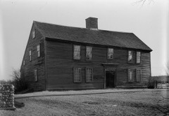
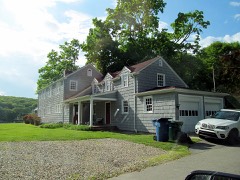
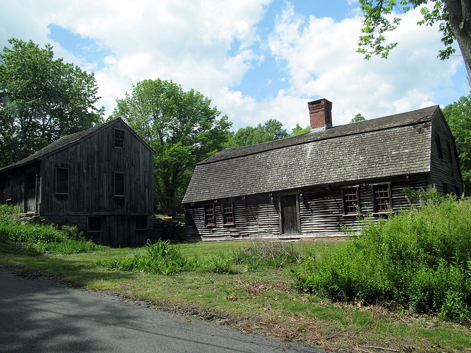
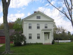
Photograph of Samuel Smith House
Photograph by Pi.1415926535, CC BY-SA 3.0. Via Wikimedia Commons.

Samuel Smith House

Listed on the National Register of Historic Places in 1979.

From the record

“The Samuel Smith House is a historic First Period house at 82 Plants Dam Road in East Lyme, Connecticut. With a construction history dating to about 1700, it is one of the oldest buildings in the community, exhibiting a pattern of architectural changes over the 18th century.”

Wikipedia article Samuel Smith House (East Lyme, Connecticut), CC BY-SA 4.0.

One of 197 National Register listings published here for New London County · listed in 1979 · category: Building.

Sources: the Wikipedia article · the case file at the National Archives · the National Register database, National Park Service · the Wikipedia article
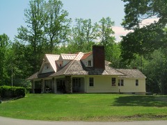
The listing

  • Listed as. Smith, Samuel, House - the National Register files a house under its owner's surname.
  • Address. 82 Plants Dam Rd., East Lyme, 06333
  • When was it listed? June 1979
  • Category. building
  • Town. East Lyme town
  • National Register reference number. 79002668 - the number the National Park Service assigned this property when it was listed, and the key its nomination file is catalogued under at the National Archives.

The ground it stands on

2,243 words

The chapter on East Lyme Town in History of New London County, Connecticut, with Biographical Sketches of Many of Its Pioneers and Prominent Men, published 1882 names East Lyme. This is what it says, exactly as the scans read.

First Baptist Church, East Lyme.' - The history of this church is shaded in some obscurity. Baptist sentiments began to prevail here before the year 1730, through the labors of the venerable Valentine Wightman, who was pastor of the Baptist Church in Groton. As early as 1747, Nathaniel Jewett, of Lyme, was expelled from the Legislature for being a member of

Passage source: History of New London County, Connecticut, with Biographical Sketches of Many of Its Pioneers and Prominent Men, published 1882.

Elder Frederick Wightman succeeded to the pastorate in 1832. He was succeeded in 1838 by Elder Wm. Palmer. On account of a division of the town, the name of the church was changed. In the winter of 1841^2, after the resignation of Elder Palmer, Elder Amos D. Watrous held a series of meetings, in which large accessions were received. The spring following twenty were dismissed to form the Lyme Church, and the next winter flfty-five were set off, forming the Second Church in East Lyme.

Passage source: History of New London County, Connecticut, with Biographical Sketches of Many of Its Pioneers and Prominent Men, published 1882.

Machine-read from a century-old scan, so expect the errors a machine makes: misspelled names, dropped words, stray characters.

Read the whole chapter on East Lyme Town - 2,243 words on its settlement, mills, schools and churches.

Fires near this property

80 since 1993

Regional context, not property-specific evidence. The federal wildfire occurrence database lists 80 fires within 5 miles of Samuel Smith House between 1993 and 2020, burning about 98 acres in total. None started naturally. 2 were recorded as arson. Distance is straight-line from the map coordinates, so a fire counted here may appear on a neighbouring settlement's page as well.

Reported cause Fires
Missing data/not specified/undetermined46
Debris and open burning11
Recreation and ceremony10
Misuse of fire by a minor5
Smoking4
Power generation/transmission/distribution2
Arson/incendiarism2

The most recent of them, most recent first, with the day each was reported and the service that recorded it.

DateCause SizeReported by Name on the report
9 September 2007Recreation and ceremony5.0 acresConnecticut Division of Forestrynot named
7 September 2015Missing data/not specified/undeterminedunder an acreConnecticut Division of Forestrynot named
6 September 2016Missing data/not specified/undeterminedunder an acreConnecticut Division of Forestry5 OAKRIDGE DRIVE OLD LYME
27 September 2007Missing data/not specified/undeterminedunder an acreConnecticut Division of Forestrynot named
24 September 2020Missing data/not specified/undeterminedunder an acreConnecticut Division of Forestry112 NECK ROAD
21 September 2015Missing data/not specified/undeterminedunder an acreConnecticut Division of Forestrynot named
16 September 2007Missing data/not specified/undeterminedunder an acreConnecticut Division of Forestrynot named
12 September 2007Missing data/not specified/undeterminedunder an acreConnecticut Division of Forestrynot named

Every fire recorded in New London County

Mines and quarries near this property

10 of 45 shown

Regional context, not property-specific evidence. The federal mineral resources record lists 45 workings within 5 miles of Samuel Smith House: 43 past producers, 1 producer, 1 prospect. 1 still produces. What was taken out: Stone, Dimension, Granite, Stone, Sand and Gravel, Construction. Distance is straight-line from the map coordinates, so a quarry counted here may appear on a neighbouring settlement's page as well.

Where SiteCommodity StatusRecorded
Chesterfield Road PitSand and Gravel, ConstructionPast Producer
Pattagansett PitSand and Gravel, ConstructionPast Producer
Alaskite Gneiss Rock Quarry No. Ak-040StonePast Producer
Gneiss Rock Quarries No. Ak-StonePast ProducerGneiss
Gneiss Rock Quarry No. Ak-041StonePast ProducerGneiss
Gneiss Rock Quarry No. Ak-042StonePast ProducerGneiss
Granite Gneiss QuarriesGranitePast Producer
Maccurdy QuarryGranitePast Producer
Malnati & Carlson QuarryGranitePast Producer
Millstone QuarryGranitePast Producer

Every working recorded in New London County

Map coverage status

No historic map-sheet match is published for this property yet. That does not mean no map exists. This record needs a coordinate-quality review before it can be joined to a sheet boundary. Browse the county's mapped places while that work is pending.

Listed places nearby

6 within 8 miles

Other National Register properties close enough to walk or drive between, ordered by distance from this one. Both positions come from the same geocoding pass that matched these properties to their map sheets.

Photograph PropertyDistance Listed
Morton Freeman Plant Hunting Lodge1.5 miles1988
Thomas Avery House1.7 miles1979
Thomas Lee House1.7 miles1970
Rocky Neck Pavilion2.9 miles1986
Oswegatchie Historic District3.4 miles2005
Oil Mill Historic District3.8 miles2023

Sources for this property

National Archives recordThe nomination case file for reference 79002668 in Record Group 79.
Wikipedia articleCommunity-written account of this property, licensed CC BY-SA.
New London CountyAll 197 listed properties in this county.

Provenance

  • Listing record. National Park Service National Register of Historic Places, listed-properties dataset, current to 2026-05-22.
  • Map join. Address geocoded through the United States Census geocoder, then tested against the published boundary of every sheet in the USGS Historical Topographic Map Collection.
  • How this page is made. Listing fields come from federal records; map-sheet coverage is a labelled coordinate-to-boundary calculation, not a source-field claim.
  • Wildfire. Short, Karen C. 2022. Spatial wildfire occurrence data for the United States, 1992-2020 [FPA_FOD_20221014]. 6th Edition. Fort Collins, CO: Forest Service Research Data Archive. https://doi.org/10.2737/RDS-2013-0009.6 Collected with United States Government funding and usable without additional permissions or fees.
  • Mines and quarries. USGS Mineral Resources Data System (MRDS) https://mrdata.usgs.gov/mrds/ A work of the United States government, no copyright under 17 U.S.C. 105.