BlockBefore
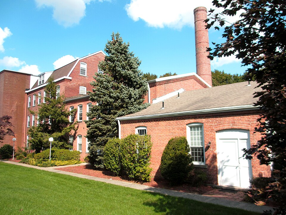
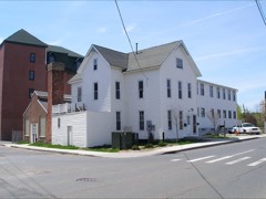
Photograph of P. Robinson Fur Cutting Company
Photograph by Carlnlisa, CC BY-SA 3.0. Via Wikimedia Commons.

P. Robinson Fur Cutting Company

Listed on the National Register of Historic Places in 1982.

From the record

“Robinson Fur Cutting Company is a historic industrial building on Oil Mill Road in Danbury, Connecticut. Also known as the Oil Mill Road building, it is a large multi-section brick structure set on the banks of the Still River.”

Wikipedia article P. Robinson Fur Cutting Company, CC BY-SA 4.0.

One of 298 National Register listings published here for Fairfield County · listed in 1982 · category: Building.

Sources: the Wikipedia article · the case file at the National Archives · the National Register database, National Park Service

The listing

  • What is counted as historic. The nomination lists 1 building as contributing to the listing.
  • Listed as. Robinson, P., Fur Cutting Company - the National Register files a house under its owner's surname.
  • Address. Oil Mill Rd., Danbury, 06810
  • When was it listed? November 1982
  • Category. building
  • Town. Danbury town
  • Architectural style. Colonial Revival architecture
  • National Register reference number. 82000998 - the number the National Park Service assigned this property when it was listed, and the key its nomination file is catalogued under at the National Archives.

The ground it stands on

25,748 words

The chapter on Danbury Town in History of Fairfield County, Connecticut, published 1881 names Danbury. This is what it says, exactly as the scans read.

After leaving Bethel the ranks were deployed, ami Danbury was a])proached in open order, s(mie of the advance being so far deployed as to take in Shelter Hock Bidge on the right. The father of the venerable Thomas Andrews, of Bethel, with several com- IKinions, went on Shelter Rock to see the British column pass, and while there were surpriseil and shot at by the royal scouts.

Passage source: History of Fairfield County, Connecticut, published 1881.

From IJberfij Street to the Court-House. - Maj. Seth Comstock lived in a substantial residence on the corner of Liberty Street. He was a merciiant, and hail a store just south of liis dwelling. Maj. Comstock was a man in good circumstances, and once in his life created quite a sensation in tlie community. He had a son doing business in New York City. The son wa.s to be married, and desired the ceremony to take ])lace in liis fatiier's liome. He sent word to that effect, directing his father to fix up the place in the best possible style, and he would make good tlie expense. The major accordingly proceeded to make the homestead into a wedding-bower. Carpenters, painters, and ui)holstcrers were set to work, and for days the transformation went on. Sunnucr-liouses, arbors, and grottos were put up in the garden. The entire front of tlie house was changed by elaborate additions placed thereon, and the premises blossomed into the appearance of a small paradise. The place was daily visited by Danbury i)eople, who were filled with ])ride and admiration as they viewed it. Even abroad went the lame of the change, and people from iieiglil)Oririg towns came to .see the (Comstock palace. The transformatiort wils all the talk of the day and supplanteil every other subject. The wedding was in keeping with the ])reiiaration therefor, and filled the street in the neighborhood with curious people.

Passage source: History of Fairfield County, Connecticut, published 1881.

Machine-read from a century-old scan, so expect the errors a machine makes: misspelled names, dropped words, stray characters.

Read the whole chapter on Danbury Town - 25,748 words on its settlement, mills, schools and churches.

Fires near this property

31 since 1994

Regional context, not property-specific evidence. The federal wildfire occurrence database lists 31 fires within 5 miles of P. Robinson Fur Cutting Company between 1994 and 2020, burning about 72 acres in total. 4 started naturally. 3 were recorded as arson. Distance is straight-line from the map coordinates, so a fire counted here may appear on a neighbouring settlement's page as well.

Reported cause Fires
Missing data/not specified/undetermined13
Natural4
Arson/incendiarism3
Recreation and ceremony2
Misuse of fire by a minor2
Debris and open burning2
Equipment and vehicle use2
Power generation/transmission/distribution2
Smoking1

The most recent of them, most recent first, with the day each was reported and the service that recorded it.

DateCause SizeReported by Name on the report
7 September 2015Naturalunder an acreFire Department of New YorkNA
27 June 2005Missing data/not specified/undeterminedunder an acreFire Department of New Yorknot named
6 May 2010Natural2.2 acresFire Department of New Yorknot named
4 May 2001Debris and open burningunder an acreConnecticut Division of Forestrynot named
8 April 2000Missing data/not specified/undetermined5.0 acresConnecticut Division of Forestrynot named
26 April 2011Power generation/transmission/distributionunder an acreFire Department of New Yorknot named
26 April 2011Naturalunder an acreFire Department of New Yorknot named
23 April 1994Misuse of fire by a minor2.0 acresConnecticut Division of Forestrynot named

Every fire recorded in Fairfield County

Mines and quarries near this property

10 of 25 shown

Regional context, not property-specific evidence. The federal mineral resources record lists 25 workings within 5 miles of P. Robinson Fur Cutting Company: 17 past producers, 5 producers, 1 occurrence, 1 unknown. 5 still produce. What was taken out: Sand and Gravel, Construction, Stone, Stone, Crushed/Broken, Garnet. Distance is straight-line from the map coordinates, so a quarry counted here may appear on a neighbouring settlement's page as well.

Where SiteCommodity StatusRecorded
Treadwell Biotite Gneiss Granite Rock QuarryStone, DimensionPast Producer1895
Calcite Marble Rock Quarry No. Fk-004Limestone, GeneralProducer
Collins QuarryGranitePast Producer
Dolomitic Marble Rock Quarries No. Fk-006Limestone, GeneralPast Producer
Marble QuarryMarble, DimensionPast Producer
Redding Marble Co. QuarryMarble, DimensionPast Producer
Treadwell ProspectGraniteProspect
West Redding Garnet OccurrenceGarnetOccurrence
West Redding MineGarnetPast Producer
Collins Granite Gneiss Rock QuarryStone, Crushed/BrokenPast ProducerUnknown

Every working recorded in Fairfield County

Storms near this property

48 since 1994

Regional context, not property-specific evidence. The National Weather Service names Danbury, the town this property stands in, in 48 storm reports between 1994 and 2025: 28 thunderstorm wind, 11 flash flood, 7 hail, 1 lightning. The reports record 1 death and 1 injury. Each account below is quoted exactly as the forecast office filed it, from the NOAA Storm Events Database, and each date opens the federal record of that event.

WhenEvent Place namedHarm What the report says
May 2018Thunderstorm WindDanbury1 killed, 1 hurt, $5,000Tree fell on truck in Candlewood Lake area killing a man.
August 2015Thunderstorm WindDanbury$15,000A tree fell and crushed a car on West Wooster Street in Danbury.
June 2011Thunderstorm WindDanbury$12,500Numerous trees, including at least one large one were reported down in Danbury.
August 2016Thunderstorm WindDanbury$7,500Numerous trees and wires were reported down throughout the town of Danbury.
July 2024Thunderstorm WindDanbury$6,000Multiple trees down with wires at several locations including Golden Hill Road and Edgewood Street.
August 2023Thunderstorm WindDanbury$6,000Several trees down blocking roads across town including Pocono Lane, Lindencrest Drive and Flintock Drive in Danbury CT.
July 2023Thunderstorm WindDanbury$5,000A couple of trees reported down around town in Danbury.
August 2011Thunderstorm WindDanbury$5,000Numerous large tree limbs, as well as a tree was downed across power lines across Danbury.
August 2015Thunderstorm WindDanbury$4,000Several trees were reported down on Park Avenue near the Danbury Field Mall.
May 2024Thunderstorm WindDanbury$3,000Several trees down. One large tree down on Clapboard Ridge Road.
June 2024Thunderstorm WindDanbury$3,000Tree and wires down on Washington Avenue.
August 2016Thunderstorm WindDanbury$2,500Wires were reported down at the intersection of Clapboard Ridge Road and Farm Street just northwest of Danbury.
July 2020LightningDanbury$2,000Lightning strike to power pole resulting in power lines down causing power outages.
October 2025FloodDanbury-Flooding along Beaver Road and West street with road closures due to elevated running water.
June 2024Flash FloodDanbury-Danbury Emergency Management reports West Street is closed due to flooding.
July 2023Flash FloodDanbury-Filmore Ave closed due to flooding.
July 2023Flash FloodDanbury-Road closures due to flooding at West Street and Beaverbrook Road off of Federal Road. White street between Federal Rd and Meadow is also closed.
September 2023Flash FloodDanbury-Water rescue on Mill Plain Road with person trapped in a car.
September 2023Flash FloodDanbury-Ongoing water rescue on West Street in Danbury.
September 2023Flash FloodDanbury-West Street at Montgomery Street closed due to flooding.
June 2020Flash FloodDanbury-Clapboard Ridge Road was closed due to flooding between Farm Street and Ventura Avenue in Danbury.
June 2019HailDanbury-One inch hail reported.
August 2011HailDanbury-Penny to quarter size hail was reported in Danbury.
June 2008Thunderstorm WindDanbury-Wires were reported down across Danbury, including on Durant and Housman Streets and Tarrywile Lake Road.
September 2008Flash FloodDanbury-Many roads in Danbury were under 1-2 ft. of water. One to three feet of standing water was reported on the roads in and near the campus of Western Connecticut State University on White Street. A one hour rainfall rate of 1.43 inches was reported between 6 pm and 7 pm in Danbury.
May 2007Thunderstorm WindDanbury-Trees down on Carriage House and Newtown Roads.
June 2007Thunderstorm WindDanbury-Trees were downed along Route US 7, south of Danbury.
July 2005Flash FloodDanbury-Flash flooding trapped several motorists in their cars as the water quickly rose. Metro North service was stopped due to high flood waters.
August 2002HailDanbury-A spotter and a local newspaper reported penny size hail.
May 1995Thunderstorm WindDanbury-A line of thunderstorms moving across the region generated damaging winds. Numerous trees and power lines were downed.
July 1995Thunderstorm WindDanbury-Thunderstorms downed several trees and power lines. A house was significantly damaged after being struck by lightning.
May 2004HailDanbury-no account filed
June 2001Flash FloodDanbury-no account filed
May 2000Thunderstorm WindDanbury-no account filed
June 2000Thunderstorm WindDanbury-no account filed
January 1999Flash FloodDanbury-no account filed
June 1999Thunderstorm WindDanbury-no account filed
May 1998Thunderstorm WindDanbury-no account filed
May 1998HailDanbury-no account filed
August 1997Thunderstorm WindDanbury-no account filed
May 1996Thunderstorm WindDanbury-no account filed
August 1996Thunderstorm WindDanbury-no account filed
July 1996HailDanbury-no account filed
May 1995Thunderstorm WindDanbury-no account filed
September 1994Thunderstorm WindDanbury-no account filed

Every storm recorded in Fairfield County

Map coverage status

No historic map-sheet match is published for this property yet. That does not mean no map exists. This record needs a coordinate-quality review before it can be joined to a sheet boundary. Browse the county's mapped places while that work is pending.

Listed places nearby

6 within 8 miles

Other National Register properties close enough to walk or drive between, ordered by distance from this one. Both positions come from the same geocoding pass that matched these properties to their map sheets.

Photograph PropertyDistance Listed
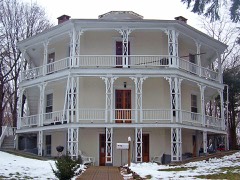
Octagon House0.4 miles1973
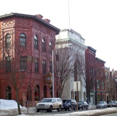
Main Street Historic District0.7 miles1983
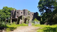
Hearthstone0.7 miles1987
Meeker's Hardware0.8 miles1983
Ball and Roller Bearing Company0.8 miles1989
John Rider House0.9 miles1977

Sources for this property

National Archives recordThe nomination case file for reference 82000998 in Record Group 79.
Wikipedia articleCommunity-written account of this property, licensed CC BY-SA.
Fairfield CountyAll 298 listed properties in this county.

Provenance

  • Listing record. National Park Service National Register of Historic Places, listed-properties dataset, current to 2026-05-22.
  • Map join. Address geocoded through the United States Census geocoder, then tested against the published boundary of every sheet in the USGS Historical Topographic Map Collection.
  • How this page is made. Listing fields come from federal records; map-sheet coverage is a labelled coordinate-to-boundary calculation, not a source-field claim.
  • Wildfire. Short, Karen C. 2022. Spatial wildfire occurrence data for the United States, 1992-2020 [FPA_FOD_20221014]. 6th Edition. Fort Collins, CO: Forest Service Research Data Archive. https://doi.org/10.2737/RDS-2013-0009.6 Collected with United States Government funding and usable without additional permissions or fees.
  • Mines and quarries. USGS Mineral Resources Data System (MRDS) https://mrdata.usgs.gov/mrds/ A work of the United States government, no copyright under 17 U.S.C. 105.
  • Storms. NOAA National Centers for Environmental Information, Storm Events Database https://www.ncei.noaa.gov/stormevents/ A work of the United States government, no copyright under 17 U.S.C. 105. Narratives are quoted verbatim from the National Weather Service report and are not edited or summarised.