 Block
From the record
One of 272 National Register listings published here for New Haven County · listed in 1982 · category: Structure.
Sources: the case file at the National Archives · the National Register database, National Park Service
Listed on the National Register of Historic Places in 1982.
One of 272 National Register listings published here for New Haven County · listed in 1982 · category: Structure.
Sources: the case file at the National Archives · the National Register database, National Park Service
Regional context, not property-specific evidence. The federal wildfire occurrence database lists 318 fires within 5 miles of Farmington Canal Lock No. 13 between 1992 and 2020, burning about 392 acres in total. 1 started naturally. 49 were recorded as arson. Distance is straight-line from the map coordinates, so a fire counted here may appear on a neighbouring settlement's page as well.
| Reported cause | Fires |
|---|---|
| Missing data/not specified/undetermined | 212 |
| Arson/incendiarism | 49 |
| Debris and open burning | 20 |
| Smoking | 17 |
| Recreation and ceremony | 10 |
| Misuse of fire by a minor | 6 |
| Equipment and vehicle use | 2 |
| Natural | 1 |
| Power generation/transmission/distribution | 1 |
The most recent of them, most recent first, with the day each was reported and the service that recorded it.
| Date | Cause | Size | Reported by | Name on the report |
|---|---|---|---|---|
| 9 September 2007 | Missing data/not specified/undetermined | under an acre | Connecticut Division of Forestry | not named |
| 8 September 2010 | Smoking | 1.0 acres | Connecticut Division of Forestry | not named |
| 7 September 2004 | Missing data/not specified/undetermined | under an acre | Connecticut Division of Forestry | not named |
| 6 September 2007 | Missing data/not specified/undetermined | under an acre | Connecticut Division of Forestry | not named |
| 5 September 2010 | Missing data/not specified/undetermined | under an acre | Connecticut Division of Forestry | not named |
| 4 September 2007 | Smoking | under an acre | Connecticut Division of Forestry | not named |
| 3 September 2007 | Missing data/not specified/undetermined | under an acre | Connecticut Division of Forestry | not named |
| 3 September 2005 | Debris and open burning | under an acre | Connecticut Division of Forestry | not named |
Regional context, not property-specific evidence. The federal mineral resources record lists 30 workings within 5 miles of Farmington Canal Lock No. 13: 27 past producers, 2 occurrences, 1 producer. 1 still produces. What was taken out: Copper, Stone, Dimension, Sand and Gravel, Construction, Barium-Barite. Distance is straight-line from the map coordinates, so a quarry counted here may appear on a neighbouring settlement's page as well.
| Where | Site | Commodity | Status | Recorded |
|---|---|---|---|---|
| Cheshire Barytes Co. Mine | Barium-Barite, Copper, Silver, Strontium | Past Producer | Barite | |
| Copper Prospect No. Dk-006 | Copper, Sulfur | Occurrence | Void Fill And Replacement | |
| Gaylord Copper Prospect | Sulfur, Copper | Past Producer | Void Filling And Replacement | |
| Jinny Hill Barite Mine | Barium-Barite, Sulfur, Silver, Copper | Past Producer | 1813, 1838 | |
| Sandstone Quarry | Flagstone | Past Producer | ||
| Bellamy Copper Valley Mine | Sulfur, Copper, Barium-Barite | Past Producer | Void Filling And Replacement | |
| Cross-Rock Copper Mine | Sulfur, Copper, Barium-Barite | Past Producer | Void Filling And Replacement | |
| Crushed Diabase Rock Quarry No. Dj-016 | Stone, Crushed/Broken | Past Producer | Diabase | |
| Crushed Diabase Rock Quarry No. Dj-017 | Stone, Crushed/Broken | Past Producer | Diabase | |
| Crushed Trap Rock Quarry No. Dk-007 | Stone, Crushed/Broken | Past Producer | Diabase |
Regional context, not property-specific evidence. The National Weather Service names Hamden, the town this property stands in, in 17 storm reports between 1995 and 2015: 11 thunderstorm wind, 3 flash flood, 2 lightning, 1 hail. No death or injury is recorded in these reports. Each account below is quoted exactly as the forecast office filed it, from the NOAA Storm Events Database, and each date opens the federal record of that event.
| When | Event | Place named | Harm | What the report says |
|---|---|---|---|---|
| June 2011 | Thunderstorm Wind | Hamden | $7,500 | Numerous trees were reported down in Hamden. |
| June 2015 | Thunderstorm Wind | Hamden | $5,000 | Multiple large branches and wires were reported down across the town of Hamden. |
| June 2013 | Thunderstorm Wind | Hamden | $2,500 | Limbs and branches were reported down across town. |
| July 2006 | Thunderstorm Wind | Hamden | - | As a severe thunderstorm moved east across Hamden, it produced high winds that downed trees and power lines. |
| September 2005 | Thunderstorm Wind | Hamden | - | A line of intense showers with embedded thunderstorms downed trees and power lines in Hamden. A maple tree fell on a house. Another tree fell on a parked car. |
| August 2002 | Thunderstorm Wind | Hamden | - | Local police reported several trees and power lines down as a result of damaging winds. |
| August 2011 | Hail | Hamden | - | no account filed |
| March 2001 | Flash Flood | Hamden | - | no account filed |
| April 2000 | Flash Flood | Hamden | - | no account filed |
| April 2000 | Lightning | Hamden | - | no account filed |
| May 2000 | Thunderstorm Wind | Hamden | - | no account filed |
| July 2000 | Flash Flood | Hamden | - | no account filed |
| August 1998 | Lightning | Hamden | - | no account filed |
| August 1998 | Thunderstorm Wind | Hamden | - | no account filed |
| July 1997 | Thunderstorm Wind | Hamden | - | no account filed |
| July 1997 | Thunderstorm Wind | Hamden | - | no account filed |
| October 1995 | Thunderstorm Wind | Hamden | - | no account filed |
No historic map-sheet match is published for this property yet. That does not mean no map exists. This record needs a coordinate-quality review before it can be joined to a sheet boundary. Browse the county's mapped places while that work is pending.
Other National Register properties close enough to walk or drive between, ordered by distance from this one. Both positions come from the same geocoding pass that matched these properties to their map sheets.
| Photograph | Property | Distance | Listed |
|---|---|---|---|
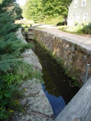 | Farmington Canal Lock | 1.2 miles | 1973 |
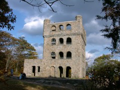 | Sleeping Giant Tower | 2.4 miles | 1986 |
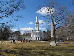 | First Congregational Church of Cheshire | 2.8 miles | 1973 |
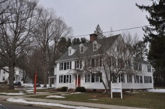 | Cheshire Historic District | 2.8 miles | 1986 |
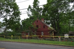 | Jonathan Dickerman II House | 2.9 miles | 1982 |
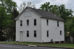 | Orrin Todd House | 3.0 miles | 1991 |
| National Archives record | The nomination case file for reference 82004350 in Record Group 79. |
| New Haven County | All 272 listed properties in this county. |