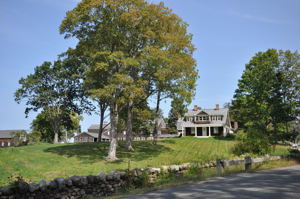
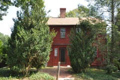
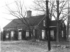
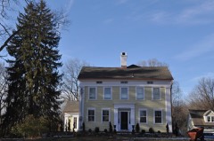
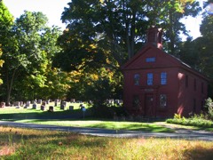
Built in 1895 (Shingle style architecture). Listed on the National Register of Historic Places in 1982.
From the record
“Tranquility Farm is a historic summer estate located on Tranquility Road in Middlebury, Connecticut. The estate was developed in the 1890s by industrialist John H.”
Wikipedia article Tranquility Farm, CC BY-SA 4.0.
One of 272 National Register listings published here for New Haven County · listed in 1982 · category: Building · built in 1895, Shingle style architecture, by McKim, Mead & White.
National Register reference number.82004355- the number the National Park Service assigned this property when it was listed, and the key its nomination file is catalogued under at the National Archives.
ORGANIZED as a parish in 1791 and incorporated a town in 1807, Middlebury received its name from the fact that it occupies a middle position between Waterbury and Southbury, from which it was mainly formed. On the north is Watertown, and northwest Woodbury, in Litchfield county; south and southeast are Oxford and Naugatuck. The town is small, being less than five miles square, with greater length north and south. The surface is elevated and broken by high hills, the chief ones being Mount Fair, on the east, Sandy Hill, on the south, and Breakneck in the northwestern part. The latter, tradition says, received its name in the times of the revolution, when General Lafayette, with his command, passed over it on his way from the east to the Hudson river country. In descending the steep hill, one of the oxen used in transporting goods, fell and broke his neck - hence the name. It is a fact, however, that the name Breakneck was applied to that locality many years before the revolution,* and was, no doubt, suggested by its perpendicular appearance, as viewed from some directions. Many huge rocks are scattered over the surface of the town, or appear in ledges. Most of them are granite. There are fine lands in some localities, which have been well improved. In other parts the soil is not susceptible of successful tillage, being rough and sterile, but has been used for grazing purposes.
Nearly all the present territory of Middlebury was included in the Mattatuck purchase and the early history is closely connected with that of Woodbury and Waterbury. Settlements were not made as early as in the localities along the Naugatuck and the Pomperaug and by far the greatest influx was after the revolution. Among those who claim pioneer distinction were the Bronsons, in the Breakneck section, where, in 1707, was born in the family of Isaac Bronson, the first white child. This also received the name of Isaac, who became a well-known citizen of that part of the town and was the great-grandfather of Julius Bronson, born in the same locality in 1807, and who was, in 1890, one of the few surviving old men in the town. The Bronsons were numerous and influential; but few have remained in Middlebury. Here the Abbott family settled later and descendants occupy some of the old places improved many years ago. The Tyler family lived west of the Bronsons, in what is to this day called the Tylertown district. Here was born the Reverend Bennett Tyler, D. D., who became famous as one of the old school theologians, and was president of Dartmouth College.
Regional context, not property-specific
evidence. The
federal wildfire occurrence database
lists 168 fires within 5 miles of Tranquility Farm
between 1992 and 2020, burning about 133 acres in total. None started naturally. 20 were recorded as arson.
Distance is straight-line from the map coordinates, so a fire counted
here may appear on a neighbouring settlement's page as well.
Reported cause
Fires
Missing data/not specified/undetermined
119
Arson/incendiarism
20
Debris and open burning
15
Misuse of fire by a minor
6
Recreation and ceremony
5
Smoking
3
The most recent of
them, most recent first, with the day each was reported and the service
that recorded it.
Regional context, not property-specific
evidence. The federal mineral resources record lists
16 workings within 5 miles of Tranquility Farm: 9 producers, 6 past producers, 1 unknown.
9 still produce. What was taken out: Stone, Crushed/Broken, Sand and Gravel, Construction, Stone, Feldspar. Distance is straight-line from the
map coordinates, so a quarry counted here may appear on a neighbouring
settlement's page as well.
Regional context, not property-specific
evidence. The National Weather Service names
Middlebury, the town this property stands in, in 11 storm reports between 1998 and 2025: 8 thunderstorm wind, 2 hail, 1 flash flood.
No death or injury is recorded in these reports. Each account below is quoted exactly as the forecast office
filed it, from the NOAA Storm Events Database, and each date
opens the federal record of that event.
No historic map-sheet match is published
for this property yet. That does not mean no map exists. This record needs
a coordinate-quality review before it can be joined to a sheet boundary.
Browse the county's mapped places while that work is
pending.
Listed places nearby
6 within 8 miles
Other National Register properties close
enough to walk or drive between, ordered by distance from this one. Both
positions come from the same geocoding pass that matched these properties
to their map sheets.
Listing record. National Park Service National Register of Historic Places, listed-properties dataset, current to 2026-05-22.
Map join. Address geocoded through the United States Census geocoder, then tested against the published boundary of every sheet in the USGS Historical Topographic Map Collection.
How this page is made. Listing fields come from federal records; map-sheet coverage is a labelled coordinate-to-boundary calculation, not a source-field claim.
Wildfire. Short, Karen C. 2022. Spatial wildfire occurrence data for the United States, 1992-2020 [FPA_FOD_20221014]. 6th Edition. Fort Collins, CO: Forest Service Research Data Archive. https://doi.org/10.2737/RDS-2013-0009.6 Collected with United States Government funding and usable without additional permissions or fees.
Mines and quarries. USGS Mineral Resources Data System (MRDS) https://mrdata.usgs.gov/mrds/ A work of the United States government, no copyright under 17 U.S.C. 105.
Storms. NOAA National Centers for Environmental Information, Storm Events Database https://www.ncei.noaa.gov/stormevents/ A work of the United States government, no copyright under 17 U.S.C. 105. Narratives are quoted verbatim from the National Weather Service report and are not edited or summarised.
 Block