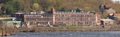
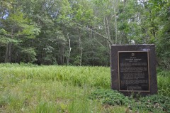
Listed on the National Register of Historic Places in 1982.
From the record
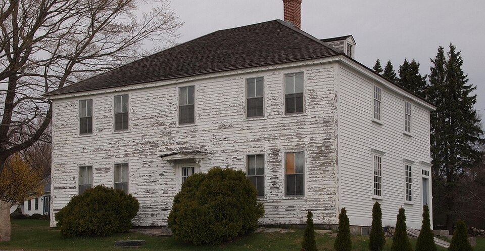
“The Raymond-Bradford Homestead is a historic house on Raymond Hill Road in Montville, Connecticut, built about 1710. It is notable for its history of alteration, dating into the late 19th century, its construction by a woman named Mercy Sands Raymond in the colonial period, and its continuous ownership by a single family line.”
Wikipedia article Raymond-Bradford Homestead, CC BY-SA 4.0.
One of 197 National Register listings published here for New London County · listed in 1982 · category: Building.
National Register reference number.82004372- the number the National Park Service assigned this property when it was listed, and the key its nomination file is catalogued under at the National Archives.
On the 23d day of February, 1788, a church was organized by Elders Christopher and Abel Palmer, by giving to those persons whose names had been signed to a covenant the right hand of fellowship. Soon after the church was organized Elder Reuben Palmer was called to be their minister. Mr. Palmer had been ordained to the ministry in Stonington, where he resided until his removal to Montville in 1788. He was not installed pastor of the church until several years afterwards. In November, 1798, a Council was called for the purpose of installing Mr. Palmer. The Council convened December 25th, and publicly installed him as their pastor. The sermon was preached by Elder Asa Wilcox. Elder Zadoc Darrow gave the charge to the pastor, and Elder Wilcox gave the right hand of fellowship. Deacon Oliver Comstock offered the first prayer, and Deacon Jehial Rogers the concluding prayer. Elder Palmer continued their pastor until his death, April 22, 1822. His ministry was continued with great success, several hundred being baptized under his ministry. During his ministry connection with this church his son, Reuben Palmer, Jr., was converted, and after his father's death was ordained to the work of the ministry, and continued for a time to conduct the affairs of this church. After the death of Elder Palmer, Sr., the church was irregularly supplied by various ministers, and continued to decline till 1881, when the church was dropped from the Baptist Association, and the body was considered extinct. It, however, struggled on till the 6th day of January, 1842, when by a vote of the few remaining members the church organization was dissolved, and the body known as the Union Baptist Church was formed.
Elder Levi Meach was instrumental in the reorganization of the old Palmer Baptist Church, and was its first pastor. A powerful revival was experienced in the winter of 1841-42, and many were converted and baptized. Forty-eight members united in forming the new church in 1842. This church is called the Union Baptist Church of Montville.
Regional context, not property-specific
evidence. The
federal wildfire occurrence database
lists 45 fires within 5 miles of Raymond-Bradford Homestead
between 1992 and 2020, burning about 67 acres in total. None started naturally. 5 were recorded as arson.
Distance is straight-line from the map coordinates, so a fire counted
here may appear on a neighbouring settlement's page as well.
Reported cause
Fires
Missing data/not specified/undetermined
27
Arson/incendiarism
5
Recreation and ceremony
5
Debris and open burning
3
Equipment and vehicle use
2
Smoking
2
Misuse of fire by a minor
1
The most recent of
them, most recent first, with the day each was reported and the service
that recorded it.
Regional context, not property-specific
evidence. The federal mineral resources record lists
25 workings within 5 miles of Raymond-Bradford Homestead: 19 past producers, 4 producers, 1 unknown, 1 plant.
5 still produce. What was taken out: Sand and Gravel, Construction, Stone, Dimension, Stone, Stone, Crushed/Broken. Distance is straight-line from the
map coordinates, so a quarry counted here may appear on a neighbouring
settlement's page as well.
No historic map-sheet match is published
for this property yet. That does not mean no map exists. This record needs
a coordinate-quality review before it can be joined to a sheet boundary.
Browse the county's mapped places while that work is
pending.
Listed places nearby
6 within 8 miles
Other National Register properties close
enough to walk or drive between, ordered by distance from this one. Both
positions come from the same geocoding pass that matched these properties
to their map sheets.
Listing record. National Park Service National Register of Historic Places, listed-properties dataset, current to 2026-05-22.
Map join. Address geocoded through the United States Census geocoder, then tested against the published boundary of every sheet in the USGS Historical Topographic Map Collection.
How this page is made. Listing fields come from federal records; map-sheet coverage is a labelled coordinate-to-boundary calculation, not a source-field claim.
Wildfire. Short, Karen C. 2022. Spatial wildfire occurrence data for the United States, 1992-2020 [FPA_FOD_20221014]. 6th Edition. Fort Collins, CO: Forest Service Research Data Archive. https://doi.org/10.2737/RDS-2013-0009.6 Collected with United States Government funding and usable without additional permissions or fees.
Mines and quarries. USGS Mineral Resources Data System (MRDS) https://mrdata.usgs.gov/mrds/ A work of the United States government, no copyright under 17 U.S.C. 105.
 Block