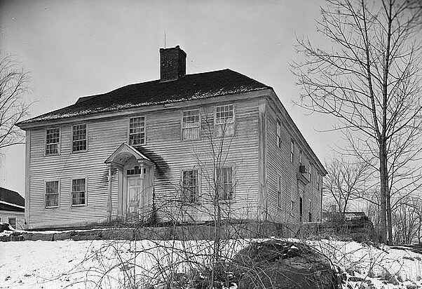
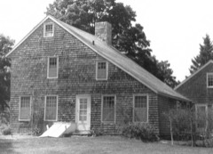
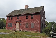
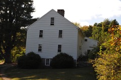
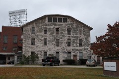
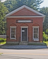
Photograph by Stanley P. Mixon, Photographer, Public domain. Via
Wikimedia Commons.
North Stonington Village Historic District
Listed on the National Register of Historic Places in 1983.
From the record
“The North Stonington Village Historic District is a 105-acre (42 ha) historic district encompassing the historic center of the main village of North Stonington, Connecticut. The district includes a well-preserved small industrial village, which flourished in the years before the American Civil War, and declined afterward.”
Wikipedia article North Stonington Village Historic District, CC BY-SA 4.0.
One of 197 National Register listings published here for New London County · listed in 1983 · category: District.
National Register reference number.83001289- the number the National Park Service assigned this property when it was listed, and the key its nomination file is catalogued under at the National Archives.
In June following two of the Assembly's committee appointed, viz., Roger Huntington and Jabez Perkins, came to North Stonington, and spent several days in an unsuccessful attempt to effect an agreement among the people, and finally decided upon a place themselves. But their findings did not suit the inhabitants, and the struggle went on, and finally about fifty members of the society agreed upon another place and sent again for the Assembly's committee, who came in February, 1723, and, after patient and exhaustive hearings, decided that the house should be built a few rods northwest of the present town hall. Their decision was so far acceptable that the society proceeded forthwith to build the house thereon, and in the month of May following it was raised.
The Second Baptist Cliiircli in North Stonington was organized in 1765, and Deacon Simeon Brown was ordained their pastor in March of that year. He was a native of Stonington and a man of sterling worth, but not a natural pulpit orator. He was greatly beloved by his parishioners, and gathered about him a church of respectable numbers, who loved and sustained him under all the circumstances in which he was placed. Other ordained ministers have been raised up in this church or employed by it, viz. : Asher Miner, Asa Spalding, Jedediah Randall, Foronda Bestor, Amos R. Wells, Levi Meech, John Green, Erastus Denison, Levi Walker, also a number of licentiates. There has been a good many special seasons of refreshing from the Lord enjoyed by this church, mingled with the depressing influence of religious declension. At present they are enjoying the preaching and pastoral care of the Rev. E. P. Mathewson, who is greatly respected and beloved. The church numbers one hundred and sixty-eight, with a Sundayschool well organized and progressing finely.
Regional context, not property-specific
evidence. The
federal wildfire occurrence database
lists 20 fires within 5 miles of North Stonington Village Historic District
between 1995 and 2019, burning about 23 acres in total. None started naturally. 2 were recorded as arson.
Distance is straight-line from the map coordinates, so a fire counted
here may appear on a neighbouring settlement's page as well.
Reported cause
Fires
Missing data/not specified/undetermined
5
Debris and open burning
5
Recreation and ceremony
4
Arson/incendiarism
2
Misuse of fire by a minor
1
Equipment and vehicle use
1
Smoking
1
Fireworks
1
The most recent of
them, most recent first, with the day each was reported and the service
that recorded it.
Regional context, not property-specific
evidence. The federal mineral resources record lists
20 workings within 5 miles of North Stonington Village Historic District: 14 past producers, 6 producers.
6 still produce. What was taken out: Sand and Gravel, Construction, Granite, Silica, Stone, Crushed/Broken. Distance is straight-line from the
map coordinates, so a quarry counted here may appear on a neighbouring
settlement's page as well.
Regional context, not property-specific
evidence. The National Weather Service names
North Stonington, the town this property stands in, in 9 storm reports between 1998 and 2024: 5 thunderstorm wind, 2 flash flood, 1 hail, 1 lightning.
The reports record 1 injury. Each account below is quoted exactly as the forecast office
filed it, from the NOAA Storm Events Database, and each date
opens the federal record of that event.
No historic map-sheet match is published
for this property yet. That does not mean no map exists. This record needs
a coordinate-quality review before it can be joined to a sheet boundary.
Browse the county's mapped places while that work is
pending.
Listed places nearby
6 within 8 miles
Other National Register properties close
enough to walk or drive between, ordered by distance from this one. Both
positions come from the same geocoding pass that matched these properties
to their map sheets.
Listing record. National Park Service National Register of Historic Places, listed-properties dataset, current to 2026-05-22.
Map join. Address geocoded through the United States Census geocoder, then tested against the published boundary of every sheet in the USGS Historical Topographic Map Collection.
How this page is made. Listing fields come from federal records; map-sheet coverage is a labelled coordinate-to-boundary calculation, not a source-field claim.
Wildfire. Short, Karen C. 2022. Spatial wildfire occurrence data for the United States, 1992-2020 [FPA_FOD_20221014]. 6th Edition. Fort Collins, CO: Forest Service Research Data Archive. https://doi.org/10.2737/RDS-2013-0009.6 Collected with United States Government funding and usable without additional permissions or fees.
Mines and quarries. USGS Mineral Resources Data System (MRDS) https://mrdata.usgs.gov/mrds/ A work of the United States government, no copyright under 17 U.S.C. 105.
Storms. NOAA National Centers for Environmental Information, Storm Events Database https://www.ncei.noaa.gov/stormevents/ A work of the United States government, no copyright under 17 U.S.C. 105. Narratives are quoted verbatim from the National Weather Service report and are not edited or summarised.
 Block