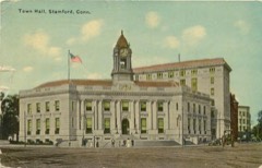
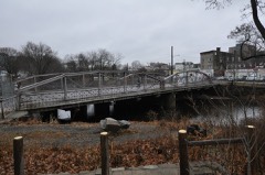
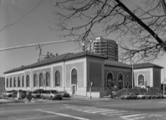
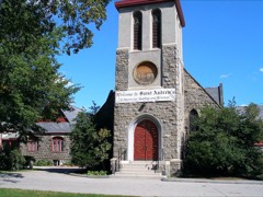
Listed on the National Register of Historic Places in 1983.
From the record
“Downtown Stamford, or Stamford Downtown, is the central business district of the city of Stamford, Connecticut, United States. It includes major retail establishments, a shopping mall, a university campus, the headquarters of major corporations and Fortune 500 companies, as well as other retail businesses, hotels, restaurants, offices, entertainment venues and high-rise apartment buildings.”
Wikipedia article Downtown Stamford, CC BY-SA 4.0.
One of 298 National Register listings published here for Fairfield County · listed in 1983 · category: District.
National Register reference number.83003502- the number the National Park Service assigned this property when it was listed, and the key its nomination file is catalogued under at the National Archives.
The first movement towards the settlement of this town was made in the early part of tlie year l(i40 by a number of .sturdy pioneers from Wcthersfield, who, liaving become dissatisfied with certain rules and regulations governing that parish, decided to seek a peaceful retreat elsewhere, and under the leadership of Rev, 5Ir. I)avenp(jrt, of honored memory, wiio had been their champion in the distiensions at Wetiiersfield, resolved to locate farther inland, and in tlie following year, leaving their old home, pursued their course westward, and settled where now is located the borough of Stamford, then in the New Haven jurisdiction.
Thomas Arniitage received ten acres of land, December, 1()41. According to Bavage, he belonged to Lynn, Mass. He came from Bristol, England, in 1635, in the ship "James," with the Rev. Richard Mather and others, and removed in 1(;87 to Sandwich, Miuss., whence he came to Stamford as above, lu 1647 he appears on the list of Hempstead settlers. Robert Rates came from Wethersfield with the first colony, and is on the list of the thirty who paid one hundred bushels of corn to the New Haven "friends," who had surveyed and transferred tlie territory to them. His lot in Wethersfield, which was thirty and a third rods in width, containing one hundred and eighty-two acres, was sold in 1641 to William (iibbons. His death is recorded, at Stamford, June 11, 1675. His will, probated Nov. 1, 1675, makes bequests to his son John, his tlaughter jMary Ambler, and son-in-law John Cross. He bequeathed certain negroes, who are to be made free at forty years of age. Francis Rell is on the list of the twenty-nine settlers who were assigned land in 1640, when he received seven acres. As his name does not appear on the Wethersfield records with the other Stamford settlers, it is probable he was still quite young. He became prominent here, and has been fully represented in every generation since in descendants both of his own and of other names. His wife Rebecca died here in 1684, and he Jan. 8, 1690. His son Jonathan was the first child born in the town, and his birth was in 1041. Mrs. Bell's clothes, of which the inventory is on record, Book 1, page 12, were by the husband's order divided equally between the two daughters, Rebecca Tuttle and Mary Hoyt. Tlie inventory of Lieut. ]'"rancis Rell, dated January, 1689, is found on page 116, of first book of records, amounting to three hundred and .seventeen pounds twelve shillings. His will, on record at Fairfield, dated 3, 24, 1(;S9, makes becjuests to his son Jonathan, grandson Jonatlian, Mary Hoyt, granddaughter Hannah, and " granddaughter Rebecca, whom he had brought up," and to his daughter Tuttle's four sons, - Jonathan, Simon, William, and Nathaniel.
Regional context, not property-specific
evidence. The
federal wildfire occurrence database
lists 8 fires within 5 miles of Downtown Stamford Historic District
between 2016 and 2020, burning about 10 acres in total. None started naturally. 1 was recorded as arson.
Distance is straight-line from the map coordinates, so a fire counted
here may appear on a neighbouring settlement's page as well.
Reported cause
Fires
Missing data/not specified/undetermined
6
Arson/incendiarism
1
Power generation/transmission/distribution
1
The most recent of
them, most recent first, with the day each was reported and the service
that recorded it.
Regional context, not property-specific
evidence. The federal mineral resources record lists
1 working within 5 miles of Downtown Stamford Historic District: 1 past producer.
None of them still produces. What was taken out: Sand and Gravel, Construction. Distance is straight-line from the
map coordinates, so a quarry counted here may appear on a neighbouring
settlement's page as well.
Regional context, not property-specific
evidence. The National Weather Service names
Stamford, the town this property stands in, in 32 storm reports between 1996 and 2022: 14 thunderstorm wind, 11 flash flood, 4 lightning, 1 flood.
The reports record 1 death. Each account below is quoted exactly as the forecast office
filed it, from the NOAA Storm Events Database, and each date
opens the federal record of that event.
Flash flooding caused 4 feet of water to accumulate in a garage on Hoyt St. in Northfield. Water also accumulated in basements on Lincoln Ave. in Glenbrook and on Ledge Ln. in Belltown. In addition, a resident was stranded in their home from the high water levels on Research Dr. also in Belltown.
Strong outflow winds from a line of thunderstorms toppled over several trees and caused power outages. a microburst was embedded in the weaker thunderstorms winds on or near Bedford street in Stamford, where winds were estimated between 70 and 80 mph. This small area experienced a large concentration of high end tree damage.
Stamford Police reported numerous trees and power lines down from severe winds produced by a line of thunderstorms that moved through during the pre-dawn hours. Northeast Utilities reported that over 40,000 customers experienced a power interruption as a result of these storms.
The Stamford Police Department, as well as several newspapers, reported large tree limbs, power lines and fires as a result of lightning strikes. One such fire severely damaged a barn on James Farm Road. Connecticut Light and Power reported that approximately 43,000 of its customers lost power as a result of wires downed when lightning struck equipment or trees, which in turn fell onto wires.
Law enforcement reported that numerous streets in Westport were flooded and had to be closed. A local newspaper reported that portions of Elm, East Main, and Dock Streets had to be closed due to flooding and that three feet of water covered portions of Cove Road in Stamford. The water rose to about two and a half feet deep at the intersection of Meadow and South Main Streets in Norwalk. State Police reported that flash flooding forced them to close the Exit 14 ramp off I-95 North in Norwalk from 230pm to 630pm and that the Route 7 connector's ramp to I-95 south was closed from 3pm to 5pm. Spotter and Official National Weather Service Observations showed that coastal sections of Fairfield County received between 2 and four and a half inches of rain from this event.
A cluster of severe thunderstorms moved east at about 35 MPH. High winds knocked down power lines on River Bank Road in Stamford. Additional power lines were downed in Norwalk.
No historic map-sheet match is published
for this property yet. That does not mean no map exists. This record needs
a coordinate-quality review before it can be joined to a sheet boundary.
Browse the county's mapped places while that work is
pending.
Listed places nearby
6 within 8 miles
Other National Register properties close
enough to walk or drive between, ordered by distance from this one. Both
positions come from the same geocoding pass that matched these properties
to their map sheets.
Listing record. National Park Service National Register of Historic Places, listed-properties dataset, current to 2026-05-22.
Map join. Address geocoded through the United States Census geocoder, then tested against the published boundary of every sheet in the USGS Historical Topographic Map Collection.
How this page is made. Listing fields come from federal records; map-sheet coverage is a labelled coordinate-to-boundary calculation, not a source-field claim.
Wildfire. Short, Karen C. 2022. Spatial wildfire occurrence data for the United States, 1992-2020 [FPA_FOD_20221014]. 6th Edition. Fort Collins, CO: Forest Service Research Data Archive. https://doi.org/10.2737/RDS-2013-0009.6 Collected with United States Government funding and usable without additional permissions or fees.
Mines and quarries. USGS Mineral Resources Data System (MRDS) https://mrdata.usgs.gov/mrds/ A work of the United States government, no copyright under 17 U.S.C. 105.
Storms. NOAA National Centers for Environmental Information, Storm Events Database https://www.ncei.noaa.gov/stormevents/ A work of the United States government, no copyright under 17 U.S.C. 105. Narratives are quoted verbatim from the National Weather Service report and are not edited or summarised.
 Block