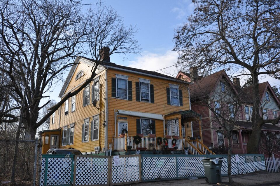
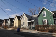
Built in 1826 (Federal architecture). Listed on the National Register of Historic Places in 1984.
From the record
“The David Perry House is a historic house at 531 Lafayette Street in Bridgeport, Connecticut. Built in 1826, it is the only known Federal period dwelling extant within the historic bounds of Bridgeport's original village center.”
Wikipedia article David Perry House, CC BY-SA 4.0.
One of 298 National Register listings published here for Fairfield County · listed in 1984 · category: Building · built in 1826, Federal architecture.
National Register reference number.84000814- the number the National Park Service assigned this property when it was listed, and the key its nomination file is catalogued under at the National Archives.
The following paper upon the history of Bridgeport has been compiled after a careful study of original documents, such as church and society records, contemporary newspapers and pamphlets, petitions, deeds, wills, etc. It undoubtedly contains some errors, but it is hoped tliat they will not be very numerous, and a number of mistakes made by me in previous publications are here corrected. Thanks are due to Mr. R. B. Lacey, from whose excellent " Municipal Register" I have made frequent quotations, to the Sfnndard Association for the use of their files, and to all otiiers who have kindly assisted me. If the article is found to be of service to the community, I shall feel well repaid for the time spent in its preparation.
In 1841, Ruby Mansfield and Nancy Sharp, alias Nancy Pease, petitioned the Legislature, alleging that they were the sole survivors of the tribe, and asking that a portion of the money in care of their agent. Smith Tweedy, be used to purchase a dwelling-house and sufficient land for their use and benefit. The Legislature by vote authorized Mr. Tweedy, with the advice and consent of the judge of Probate for the District of Bridgeport, to expend a sum not exceeding six hundred dollars for this object, and in November he purchased from Samuel Edwards about twenty acres of land, with a small house upon it, situated in Trumbull, at a place called Turkey Hill Meadow, where Ruby and Nancy took up their abode. Their statement, however, that they were the sole survivors of the tribe was not strictly accurate.
Regional context, not property-specific
evidence. The
federal wildfire occurrence database
lists 42 fires within 5 miles of David Perry House
between 1998 and 2020, burning about 69 acres in total. None started naturally. 3 were recorded as arson.
Distance is straight-line from the map coordinates, so a fire counted
here may appear on a neighbouring settlement's page as well.
Reported cause
Fires
Missing data/not specified/undetermined
34
Arson/incendiarism
3
Debris and open burning
2
Equipment and vehicle use
1
Fireworks
1
Smoking
1
The most recent of
them, most recent first, with the day each was reported and the service
that recorded it.
Regional context, not property-specific
evidence. The federal mineral resources record lists
10 workings within 5 miles of David Perry House: 9 past producers, 1 plant.
1 still produces. What was taken out: Stone, Dimension, Granite, Stone, Crushed/Broken, Silver. Distance is straight-line from the
map coordinates, so a quarry counted here may appear on a neighbouring
settlement's page as well.
Regional context, not property-specific
evidence. The National Weather Service names
Bridgeport, the town this property stands in, in 32 storm reports between 1995 and 2023: 14 thunderstorm wind, 9 flash flood, 4 hail, 2 flood.
The reports record 1 death and 30 injuries. Each account below is quoted exactly as the forecast office
filed it, from the NOAA Storm Events Database, and each date
opens the federal record of that event.
A 21 year old man was killed when a large tree limb and power lines fell onto his car in the northbound lanes of Park Avenue between Wilson Street and Merritt Street.
Straight line winds in Bridgeport, in addition to the small EF1 Tornado, caused the collapse of 5 complete buildings, including one on Knowlton Street, with damage to 9 other buildings. The winds, estimated at 100 mph also blew a billboard off an apartment building, blew out windows and off bricks from buildings, flipped over a tractor trailer on I-95 between exits 27 and 28, flipped over cars on Route 25 between exits 3 and 4, and tore some siding of off the City Hall Annex. It also tore down radio towers, brought down hundreds of trees, including 2 on a house on Bond Street, and across Route 25 between exits 3 and 4. 57 streets were at least partially closed due to the wind damage. Around two dozen people were displaced by the storm. Note damage estimate includes damage from the tornado, as the total is hard to separate.
An NWS Storm Survey determined that an EF-1 Tornado, with maximum winds of 110 mph, impacted a small portion of Bridgeport. The survey found many signs of wind rotation in a highly localized area just north of Interstate 95. The area was bounded by the Interstate 95 northbound connector on the west and Pembroke Street on the east. The most severe damage was concentrated along East Main Street between Nichols Street on the south and Cedar Street on the North. In this area, windows were blown in, the facade of a building was stripped off, tree tops were sheared off, and large pieces of metal blown off from surrounding structures were wrapped around a fire hydrant. Eyewitness reports described a rain wrapped tornado with visibility near zero in swirling heavy rain and debris. Note the damage estimate is just a portion of the total damage to Bridgeport.
A car was stuck in high water under an overpass at the intersection of Bishop St. and Connecticut Ave. in Bridgeport. In Fairfield, Rooster River exceeded bankfull and flooded nearby streets.
In Bridgeport, the intersections of Iranistan Ave. and State St., and Fairfield Ave. and Railroad Ave., as well as Bishop Ave., River St., Savoy St. and Amsterdam Ave. were all closed due to flooding. Total reported rainfall amounts in Fairfield County ranged from 3.34 inches in Stamford to 4.60 inches at Sikorsky Airport in Bridgeport.
The combination of heavy rain and the Pequonnock River exceeding bankfull caused flooding and the closing of Water Street in Bridgeport. Total rainfall at Sikorsky Airport in Bridgeport was 3.73 inches.
No historic map-sheet match is published
for this property yet. That does not mean no map exists. This record needs
a coordinate-quality review before it can be joined to a sheet boundary.
Browse the county's mapped places while that work is
pending.
Listed places nearby
6 within 8 miles
Other National Register properties close
enough to walk or drive between, ordered by distance from this one. Both
positions come from the same geocoding pass that matched these properties
to their map sheets.
Listing record. National Park Service National Register of Historic Places, listed-properties dataset, current to 2026-05-22.
Map join. Address geocoded through the United States Census geocoder, then tested against the published boundary of every sheet in the USGS Historical Topographic Map Collection.
How this page is made. Listing fields come from federal records; map-sheet coverage is a labelled coordinate-to-boundary calculation, not a source-field claim.
Wildfire. Short, Karen C. 2022. Spatial wildfire occurrence data for the United States, 1992-2020 [FPA_FOD_20221014]. 6th Edition. Fort Collins, CO: Forest Service Research Data Archive. https://doi.org/10.2737/RDS-2013-0009.6 Collected with United States Government funding and usable without additional permissions or fees.
Mines and quarries. USGS Mineral Resources Data System (MRDS) https://mrdata.usgs.gov/mrds/ A work of the United States government, no copyright under 17 U.S.C. 105.
Storms. NOAA National Centers for Environmental Information, Storm Events Database https://www.ncei.noaa.gov/stormevents/ A work of the United States government, no copyright under 17 U.S.C. 105. Narratives are quoted verbatim from the National Weather Service report and are not edited or summarised.
 Block