 Block
From the record
One of 451 National Register listings published here for Hartford County · listed in 1989 · category: Building.
Sources: the case file at the National Archives · the National Register database, National Park Service
Listed on the National Register of Historic Places in 1989.
One of 451 National Register listings published here for Hartford County · listed in 1989 · category: Building.
Sources: the case file at the National Archives · the National Register database, National Park Service
Regional context, not property-specific evidence. The federal wildfire occurrence database lists 6 fires within 5 miles of Royal Typewriter Company Building between 1992 and 2016, burning about 59 acres in total. None started naturally. 2 were recorded as arson. Distance is straight-line from the map coordinates, so a fire counted here may appear on a neighbouring settlement's page as well.
| Reported cause | Fires |
|---|---|
| Missing data/not specified/undetermined | 2 |
| Arson/incendiarism | 2 |
| Smoking | 1 |
| Debris and open burning | 1 |
The most recent of them, most recent first, with the day each was reported and the service that recorded it.
| Date | Cause | Size | Reported by | Name on the report |
|---|---|---|---|---|
| 7 May 1992 | Arson/incendiarism | 1.5 acres | Connecticut Division of Forestry | not named |
| 30 April 1992 | Arson/incendiarism | 50 acres | Connecticut Division of Forestry | not named |
| 3 April 2011 | Missing data/not specified/undetermined | 2.0 acres | Connecticut Division of Forestry | NEWINGTON |
| 23 April 2016 | Smoking | under an acre | Connecticut Division of Forestry | 175 LOWREY PL, NEWINGTON, CT 06111 |
| 18 April 2005 | Missing data/not specified/undetermined | 3.0 acres | Connecticut Division of Forestry | not named |
| 31 March 2016 | Debris and open burning | 2.0 acres | Connecticut Division of Forestry | 380 WIESE ALBERT ROAD |
Regional context, not property-specific evidence. The federal mineral resources record lists 20 workings within 5 miles of Royal Typewriter Company Building: 16 past producers, 2 producers, 2 plants. 4 still produce. What was taken out: Stone, Crushed/Broken, Stone, Dimension, Sand and Gravel, Construction, Iron. Distance is straight-line from the map coordinates, so a quarry counted here may appear on a neighbouring settlement's page as well.
| Where | Site | Commodity | Status | Recorded |
|---|---|---|---|---|
| Abbott Ball Co/ Hartford, Ct. | Corundum | Plant | ||
| American Steel & Aluminum/Hartford | Iron | Plant | ||
| Russo Brothers Pit | Sand and Gravel, Construction | Past Producer | Sedimentary | |
| Russo Brothers Pit | Sand and Gravel, Construction | Past Producer | ||
| Quarry | Stone, Dimension | Past Producer | ||
| Traprock Quarries | Stone, Dimension | Past Producer | ||
| Traprock Quarries | Stone, Dimension | Past Producer | ||
| Traprock Quarry | Stone, Dimension | Past Producer | ||
| Traprock Quarry | Stone, Dimension | Past Producer | ||
| Traprock Quarry | Stone, Dimension | Past Producer |
Regional context, not property-specific evidence. The National Weather Service names Hartford, the town this property stands in, in 94 storm reports between 1995 and 2024: 42 thunderstorm wind, 23 flash flood, 15 hail, 10 flood. No death or injury is recorded in these reports. Each account below is quoted exactly as the forecast office filed it, from the NOAA Storm Events Database, and each date opens the federal record of that event.
| When | Event | Place named | Harm | What the report says |
|---|---|---|---|---|
| September 2021 | Flash Flood | East Hartford | $100,000 | In East Hartford, Willow Brook went out of its banks, inundating parking lots and roadways at Rentschler Field at Pratt & Whitney Stadium. Roads and buildings also were flooded elsewhere in town, including several homes. |
| August 2021 | Flash Flood | Hartford | $100,000 | Significant urban flash flooding occurred in Hartford. The Fire Dept. reported that Homestead Avenue was closed due to flash flooding. Cars were stuck, with water up to the roofs of the cars. Amateur radio operators reported that sections of Albany Avenue, Laurel Street, and Farmington Acenue were all closed due to flash flooding. On South Whitney Street at Warrenton Avenue, there was 3 feet of water at the intersection. There was basement flooding inside St. Francis Hospital. Rainfall totals ended up between 5.0 and 5.8 inches in northern Hartford and Tolland Counties. |
| June 2009 | Thunderstorm Wind | Hartford | $100,000 | Trees were downed by thunderstorm winds. |
| June 2009 | Thunderstorm Wind | West Hartford | $75,000 | Several trees and five utility poles were downed by thunderstorm winds. |
| July 2020 | Flash Flood | West Hartford | $60,000 | More than 2 inches of rain fell in less than 1 hour. In Hartford, numerous cars were stuck in flash flood waters... on Franklin Street at South Street; Buckingham, John, Hamilton, Bonner, and Brown Streets, and Hillside Avenue. A small portion of Airport Road in Hartford, east of Wethersfield Avenue, buckled inward as a result of the heavy rainfall. A family on Sisson Avenue was forced from their home when water entered the home. A basement was flooded on Wolcott Street. Reports were from a combination of law enforcement, amateur radio, and newspaper and tv stations. |
| June 2009 | Thunderstorm Wind | Hartford | $50,000 | Trees were downed by thunderstorm winds, some of them are blocking a road. |
| July 2009 | Thunderstorm Wind | Hartford | $40,000 | Trees were downed by thunderstorm winds, including one that fell on a house on North Main Street. |
| July 2013 | Thunderstorm Wind | Hartford | $30,000 | A tree on Ledyard Road and two trees on Albany Avenue were downed by thunderstorm winds. A telephone pole on Albany Avenue also was downed by the thunderstorm winds. |
| August 2021 | Flash Flood | East Hartford | $25,000 | In East Hartford, Governor Street was closed due to flash flooding, with cars stuck in the waters. |
| July 2005 | Flash Flood | East Hartford | $20,000 | no account filed |
| July 2005 | Lightning | Hartford | $20,000 | no account filed |
| June 2001 | Lightning | Hartford | $20,000 | no account filed |
| June 2012 | Thunderstorm Wind | Hartford | $15,000 | Several trees were downed by thunderstorm winds. |
| August 2011 | Thunderstorm Wind | Hartford | $15,000 | A large tree on Pliny Street was downed by thunderstorm winds, landing on a house. |
| June 2006 | Thunderstorm Wind | West Hartford | $15,000 | no account filed |
| July 2006 | Thunderstorm Wind | East Hartford | $15,000 | no account filed |
| May 2003 | Lightning | West Hartford | $15,000 | no account filed |
| August 2021 | Flash Flood | Hartford | $10,000 | In West Hartford, a car was stuck in flood waters on Brewster Road at Skonet Road. South Main Street and Woodrow Street were flooded and impassable. Also, King Philip Drive at Mohawk Drive was flooded and impassable with cars stuck in the flood waters. Rainfall totals ended up between 5.0 and 5.8 inches in northern Hartford and Tolland Counties. |
| August 2019 | Flash Flood | Hartford | $10,000 | In Hartford, cars were stuck in flash flooding at Cornwall and Granby Streets. Cars were stuck in flash flood waters that were several feet deep at Granby and Burlington Streets and at Cornwall and Burlington Streets. |
| February 2016 | Thunderstorm Wind | Hartford | $10,000 | Trees and wires on Hubbard Road in Hartford were downed by severe thunderstorm winds. |
| July 2005 | Thunderstorm Wind | Hartford | $10,000 | no account filed |
| July 2005 | Lightning | Hartford | $10,000 | no account filed |
| August 2005 | Thunderstorm Wind | Hartford | $10,000 | no account filed |
| July 2019 | Thunderstorm Wind | Hartford | $8,000 | Numerous trees and wires were downed on Albany Avenue in West Hartford. |
| August 2019 | Flash Flood | Hartford | $8,000 | In West Hartford, Albany Avenue at Mohegan Drive was flooded and impassable. Cars were stuck in flash flood waters at King Philip Drive and Brewster Road. There were reports of eight cars stuck in flash flood waters on Mohegan Drive near the intersection with Brewster Road, which was impassable. |
| February 2016 | Thunderstorm Wind | Hartford | $5,000 | Power lines on Newbury Street and a large limb and wires on Grandview Terrace in Hartford were downed by severe thunderstorm winds. |
| July 2009 | Thunderstorm Wind | Hartford | $5,000 | Trees on Lasalle Road were downed by thunderstorm winds. |
| June 2008 | Thunderstorm Wind | Hartford | $5,000 | Large branches and wires were downed by thunderstorm winds. |
| June 2008 | Thunderstorm Wind | Hartford | $5,000 | Large tree limbs, trees and wires in Hartford and Newington were downed by thunderstorm winds. |
| September 2005 | Thunderstorm Wind | West Hartford | $5,000 | no account filed |
| July 2013 | Flash Flood | Hartford | $3,000 | Three feet of water flooded Love Lane in Hartford. A car was stuck in flood waters on Lyme and Palm Streets. |
| July 2010 | Thunderstorm Wind | Hartford | $3,000 | Wires were downed by thunderstorm winds. |
| June 2008 | Thunderstorm Wind | Hartford | $3,000 | Wires were downed by thunderstorm winds. |
| June 2010 | Thunderstorm Wind | Hartford | $2,000 | Trees, wires, and large tree limbs were downed by thunderstorm winds in East Hartford and West Hartford. |
| June 2024 | Thunderstorm Wind | West Hartford | $1,500 | In West Hartford, there were wires down on South Highland St and a tree and wires down on Quaker Ln. |
| June 2024 | Thunderstorm Wind | Hartford | $1,500 | In West Hartford, trees and wires were down. |
| June 2024 | Thunderstorm Wind | Hartford | $1,000 | In West Hartford, there was a tree down on Overlook Rd and on Beverly Rd. |
| June 2024 | Thunderstorm Wind | Hartford | $1,000 | In West Hartford, trees were down on several roads across town. |
| June 2024 | Thunderstorm Wind | West Hartford | $1,000 | In West Hartford, a tree was down into a window on the third floor of an apartment. |
| July 2023 | Thunderstorm Wind | Hartford | $1,000 | In West Hartford, a tree was down on wires and a utility pole was snapped. |
| June 2021 | Thunderstorm Wind | East Hartford | $1,000 | In Hartford at 247 PM EDT (147 PM EST), two trees were down on Jennings Road. |
| August 2019 | Flood | Hartford | $1,000 | In West Hartford, North Main Street at Albany Avenue was flooded and impassable, with a car stuck in flood waters. Albany Avenue at Trout Brook Drive was also flooded and impassable. |
| May 2010 | Thunderstorm Wind | Hartford | $1,000 | A tree on Capen Street was downed by thunderstorm winds. |
| June 2010 | Thunderstorm Wind | Hartford | $1,000 | Wires on Brook and Atwood Streets were downed by thunderstorm winds. |
| July 2024 | Thunderstorm Wind | Hartford | $800 | In West Hartford, there were multiple reports of trees and wires down including Timber Ln. |
| November 2020 | Thunderstorm Wind | Hartford | $500 | In West Hartford, a tree was down on Route 44 at Toll House Lane. |
| July 2009 | Thunderstorm Wind | Hartford | $500 | Large branches on Cotton Road were downed by thunderstorm winds. |
| April 2008 | Thunderstorm Wind | East Hartford | $500 | Five inch diameter tree limbs were downed on Burnside Avenue in East Hartford. |
| June 2024 | Flash Flood | West Hartford | - | In West Hartford, a car was stuck in street flooding at Flatbush Ave and Oakwood Ave. |
| September 2023 | Flash Flood | West Hartford | - | In West Hartford, the parking lot at Armory building flooded up to wheelbases. |
| July 2023 | Flash Flood | West Hartford | - | In West Hartford, there was 3 feet of water on Argyle Rd with a vehicle stuck. |
| July 2023 | Flash Flood | Hartford | - | In Hartford, a car was stuck in flood waters on Prospect St. |
| July 2023 | Flash Flood | Hartford | - | In Hartford, cars were stuck in flood waters on Albany Ave. Water rescues were performed. |
| July 2023 | Flash Flood | Hartford | - | In Hartford, several cars were stuck in flood waters on Scarborough St. |
| September 2021 | Flash Flood | West Hartford | - | In West Hartford, the Dept. of Public Works sent a Twitter photo showing that a large stretch of Fern Street, from Mountain Road to North Main Street, was closed due to flooding. |
| July 2019 | Flood | Hartford | - | In West Hartford, Trout Brook Drive was closed north of Farmington Avenue due to flooding. |
| August 2019 | Flood | Hartford | - | In West Hartford, Trout Brook Road at Asylum Avenue was flooded and impassable. All surrounding areas were also closed due to flooding. |
| August 2019 | Flash Flood | Hartford | - | In Hartford, flash flooding caused the intersection of Farmington Avenue and Woodland street to be impassable. |
| August 2019 | Flood | Hartford | - | In Hartford, Milford Street at Homestead Avenue was flooded and impassable. |
| September 2018 | Flood | West Hartford | - | At 12 PM EST, the intersection of Arlington Road and Farmington Avenue in West Hartford was under two feet of water. |
No historic map-sheet match is published for this property yet. That does not mean no map exists. This record needs a coordinate-quality review before it can be joined to a sheet boundary. Browse the county's mapped places while that work is pending.
Other National Register properties close enough to walk or drive between, ordered by distance from this one. Both positions come from the same geocoding pass that matched these properties to their map sheets.
| Photograph | Property | Distance | Listed |
|---|---|---|---|
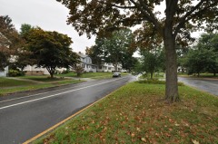 | West Boulevard Historic District | 0.7 miles | 2007 |
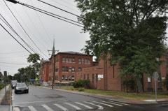 | Parkville Historic District | 0.7 miles | 2015 |
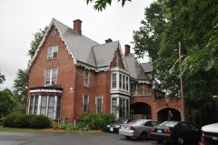 | John and Isabella Hooker House | 0.7 miles | 1979 |
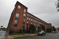 | Underwood Computing Machine Company Factory | 0.7 miles | 2010 |
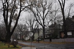 | West End South Historic District | 0.8 miles | 1985 |
 | Noah Webster Memorial Library | 0.8 miles | 1981 |
| National Archives record | The nomination case file for reference 84003898 in Record Group 79. |
| Hartford County | All 451 listed properties in this county. |