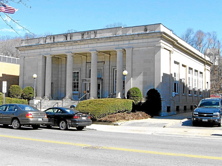
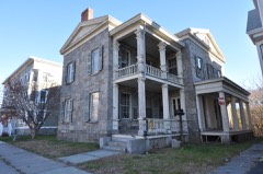
Built in 1914 (Neoclassical architecture). Listed on the National Register of Historic Places in 1985.
From the record
“Post Office-Ansonia Main, also known as the Ansonia Main Post Office, is located at 237 Main Street in Ansonia, Connecticut. Designed by Oscar Wenderoth and completed in 1914, it is one of the more architecturally sophisticated buildings in Ansonia's central business district.”
Wikipedia article United States Post Office-Ansonia Main, CC BY-SA 4.0.
One of 272 National Register listings published here for New Haven County · listed in 1985 · category: Building · built in 1914, Neoclassical architecture, by Oscar Wenderoth.
National Register reference number.85003327- the number the National Park Service assigned this property when it was listed, and the key its nomination file is catalogued under at the National Archives.
Higher up Beaver brook were also farming lands, less fertile, at a point on that stream, half a mile east from Cliff street, in the borough of Ansonia, and at what was called the upper end of Plum Meadows the first grist mill in old Derby was built, in 1681, by Doctor John Hull. This naturally caused a small settlement to spring up at that place. In October, 1684, the town granted to Doctor John Hull and John Griffin " each of them a home lot in the Little Neck, near the ponds." No doubt this referred to the ponds made by the mill dam. Doctor Hull removed to Wallino-ford five vears later, but members of his family remained at the mill, which was here discontinued sometime about 1700. and the interest transferred to a power on the Naugatuck, in the lower part of the town. Thereafter the power was probably devoted to lesser use, Doctor Beardsley being of the opinion that many years later James Humphreys had a hat shop at that place, which he removed to Humphreysville.
Along the Naugatuck, north of the meadows, the land was of the nature of a sandy plain, and not adapted for the uses of agriculture. But the hills, though high and not free from rocks, were to some extent utilized for farming purposes. On the west side were the Samuel Durand and the Bassett farms, each having a generous acreage. They have long since been devoted to suburban uses, Ansonia having become distinctively a manufacturing town, which was called into existence less than half a century ago. Its most interesting history consequently is confined to the present population, accounts of which are given in the following pages.
Regional context, not property-specific
evidence. The
federal wildfire occurrence database
lists 311 fires within 5 miles of US Post Office-Ansonia Main
between 1992 and 2019, burning about 263 acres in total. None started naturally. 79 were recorded as arson.
Distance is straight-line from the map coordinates, so a fire counted
here may appear on a neighbouring settlement's page as well.
Reported cause
Fires
Missing data/not specified/undetermined
117
Arson/incendiarism
79
Recreation and ceremony
43
Misuse of fire by a minor
34
Debris and open burning
26
Equipment and vehicle use
8
Smoking
4
The most recent of
them, most recent first, with the day each was reported and the service
that recorded it.
Regional context, not property-specific
evidence. The federal mineral resources record lists
37 workings within 5 miles of US Post Office-Ansonia Main: 31 past producers, 3 producers, 2 occurrences, 1 unknown.
3 still produce. What was taken out: Stone, Dimension, Stone, Sand and Gravel, Construction, Quartz. Distance is straight-line from the
map coordinates, so a quarry counted here may appear on a neighbouring
settlement's page as well.
Regional context, not property-specific
evidence. The National Weather Service names
Ansonia, the town this property stands in, in 16 storm reports between 1997 and 2024: 7 flash flood, 6 thunderstorm wind, 2 hail, 1 lightning.
The reports record 1 injury. Each account below is quoted exactly as the forecast office
filed it, from the NOAA Storm Events Database, and each date
opens the federal record of that event.
Trees and numerous wires were reported down throughout Ansonia, including wires reported down on a house along Wakelee Avenue, near Hull Street, and a large tree along Farther Salemi Drive, and a tree on a car on Platt Street. The roof of the Ansonia Armory was also damaged.
No historic map-sheet match is published
for this property yet. That does not mean no map exists. This record needs
a coordinate-quality review before it can be joined to a sheet boundary.
Browse the county's mapped places while that work is
pending.
Listed places nearby
6 within 8 miles
Other National Register properties close
enough to walk or drive between, ordered by distance from this one. Both
positions come from the same geocoding pass that matched these properties
to their map sheets.
Listing record. National Park Service National Register of Historic Places, listed-properties dataset, current to 2026-05-22.
Map join. Address geocoded through the United States Census geocoder, then tested against the published boundary of every sheet in the USGS Historical Topographic Map Collection.
How this page is made. Listing fields come from federal records; map-sheet coverage is a labelled coordinate-to-boundary calculation, not a source-field claim.
Wildfire. Short, Karen C. 2022. Spatial wildfire occurrence data for the United States, 1992-2020 [FPA_FOD_20221014]. 6th Edition. Fort Collins, CO: Forest Service Research Data Archive. https://doi.org/10.2737/RDS-2013-0009.6 Collected with United States Government funding and usable without additional permissions or fees.
Mines and quarries. USGS Mineral Resources Data System (MRDS) https://mrdata.usgs.gov/mrds/ A work of the United States government, no copyright under 17 U.S.C. 105.
Storms. NOAA National Centers for Environmental Information, Storm Events Database https://www.ncei.noaa.gov/stormevents/ A work of the United States government, no copyright under 17 U.S.C. 105. Narratives are quoted verbatim from the National Weather Service report and are not edited or summarised.
 Block