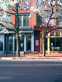
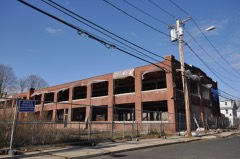
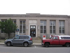
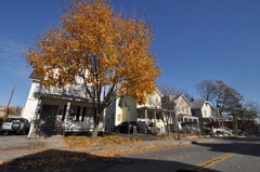
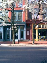
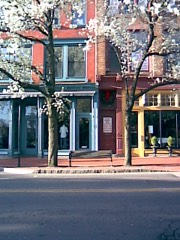
Photograph by StephenTS42 at English Wikipedia, Public domain. Via
Wikimedia Commons.
South Main and Washington Streets Historic District (Boundary Increase)
Listed on the National Register of Historic Places in 1985.
From the record
“The South Main and Washington Streets Historic District - 68-139 Washington Street and 2-24 South Main Street is a historic district in South Norwalk, Connecticut. The 110-acre (45 ha) district encompasses 35 buildings and two other structures.”
Wikipedia article South Main and Washington Streets Historic District, CC BY-SA 4.0.
One of 298 National Register listings published here for Fairfield County · listed in 1985 · category: District.
National Register reference number.85003505- the number the National Park Service assigned this property when it was listed, and the key its nomination file is catalogued under at the National Archives.
I " Know all men by these presents, that I Winnipank, Indian Sagamour of Norwalk, do freely Give to my beloved friend Thomas Hanford, senior. Minister of Norwalk in y'' County of Fairfield, in y' (^)lony of I Connecticut, my Island of Land Lying against Rower- I ton, containing Twenty acres more or less, with all y trees, Herbage, and other Appurtenances thereof; which s*" Island is bounded on y' East with y' Island called Mamachimins, and Chachanenas, and on y° West witli the ))oint of Rowertoii ; I the said Winnipank Do by this my act and Deed, Alienate the s* Island from all claims of English or Indians, and as being my peculiar propriety, never by deed of gift, or sale made over to any, but now by this my deed I do give it freely to my beloved friend Thomas Hanford, senr., to possess, improve, to liim and iiis heirs forever. In confirmation of this my act or deed, I have set to my hand & seal this second day of December Anno Domini One thousand six Hundred and Ninety.
A large and commodious steamer leaves the dock at the foot of Washington Street every morning, except Sundays, for New York City, returning at six r. M. Two freight-steamers make tri-weekly trips between this city and New York. Within the city are ample dock accommodations for vessels drawing from ten to twelve feet of water, at which are constantly moored in tlie busy season sailing-crafts of every description discharging lumber, timber, and every kinds of building-materials, coal, and wood, and receiving cargoes of various sorts for other ports. Here tlie oyster-trade is a large factor of wealth. .\t certain sea.sons of the year the docks are crowded with vessels engaged in transporting oysters to New York City, Bridgeport, New Haven, Hartford, and to foreign countries. It is computed that at least two millions of dollars' worth of bivalves arc planted in the waters of Norwalk, three-quarters of which are owned by citizens of South and Ea.st Norwalk.
Regional context, not property-specific
evidence. The
federal wildfire occurrence database
lists 70 fires within 5 miles of South Main and Washington Streets Historic District (Boundary Increase)
between 1995 and 2020, burning about 25 acres in total. None started naturally. 2 were recorded as arson.
Distance is straight-line from the map coordinates, so a fire counted
here may appear on a neighbouring settlement's page as well.
Reported cause
Fires
Missing data/not specified/undetermined
40
Smoking
16
Debris and open burning
8
Arson/incendiarism
2
Railroad operations and maintenance
2
Power generation/transmission/distribution
1
Recreation and ceremony
1
The most recent of
them, most recent first, with the day each was reported and the service
that recorded it.
Regional context, not property-specific
evidence. The federal mineral resources record lists
4 workings within 5 miles of South Main and Washington Streets Historic District (Boundary Increase): 3 past producers, 1 producer.
1 still produces. What was taken out: Stone, Dimension, Lead, Granite, Sand and Gravel, Construction. Distance is straight-line from the
map coordinates, so a quarry counted here may appear on a neighbouring
settlement's page as well.
Regional context, not property-specific
evidence. The National Weather Service names
Norwalk, the town this property stands in, in 26 storm reports between 1997 and 2020: 10 thunderstorm wind, 6 flash flood, 5 hail, 1 heavy rain.
No death or injury is recorded in these reports. Each account below is quoted exactly as the forecast office
filed it, from the NOAA Storm Events Database, and each date
opens the federal record of that event.
EF1 Tornado confirmed, severe damage to house on Surf Road with Roof ripped off and several pine trees snapped off.||A discrete, low topped storm cell, moving north northwest from |Long Island Sound and over Saugatuck Shores in Westport CT, |produced a waterspout, that made landfall as an EF1 tornado |around 140pm on August 4 2020. ||The waterspout was captured on video by a private meteorologist |as it was moving towards Saugatuck Shores in Westport CT around |140pm. The tornado produced severe damage to a house on Surf Rd, |with the roof being ripped off, as well as portions of the second |floor's supporting wall structure. This debris was tossed about |30-50 feet north on the property. In addition, the tops of several|pine trees in the front and side yard were either sheared or |snapped off. The tornado likely quickly lifted and possibly |tracked north as a funnel cloud for another 1 to 2 miles, before |dissipating. The funnel cloud could have touched down as a |waterspout on the Saugatuck River, south of Route 1, based on an |eyewitness report from S Compo Rd in Westport, CT. Otherwise, |downstream damage reports are inconclusive for tornado damage, but|consistent with the damaging 40 to 50 mph straight line sustained|winds and 60 to 70 mph gusts observed between 2pm and 5pm across |southwestern CT from Tropical Storm Isaias.
No historic map-sheet match is published
for this property yet. That does not mean no map exists. This record needs
a coordinate-quality review before it can be joined to a sheet boundary.
Browse the county's mapped places while that work is
pending.
Listed places nearby
6 within 8 miles
Other National Register properties close
enough to walk or drive between, ordered by distance from this one. Both
positions come from the same geocoding pass that matched these properties
to their map sheets.
Listing record. National Park Service National Register of Historic Places, listed-properties dataset, current to 2026-05-22.
Map join. Address geocoded through the United States Census geocoder, then tested against the published boundary of every sheet in the USGS Historical Topographic Map Collection.
How this page is made. Listing fields come from federal records; map-sheet coverage is a labelled coordinate-to-boundary calculation, not a source-field claim.
Wildfire. Short, Karen C. 2022. Spatial wildfire occurrence data for the United States, 1992-2020 [FPA_FOD_20221014]. 6th Edition. Fort Collins, CO: Forest Service Research Data Archive. https://doi.org/10.2737/RDS-2013-0009.6 Collected with United States Government funding and usable without additional permissions or fees.
Mines and quarries. USGS Mineral Resources Data System (MRDS) https://mrdata.usgs.gov/mrds/ A work of the United States government, no copyright under 17 U.S.C. 105.
Storms. NOAA National Centers for Environmental Information, Storm Events Database https://www.ncei.noaa.gov/stormevents/ A work of the United States government, no copyright under 17 U.S.C. 105. Narratives are quoted verbatim from the National Weather Service report and are not edited or summarised.
 Block