Listed on the National Register of Historic Places in 1986.
From the record
“Post Office-Manchester Main is a historic building at 491 Main Street in Manchester, Connecticut. It was built in 1931 and was listed on the National Register of Historic Places in 1986 for its architecture.”
Wikipedia article Weiss Center, CC BY-SA 4.0.
One of 451 National Register listings published here for Hartford County · listed in 1986 · category: Building.
National Register reference number.86000127- the number the National Park Service assigned this property when it was listed, and the key its nomination file is catalogued under at the National Archives.
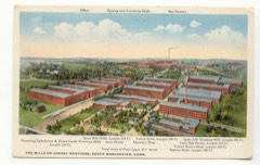
By the act of incorporation the western boundary of the town of Manchester was placed half a mile west of the west line of the Five Miles. The town therefore included, in addition to the Five Miles, a section, half a mile wide, of the original Three-mile Lots. In 1842 a portion of East Windsor, com])rising an area of nearly two square miles, and including Oakland district, was annexed to this town, making its present area about twenty-eight square miles, bounded north by South Windsor, east by Bolton and Vernon, south by Glastonbury, and west by East Hartford. The face of the coimtiy east of Connecticut River for a considerable distance is generallv level, risinsf into broken uplands in the northern part. Near the centre of the town of Manchester the land gradually rises into a moderately elevated plain, along which extends the broad avenue which is the continuation of the old " country road " from East Hartford Street, beginning at the corner near tlie moutli of the Hockanum River. This plain gradually terminates on the east in the high range of hills which, sweeping round to the southwest, encloses the extensive valley that forms the southeast part of the town.
The Hockanum River, the outlet of Snipsic Lake, in Vernon, flows through the entire northern portion of the town, receiving as chief tributaries Hop Brook and Bigelow Brook. In the vicinity of tliese streams the manufactories are located. The chief centres of business and population are North Manchester and South Manchester. Other settlements are Manchester Green, Lydallville, Parker Village, Oakland, Buckland, Hilliardville, and the Highlands.
Regional context, not property-specific
evidence. The
federal wildfire occurrence database
lists 72 fires within 5 miles of US Post Office-Manchester Main
between 1992 and 2020, burning about 130 acres in total. None started naturally. 3 were recorded as arson.
Distance is straight-line from the map coordinates, so a fire counted
here may appear on a neighbouring settlement's page as well.
Reported cause
Fires
Missing data/not specified/undetermined
51
Recreation and ceremony
8
Debris and open burning
6
Arson/incendiarism
3
Smoking
2
Equipment and vehicle use
1
Power generation/transmission/distribution
1
The most recent of
them, most recent first, with the day each was reported and the service
that recorded it.
Regional context, not property-specific
evidence. The federal mineral resources record lists
33 workings within 5 miles of US Post Office-Manchester Main: 24 past producers, 9 producers.
9 still produce. What was taken out: Stone, Dimension, Sand and Gravel, Construction, Granite, Flagstone. Distance is straight-line from the
map coordinates, so a quarry counted here may appear on a neighbouring
settlement's page as well.
Regional context, not property-specific
evidence. The National Weather Service names
Manchester, the town this property stands in, in 32 storm reports between 1995 and 2024: 13 thunderstorm wind, 9 hail, 4 flash flood, 3 lightning.
No death or injury is recorded in these reports. Each account below is quoted exactly as the forecast office
filed it, from the NOAA Storm Events Database, and each date
opens the federal record of that event.
There was widespread, damaging flash flooding throughout Manchester. Fire officials evacuated 18 homes due to flash flooding. The Hartford Courant newspaper had a photo of a culvert collapse on Ambassador Drive, after Lydall Brook overflowed its banks. The culvert running under Ambassador Drive collapsed, destroying that secion of road. On Prospect Street, at least four first-floor condominiums at the Millbridge Hollow Condominium complex when the Hop Brook overflowed its banks. Floodwaters also entered the first floor of the Highland Park Elementary School when the Porter Brook overflowed its banks. At 356 PM EST, WFSB-TV showed a video of major flash flooding on Gerard Street, with first responders canoeing to the front door of a residence. Other streets with significant flooding included Lydall Street, Middle Turnpike East, and Route 83 near Vernon. A CoCoRaHS observer in Manchester recorded a total of 5.68 inches from Henri, the majority of which fell during the afternoon of August 22.
Heavy downpours in Manchester Connecticut brought street flooding to the East Side between 350 PM and 630 PM EST. Pearl Street and Birch Street were under 1 to 2 feet of water, making them impassable.
Trees and wires on Oak Street and Purrell Place were downed by thunderstorm winds. A tree was downed onto a house on Scarborough Road. No damage to the house.
In Manchester, a tree was down on a house on Pearl Street. A tree was down on Bissell Street. Wires were down at Bissell Street at Spruce Street. Power lines were down on Summit Street. Large branches were down on wires on Florence Street. A branch was down on wires on Clinton Street.
In Manchester, the Hop Brook overflowed its banks and inundated a large portion of Charter Oak Park. In addition, farther north, portions of East Center Street (Route 44) were flooded.
At 4:40 PM EST, thunderstorm winds brought down four trees in Manchester. One was on East Eldridge Street, the others at the intersection of East Maple and Grandview Streets.
A severe thunderstorm produced large hail, gusty winds, and lightning strikes, which caused property damage. At Vernon, the hail began falling small and increased to baseball-size. Lightning struck three buildings in Somers and trees and wires were knocked down in East Windsor and Ellington. Baseball-size hail fell in Manchester. Trees and wires were knocked down in Bolton and Andover. The large hailstones broke windows and damaged many automobiles. Damage was estimated at up to several hundred thousand dollars.
No historic map-sheet match is published
for this property yet. That does not mean no map exists. This record needs
a coordinate-quality review before it can be joined to a sheet boundary.
Browse the county's mapped places while that work is
pending.
Listed places nearby
6 within 8 miles
Other National Register properties close
enough to walk or drive between, ordered by distance from this one. Both
positions come from the same geocoding pass that matched these properties
to their map sheets.
Listing record. National Park Service National Register of Historic Places, listed-properties dataset, current to 2026-05-22.
Map join. Address geocoded through the United States Census geocoder, then tested against the published boundary of every sheet in the USGS Historical Topographic Map Collection.
How this page is made. Listing fields come from federal records; map-sheet coverage is a labelled coordinate-to-boundary calculation, not a source-field claim.
Wildfire. Short, Karen C. 2022. Spatial wildfire occurrence data for the United States, 1992-2020 [FPA_FOD_20221014]. 6th Edition. Fort Collins, CO: Forest Service Research Data Archive. https://doi.org/10.2737/RDS-2013-0009.6 Collected with United States Government funding and usable without additional permissions or fees.
Mines and quarries. USGS Mineral Resources Data System (MRDS) https://mrdata.usgs.gov/mrds/ A work of the United States government, no copyright under 17 U.S.C. 105.
Storms. NOAA National Centers for Environmental Information, Storm Events Database https://www.ncei.noaa.gov/stormevents/ A work of the United States government, no copyright under 17 U.S.C. 105. Narratives are quoted verbatim from the National Weather Service report and are not edited or summarised.
 Block