BlockBefore
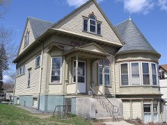
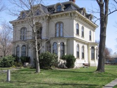
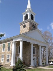
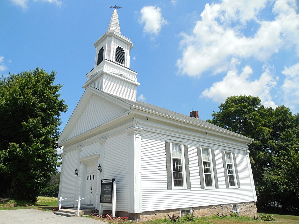
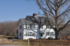
Photograph of Sterling Hill Historic District
Photograph by John Phelan, CC BY-SA 3.0. Via Wikimedia Commons.

Sterling Hill Historic District

Listed on the National Register of Historic Places in 1986.

From the record

“The Sterling Hill Historic District encompasses a well-preserved early 19th-century rural village center on western edge of the town of Sterling, Connecticut. Centered at the junction of Plainfield Pike and Sterling Hill Road, it consists of a cluster of 19th and early 19th-century houses, and a church.”

Wikipedia article Sterling Hill Historic District (Plainfield and Sterling, Connecticut), CC BY-SA 4.0.

One of 82 National Register listings published here for Windham County · listed in 1986 · category: District.

Sources: the Wikipedia article · the case file at the National Archives · the National Register database, National Park Service · the Wikipedia article
The listing

  • Address. Green Ln. and CT 14A, Sterling, 06354
  • When was it listed? February 1986
  • Category. district
  • Town. Sterling town
  • Architectural style. Greek Revival architecture, Renaissance Revival architecture
  • National Register reference number. 86000152 - the number the National Park Service assigned this property when it was listed, and the key its nomination file is catalogued under at the National Archives.

The ground it stands on

14,025 words

The chapter on Sterling Town in History of Windham County, Connecticut .., published 1889 names Sterling. This is what it says, exactly as the scans read.

THE township of Sterling occupies the vsoutheast corner of the county, being bounded on the north by Killingly, east by Rhode Island, south by Voluntown (formerly a town of Windham county, but recently transferred to New London county), and west by Plainfiield. The town is nine miles long from north to south, and has an average width of three miles. It is centrally distant from Hartford 49 miles and from New Haven 73 miles. It contains an area of twenty-seven square miles. Much of the land is hilly or swampy. The town is well drained by the Quanduck and Cedar Swamp branches of Moosup river. It contains valuable building stones, which are quarried to some extent. Sterling hill, in the western part, is the original settlement, and occupies an eminence, furnishing a delightful view of the surrounding country. The town is crossed near the center by the Providence Division of the N. Y. & N. E. railroad. Large quantities of railroad ties are cut from the woods of the town. Farming and manufacturing form the industrial interests of the town. Its population at different periods has been : In 1800, 908; in 1840, 1,099 ; 1870, 1,022; 1880, 957. The grand list of the town in 1800 was $20,873 ; in 1847, $11,791 ; in 1857, $13,447; and 1887, $259,263. The number of children between the ages of four and sixteen in 1858 was 280 ; in 1881, 227; and in 1887, 197. The post offices of Sterling, Oneco, Ekonk and North Sterling are in this town.

Passage source: History of Windham County, Connecticut .., published 1889.

Some years passed before the division was completed. After the disputed Mohegan claim was settled a survey of the land was made in 1705. This land extended from the north bounds of Stonington northward to the Whetstone country, being a tract some twenty miles long, and from three to six miles in width. Its original quantity was diminished somewhat by the of the Rhode Island line, but after that had teen established the tract was substantially the same as that now occupied by the towns of A'oluntown and Sterling. One hundred and sixty persons had enrolled themselves as desirous of sharing in the benefit of this grant, and the land was distributed among them by a drawing made April 6th, 1706. These drawers of lots were residents of New London, Norwich, Stonington, Windham, Plainfield and other neighboring towns. The list comprised not only officers and soldiers, but ministers, chaplains and many who had served the colony in civil capacity as well as military, during the war. Samuel Fish was probably the first -settler on this tract, but at what point his settlement had been made (it being already there), we are not informed. Very few of the "volunteers" took personal possession of their allotments. Some of the proprietors sold Out their rights at an early date, receiving five, six, eight, eleven and twelve pounds for an allotment. Others retained their shares and rented out farms on them whenever practicable. These first divisions were made in the southern part of the tract surveyed and most, if not all of the first land divisions and operations were probably within the limits of the present town of Voluntown. Northward lay the vacant land east of Plainfield. This land was petitioned for both by Plainfield and Voluntown. Some few had already obtained possession of lands here and had made improvements upon them. Reverend Mr. Coit, of Plainfield, had received a grant of three hundred acres north of Egunk hill, and he conveyed it to Francis Smith and oSIiles Jordan. Smith soon put up a mill and opened his house for the accommodation of travelers. Smith and Jordan, in 1714, erected a bridge over the river there, and received in payment 150 acres of land on the Providence road. This convenient road and pleasant locality soon attracted other settlers - John Smith, Ebenezer and Thomas Dow, Robert and John Parke, Robert Williams, Nathaniel French and others. In May, 1719, this vacant country was annexed to Voluntown, by act of the assembly, a strip one mile in width across the north end being reserved as public land. The settlers who were established in the vacant land had their purchases confirmed to them by the assembly, in October, 1719, on condition that each should have a tenantable house and settle themselves within the space

Passage source: History of Windham County, Connecticut .., published 1889.

Machine-read from a century-old scan, so expect the errors a machine makes: misspelled names, dropped words, stray characters.

Read the whole chapter on Sterling Town - 14,025 words on its settlement, mills, schools and churches.

Fires near this property

157 since 1994

Regional context, not property-specific evidence. The federal wildfire occurrence database lists 157 fires within 5 miles of Sterling Hill Historic District between 1994 and 2020, burning about 204 acres in total. 1 started naturally. 8 were recorded as arson. Distance is straight-line from the map coordinates, so a fire counted here may appear on a neighbouring settlement's page as well.

Reported cause Fires
Missing data/not specified/undetermined105
Recreation and ceremony14
Debris and open burning10
Arson/incendiarism8
Smoking7
Misuse of fire by a minor7
Equipment and vehicle use2
Power generation/transmission/distribution2
Natural1
Railroad operations and maintenance1

The most recent of them, most recent first, with the day each was reported and the service that recorded it.

DateCause SizeReported by Name on the report
28 September 2011Missing data/not specified/undeterminedunder an acreConnecticut Division of ForestryPLAINFIELD
6 August 2020Power generation/transmission/distribution2.0 acresConnecticut Division of Forestrynot named
5 August 2020Missing data/not specified/undetermined1.0 acresConnecticut Division of Forestry289 STERLING ROAD
5 August 2020Missing data/not specified/undeterminedunder an acreConnecticut Division of Forestry91 GIBSON LANE
5 August 2007Arson/incendiarism1.0 acresRhode Island Division of Forest Environmentnot named
6 July 2010Missing data/not specified/undeterminedunder an acreConnecticut Division of Forestrynot named
4 July 2016Missing data/not specified/undeterminedunder an acreConnecticut Division of ForestryPORTER POND RD / PLAINFIELD PIKE, STERLING

Every fire recorded in Windham County

Mines and quarries near this property

10 of 13 shown

Regional context, not property-specific evidence. The federal mineral resources record lists 13 workings within 5 miles of Sterling Hill Historic District: 10 past producers, 3 producers. 3 still produce. What was taken out: Granite, Sand and Gravel, Construction, Stone, Crushed/Broken, Flagstone. Distance is straight-line from the map coordinates, so a quarry counted here may appear on a neighbouring settlement's page as well.

Where SiteCommodity StatusRecorded
Strouse Brothers QuarryFlagstonePast Producer
Route 205 PitSand and Gravel, ConstructionProducer
Strouse Brothers QuarryStone, Crushed/BrokenPast ProducerSedimentary
Wauregan Pit and QuarryStone, Crushed/Broken, Sand and Gravel, ConstructionProducer
Bennett QuarriesGranitePast Producer
Granite QuarriesGranitePast Producer
Granite QuarryGranitePast Producer
Oneco QuarryGranitePast Producer
R.B. Marriot and Son QuarryGranitePast ProducerGranite

Every working recorded in Windham County

Storms near this property

3 since 2008

Regional context, not property-specific evidence. The National Weather Service names Sterling, the town this property stands in, in 3 storm reports between 2008 and 2024: 2 thunderstorm wind, 1 flash flood. No death or injury is recorded in these reports. Each account below is quoted exactly as the forecast office filed it, from the NOAA Storm Events Database, and each date opens the federal record of that event.

WhenEvent Place namedHarm What the report says
December 2011Thunderstorm WindSterling$10,000Trees and wires along Gibson Hill Road were downed by thunderstorm winds.
March 2008Thunderstorm WindSterling$2,000Numerous large branches were downed as well as an 18 inch diameter tree in the Moosup section of Sterling.
June 2024Flash FloodSterling-In Sterling, several roads were flooded in the Plainfield and Sterling, CT area including I-395 and Rt 12.

Every storm recorded in Windham County

Map coverage status

No historic map-sheet match is published for this property yet. That does not mean no map exists. This record needs a coordinate-quality review before it can be joined to a sheet boundary. Browse the county's mapped places while that work is pending.

Listed places nearby

6 within 8 miles

Other National Register properties close enough to walk or drive between, ordered by distance from this one. Both positions come from the same geocoding pass that matched these properties to their map sheets.

Sources for this property

National Archives recordThe nomination case file for reference 86000152 in Record Group 79.
Wikipedia articleCommunity-written account of this property, licensed CC BY-SA.
Windham CountyAll 82 listed properties in this county.

Provenance

  • Listing record. National Park Service National Register of Historic Places, listed-properties dataset, current to 2026-05-22.
  • Map join. Address geocoded through the United States Census geocoder, then tested against the published boundary of every sheet in the USGS Historical Topographic Map Collection.
  • How this page is made. Listing fields come from federal records; map-sheet coverage is a labelled coordinate-to-boundary calculation, not a source-field claim.
  • Wildfire. Short, Karen C. 2022. Spatial wildfire occurrence data for the United States, 1992-2020 [FPA_FOD_20221014]. 6th Edition. Fort Collins, CO: Forest Service Research Data Archive. https://doi.org/10.2737/RDS-2013-0009.6 Collected with United States Government funding and usable without additional permissions or fees.
  • Mines and quarries. USGS Mineral Resources Data System (MRDS) https://mrdata.usgs.gov/mrds/ A work of the United States government, no copyright under 17 U.S.C. 105.
  • Storms. NOAA National Centers for Environmental Information, Storm Events Database https://www.ncei.noaa.gov/stormevents/ A work of the United States government, no copyright under 17 U.S.C. 105. Narratives are quoted verbatim from the National Weather Service report and are not edited or summarised.