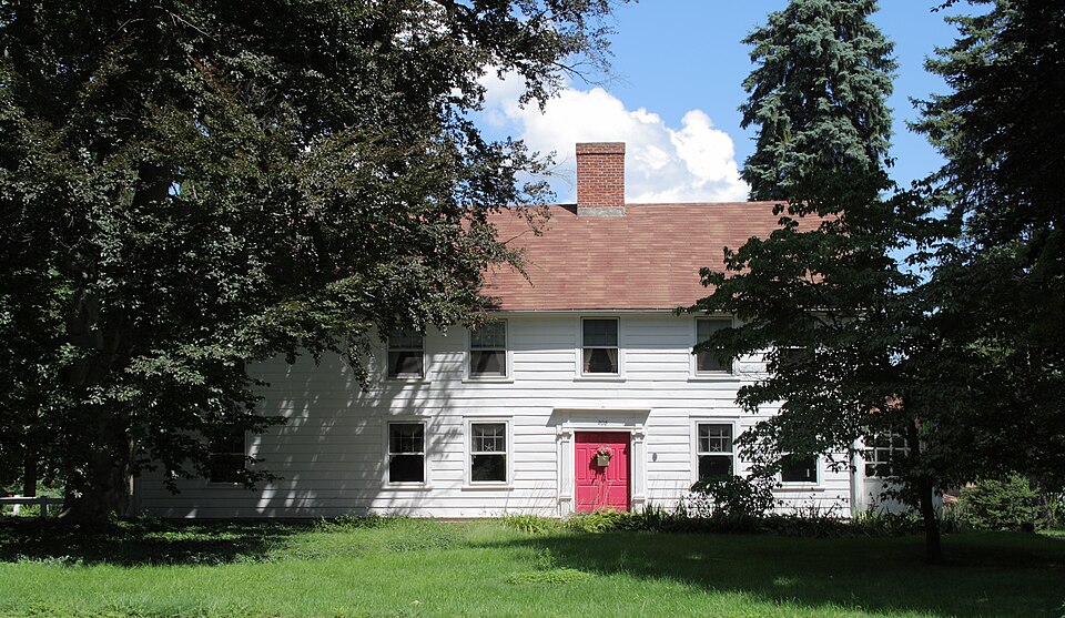
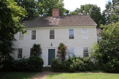
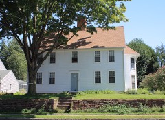
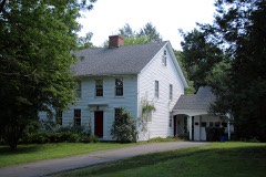
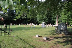
Listed on the National Register of Historic Places in 1986.
From the record
“The Whitman House is a historic house at 208 North Main Street in West Hartford, Connecticut. Built about 1764, it is one of the town's few surviving 18th-century buildings.”
Wikipedia article Whitman House (West Hartford, Connecticut), CC BY-SA 4.0.
One of 451 National Register listings published here for Hartford County · listed in 1986 · category: Building.
Also known as. Eighteenth-Century Houses of West Hartford TR
Town. West Hartford town
National Register reference number.86002028- the number the National Park Service assigned this property when it was listed, and the key its nomination file is catalogued under at the National Archives.
What happened here
An account from the chapter on West Hartford town. The inset identifies its exact
source book and publication year.
The most remarkable pastorate was that of Nathan Perkins. He served sixty-six years, liis pastorate being ^yell begun when the first shot was fired at Lexington, and not quite over when the financial panic of 1837 occurred. Thoug]i probably inferior in nj,tural ability to his distinguished y'^^
THE locality now known as the town of West Hartford was two hundred years ago an undivided tract of land in the West Division of Hartford, It was owned by a large company of proprietors, sixty-eight of whom are named in the division record. On the 30th of January, 1672, the joint owners of this tract voted to divide a portion of the same according to their individual interests. In pursuance of this vote a committee set off, in November, 1674, an oblong section of land extending from the northern to the southern l)oundary of the town of Hartford, and from the eastern boundary of Farmington one mile and a half east. The Farmington line was at that time along the level land at the foot of Talcott iMountain, and the eastern bound of this new rectangle was not far from what is now known as Vanderbilt Hill. This strip of land was divided into lots running the entire distance across it, the width being proportioned to each pei'son's interest in the undivided territory. The widest tract was ninety-one rods wide ; the narrowest, a mere whip-lash three rods wide and a mile and a half long. The original strip was subsequently enlarged and made more symmetrical by pushing the Farmington lino westward to the top of Talcott Mountain and adding a strip of land to the east end of the division lots. This part of the town of Hartford was commonly called the West Division. It never ceased to agitate for its individuality until it became a distinct ecclesiastical society, and, very recently, a separate township.
The church related to the Ecclesiastical Society was organized on or about tlie 24th of February, 1713, when also the first pastor, Benjamin Colton, was ordained and installed. Starting with a membership of twenty-nine, it now numbers three Iff/^C^^t^^ hundred and twenty-five, having received into its communion during its life of a hundred and seventy-one years nearly two thousand i)ersons. It was originally called the Fourth Church of Christ in Hartford, but for a long series of years has been knoAvn as the Church of Christ in West Hartford, Mr. Colton was pastor of the church about forty -three years, and several of his descendants became clergymen. One of these was his son George, the famous and eccentric " Colton of Bolton." The latter part of this long pastorate was marred by some unhappy divisions, which were healed only by summoning advice from wdthout.
Regional context, not property-specific
evidence. The
federal wildfire occurrence database
lists 19 fires within 5 miles of Whitman House
between 1992 and 2012, burning about 122 acres in total. None started naturally. 2 were recorded as arson.
Distance is straight-line from the map coordinates, so a fire counted
here may appear on a neighbouring settlement's page as well.
Reported cause
Fires
Missing data/not specified/undetermined
8
Recreation and ceremony
3
Debris and open burning
3
Arson/incendiarism
2
Misuse of fire by a minor
2
Equipment and vehicle use
1
The most recent of
them, most recent first, with the day each was reported and the service
that recorded it.
Regional context, not property-specific
evidence. The federal mineral resources record lists
26 workings within 5 miles of Whitman House: 22 past producers, 2 producers, 2 plants.
4 still produce. What was taken out: Stone, Dimension, Stone, Crushed/Broken, Sand and Gravel, Construction, Flagstone. Distance is straight-line from the
map coordinates, so a quarry counted here may appear on a neighbouring
settlement's page as well.
Regional context, not property-specific
evidence. The National Weather Service names
West Hartford, the town this property stands in, in 21 storm reports between 1995 and 2024: 8 thunderstorm wind, 6 flash flood, 4 hail, 2 flood.
No death or injury is recorded in these reports. Each account below is quoted exactly as the forecast office
filed it, from the NOAA Storm Events Database, and each date
opens the federal record of that event.
More than 2 inches of rain fell in less than 1 hour. In Hartford, numerous cars were stuck in flash flood waters... on Franklin Street at South Street; Buckingham, John, Hamilton, Bonner, and Brown Streets, and Hillside Avenue. A small portion of Airport Road in Hartford, east of Wethersfield Avenue, buckled inward as a result of the heavy rainfall. A family on Sisson Avenue was forced from their home when water entered the home. A basement was flooded on Wolcott Street. Reports were from a combination of law enforcement, amateur radio, and newspaper and tv stations.
In West Hartford, the Dept. of Public Works sent a Twitter photo showing that a large stretch of Fern Street, from Mountain Road to North Main Street, was closed due to flooding.
No historic map-sheet match is published
for this property yet. That does not mean no map exists. This record needs
a coordinate-quality review before it can be joined to a sheet boundary.
Browse the county's mapped places while that work is
pending.
Listed places nearby
6 within 8 miles
Other National Register properties close
enough to walk or drive between, ordered by distance from this one. Both
positions come from the same geocoding pass that matched these properties
to their map sheets.
Listing record. National Park Service National Register of Historic Places, listed-properties dataset, current to 2026-05-22.
Map join. Address geocoded through the United States Census geocoder, then tested against the published boundary of every sheet in the USGS Historical Topographic Map Collection.
How this page is made. Listing fields come from federal records; map-sheet coverage is a labelled coordinate-to-boundary calculation, not a source-field claim.
Wildfire. Short, Karen C. 2022. Spatial wildfire occurrence data for the United States, 1992-2020 [FPA_FOD_20221014]. 6th Edition. Fort Collins, CO: Forest Service Research Data Archive. https://doi.org/10.2737/RDS-2013-0009.6 Collected with United States Government funding and usable without additional permissions or fees.
Mines and quarries. USGS Mineral Resources Data System (MRDS) https://mrdata.usgs.gov/mrds/ A work of the United States government, no copyright under 17 U.S.C. 105.
Storms. NOAA National Centers for Environmental Information, Storm Events Database https://www.ncei.noaa.gov/stormevents/ A work of the United States government, no copyright under 17 U.S.C. 105. Narratives are quoted verbatim from the National Weather Service report and are not edited or summarised.
 Block