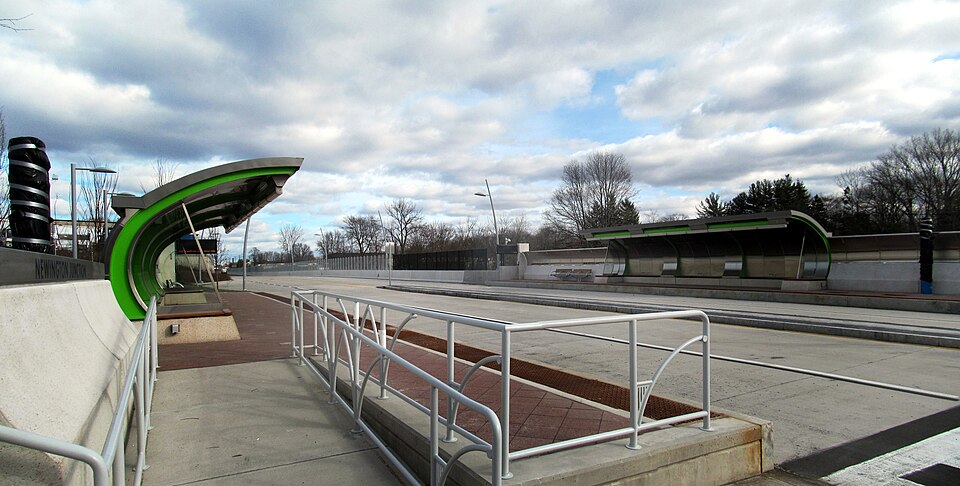
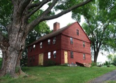
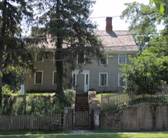
Built in 2015. Listed on the National Register of Historic Places in 1986.
From the record
“Newington Junction is a bus rapid transit station on the CTfastrak line opened in 2015 located off Willard Avenue in the Newington Junction neighborhood of Newington, Connecticut.”
Wikipedia article Newington Junction station, CC BY-SA 4.0.
One of 451 National Register listings published here for Hartford County · listed in 1986 · category: Building · built in 2015.
National Register reference number.86003478- the number the National Park Service assigned this property when it was listed, and the key its nomination file is catalogued under at the National Archives.
Sowheag, a sachem of the Mattabesett tribe, originally sold the land in Newington to the first settlers of Wethersfield. A committee appointed by the two towns of Wethersfield and Farmington definitely settled the western limit of this Indian purchase on the 29th of October, 1670, by a line which established their boundary, running from
There was another general division of common land authorized by the town in February, 1G94. In October following a committee was appointed to make the division. In April, 1005, it reported a division of five different tiers of lots. The third tier ran east from the Woodbridge grant, abutting north on the Hartford line and south on what is now called Jordan Lane, which then extended west of Cedar Mountain in what was as nearly a straight line as the topographical character of the mountain would permit. The lots ran north and south one hundred rods across the tier, and being of shorter length than was usual, Avere called short lots." There were but nine of these lots in all, numbered 70 to 87 inclusive, extending from Ensign Stedman's on the east to the Woodbridge grant on the west. Land was left for a highway south af them. The first, second, and fifth tiers were in Wethersfield, in that part now constituting Rocky Hill. The fourth tier of lots was wholly in Newington, called the East Tier, and ran ])arallel to the West Division, and half a mile cast ; being separated from it by a strip of common land called the Half-mile Common. It was a half-mile wide, and extended from the highway south of the " slioi't lots " to the New Haven road as its southern terminus, or about four miles. It contained thirty-nine lots, beginning at the north end with lot 88, and ending with lot 126 at the south. The lots of this second division were all apportioned according to the lists of the proprietors as taken in October, 1693, because a purchase of land had been made from the Indians and paid for by a special tax laid u])on the list.
Regional context, not property-specific
evidence. The
federal wildfire occurrence database
lists 20 fires within 5 miles of Newington Junction Railroad Depot
between 1992 and 2016, burning about 67 acres in total. None started naturally. 5 were recorded as arson.
Distance is straight-line from the map coordinates, so a fire counted
here may appear on a neighbouring settlement's page as well.
Reported cause
Fires
Missing data/not specified/undetermined
10
Arson/incendiarism
5
Misuse of fire by a minor
2
Smoking
1
Debris and open burning
1
Recreation and ceremony
1
The most recent of
them, most recent first, with the day each was reported and the service
that recorded it.
Regional context, not property-specific
evidence. The federal mineral resources record lists
26 workings within 5 miles of Newington Junction Railroad Depot: 20 past producers, 3 producers, 2 plants, 1 occurrence.
5 still produce. What was taken out: Stone, Crushed/Broken, Stone, Dimension, Zinc, Sulfur, Iron. Distance is straight-line from the
map coordinates, so a quarry counted here may appear on a neighbouring
settlement's page as well.
Regional context, not property-specific
evidence. The National Weather Service names
Newington, the town this property stands in, in 18 storm reports between 1994 and 2025: 8 thunderstorm wind, 5 hail, 2 flood, 2 flash flood.
No death or injury is recorded in these reports. Each account below is quoted exactly as the forecast office
filed it, from the NOAA Storm Events Database, and each date
opens the federal record of that event.
Large branches up to one foot in diameter and numerous trees were downed by thunderstorm winds. A two foot diameter tree landed on a house on Cedar Street when it was downed by thunderstorm winds. This tree also blocked Cedar Street, resulting in its closure.
Trees and wires were downed throughout town. On Mountain View Drive, a large tree was downed onto five cars parked in a driveway. All were damaged, two were totaled.
At 336 PM EST in Newington, Willard Avenue at Garfield Street was reported closed due to flooding. Rainfall between 1.5 inches and 3.0 inches was reported in Hartford County.
No historic map-sheet match is published
for this property yet. That does not mean no map exists. This record needs
a coordinate-quality review before it can be joined to a sheet boundary.
Browse the county's mapped places while that work is
pending.
Listed places nearby
6 within 8 miles
Other National Register properties close
enough to walk or drive between, ordered by distance from this one. Both
positions come from the same geocoding pass that matched these properties
to their map sheets.
Listing record. National Park Service National Register of Historic Places, listed-properties dataset, current to 2026-05-22.
Map join. Address geocoded through the United States Census geocoder, then tested against the published boundary of every sheet in the USGS Historical Topographic Map Collection.
How this page is made. Listing fields come from federal records; map-sheet coverage is a labelled coordinate-to-boundary calculation, not a source-field claim.
Wildfire. Short, Karen C. 2022. Spatial wildfire occurrence data for the United States, 1992-2020 [FPA_FOD_20221014]. 6th Edition. Fort Collins, CO: Forest Service Research Data Archive. https://doi.org/10.2737/RDS-2013-0009.6 Collected with United States Government funding and usable without additional permissions or fees.
Mines and quarries. USGS Mineral Resources Data System (MRDS) https://mrdata.usgs.gov/mrds/ A work of the United States government, no copyright under 17 U.S.C. 105.
Storms. NOAA National Centers for Environmental Information, Storm Events Database https://www.ncei.noaa.gov/stormevents/ A work of the United States government, no copyright under 17 U.S.C. 105. Narratives are quoted verbatim from the National Weather Service report and are not edited or summarised.
 Block