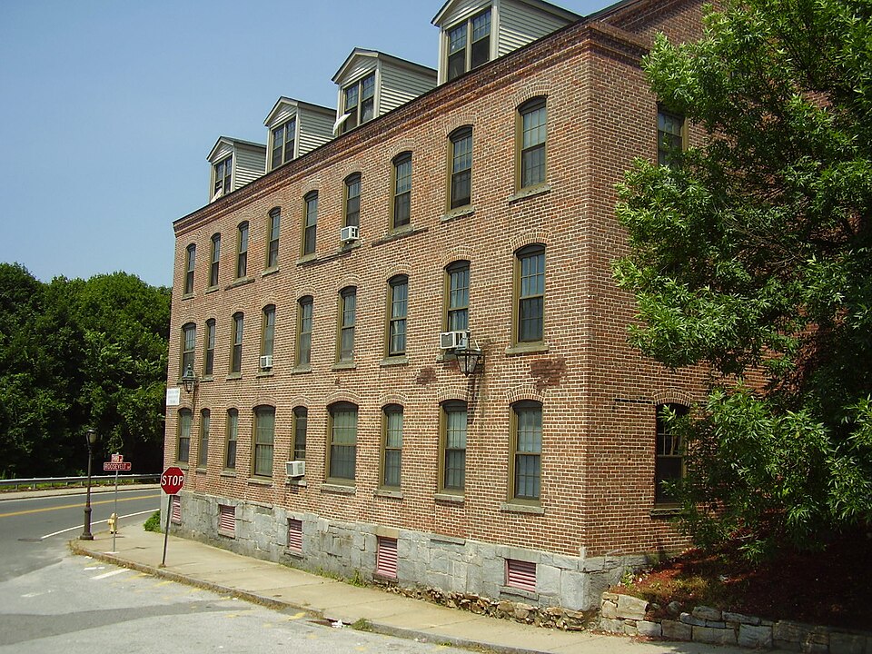
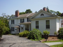
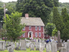
Listed on the National Register of Historic Places in 1987.
From the record
“The Kraus Corset Factory is a historic industrial property at 33 Roosevelt Drive CT 34 in Derby, Connecticut, United States. The oldest portion of the large brick building, built in 1879, faces Third Street, while a c. 1910 addition extends along Roosevelt Drive CT 34.”
Wikipedia article Kraus Corset Factory, CC BY-SA 4.0.
One of 272 National Register listings published here for New Haven County · listed in 1987 · category: Building.
National Register reference number.87000128- the number the National Park Service assigned this property when it was listed, and the key its nomination file is catalogued under at the National Archives.
THE town of Derby is on the western border of the county, about nine miles northwest from New Haven and a little more than that distance north of Long Island sound. As created by the charter of 1675, it extended 12 miles north from the Two Mile brook, and the northeastern corner was seven and a half miles east from a point on the Housatonic; the southeastern corner was two and a half miles east from that stream, the river forming the southwestern boundary and separating the town from Fairfield county. This area of about 14,000 acres of land has been reduced to about one-fourth that number of acres, by the formation of new towns, only the southeastern part of the old town remaining. Here, where is the junction of the Naugatuck with the Housatonic, the first settlements were made. Adjoining the present Derby are Ansonia, on the north; Woodbridge and Orange on the east and southeast.
In aboriginal times this locality was known as Paugasuck, which name was corrupted by the English into Paugassett. The general features are variable, hilly lands predominating, the level lands being confined mainly to the areas along the streams, and are small in extent. Ascending the Housatonic from the point of confluence a mile or two, at a marked bend of the river is the point which from the first has been called Derby Neck, where some lands were early tilled. Southeast are the pleasantly elevated lands on which is located Birmingham, with the intervale along the Naugatuck, on the east, as meadows or lowlands. Beyond the Naugatuck the ground ascends gradually until it culminates in a beautiful elevation, called Sentinel hill, which is cultivated to its summit, and which is a most attractive object, with its orchards and verdant fields. Southwest is another elevation, called Turkey hill, which appears to have been a favorite resort of the Indians. North from this are hills encroaching upon it was desired to know"whether Paugassetl should be attached to their town." But before the proprietors of thi posl gave answer, their interests were sold to Richard Baldwin and others, of Milford, and thenceforth the interests oJ this locality wen practically controlled by that town. Hence, when th< : ral court gave liberty to the people of Paugassett to form themselves into a separate villag Milford di clared that such a such a step would be injurious to its interests, and opposed th( measun ; and this opposition Milford successfully maintained more than 20 years, n tarding the di vi lopmi nt of this section.
Regional context, not property-specific
evidence. The
federal wildfire occurrence database
lists 231 fires within 5 miles of Kraus Corset Factory
between 1992 and 2020, burning about 95 acres in total. None started naturally. 46 were recorded as arson.
Distance is straight-line from the map coordinates, so a fire counted
here may appear on a neighbouring settlement's page as well.
Reported cause
Fires
Missing data/not specified/undetermined
96
Arson/incendiarism
46
Misuse of fire by a minor
31
Recreation and ceremony
30
Debris and open burning
17
Equipment and vehicle use
8
Smoking
3
The most recent of
them, most recent first, with the day each was reported and the service
that recorded it.
Regional context, not property-specific
evidence. The federal mineral resources record lists
37 workings within 5 miles of Kraus Corset Factory: 33 past producers, 2 producers, 1 unknown, 1 occurrence.
2 still produce. What was taken out: Stone, Dimension, Stone, Sand and Gravel, Construction, Quartz. Distance is straight-line from the
map coordinates, so a quarry counted here may appear on a neighbouring
settlement's page as well.
Regional context, not property-specific
evidence. The National Weather Service names
Derby, the town this property stands in, in 5 storm reports between 1998 and 2011: 3 thunderstorm wind, 1 hail, 1 funnel cloud.
No death or injury is recorded in these reports. Each account below is quoted exactly as the forecast office
filed it, from the NOAA Storm Events Database, and each date
opens the federal record of that event.
No historic map-sheet match is published
for this property yet. That does not mean no map exists. This record needs
a coordinate-quality review before it can be joined to a sheet boundary.
Browse the county's mapped places while that work is
pending.
Listed places nearby
6 within 8 miles
Other National Register properties close
enough to walk or drive between, ordered by distance from this one. Both
positions come from the same geocoding pass that matched these properties
to their map sheets.
Listing record. National Park Service National Register of Historic Places, listed-properties dataset, current to 2026-05-22.
Map join. Address geocoded through the United States Census geocoder, then tested against the published boundary of every sheet in the USGS Historical Topographic Map Collection.
How this page is made. Listing fields come from federal records; map-sheet coverage is a labelled coordinate-to-boundary calculation, not a source-field claim.
Wildfire. Short, Karen C. 2022. Spatial wildfire occurrence data for the United States, 1992-2020 [FPA_FOD_20221014]. 6th Edition. Fort Collins, CO: Forest Service Research Data Archive. https://doi.org/10.2737/RDS-2013-0009.6 Collected with United States Government funding and usable without additional permissions or fees.
Mines and quarries. USGS Mineral Resources Data System (MRDS) https://mrdata.usgs.gov/mrds/ A work of the United States government, no copyright under 17 U.S.C. 105.
Storms. NOAA National Centers for Environmental Information, Storm Events Database https://www.ncei.noaa.gov/stormevents/ A work of the United States government, no copyright under 17 U.S.C. 105. Narratives are quoted verbatim from the National Weather Service report and are not edited or summarised.
 Block