 Block
From the record
One of 272 National Register listings published here for New Haven County · listed in 1987 · category: District.
Sources: the case file at the National Archives · the National Register database, National Park Service

Listed on the National Register of Historic Places in 1987.
One of 272 National Register listings published here for New Haven County · listed in 1987 · category: District.
Sources: the case file at the National Archives · the National Register database, National Park Service
Regional context, not property-specific evidence. The federal wildfire occurrence database lists 37 fires within 5 miles of Branford Center Historic District between 1992 and 2020, burning about 249 acres in total. None started naturally. 2 were recorded as arson. Distance is straight-line from the map coordinates, so a fire counted here may appear on a neighbouring settlement's page as well.
| Reported cause | Fires |
|---|---|
| Missing data/not specified/undetermined | 25 |
| Railroad operations and maintenance | 5 |
| Debris and open burning | 3 |
| Arson/incendiarism | 2 |
| Misuse of fire by a minor | 2 |
The most recent of them, most recent first, with the day each was reported and the service that recorded it.
| Date | Cause | Size | Reported by | Name on the report |
|---|---|---|---|---|
| 5 September 2007 | Missing data/not specified/undetermined | 1.0 acres | Connecticut Division of Forestry | not named |
| 4 September 2007 | Missing data/not specified/undetermined | 1.0 acres | Connecticut Division of Forestry | not named |
| 30 September 2007 | Missing data/not specified/undetermined | 1.0 acres | Connecticut Division of Forestry | not named |
| 1 September 2007 | Missing data/not specified/undetermined | 1.0 acres | Connecticut Division of Forestry | not named |
| 5 August 2007 | Missing data/not specified/undetermined | 1.0 acres | Connecticut Division of Forestry | not named |
| 29 August 2007 | Missing data/not specified/undetermined | 1.0 acres | Connecticut Division of Forestry | not named |
| 3 July 2007 | Missing data/not specified/undetermined | 1.0 acres | Connecticut Division of Forestry | not named |
| 28 July 1999 | Railroad operations and maintenance | 5.0 acres | Connecticut Division of Forestry | not named |
Regional context, not property-specific evidence. The federal mineral resources record lists 31 workings within 5 miles of Branford Center Historic District: 26 past producers, 3 producers, 1 occurrence, 1 unknown. 3 still produce. What was taken out: Stone, Dimension, Granite, Stone, Crushed/Broken, Flagstone. Distance is straight-line from the map coordinates, so a quarry counted here may appear on a neighbouring settlement's page as well.
| Where | Site | Commodity | Status | Recorded |
|---|---|---|---|---|
| Bog Iron Mine | Iron | Past Producer | ||
| Brooklyn Granite Gneiss Quarry | Stone | Past Producer | Unknown | |
| Brownstone Quarry | Flagstone | Past Producer | ||
| Silver Prospect No. Dk-019 | Silver | Occurrence | Unknown | |
| Basalt Rock Quarry No. Dk-011 | Stone, Crushed/Broken | Past Producer | Basalt | |
| Basalt Rock Quarry No. Dk-013 | Stone, Crushed/Broken | Producer | ||
| Basalt Rock Quarry No. Dk-014 | Stone, Crushed/Broken | Past Producer | Basalt | |
| Basalt Rock Quarry No. Dk-022 | Stone, Crushed/Broken | Past Producer | Basalt | |
| Dolerite Rock Quarry No. Dk-020 | Stone, Crushed/Broken | Past Producer | Diabase | |
| Dolerite Rock Quarry No. Dk-021 | Stone, Crushed/Broken | Past Producer | Diabase |
Regional context, not property-specific evidence. The National Weather Service names Branford, the town this property stands in, in 17 storm reports between 1993 and 2024: 14 thunderstorm wind, 2 hail, 1 flash flood. No death or injury is recorded in these reports. Each account below is quoted exactly as the forecast office filed it, from the NOAA Storm Events Database, and each date opens the federal record of that event.
| When | Event | Place named | Harm | What the report says |
|---|---|---|---|---|
| August 2020 | Thunderstorm Wind | Branford | $20,000 | Numerous large trees and power lines down across Branford. |
| November 2021 | Thunderstorm Wind | Branford | $5,000 | Power pole toppled over at the Branford Yacht Club. Time estimated by radar. |
| July 2023 | Thunderstorm Wind | North Branford | $3,000 | Tree limbs down on wires causing power outages in Brandford CT. |
| June 2008 | Thunderstorm Wind | North Branford | $1,000 | Trees and wires were downed in Branford. |
| August 2024 | Hail | North Branford | - | Picture of 1.00 inch hail from social media. |
| April 2010 | Hail | North Branford | - | Quarter size hail was reported near Totoket RV Park. |
| September 2005 | Thunderstorm Wind | North Branford | - | Trees and wires downed. |
| August 2003 | Thunderstorm Wind | Branford | - | As a line of thunderstorms moved east, one developed into a severe thunderstorm producing high winds that knocked over a tree which fell onto a car. This was reported by a local television station. |
| July 1995 | Thunderstorm Wind | North Branford | - | Several trees and power lines were downed across eastern portions of the county. One resident's swimming pool was severely damaged by a falling tree. In Hamden, a limousine was almost totalled by a falling tree. |
| August 1993 | Thunderstorm Wind | North Branford | - | Police report wind damage to a home on Mill Road. A fence was twisted. Numerous trees were downed, windows blown in and furniture moved about. A home in North Haven was hit by a fallen tree that left two holes in the roof. Also a dog tied to a metal chain was killed by lightning in Cheshire. |
| May 1993 | Thunderstorm Wind | Branford | - | Thunderstorms brought a recorded wind gust of 58 MPH to the Tweed-New Haven Airport. Screens were torn from windows in a condominium complex in East Haven and several large tree limbs were knocked down in Branford. |
| July 2009 | Thunderstorm Wind | North Branford | - | no account filed |
| August 2003 | Flash Flood | Branford | - | no account filed |
| October 2003 | Thunderstorm Wind | North Branford | - | no account filed |
| June 1998 | Thunderstorm Wind | Branford | - | no account filed |
| August 1997 | Thunderstorm Wind | North Branford | - | no account filed |
| May 1997 | Thunderstorm Wind | North Branford | - | no account filed |
No historic map-sheet match is published for this property yet. That does not mean no map exists. This record needs a coordinate-quality review before it can be joined to a sheet boundary. Browse the county's mapped places while that work is pending.
Other National Register properties close enough to walk or drive between, ordered by distance from this one. Both positions come from the same geocoding pass that matched these properties to their map sheets.
| Photograph | Property | Distance | Listed |
|---|---|---|---|
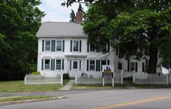 | Isaac Palmer House | 0.2 miles | 1988 |
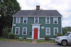 | Timothy Bradley House | 0.5 miles | 1988 |
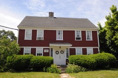 | Samuel Beach House | 0.5 miles | 1988 |
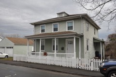 | Canoe Brook Historic District | 0.6 miles | 2002 |
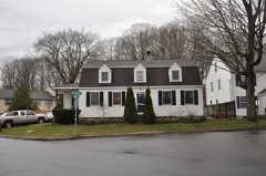 | Thomas Harrison House | 0.7 miles | 1988 |
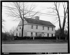 | Swain-Harrison House | 0.8 miles | 1975 |
| National Archives record | The nomination case file for reference 87000636 in Record Group 79. |
| New Haven County | All 272 listed properties in this county. |