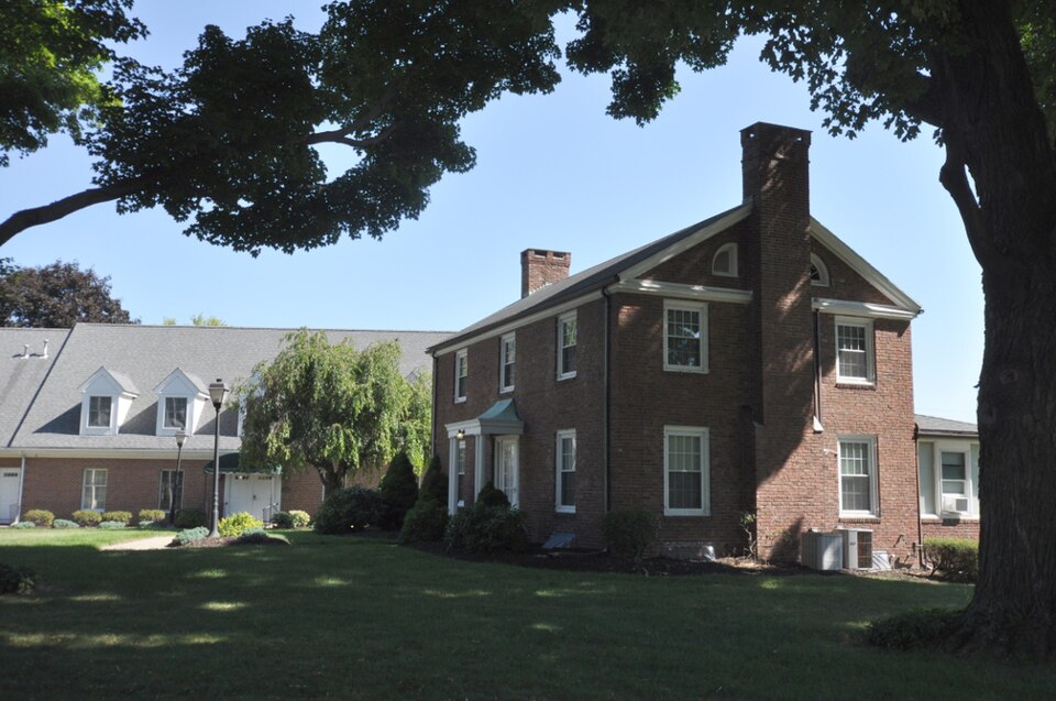
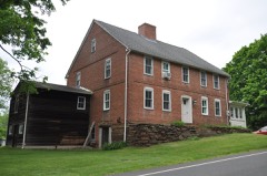
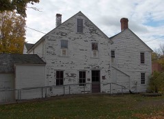
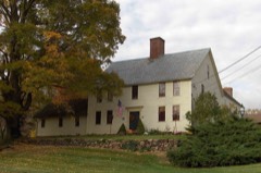
Listed on the National Register of Historic Places in 1988.
From the record
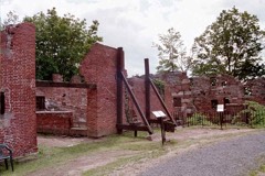
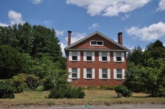
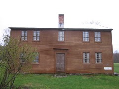
“The East Granby Historic District encompasses a predominantly rural and agricultural area of the town of East Granby, Connecticut. Extending northward from the town center and covering some two square miles, it includes one of the state's highest concentrations of surviving 18th and early 19th-century farmsteads, and a relatively little-altered landscape.”
Wikipedia article East Granby Historic District, CC BY-SA 4.0.
One of 451 National Register listings published here for Hartford County · listed in 1988 · category: District.
National Register reference number.88001318- the number the National Park Service assigned this property when it was listed, and the key its nomination file is catalogued under at the National Archives.
As early as 1793 an effort was made to have East Granby set off as a separate town, because Granby at that time reconsidered the vote under which the town-meeting was held once in three years at Turkey Hills. The limits then asked for the proposed town were practically those which were at last fixed upon.
The celebrated Simsbury copper-mine, where afterward was located for fifty-four years the Connecticut State prison called Newgate, was first known to the inhabitants of Simsbury in 1705. Two years later there was an association of such proprietors of the town as chose to subscribe to articles of agreement for the purpose of opening and working it. The location of the mine was about a hundred rods from the west ledge of the Talcott Mountain, at its highest point in East Granby, which is a point nearly as high as any in the same ridge in the State. The position is one of much picturesqueness and beauty. The period of greatest mining activity was from 1715 to 1737 ; during these years it was carried on in face of great dangers and greater discouragements arising from the newness of the country and the want of proper facilities of every nature pertaining to the business. The articles of agreement under which the subscribing proprietors, in 1707, undertook to work the mine, provided that, after deducting the expenses of the work, there be allowed to the town ten shillings on each ton of copper produced, and the residue be divided among the proprietors in proportion to their subscriptions. The company only dug the ore ; they did not undertake to smelt and refine it. In the same year they entered into a contract with Messrs. John Woodbridge, of Springfield, Dudley Woodbridge, of Simsbury, and Timothy Woodbridge, Jr., of Hartford, all clergymen, who agreed to run and refine the ore, and cast the metal into bars fit for transportation or a market ; and, after deducting the tenth part belonging to the town (of which two thirds was to be given for the maintenance of an able schoolmaster in Simsbury, and the other third to the collegiate school of Yale College), the residue was to be equally divided between them and the proprietors, or workers of the mine. The legislature, in 1709, passed an act vesting the right to control all matters relating to tlie mine in the major part of the proprietors, according to the interests of each ; and it was under arrangement with this organization that mining operations were carried on until the State began to use the mine as a prison. The act also provided for the adjudication of all matters in controversy between any and all persons connected with the mines, by a board of commissioners. During the mining excitement companies, organized in Boston, in London, and in Holland, expended large sums at Copper Hill. Governor Belcher, of Massachusetts, said in 1735 that he had spent £15,000 there. The mine most improved, and where the greatest excavation was made, was the one purchased for a prison. The most extensive workings, aside from those on Copper Hill, Avere known as Higley's mine, situated a little more than a mile southward, on land now owned by Hilton Griffin, and nearly west of the old vineyard gap in the mountain, where upon the map of ancient Simsbury Mr. Higley's house is seen to have been located. Mr. Edmund Quincy, of Boston, had a company of miners working here at the outbreak of the Revolutionary War ; soon afterward the works were abandoned. About 1737 Samuel Higley, here referred to, manufactured a rude copper coin which to some extent circulated as a representative of value in the vicinity, and has since been known as the Higley Copper. The coins are said to have passed current for " two and sixpence ; " presumably in paper, because their intrinsic value was only a penny. They were not all of one device ; but one now in the Connecticut His- A HIGLEY COPPER. torical Socicty, at Hartford, is here represented by engravings, showing both sides. Such a coin has now a cabinet value of perhaps a hundred dollars. The interest in the mines was very much abated after 1737. Of the ore dug, a considerable part Avas shipped to Europe ; some of it arrived safely, and was smelted. One cargo was reported lost in the English Channel, and one captured by the French. About 1721 smelting and refining works were built and secretly operated (to what extent is unknown) at a place in West Simsbury called Hanover by the Germans, who were then conducting the business. The locality has since retained the name.
Regional context, not property-specific
evidence. The
federal wildfire occurrence database
lists 29 fires within 5 miles of East Granby Historic District
between 1993 and 2020, burning about 24 acres in total. 2 started naturally. 1 was recorded as arson.
Distance is straight-line from the map coordinates, so a fire counted
here may appear on a neighbouring settlement's page as well.
Reported cause
Fires
Missing data/not specified/undetermined
18
Debris and open burning
4
Recreation and ceremony
3
Natural
2
Fireworks
1
Arson/incendiarism
1
The most recent of
them, most recent first, with the day each was reported and the service
that recorded it.
Regional context, not property-specific
evidence. The federal mineral resources record lists
32 workings within 5 miles of East Granby Historic District: 27 past producers, 5 producers.
5 still produce. What was taken out: Stone, Dimension, Stone, Crushed/Broken, Copper, Sand and Gravel, Construction. Distance is straight-line from the
map coordinates, so a quarry counted here may appear on a neighbouring
settlement's page as well.
Regional context, not property-specific
evidence. The National Weather Service names
East Granby, the town this property stands in, in 6 storm reports between 2008 and 2024: 5 thunderstorm wind, 1 hail.
No death or injury is recorded in these reports. Each account below is quoted exactly as the forecast office
filed it, from the NOAA Storm Events Database, and each date
opens the federal record of that event.
No historic map-sheet match is published
for this property yet. That does not mean no map exists. This record needs
a coordinate-quality review before it can be joined to a sheet boundary.
Browse the county's mapped places while that work is
pending.
Listed places nearby
6 within 8 miles
Other National Register properties close
enough to walk or drive between, ordered by distance from this one. Both
positions come from the same geocoding pass that matched these properties
to their map sheets.
Listing record. National Park Service National Register of Historic Places, listed-properties dataset, current to 2026-05-22.
Map join. Address geocoded through the United States Census geocoder, then tested against the published boundary of every sheet in the USGS Historical Topographic Map Collection.
How this page is made. Listing fields come from federal records; map-sheet coverage is a labelled coordinate-to-boundary calculation, not a source-field claim.
Wildfire. Short, Karen C. 2022. Spatial wildfire occurrence data for the United States, 1992-2020 [FPA_FOD_20221014]. 6th Edition. Fort Collins, CO: Forest Service Research Data Archive. https://doi.org/10.2737/RDS-2013-0009.6 Collected with United States Government funding and usable without additional permissions or fees.
Mines and quarries. USGS Mineral Resources Data System (MRDS) https://mrdata.usgs.gov/mrds/ A work of the United States government, no copyright under 17 U.S.C. 105.
Storms. NOAA National Centers for Environmental Information, Storm Events Database https://www.ncei.noaa.gov/stormevents/ A work of the United States government, no copyright under 17 U.S.C. 105. Narratives are quoted verbatim from the National Weather Service report and are not edited or summarised.
 Block