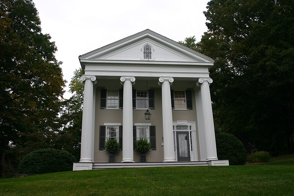
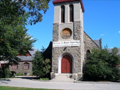
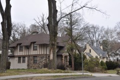
Listed on the National Register of Historic Places in 1988.
From the record
“The Josiah Wilcox House is a historic house at 354 Riversville Road in Greenwich, Connecticut. Built in 1838, it is one of the town's finest examples of Greek Revival architecture.”
Wikipedia article Josiah Wilcox House, CC BY-SA 4.0.
One of 298 National Register listings published here for Fairfield County · listed in 1988 · category: Building.
National Register reference number.88001344- the number the National Park Service assigned this property when it was listed, and the key its nomination file is catalogued under at the National Archives.
Jeftrey Ferris, made freeman in Boston in 1635, came with the first settlers, is on the list of those who paid for the survey, and received ten acres at the first assignment of land. Savage says he was from Watertown, Mass., where he was made freeman, probably May 6, 163."), whence he came to Wethersfield. He sold his lot in Wethersfield, of forty-five acres, to John Doming. He came with the first eohmy from Wethersfield, and in 1656 is one of the eleven Greenwich men who petitioned to be accepted under the New Haven jurisdiction. His will, found on the Probate records at Fairfield, is dated Jan. 6, 1664. He wills to the four boys he brought up ten pounds sterling apiece if they live with any of his children until they are eighteen years old, the money then to be put out for them until they are twenty years of age. His will names also his wife Judy, son James, son Jonathan Lockwood, and Mary Lockwood, son Peter's three children, and son Jo.soph's two. Judy Bowers, his widow, receipts for her widow's portion, March 6, 1667. His marriage contract with his wife Susannah, widow of Robert Lockwood, of date May 28, 1661, pledges certain legacies to the children of Robert Lockwood, deceased, and mortgages liis Greenwich lands and " housings." He died in 1666. The name Ferris is from Leicestershire, house of Feriors, tVom Henry, son of (iualelielme ile Feriers, to whom William the Con(|ueror gave large grants of land in the three shires of Staflbrd, Derby, and Leicester.
" Within hearing distance of the Stamford settlement* were three Dutch settlers who had excited tho wrath of the restless and brave Mayano. He nobly met them, armed ivs they were, with his bow and arrows, and brought two of them to the ground. The third only saved himself by a well-directed blow which laid the fearless savage at his feet ; and the daring of the fallen sachem had made the extermination of his tribe a necessity to the safety of the whites. A company of soldiiTs were inimeiliately dispatched to capture tlieiii. At Greenwich tlioy were directed liy ( 'apt. Patrick to the reiidezvou.s of the maddened Indians, lint on reaching it not a soul could be found. I'rocccdini; on into the Stamford settlement they find Patrick witli his own former comrade in arms, our Capt. John Underhill. Tlicy immediately suspect him of having given the Indians notice of their apjiroach. They taunt him with the treachery.
Regional context, not property-specific
evidence. The
federal wildfire occurrence database
lists 8 fires within 5 miles of Josiah Wilcox House
between 2016 and 2020, burning about 10 acres in total. None started naturally. 1 was recorded as arson.
Distance is straight-line from the map coordinates, so a fire counted
here may appear on a neighbouring settlement's page as well.
Reported cause
Fires
Missing data/not specified/undetermined
6
Arson/incendiarism
1
Power generation/transmission/distribution
1
The most recent of
them, most recent first, with the day each was reported and the service
that recorded it.
Regional context, not property-specific
evidence. The federal mineral resources record lists
3 workings within 5 miles of Josiah Wilcox House: 3 past producers.
None of them still produces. What was taken out: Stone, Dimension, Granite, Sand and Gravel, Construction. Distance is straight-line from the
map coordinates, so a quarry counted here may appear on a neighbouring
settlement's page as well.
Regional context, not property-specific
evidence. The National Weather Service names
Greenwich, the town this property stands in, in 31 storm reports between 1993 and 2022: 18 thunderstorm wind, 8 flash flood, 3 lightning, 1 hail.
The reports record 1 injury. Each account below is quoted exactly as the forecast office
filed it, from the NOAA Storm Events Database, and each date
opens the federal record of that event.
Dozens of trees were reported down throughout the town of Greenwich, including several into homes. A combination of the downed trees and associated power lines down closed all or parts of 62 roads in the town, including 2 southbound lanes of I-95 between exits 2 and 3. One of the uprooted trees broke a gas line at the intersection of Shore Road and Nawthorne Road. Some of these trees fell across the tracks for the New Haven Line for Metro-North, resulting in the suspension of service along this line in both directions between Stamford, CT and Harrison NY.
Dozens of trees were reported down, with ten roads blocked by fallen trees throughout the town of Greenwich. One home along Knollwood Drive received significant damage when a tree fell on it.
As a line of showers and thunderstorms moved east, it produced torrential rains. Rainfall amounts of up to three to four inches resulted in significant street flooding in Greenwich as reported by a trained spotter.
A gust to 59 mph was recorded at the Sikorsky Memorial Airport National Weather Service Office in Stratford. One small plane flipped over. Additionally, considerable tree and power line damage was reported in Greenwich and Darien by Darien Police.
No historic map-sheet match is published
for this property yet. That does not mean no map exists. This record needs
a coordinate-quality review before it can be joined to a sheet boundary.
Browse the county's mapped places while that work is
pending.
Listed places nearby
6 within 8 miles
Other National Register properties close
enough to walk or drive between, ordered by distance from this one. Both
positions come from the same geocoding pass that matched these properties
to their map sheets.
Listing record. National Park Service National Register of Historic Places, listed-properties dataset, current to 2026-05-22.
Map join. Address geocoded through the United States Census geocoder, then tested against the published boundary of every sheet in the USGS Historical Topographic Map Collection.
How this page is made. Listing fields come from federal records; map-sheet coverage is a labelled coordinate-to-boundary calculation, not a source-field claim.
Wildfire. Short, Karen C. 2022. Spatial wildfire occurrence data for the United States, 1992-2020 [FPA_FOD_20221014]. 6th Edition. Fort Collins, CO: Forest Service Research Data Archive. https://doi.org/10.2737/RDS-2013-0009.6 Collected with United States Government funding and usable without additional permissions or fees.
Mines and quarries. USGS Mineral Resources Data System (MRDS) https://mrdata.usgs.gov/mrds/ A work of the United States government, no copyright under 17 U.S.C. 105.
Storms. NOAA National Centers for Environmental Information, Storm Events Database https://www.ncei.noaa.gov/stormevents/ A work of the United States government, no copyright under 17 U.S.C. 105. Narratives are quoted verbatim from the National Weather Service report and are not edited or summarised.
 Block