Listed on the National Register of Historic Places in 1988.
From the record
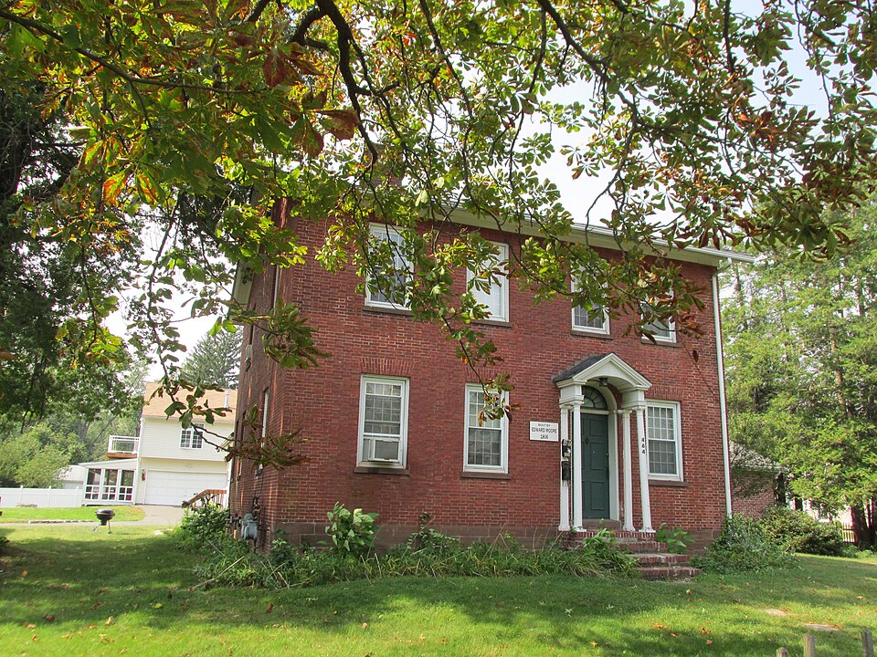
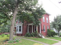
“The Edward and Ann Moore House is a historic house at 464 Broad Street in Windsor, Connecticut. Built in 1806, it is a good example of Federal style residential architecture executed in brick.”
Wikipedia article Edward and Ann Moore House, CC BY-SA 4.0.
One of 451 National Register listings published here for Hartford County · listed in 1988 · category: Building.
Also known as. 18th and 19th Century Brick Architecture of Windsor TR
Town. Windsor town
Architectural style. Federal architecture
National Register reference number.88001478- the number the National Park Service assigned this property when it was listed, and the key its nomination file is catalogued under at the National Archives.
DURING the year 1631, Wahginnacut, an Indian sachem from the Connecticut River, visited the governors of Massachusetts and Plymouth colonies, in order to induce emigration to the Connecticut valley from both these colonies. He pleaded as an inducement the fruitfulness of the country, the opportunity for trade in such commodities as corn, and the skins of the beaver and otter ; and he pledged an annual present of a full supply of corn and eighty beaverskins to the Englishmen who would settle in tlie valley. Governor Winthrop courteously declined the proposition, but Governor Winslow, of Plymouth, consented to go and view the savage paradise. His visit must have been satisfactory, for he called himself the " discoverer" of the river and the valley;^ and his favorable account no doubt incited the ardor of other explorers who soon followed. The earnest solicitation of the Indian sachem may be accounted for in the fact that the river Indians Avere distressed and alarmed because Pekoath, the great sachem of the Pequots, had made war with them and was driving them from the countrv. The assistance of an EuR-lish settlement was desired, therefore, as a protection and defence against their powerful enemies. The Plymouth people, notwithstanding the refusal of the Massachusetts colony to unite Avith them, determined to form a trading-company and to establish a trading-post. In September, 1633, John Oldham and three others from Dorchester made the journey to the Connecticut through the wilderness. The native chiefs showed him kindness and made him ])res(mts, and he carried back with him to Dorchester specimens of black lead and Indian hemp. William Holmes was selected by the governor of Plymouth to build a trading-house in Windsor. With this commission, in the latter part of October, in " a large new bark," with a daring and adventurous crew, he set sail for
Saltonstall. In tliis conflict of claims Stiles was at length thwarted, and he removed his stores to a place near where the residence of the late Chief Justice Ellsworth was built. The Dorchester party and the Plymouth people now held the land in dispute. The latter claimed the prior right of purchase and occupation, and the former relied upon the tender mercies of God's providence. The Dorchester men therefore continued to prepare and improve this '" Lord's waste " of Matianuck (Windsor) as the future abode of themselves and their children. The main body of the Dorchester people followed on the loth of October, 1635. Their household goods and ])rovisions were sent around by water, and sixty persons, among whom were women and little children, began the slow and wearisome journey through the wilderness to the distant settlement. They drove their cattle, horses, and swine before them, and the frosts and snows of winter were hard upon them ere they reached their destination. The river was frozen over by the loth of November, and the vessel containing their goods had not arrived. The winter which followed was marked by great suffering. They had insufficient shelter for themselves and their animals, and they could get but part of the latter across the river. On the 26th of November thirteen of the number resolved to return to Massachusetts. One of them fell through the ice and was drowned ; the rest reached Dorchester in ten days. Those who remained in Connecticut suffered extreme destitution, being obliged to live on acorns, malt, and grains. Winthrop tells us that they lost nearly X 2,000 worth of cattle. Most of this first party returned to Dorchester in the small vessel " Rebecca," which had providentially aj> peared. But, nothing daunted, in the spring of 1636 they set out again with Mr. Warham, the junior pastor of the church, and a large part of its meml.)ers. With those from Dorchester thei'e came others from Cambi'idge and Watertown. Matianuck was first called Dorchester. In February, 1637, the name was changed to Windsor.^ Notwithstanding the efforts of the colonial government to discourage emigration, it did not cease until 1637.
Regional context, not property-specific
evidence. The
federal wildfire occurrence database
lists 17 fires within 5 miles of Edward and Ann Moore House
between 1992 and 2020, burning about 26 acres in total. None started naturally. 2 were recorded as arson.
Distance is straight-line from the map coordinates, so a fire counted
here may appear on a neighbouring settlement's page as well.
Reported cause
Fires
Missing data/not specified/undetermined
10
Debris and open burning
3
Arson/incendiarism
2
Misuse of fire by a minor
1
Other causes
1
The most recent of
them, most recent first, with the day each was reported and the service
that recorded it.
Regional context, not property-specific
evidence. The federal mineral resources record lists
13 workings within 5 miles of Edward and Ann Moore House: 8 past producers, 4 producers, 1 unknown.
4 still produce. What was taken out: Sand and Gravel, Construction, Clay, Flagstone, Stone, Dimension. Distance is straight-line from the
map coordinates, so a quarry counted here may appear on a neighbouring
settlement's page as well.
Regional context, not property-specific
evidence. The National Weather Service names
Windsor, the town this property stands in, in 55 storm reports between 1994 and 2025: 34 thunderstorm wind, 14 hail, 4 flash flood, 2 flood.
The reports record 12 injuries. Each account below is quoted exactly as the forecast office
filed it, from the NOAA Storm Events Database, and each date
opens the federal record of that event.
Trees and wires were downed throughout South Windsor. Several roads were closed due to this damage, including: Ellington Road between Pierce Road and Deming Street and Niederwerfer Road at the East Windsor town line.
A fast-moving squall line of severe thunderstorms moving toward the east-southeast resulted in numerous reports of damaging winds across the northern portion of the state. The storms were part of a major mesoscale convective complex (derecho) that had tracked across the Great Lakes Region and New York State during the early morning hours. Many trees and power lines were knocked down by winds that reportedly gusted up to 60 mph. Up to 50,000 electric customers were reported to have lost power in Litchfield County.
A severe thunderstorm produced large hail, gusty winds, and lightning strikes, which caused property damage. At Vernon, the hail began falling small and increased to baseball-size. Lightning struck three buildings in Somers and trees and wires were knocked down in East Windsor and Ellington. Baseball-size hail fell in Manchester. Trees and wires were knocked down in Bolton and Andover. The large hailstones broke windows and damaged many automobiles. Damage was estimated at up to several hundred thousand dollars.
No historic map-sheet match is published
for this property yet. That does not mean no map exists. This record needs
a coordinate-quality review before it can be joined to a sheet boundary.
Browse the county's mapped places while that work is
pending.
Listed places nearby
6 within 8 miles
Other National Register properties close
enough to walk or drive between, ordered by distance from this one. Both
positions come from the same geocoding pass that matched these properties
to their map sheets.
Listing record. National Park Service National Register of Historic Places, listed-properties dataset, current to 2026-05-22.
Map join. Address geocoded through the United States Census geocoder, then tested against the published boundary of every sheet in the USGS Historical Topographic Map Collection.
How this page is made. Listing fields come from federal records; map-sheet coverage is a labelled coordinate-to-boundary calculation, not a source-field claim.
Wildfire. Short, Karen C. 2022. Spatial wildfire occurrence data for the United States, 1992-2020 [FPA_FOD_20221014]. 6th Edition. Fort Collins, CO: Forest Service Research Data Archive. https://doi.org/10.2737/RDS-2013-0009.6 Collected with United States Government funding and usable without additional permissions or fees.
Mines and quarries. USGS Mineral Resources Data System (MRDS) https://mrdata.usgs.gov/mrds/ A work of the United States government, no copyright under 17 U.S.C. 105.
Storms. NOAA National Centers for Environmental Information, Storm Events Database https://www.ncei.noaa.gov/stormevents/ A work of the United States government, no copyright under 17 U.S.C. 105. Narratives are quoted verbatim from the National Weather Service report and are not edited or summarised.
 Block