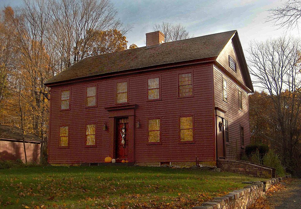
Listed on the National Register of Historic Places in 1989.
From the record
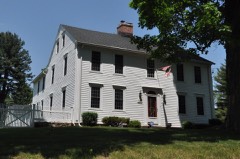
“The Luman Andrews House is a historic house at 469 Andrews Street in Southington, Connecticut. Built in 1745, it is one of the oldest houses in Southington.”
Wikipedia article Luman Andrews House, CC BY-SA 4.0.
One of 451 National Register listings published here for Hartford County · listed in 1989 · category: Building.
National Register reference number.88003095- the number the National Park Service assigned this property when it was listed, and the key its nomination file is catalogued under at the National Archives.
The sandstone between the mountains has been worn away by glacial action and covered by alluvium, except at the base of the trap and in a ridge called Wolf Hill, Avhich extends from the north eiid of the town to the confluence of the Quinnii)iac and Eight Mile rivers. As a rule this sandstone is shaly, contains much potash and considerable magnesia, and on exposure to the surface readily crumbles into a productive soil. Near Hanging Hills, however, it is a coarse conglomerate suitable for building-stone. Its strata have a uniform dip to the east of about twenty-five degrees. The alluvium between the mountains is deposited at an average level of about 225 feet above the sea.^ A large part of its surface consists of two plains. The lirst, lying east of the Quinnipiac, formerly called " Nashaway plain," is 225 feet high, and the second, in the southwest part of the town, anciently named the " little plain," is 216 feet high. The tops of the hills near Southington Centre are mostly on a level with Nashaway plain, - only one, the highest, behig thirteen feet higher.^ The northern part of the town is a low plain, probably 160 feet high. The soil of these plains is sandy. A narrow belt of clay extends from the West Mountain half across the valley near the southern part. The strongest land, well adapted to grazing, is on Wolf Hill and at the bases of the mountains on either side where the sandstone comes near the surface.
About the year 1696 Samuel Woodruff, a son of one of the original proprietors of Farmington, established himself at a place afterward called Pudding Hill. He built a house there, and brought his family from Farmington in 1698. It is confidently believed that he was the first settler within the limits of Southington. The site of his house is still pointed out a few rods north of the residence of Adna N. Woodruff, a descendant of the fifth generation.
Regional context, not property-specific
evidence. The
federal wildfire occurrence database
lists 69 fires within 5 miles of Luman Andrews House
between 1992 and 2020, burning about 272 acres in total. None started naturally. 11 were recorded as arson.
Distance is straight-line from the map coordinates, so a fire counted
here may appear on a neighbouring settlement's page as well.
Reported cause
Fires
Missing data/not specified/undetermined
37
Arson/incendiarism
11
Recreation and ceremony
8
Misuse of fire by a minor
4
Debris and open burning
4
Smoking
3
Equipment and vehicle use
2
The most recent of
them, most recent first, with the day each was reported and the service
that recorded it.
Regional context, not property-specific
evidence. The federal mineral resources record lists
43 workings within 5 miles of Luman Andrews House: 30 past producers, 11 producers, 1 unknown, 1 occurrence.
11 still produce. What was taken out: Stone, Crushed/Broken, Stone, Dimension, Sand and Gravel, Construction, Barium-Barite. Distance is straight-line from the
map coordinates, so a quarry counted here may appear on a neighbouring
settlement's page as well.
Regional context, not property-specific
evidence. The National Weather Service names
Southington, the town this property stands in, in 29 storm reports between 1993 and 2024: 15 thunderstorm wind, 10 flash flood, 3 hail, 1 lightning.
No death or injury is recorded in these reports. Each account below is quoted exactly as the forecast office
filed it, from the NOAA Storm Events Database, and each date
opens the federal record of that event.
Numerous trees were downed by straight line winds throughout Southington. These included trees on West Queen Street and Dunham Road, as well as a tree downed onto a car on Oakland Drive.
A thunderstorm dropped hail varying in size from pennies to golf balls in Southington. A few cars sustained hail damage from some of the bigger hailstones.
Large limbs were downed in Simsbury and Southington while lightning caused a fire which destroyed a hay-filled 200-year-old barn in Glastonbury. This lightning/wind event was the first of many in Connecticut that knocked out power to at least 44,000 customers that afternoon.
No historic map-sheet match is published
for this property yet. That does not mean no map exists. This record needs
a coordinate-quality review before it can be joined to a sheet boundary.
Browse the county's mapped places while that work is
pending.
Listed places nearby
6 within 8 miles
Other National Register properties close
enough to walk or drive between, ordered by distance from this one. Both
positions come from the same geocoding pass that matched these properties
to their map sheets.
Listing record. National Park Service National Register of Historic Places, listed-properties dataset, current to 2026-05-22.
Map join. Address geocoded through the United States Census geocoder, then tested against the published boundary of every sheet in the USGS Historical Topographic Map Collection.
How this page is made. Listing fields come from federal records; map-sheet coverage is a labelled coordinate-to-boundary calculation, not a source-field claim.
Wildfire. Short, Karen C. 2022. Spatial wildfire occurrence data for the United States, 1992-2020 [FPA_FOD_20221014]. 6th Edition. Fort Collins, CO: Forest Service Research Data Archive. https://doi.org/10.2737/RDS-2013-0009.6 Collected with United States Government funding and usable without additional permissions or fees.
Mines and quarries. USGS Mineral Resources Data System (MRDS) https://mrdata.usgs.gov/mrds/ A work of the United States government, no copyright under 17 U.S.C. 105.
Storms. NOAA National Centers for Environmental Information, Storm Events Database https://www.ncei.noaa.gov/stormevents/ A work of the United States government, no copyright under 17 U.S.C. 105. Narratives are quoted verbatim from the National Weather Service report and are not edited or summarised.
 Block