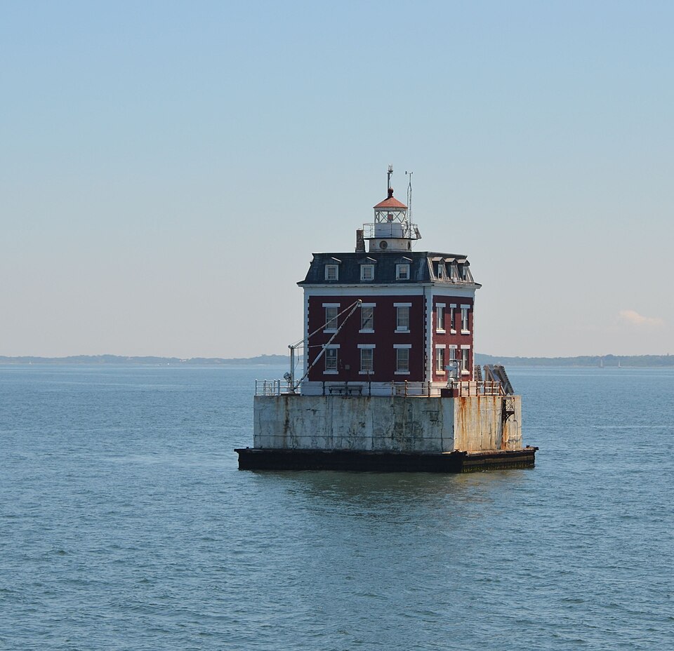
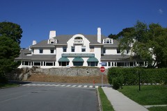
Built in 1909 (Second Empire architecture in Europe). Listed on the National Register of Historic Places in 1990.
From the record
“New London Ledge Lighthouse is a lighthouse on the Thames River in the U.S. state of Connecticut, at the mouth of New London Harbor. It was built in 1909 in the Second Empire style and was automated in 1987.”
Wikipedia article New London Ledge Light, CC BY-SA 4.0.
One of 197 National Register listings published here for New London County · listed in 1990 · category: Structure · built in 1909, Second Empire architecture in Europe.
Also known as. Operating Lighthouses in Connecticut MPS
Town. Groton town
When was it built? 1909
Architectural style. Second Empire architecture in Europe
National Register reference number.89001471- the number the National Park Service assigned this property when it was listed, and the key its nomination file is catalogued under at the National Archives.
Of Thomas Mumford, so often mentioned in townmeetings before, during, and after the war, a passing word may properly be said. He was first chosen to the office of selectman in 1759, and was termed Ensign Mumford as early as 1766. He was in the first, or Groton Bank company, there being five military companies in the town. He was one of the foremost and most efficient of the Sons of Liberty. The historian of New London, already quoted, says, "Thomas Mumford, of Groton, belonged to that company of gentlemen, eleven in number, who in April, 1775, formed the project of taking Ticonderoga. This undertaking, so eminently successful, was wholly concerted in Connecticut, without any authority from Congress. Mumford was first selectman through the earlier years of the war, and was the financial manager of the affiiirs of Groton; in constant communication with fellow-patriots in other towns and in other States, a man in whom Governor Trumbull trusted, and the confidential adviser with Deane and others. In 1778 he was one of a committee appointed by Congress to receive and sign emissions of bills. He was
In the autumn of 1775 the formal report of the committee on fortifications was made, urging immediate action in addition to what had been accomplished by private and patriotic enterprise. Six persons were designated to superintend the work, among whom were Ebenezer Ledyard and Capt. Peter Avery, two leading citizens. It was in December, 1776, that the name of the Governor was given to the fort on the New London side, and the name of the Lieutenant- Governor to the Groton Heights fort, names never thereafter to be forgotten. Col. Mott was the engineer of the latter fortification. Ledyard first took possession of it with his artillery company July 3, 1776, and subsequently, as we shall see, had charge of all the fortifications on both sides of the river and at Stonington.
Regional context, not property-specific
evidence. The
federal wildfire occurrence database
lists 11 fires within 5 miles of New London Ledge Lighthouse
between 1992 and 2018, burning about 81 acres in total. None started naturally. None was recorded as arson.
Distance is straight-line from the map coordinates, so a fire counted
here may appear on a neighbouring settlement's page as well.
Reported cause
Fires
Missing data/not specified/undetermined
6
Recreation and ceremony
3
Debris and open burning
2
The most recent of
them, most recent first, with the day each was reported and the service
that recorded it.
Regional context, not property-specific
evidence. The federal mineral resources record lists
36 workings within 5 miles of New London Ledge Lighthouse: 31 past producers, 4 producers, 1 prospect.
4 still produce. What was taken out: Stone, Dimension, Sand and Gravel, Construction, Stone, Granite. Distance is straight-line from the
map coordinates, so a quarry counted here may appear on a neighbouring
settlement's page as well.
Regional context, not property-specific
evidence. The National Weather Service names
New London, the town this property stands in, in 21 storm reports between 1995 and 2023: 16 flash flood, 3 hail, 1 thunderstorm wind, 1 flood.
No death or injury is recorded in these reports. Each account below is quoted exactly as the forecast office
filed it, from the NOAA Storm Events Database, and each date
opens the federal record of that event.
Several roads are closed in urban areas of New London including Broad St, Bank St, Garfield Ave, and Shaw St. Spotter reports 2 inches of rain in 2 hours.
Several roads were closed due to flooding in New London including Broad Street at Ledyard Street, Bank Street between Howard Street and Tilley Street, Bank Street at Truman Street, Pequot Avenu at Green Harbor Beach, and Garfield Avenue at Elm Street.
Torrential rains caused flash flooding of streets in New London. Flash flooding of State Street poured into businesses. The torrential rains were caused by the interaction of offshore Tropical Storm Ophelia and a cold front to the west of CT.
No historic map-sheet match is published
for this property yet. That does not mean no map exists. This record needs
a coordinate-quality review before it can be joined to a sheet boundary.
Browse the county's mapped places while that work is
pending.
Listed places nearby
6 within 8 miles
Other National Register properties close
enough to walk or drive between, ordered by distance from this one. Both
positions come from the same geocoding pass that matched these properties
to their map sheets.
Listing record. National Park Service National Register of Historic Places, listed-properties dataset, current to 2026-05-22.
Map join. Address geocoded through the United States Census geocoder, then tested against the published boundary of every sheet in the USGS Historical Topographic Map Collection.
How this page is made. Listing fields come from federal records; map-sheet coverage is a labelled coordinate-to-boundary calculation, not a source-field claim.
Wildfire. Short, Karen C. 2022. Spatial wildfire occurrence data for the United States, 1992-2020 [FPA_FOD_20221014]. 6th Edition. Fort Collins, CO: Forest Service Research Data Archive. https://doi.org/10.2737/RDS-2013-0009.6 Collected with United States Government funding and usable without additional permissions or fees.
Mines and quarries. USGS Mineral Resources Data System (MRDS) https://mrdata.usgs.gov/mrds/ A work of the United States government, no copyright under 17 U.S.C. 105.
Storms. NOAA National Centers for Environmental Information, Storm Events Database https://www.ncei.noaa.gov/stormevents/ A work of the United States government, no copyright under 17 U.S.C. 105. Narratives are quoted verbatim from the National Weather Service report and are not edited or summarised.
 Block