BlockBefore
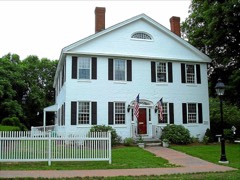
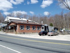
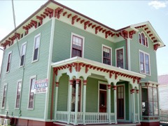
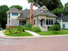
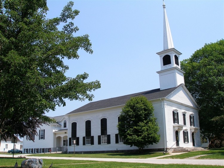
Photograph of Columbia Green Historic District
Photograph by Jerry Dougherty, CC BY 2.5. Via Wikimedia Commons.

Columbia Green Historic District

Listed on the National Register of Historic Places in 1990.

From the record

“Columbia Green Historic District is a historic district that includes the town green, Columbia Green, of the town of Columbia, Connecticut, United States. The district includes buildings around the green and extending northwest along Route 87.”

Wikipedia article Columbia Green Historic District, CC BY-SA 4.0.

One of 47 National Register listings published here for Tolland County · listed in 1990 · category: District.

Sources: the Wikipedia article · the case file at the National Archives · the National Register database, National Park Service
The listing

  • Address. Along CT 87 at jct. with CT 66, Columbia, 06237
  • When was it listed? December 1990
  • Category. district
  • Town. Columbia town
  • National Register reference number. 90001759 - the number the National Park Service assigned this property when it was listed, and the key its nomination file is catalogued under at the National Archives.

Fires near this property

75 since 1992

Regional context, not property-specific evidence. The federal wildfire occurrence database lists 75 fires within 5 miles of Columbia Green Historic District between 1992 and 2020, burning about 94 acres in total. None started naturally. 4 were recorded as arson. Distance is straight-line from the map coordinates, so a fire counted here may appear on a neighbouring settlement's page as well.

Reported cause Fires
Missing data/not specified/undetermined47
Debris and open burning11
Recreation and ceremony5
Arson/incendiarism4
Smoking4
Power generation/transmission/distribution2
Misuse of fire by a minor1
Equipment and vehicle use1

The most recent of them, most recent first, with the day each was reported and the service that recorded it.

DateCause SizeReported by Name on the report
5 September 2016Missing data/not specified/undeterminedunder an acreConnecticut Division of Forestry164 LEONARD BRIDGE RD, LEBANON CT
5 September 2016Arson/incendiarism2.0 acresConnecticut Division of ForestryLEONARDS BRIDGE ROAD
25 September 2020Recreation and ceremonyunder an acreConnecticut Division of Forestry60 HENNEQUIN ROAD
7 August 2008Missing data/not specified/undeterminedunder an acreConnecticut Division of Forestrynot named
10 August 2008Missing data/not specified/undeterminedunder an acreConnecticut Division of Forestrynot named
3 July 2016Power generation/transmission/distributionunder an acreConnecticut Division of ForestrySTAFFORD RD / STEARNS RD MANSFIELD CT
25 July 2010Missing data/not specified/undetermined1.0 acresConnecticut Division of Forestrynot named
16 July 2015Missing data/not specified/undeterminedunder an acreConnecticut Division of Forestrynot named

Every fire recorded in Tolland County

Mines and quarries near this property

10 of 31 shown

Regional context, not property-specific evidence. The federal mineral resources record lists 31 workings within 5 miles of Columbia Green Historic District: 28 past producers, 3 producers. 3 still produce. What was taken out: Stone, Stone, Dimension, Sand and Gravel, Construction, Granite. Distance is straight-line from the map coordinates, so a quarry counted here may appear on a neighbouring settlement's page as well.

Where SiteCommodity StatusRecorded
Larrabee QuarryGranitePast Producer
QuarryGranitePast Producer
Columbia Town PitSand and Gravel, ConstructionPast Producer
Richard Lee PitSand and Gravel, ConstructionPast ProducerSedimentary
Richard Lee PitSand and Gravel, ConstructionProducer
Alaskite Or Quartz Monzonite Gneiss Rock Quarry No. Aj-007StoneProducer
Flagstone QuarryStone, DimensionPast Producer
Gabbro Rock Quarry No. Aj-015StonePast Producer
Gneiss Rock Quarry No. Aj-012StoneProducer
Gneiss Rock Quarry No. Aj-003StonePast Producer

Every working recorded in Tolland County

Storms near this property

8 since 1999

Regional context, not property-specific evidence. The National Weather Service names Columbia, the town this property stands in, in 8 storm reports between 1999 and 2024: 7 thunderstorm wind, 1 hail. No death or injury is recorded in these reports. Each account below is quoted exactly as the forecast office filed it, from the NOAA Storm Events Database, and each date opens the federal record of that event.

WhenEvent Place namedHarm What the report says
July 2022Thunderstorm WindColumbia$30,000In Columbia, a billboard was blown down on Route 66 East. Trees were downed on Cherry Valley Road, Flanders River Road, Cards Mill Road, and Old Willimantic Road. A tree and wires were down on both Newberry Road and on Devonshire Lane, per the Fire Department. Reports were relayed to NWS via amateur radio operators.
July 2011Thunderstorm WindColumbia$3,000A tree on Route 66 was downed by thunderstorm winds.
July 2021Thunderstorm WindColumbia$1,300In Columbia, trees and wires were down on Old Willimantic Road.
June 2024Thunderstorm WindColumbia$800In Columbia, trees and wires were down.
July 2023Thunderstorm WindColumbia$500In Columbia, a tree was down on Old Willimantic Rd.
July 2023Thunderstorm WindColumbia$300In Columbia, a 2 inch diameter tree limb snapped from the top of a tree.
May 2000HailColumbia-no account filed
July 1999Thunderstorm WindColumbia-no account filed

Every storm recorded in Tolland County

Map coverage status

No historic map-sheet match is published for this property yet. That does not mean no map exists. This record needs a coordinate-quality review before it can be joined to a sheet boundary. Browse the county's mapped places while that work is pending.

Listed places nearby

6 within 8 miles

Other National Register properties close enough to walk or drive between, ordered by distance from this one. Both positions come from the same geocoding pass that matched these properties to their map sheets.

Photograph PropertyDistance Listed
Parker-Hutchinson Farm2.9 miles1982
Andover Center Historic District4.3 miles2003
Post, Augustus, House4.5 miles1982
South Coventry Historic District4.5 miles1991
Capron-Phillips House4.5 miles1982
Hebron Center Historic District4.5 miles1993

Sources for this property

National Archives recordThe nomination case file for reference 90001759 in Record Group 79.
Wikipedia articleCommunity-written account of this property, licensed CC BY-SA.
Tolland CountyAll 47 listed properties in this county.

Provenance

  • Listing record. National Park Service National Register of Historic Places, listed-properties dataset, current to 2026-05-22.
  • Map join. Address geocoded through the United States Census geocoder, then tested against the published boundary of every sheet in the USGS Historical Topographic Map Collection.
  • How this page is made. Listing fields come from federal records; map-sheet coverage is a labelled coordinate-to-boundary calculation, not a source-field claim.
  • Wildfire. Short, Karen C. 2022. Spatial wildfire occurrence data for the United States, 1992-2020 [FPA_FOD_20221014]. 6th Edition. Fort Collins, CO: Forest Service Research Data Archive. https://doi.org/10.2737/RDS-2013-0009.6 Collected with United States Government funding and usable without additional permissions or fees.
  • Mines and quarries. USGS Mineral Resources Data System (MRDS) https://mrdata.usgs.gov/mrds/ A work of the United States government, no copyright under 17 U.S.C. 105.
  • Storms. NOAA National Centers for Environmental Information, Storm Events Database https://www.ncei.noaa.gov/stormevents/ A work of the United States government, no copyright under 17 U.S.C. 105. Narratives are quoted verbatim from the National Weather Service report and are not edited or summarised.