Block
From the record
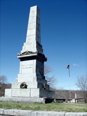
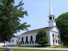
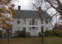
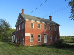
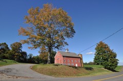
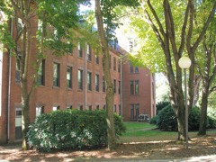
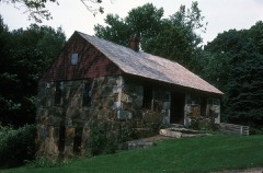
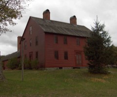
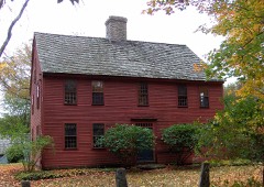
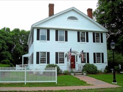
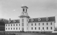
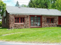
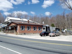
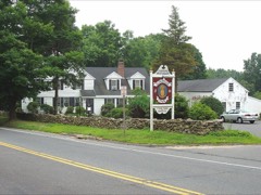
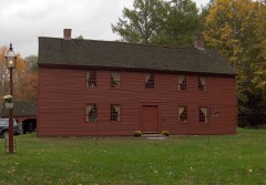
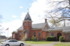
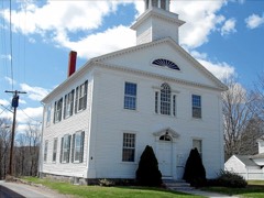
47 National Register listings published here.
Sources: the National Register database, National Park Service
214 topographic sheets cover 53 settlements here, and 47 properties are on the National Register of Historic Places.
47 National Register listings published here.
Sources: the National Register database, National Park Service
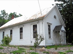
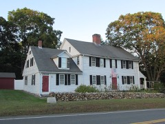
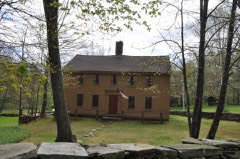
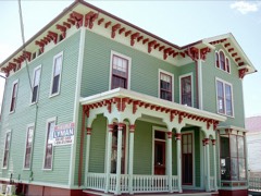
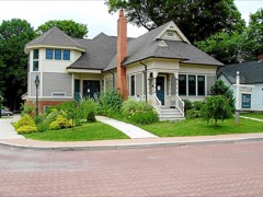
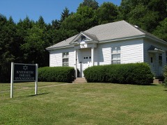
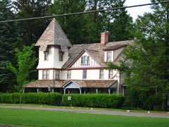
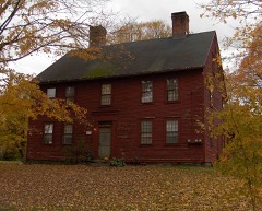
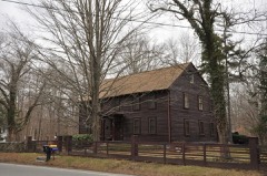
Every property in this county listed on the National Register of Historic Places, with the year it was listed and the federal nomination document.
Every wildfire the federal occurrence database records inside this county: 641 of them, burning about 713 acres. 1 started naturally and 31 were recorded as arson. Each settlement page carries the fires within five miles of it.
| Reported cause | Fires |
|---|---|
| Missing data/not specified/undetermined | 406 |
| Debris and open burning | 78 |
| Recreation and ceremony | 41 |
| Smoking | 39 |
| Arson/incendiarism | 31 |
| Misuse of fire by a minor | 17 |
| Equipment and vehicle use | 13 |
| Railroad operations and maintenance | 7 |
| Power generation/transmission/distribution | 5 |
| Fireworks | 2 |
| Other causes | 1 |
| Natural | 1 |
The five largest, by the area the report gives. Four of them were set deliberately.
| Date | Cause | Size | Reported by | Name on the report |
|---|---|---|---|---|
| 8 April 1999 | Arson/incendiarism | 45 acres | Connecticut Division of Forestry | not named |
| 14 March 1992 | Equipment and vehicle use | 25 acres | Connecticut Division of Forestry | not named |
| 20 April 1994 | Recreation and ceremony | 15 acres | Connecticut Division of Forestry | not named |
| 8 April 1999 | Arson/incendiarism | 15 acres | Connecticut Division of Forestry | not named |
| 7 March 2000 | Debris and open burning | 12 acres | Connecticut Division of Forestry | not named |
| 30 April 1999 | Arson/incendiarism | 12 acres | Connecticut Division of Forestry | not named |
| 15 March 2000 | Arson/incendiarism | 11 acres | Connecticut Division of Forestry | not named |
| 12 May 2001 | Recreation and ceremony | 10 acres | Connecticut Division of Forestry | not named |
Every settlement page carries the fires within five miles of it - see the settlement index below.
The NOAA Storm Events Database holds 327 reports for this county, causing no deaths, 11 injuries and about $2,057,150 in recorded property damage. Each settlement page carries the reports that name it.
| Kind of event | Reports |
|---|---|
| Thunderstorm Wind | 212 |
| Hail | 61 |
| Tornado | 15 |
| Heavy Rain | 10 |
| Lightning | 10 |
| Flood | 10 |
| Flash Flood | 7 |
| Funnel Cloud | 2 |
The most serious of them, by death, then injury, then recorded damage. The accounts are quoted exactly as the forecast office filed them.
| When | Event | Place named | Harm | What the report says |
|---|---|---|---|---|
| March 2011 | Flood | Somersville | 3 hurt | The Willimantic River at Coventry went above flood cresting above the moderate flood stage of 11 feet. In Ellington, Route 140 was closed near its intersection with Route 30 because of flooding. Portions of Routes 6 and 66 in Columbia were also closed due to flooding. Portions of Freshwater Boulevard in Enfield were flooded. In Somers, portions of Durkee, Four Bridges, and King Roads adjacent to the Scantic River flooded. Two cars got stuck on Flanders River Road in Coventry after it was closed due to flooding and had to be towed out by the fire department. The drivers of both cars and a passenger were taken to Windham Community Memorial Hospital after showing signs of hypothermia. |
| September 1958 | Tornado (F2) | not stated | 2 hurt, $250,000 | no account filed |
| May 1954 | Tornado (F3) | not stated | 2 hurt, $25,000 | no account filed |
| July 2012 | Lightning | Herbron | 1 hurt, $10,000 | A tree was struck by lightning, falling on a man's house and ripping out some of the power lines. The lightning travelled through the house, likely through the plumbing, sending a jolt through the man's arm as he was brushing his teeth, holding his hand in the running water. |
| July 2025 | Lightning | Sadds Mill | 1 hurt | In Ellington, on Jobs Hill Rd a person was struck by lightning with arm numbness reported. |
| August 2016 | Lightning | Quarryville | 1 hurt | Lightning struck at Twin Hills Country Club, causing an elderly man to collapse. When first responders arrived, the man was conscious, alert, and refused transport to the hospital. |
| August 2012 | Lightning | Mansfield | 1 hurt | A man was struck by lightning inside his house. He is expected to be alright. |
| June 1995 | Hail | Ellington | $200,000 | no account filed |
| July 2010 | Lightning | Vernon | $75,000 | A house was struck by lightning in Vernon which ignited a fire. |
| August 2021 | Flash Flood | Talcottville | $60,000 | In Vernon, the Hockanum River overflowed a roadway connecting Hartford Turnpike to the Colonial Corners shopping plaza, a motel, and a few other businesses. A significant amount of damage was done to the area parking lot. The motel guests were trapped by flood waters. Local officials created an egress onto I-84 to evacuate people from the motel. Other flooding was reported on Burke Road in Vernon. A CoCoRaHS observer in Vernon recorded 4.95 inches of rain for the two-day total from Henri. In nearby Hebron, 5.62 inches was recorded by a CoCoRaHS observer. |
| July 2016 | Thunderstorm Wind | Ellington | $50,000 | Twelve to fifteen trees along Main Street between Tomoka Avenue and West Road were downed by thunderstorm winds. |
| July 2014 | Thunderstorm Wind | Tolland | $50,000 | A microburst occurred with winds 80-90 mph downing numerous trees and wires on Interstate 195, Goose Lane, and Cedar Mill, Reed and Mile Hill Roads. |
| July 2013 | Tornado (EF1) | Andover | $50,000 | The NWS survey team found a discontinuous damage path approximately eleven miles long and 100 yards wide that extended from Andover to Mansfield, Connecticut. Most of the damage was to trees. Trees were both uprooted and in other parts of the path tops were snapped off the trees. The only structural damage was to a sheet metal barn that was torn apart. |
| July 2021 | Tornado (EF0) | Somers | $45,000 | In Somers, a weak tornado touched down in the evening. Amateur radio operators followed up on a tip from a trained Skywarn spotter via social media and then uncovered many reports. We then spoke with Somers Fire Department officials, an eyewitness who observed the tornado, and viewed several online videos. The following information summarizes all of these reports.||The tornado touched down on Colonial Drive, then tracked to the north-northeast, impacting Lake Drive just south of Shady Lake, Kibee Drive, a portion of Main Street (Route 190), Battle Street, and ended in the vicinity of Hickory Hill Drive. This was a path length of 1.9 miles. The approximate path width was 75 yards. Damage photos led to estimates of maximum wind speeds of 75 to 80 mph, which put this on the mid to upper range of the EF-0 category of the Enhanced Fujita Scale. The time, based on radar, fire department logs, and an eyewitness account, was from 611 PM to 618 PM EDT. ||Several large pine trees were downed on Colonial Drive and two cars were destroyed by the falling trees. Approximately 19 trees were snapped, twisted, and uprooted on Lake Drive. A resident of Lake Drive heard a loud whirring noise and observed the tops of trees flying by the house. Shingles were missing on a house next door. A playscape was lifted up and landed approximately 50 feet away. On Main Street, a small corner of a roof was exposed, with additional damage along the length of the gutter. Farther to the northeast, a few large oak trees were snapped on Hickory Hill Drive. ||This storm was low-topped and did not produce any lightning...only heavy rain. However high humidity and just enough wind shear aloft were sufficient to cause this isolated spin-up. |
| September 2021 | Tornado (EF0) | South Coventry | $40,000 | In Coventry, a short-lived tornado touched down near the intersection of South Street and Pucker Street, downing several large trees in a field. It had a discontinuous path as it traveled to the east-northeast across a wooded area, where it created pockets of tree damage. It then touched down again just north of the intersection of Flanders Road and Nathan Hale Drive, where it damaged power lines and then moved through another wooded area. At least 50 trees were damaged in this area, with many having their tops sheared off. More than a dozen trees were blown down. It appears that the tornado dissipated quickly after that, since no other significant damage was observed farther to the northeast. No homes in the area had any damage. Two residents reported hearing the tornado warning, moving to safety in their basement, and then about 15 minutes later hearing a loud wind that lasted just moments. The tornado is estimated to have been on the ground no more than 90 seconds. |
| August 2016 | Thunderstorm Wind | Vernon | $40,000 | Trees and wires on several roads were downed by thunderstorm winds, including Skinner Road, Neal Road, Loveland Hill Road. Trees were downed onto houses on Neal Road and Barbara Road. |
| July 2022 | Thunderstorm Wind | Columbia | $30,000 | In Columbia, a billboard was blown down on Route 66 East. Trees were downed on Cherry Valley Road, Flanders River Road, Cards Mill Road, and Old Willimantic Road. A tree and wires were down on both Newberry Road and on Devonshire Lane, per the Fire Department. Reports were relayed to NWS via amateur radio operators. |
| August 2021 | Flash Flood | Bolton Notch | $30,000 | In Bolton, a local TV station video showed Mark Anthony Road cut off and washed away by flash flooding from the Hop River. A CoCoRaHS observer in nearby Vernon recorded 4.95 inches of rain for the two-day total from Henri. In Hebron, 5.62 inches was recorded by a CoCoRaHS observer. |
| July 2016 | Thunderstorm Wind | Tolland | $30,000 | Trees and wires on Apple Road, Glenn View Terrace, Gehring Road, and Shenipsit Lake Road were downed by thunderstorm winds. One of these trees was downed onto a house. |
| June 2012 | Thunderstorm Wind | Tolland | $30,000 | Trees and wires on Route 30, Doyle Road, and Robin Circle were downed by thunderstorm winds. |
| July 2010 | Thunderstorm Wind | Ellington | $30,000 | A tree was downed onto wires on Hillsdale Road in Ellington. Trees and wires were downed by thunderstorm winds in Vernon. |
| June 2010 | Thunderstorm Wind | Vernon | $30,000 | Trees and wires on Orchard and Davis Streets and Route 74 were downed by thunderstorm winds. |
| September 2019 | Tornado (EF1) | Merrow | $25,000 | An EF-1 tornado moved through a portion of Tolland County between 540 and 549 PM EDT (440 and 449 PM EST), with maximum estimated wind speeds of 85-90 mph. The tornado traveled in a southeast direction and had a discontinuous path. It first touched down on North River Road in Coventry, then went through the Skungamaug River Golf Club on Folly Lane (where it damaged many trees). A tree and wires were down on Merrow Road. It then lifted before touching down again near Brigham Tavern Road, where it then crossed U.S. Route 44 near Depot Road in Mansfield. The tornado lifted after going across a corn field near the intersection of Plains Road and Stafford Road (Route 32). The majority of the damage was to trees. Only very minor damage to buildings was noted, with a sign at a daycare center on Depot Road blown over. Scattered branches and wires were downed on Ravine Road, just beyond where the tornado had lifted. |
| July 2013 | Thunderstorm Wind | Tolland | $25,000 | A severe thunderstorm downed several trees and large branches on Mountain Spring Road in Tolland. While several eyewitnesses reported seeing a funnel cloud, the survey team found no evidence of a tornado touching down. All of the downed trees were blown down in the same direction indicating straight line winds. |
| July 2012 | Flash Flood | Stafford | $25,000 | Route 190 and Stafford Road in Stafford was flooded with two feet of water, cars were stuck in the flood waters. In Stafford Springs, the parking lot in front of the Stafford Springs Savings Bank was flooded with one foot of water. |
| July 2010 | Thunderstorm Wind | Bolton | $25,000 | Thunderstorm winds brought down wires in Bolton. |
| July 2006 | Thunderstorm Wind | Vernon | $25,000 | no account filed |
| July 2005 | Thunderstorm Wind | Herbron | $25,000 | no account filed |
| August 1968 | Tornado (F1) | not stated | $25,000 | no account filed |
| August 1965 | Tornado (F2) | not stated | $25,000 | no account filed |
| August 1951 | Tornado (F2) | not stated | $25,000 | no account filed |
| September 2008 | Flood | Orcutts | $20,000 | Heavy rainfall associated with Tropical Storm Hanna ranged from 2.60 inches to 5.95 inches in Tolland County. This resulted in several basements flooding and a washout on Summer Street created a sinkhole. |
| July 2016 | Thunderstorm Wind | Hydeville | $15,000 | Trees and wires on Westford Avenue and Rocky Dundee Road were downed by thunderstorm winds. |
| June 2013 | Thunderstorm Wind | Coventry | $15,000 | Thunderstorms produced strong winds that downed several trees and snapped tree branches. |
| May 2010 | Thunderstorm Wind | Tolland | $15,000 | Trees were downed by thunderstorm winds, blocking a road. |
| June 2010 | Thunderstorm Wind | Tolland | $15,000 | A tree and utility pole on Route 83 were downed by thunderstorm winds. In addition, wires were downed in parts of town. An amateur radio operator recorded a wind gust of 58 mph on their home weather station. |
| June 2010 | Thunderstorm Wind | Ellington | $15,000 | A large tree downed by thunderstorm winds blocked Frog Hollow Road at its intersection with Route 140. Trees and wires on West Road were downed as well. |
| July 2009 | Thunderstorm Wind | Coventry | $15,000 | Trees along the southbound lane of Route 32 near the intersection with Route 275 were downed by thunderstorm winds. |
| May 2009 | Thunderstorm Wind | Ellington | $15,000 | A tree and wires on Abbott Road were downed by thunderstorm winds. |
| July 2008 | Flood | Rockville | $15,000 | Heavy rain fell in Rockville, flooding portions of streets and low lying parking lots. Two cars got stuck in high water in a nursing home parking lot. |
| August 2008 | Flood | Vernon | $15,000 | Numerous cars were stuck in flood waters. |
| August 2005 | Lightning | Rockville | $15,000 | no account filed |
| July 2025 | Thunderstorm Wind | Somersville | $10,000 | A tree was downed on a car near Pinney Rd in Somers. |
| February 2016 | Thunderstorm Wind | Tolland | $10,000 | Trees and wires were downed by severe thunderstorm winds. |
| February 2016 | Thunderstorm Wind | Hydeville | $10,000 | Trees and wires in Stafford were downed by severe thunderstorm winds. |
| July 2014 | Thunderstorm Wind | Mansfield | $10,000 | Trees and wires on Jonathan Lane were downed by thunderstorm winds. |
| July 2014 | Thunderstorm Wind | Somers | $10,000 | Trees and wires on George Wood Road were downed by thunderstorm winds. |
| July 2014 | Thunderstorm Wind | Tolland | $10,000 | Trees and wires were downed on Merrow Road in Tolland. |
| July 2014 | Thunderstorm Wind | Somers | $10,000 | Trees were downed on Field Road, and trees and wires were blown down on Somers Road (Rt. 83) near the town line between Somers and Ellington. |
| July 2014 | Thunderstorm Wind | Storrs | $10,000 | Trees and wires on Westwood Road and Codfish Falls Road were downed by thunderstorm winds. |
| June 2013 | Thunderstorm Wind | Bolton | $10,000 | Trees and wires along Route 6 were downed by thunderstorm winds. |
| June 2012 | Thunderstorm Wind | Tolland | $10,000 | A tree and wires were downed by thunderstorm winds on Crystal Lake Road and Old Post Road. |
| June 2012 | Thunderstorm Wind | Ellington | $10,000 | A tree on Bridge Street was downed onto wires by thunderstorm winds. |
| August 2012 | Thunderstorm Wind | Vernon | $10,000 | Trees and wires on Chamberlain and Union Streets were downed by thunderstorm winds. |
| September 2012 | Thunderstorm Wind | Tolland | $10,000 | Trees and wires were downed on Woodland Street and the intersection of Reed Road and Timber Trail. |
| July 2012 | Thunderstorm Wind | Rockville | $10,000 | Trees were downed by thunderstorm winds. |
| December 2011 | Thunderstorm Wind | Mansfield | $10,000 | Trees and wires at Birch and Hunting Lodge Roads were downed by thunderstorm winds. |
| May 2010 | Thunderstorm Wind | Somers | $10,000 | Trees and wires on Main Street were downed by thunderstorm winds. |
| May 2009 | Thunderstorm Wind | Rockville | $10,000 | A tree and wires were downed onto a house by thunderstorm winds. The roof sustained minor damage. |
| May 2009 | Thunderstorm Wind | Vernon | $10,000 | A tree and wires were downed by thunderstorm winds. |
The Survey's mineral resources record lists 72 workings inside this county. 19 still produce and 53 are closed or unrecorded. Each settlement page carries the workings within five miles of it.
| Commodity | Workings |
|---|---|
| Sand and Gravel, Construction | 29 |
| Stone, Dimension | 25 |
| Stone | 6 |
| Stone, Crushed/Broken | 5 |
| Talc-Soapstone | 2 |
| Granite | 2 |
| Gold | 2 |
| Flagstone | 1 |
The least common of them first, because a county's hundredth gravel pit says nothing its first ten did not.
| Where | Site | Commodity | Status | Recorded |
|---|---|---|---|---|
| Sandstone Quarry #Bi-007 | Flagstone | Past Producer | ||
| Gold Prospect | Gold | Occurrence | Gold | |
| Gold Prospect | Gold | Occurrence | Gold | |
| Petersen Quarry | Granite | Past Producer | ||
| Quarry | Granite | Past Producer | ||
| Soapstone Quarry #Bi-002 | Talc-Soapstone | Past Producer | ||
| Soapstone Quarry #Bi-004 | Talc-Soapstone | Past Producer | ||
| Bolton Notch Quarry | Stone, Crushed/Broken | Producer | ||
| Diabase Rock Quarry No. Bi-003 | Stone, Crushed/Broken | Past Producer | Diabase | |
| Silicified Fault Rock Quarry No. Bi-001 | Stone, Crushed/Broken | Past Producer | ||
| Silicified Fault Rock Quarry No. Bi-005 | Stone, Crushed/Broken | Past Producer | ||
| Tolland Quarry | Stone, Crushed/Broken | Unknown | ||
| Alaskite Or Quartz Monzonite Gneiss Rock Quarry No. Aj-001 | Stone | Producer | ||
| Calcic Silicate Rock Quarry No. Bj-003 | Stone | Past Producer | ||
| Granodiorite Gneiss Rock Quarry No. Bj-004 | Stone | Past Producer | Gneiss | |
| Granodiorite Gneiss Rock Quarry No. Bj-005 | Stone | Past Producer | Gneiss | |
| West Stafford Pit | Stone | Producer | ||
| West Stafford Quarry | Stone | Past Producer | ||
| Alaskite/Quartz Monz. Quarry | Stone, Dimension | Past Producer | ||
| Box Mountain Quarry | Stone, Dimension | Producer | ||
| Burgund Hill Quarries | Stone, Dimension | Past Producer | ||
| Calcic Silicate Rock Quarry | Stone, Dimension | Past Producer | ||
| Diabase Rock Quarry #Bi-003 | Stone, Dimension | Past Producer | ||
| Firestone Quarries | Stone, Dimension | Past Producer | ||
| Flaggy Quartzite Rock Quarry No. Bi-008 | Stone, Dimension | Producer | ||
| Flaggy Quartzite Rock Quarry No. Bi-009 | Stone, Dimension | Producer | ||
| Flaggy Quartzite Rock Quarry No. Bi-010 | Stone, Dimension | Producer | 1945 | |
| Flaggy Quartzite Rock Quarry No. Bi-011 | Stone, Dimension | Past Producer | 1843 | |
| Flaggy Quartzite Rock Quarry No. Bi-012 | Stone, Dimension | Producer | ||
| Flagstone Quarry | Stone, Dimension | Past Producer | ||
| Flagstone Quarry | Stone, Dimension | Past Producer | ||
| Highly Biotitic Gneiss Rock Quarry No. Bi-006 | Stone, Dimension | Past Producer | ||
| Murray Hill Quarry | Stone, Dimension | Past Producer | ||
| Paving & Curbstone Quarries | Stone, Dimension | Past Producer | ||
| Paving & Curbstone Quarry | Stone, Dimension | Past Producer | ||
| Paving Material Quarry | Stone, Dimension | Past Producer | ||
| Peterson Granite Gneiss Rock Quarry | Stone, Dimension | Past Producer | 1908 | |
| Quarries | Stone, Dimension | Past Producer | ||
| Quarry | Stone, Dimension | Past Producer | ||
| Quarry | Stone, Dimension | Past Producer | ||
| Sandstone Rock Quarries No. Bi-007 | Stone, Dimension | Past Producer | 1900 | |
| Soapstone Rock Quarry No. Bi-002 | Stone, Dimension | Past Producer | Soapstone, Steatite | |
| Soapstone Rock Quarry No. Bi-004 | Stone, Dimension | Past Producer | Soapstone, Steatite | |
| Becker Pit | Sand and Gravel, Construction | Producer | ||
| Billings Road Pit | Sand and Gravel, Construction | Past Producer | ||
| Chapman Sand and Gravel | Sand and Gravel, Construction | Past Producer | ||
| Chase Pit | Sand and Gravel, Construction | Producer | ||
| Columbia Town Pit | Sand and Gravel, Construction | Past Producer | ||
| Coventry Pit | Sand and Gravel, Construction | Past Producer | ||
| Desiato Pit | Sand and Gravel, Construction | Unknown | ||
| Desiato Pit | Sand and Gravel, Construction | Producer | ||
| Donlon Pit | Sand and Gravel, Construction | Past Producer | ||
| E. Foster Hyde Pit | Sand and Gravel, Construction | Producer | ||
| E. Foster Pit | Sand and Gravel, Construction | Past Producer | Sedimentary | |
| Ellington Pit | Sand and Gravel, Construction | Producer | ||
| Joseph E Mihaliak Pit | Sand and Gravel, Construction | Past Producer | ||
| Limberger Pit | Sand and Gravel, Construction | Producer | ||
| Lipton Pit | Sand and Gravel, Construction | Past Producer | ||
| Lipton Pit & Plant | Sand and Gravel, Construction | Unknown | ||
| Mansfield Pit | Sand and Gravel, Construction | Producer | ||
| Perkins Corner Pit | Sand and Gravel, Construction | Past Producer | ||
| Pitz Pit | Sand and Gravel, Construction | Producer | ||
| Richard Lee Pit | Sand and Gravel, Construction | Past Producer | Sedimentary | |
| Richard Lee Pit | Sand and Gravel, Construction | Producer | ||
| Route 32 Plant | Sand and Gravel, Construction | Unknown | ||
| Rutherford Sand Bank | Sand and Gravel, Construction | Past Producer | ||
| Skyline Quarry | Sand and Gravel, Construction | Past Producer | ||
| Sommers Sand & Gravel Pit | Sand and Gravel, Construction | Producer | ||
| Williams Pit | Sand and Gravel, Construction | Producer | ||
| Willington Town Pit | Sand and Gravel, Construction | Past Producer | ||
| Wilson Pit | Sand and Gravel, Construction | Past Producer | ||
| Wilson-Siano Pit | Sand and Gravel, Construction | Past Producer |
Named settlements recorded in the Geographic Names Information System, each with the topographic sheets covering it. Villages, hamlets and abandoned places alike. Each is shown with the nearest named watercourse or landform and the survey quadrangle it falls on.
Mansfield town · 06250 · On Fenton River · Spring Hill quadrangle
29 sheets, 1892 to 1994
Mansfield town · 06250 · On Conantville Brook · Willimantic quadrangle
30 sheets, 1892 to 1994
Mansfield town · 06268 · On Eagleville Brook · Coventry quadrangle
31 sheets, 1892 to 1994
Willington town · 06279 · Near Holt Mountain · Spring Hill quadrangle
29 sheets, 1892 to 1994
Stafford town · 06076 · On Crow Hill Brook · Stafford Springs quadrangle
29 sheets, 1892 to 1994
Mansfield town · 06268 · On Fishers Brook · Spring Hill quadrangle
29 sheets, 1892 to 1994
Hebron town · 06231 · On Hope Valley Brook · Marlborough quadrangle
33 sheets, 1892 to 1994
Stafford town · 06076 · On Hatch Brook · Stafford Springs quadrangle
29 sheets, 1892 to 1994
Stafford town · 06076 · On McIntyres Brook · Stafford Springs quadrangle
29 sheets, 1892 to 1994
Mansfield town · 06250 · On Schoolhouse Brook · Spring Hill quadrangle
29 sheets, 1892 to 1994
Mansfield town · 06268 · Near Chestnut Hill · Spring Hill quadrangle
29 sheets, 1892 to 1994
Mansfield town · 06268 · On Brigham Tavern Brook · Coventry quadrangle
31 sheets, 1892 to 1994
Mansfield town · 06268 · On Mason Brook · Coventry quadrangle
31 sheets, 1892 to 1994
Mansfield town · 06250 · In Mansfield Hollow · Spring Hill quadrangle
29 sheets, 1892 to 1994
Mansfield town · 06250 · Near Wormwood Hill · Spring Hill quadrangle
29 sheets, 1892 to 1994
Coventry town · 06238 · On Coventry Brook · Coventry quadrangle
31 sheets, 1892 to 1994
Stafford town · 06076 · On Edson Brook · Stafford Springs quadrangle
29 sheets, 1892 to 1994
Mansfield town · 06250 · On Cider Mill Brook · Columbia quadrangle
29 sheets, 1892 to 1994
Coventry town · 06238 · On Dunham Pond Brook · Coventry quadrangle
31 sheets, 1892 to 1994
Willington town · 06279 · On Conant Brook · Coventry quadrangle
31 sheets, 1892 to 1994
Stafford town · 06076 · On Alden Brook · Stafford Springs quadrangle
29 sheets, 1892 to 1994
Stafford town · 06076 · On Furnace Brook · Stafford Springs quadrangle
29 sheets, 1892 to 1994
Stafford town · 06076 · Near Colburn Hill · Stafford Springs quadrangle
29 sheets, 1892 to 1994
Vernon town · 06066 · On Tankerhoosen River · Manchester quadrangle
35 sheets, 1892 to 1994
Stafford town · 06076 · On Diamond Ledge Brook · Stafford Springs quadrangle
29 sheets, 1892 to 1994
Willington town · 06279 · On Grapeville Brook · Stafford Springs quadrangle
29 sheets, 1892 to 1994
Willington town · 06279 · Near Whifford Hill · Stafford Springs quadrangle
29 sheets, 1892 to 1994
Mansfield town · 06250 · On Wormwood Hill · Spring Hill quadrangle
29 sheets, 1892 to 1994