 Block
From the record
One of 124 National Register listings published here for Middlesex County · listed in 1993 · category: Structure.
Sources: the case file at the National Archives · the National Register database, National Park Service
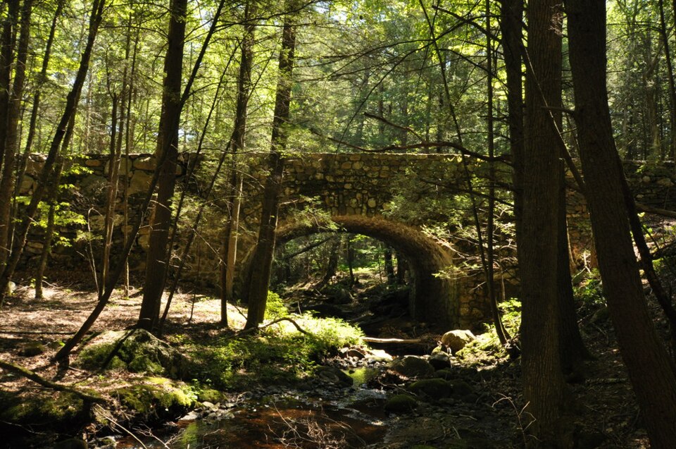
Listed on the National Register of Historic Places in 1993.
One of 124 National Register listings published here for Middlesex County · listed in 1993 · category: Structure.
Sources: the case file at the National Archives · the National Register database, National Park Service
The chapter on East Haddam Town in History of Middlesex County, Connecticut, with Biographical Sketches of Its Prominent Men, published 1884 names Millington. This is what it says, exactly as the scans read.
First, or Center District, 37 scholars; Second, or Landing, 79; Third, or Red Lane, 53; Fourth, or Uptown, 27; Fifth, or Bashan, 68; Sixth, or Town Hill, 19; Seventh, or Nicket Lane, 33; Eighth, or Leesvill-, 16; Ninth, or Moodus, 130; Tenth, or Millington Green, 31; Eleventh, or Plain, 2r; Twelfth, or Olmstead, 16; Thirteenth, or Foxtown, 8; Fourteenth, or Tater Hill, 18; Fifteenth, or Millington West, 19; Sixteenth, or Acby, 20; Seventeenth, or Hadlyme, 47; a total of 633.
Passage source: History of Middlesex County, Connecticut, with Biographical Sketches of Its Prominent Men, published 1884.
The other grave yards in East Haddam were laid out or commenced as follows: Old yard in Hadlyme, 1723; Long Pond yard, 1726; Moodus yard, 1748; Meeting House^yard, in Hadlyme, 1750; Bashan, 1760; "Tater Hill," 1760; Near Millington Green, 1764; Eight Mile River, 1769; Landing, 1773; Mt. Parnassus, 1774; Center Congregational Church, 1778; Wicket old accounts refer to periods when virulent diseases prevailed throughout the town, but of nothing very serious. Within a few years past malaria~has prevailed to some extent along the river, and, in fact, it has prevailed throughout the whole State. In 1775, there were ^^^^ 40 deaths in the town; in the year following, more than 50. The population of East Haddam in 1800 was 2,805. The total number of deaths in the town for 10 years after was 614, or an average of over 60 each year, being h much larger average of mortality than has existed since that time. In 1870, the population was but 2,952, or 147 more thsn it was at the beginning of the century. The number of deaths during the year ending June ist 1870 was 54, or an average of one in 55 persons. Twenty of these deaths were caufed by consumption, six by typhoid fever, and two were accidental. The other deaths resulted from diseases pertaining to childhood and old age. Twenty-two of the number were under 33 years of age, ii over 70; 7 over 80, and one over 90 years. Thus while two-fifths failed to reach the average of human life, more than one-third passed the three score years and ten allotted to man.
Passage source: History of Middlesex County, Connecticut, with Biographical Sketches of Its Prominent Men, published 1884.
Machine-read from a century-old scan, so expect the errors a machine makes: misspelled names, dropped words, stray characters.
Read the whole chapter on East Haddam Town - 43,998 words on its settlement, mills, schools and churches.
Regional context, not property-specific evidence. The federal wildfire occurrence database lists 112 fires within 5 miles of Bridge No. 1605 between 1992 and 2020, burning about 205 acres in total. None started naturally. 7 were recorded as arson. Distance is straight-line from the map coordinates, so a fire counted here may appear on a neighbouring settlement's page as well.
| Reported cause | Fires |
|---|---|
| Missing data/not specified/undetermined | 66 |
| Debris and open burning | 16 |
| Recreation and ceremony | 13 |
| Arson/incendiarism | 7 |
| Smoking | 4 |
| Power generation/transmission/distribution | 2 |
| Misuse of fire by a minor | 2 |
| Equipment and vehicle use | 1 |
| Fireworks | 1 |
The most recent of them, most recent first, with the day each was reported and the service that recorded it.
| Date | Cause | Size | Reported by | Name on the report |
|---|---|---|---|---|
| 5 September 2016 | Missing data/not specified/undetermined | under an acre | Connecticut Division of Forestry | 1 HONEY HILL LANE LYME |
| 2 September 2017 | Recreation and ceremony | under an acre | Connecticut Division of Forestry | 81 SCHULMAN VESELAK |
| 14 September 2009 | Recreation and ceremony | under an acre | Connecticut Division of Forestry | not named |
| 8 August 2016 | Missing data/not specified/undetermined | under an acre | Connecticut Division of Forestry | 430 WEST RD, SALEM CT |
| 22 August 2020 | Debris and open burning | under an acre | Connecticut Division of Forestry | WARNER ROAD |
| 2 August 2018 | Power generation/transmission/distribution | under an acre | Connecticut Division of Forestry | 100 JOSHUATOWN ROAD |
| 9 July 2016 | Debris and open burning | under an acre | Connecticut Division of Forestry | 31 BOGUE LANE EAST HADDAM |
| 26 July 2016 | Recreation and ceremony | under an acre | Connecticut Division of Forestry | 6 WARNER ROAD EAST HADDAM |
Regional context, not property-specific evidence. The federal mineral resources record lists 5 workings within 5 miles of Bridge No. 1605: 4 past producers, 1 producer. 1 still produces. What was taken out: Granite, Stone, Dimension, Stone. Distance is straight-line from the map coordinates, so a quarry counted here may appear on a neighbouring settlement's page as well.
| Where | Site | Commodity | Status | Recorded |
|---|---|---|---|---|
| Biotite Granitic Gneiss Rock Quarry No. Bj-014 | Stone | Producer | ||
| Quarry | Stone, Dimension | Past Producer | ||
| Biotite Granitic Gneiss Rock Quarry | Granite | Past Producer | ||
| Rattlesnake Quarry | Granite | Past Producer | Granite | |
| Rattlesnake Quarry | Granite | Past Producer |
Regional context, not property-specific evidence. The National Weather Service names Millington, the town this property stands in, in 1 storm report in 2020: 1 hail. No death or injury is recorded in these reports. Each account below is quoted exactly as the forecast office filed it, from the NOAA Storm Events Database, and each date opens the federal record of that event.
| When | Event | Place named | Harm | What the report says |
|---|---|---|---|---|
| August 2020 | Hail | Millington | - | no account filed |
No historic map-sheet match is published for this property yet. That does not mean no map exists. This record needs a coordinate-quality review before it can be joined to a sheet boundary. Browse the county's mapped places while that work is pending.
Other National Register properties close enough to walk or drive between, ordered by distance from this one. Both positions come from the same geocoding pass that matched these properties to their map sheets.
| Photograph | Property | Distance | Listed |
|---|---|---|---|
 | Bridge No. 1604 | 0.6 miles | 1993 |
 | Bridge No. 1603 | 1.1 miles | 1993 |
 | Millington Green Historic District | 1.6 miles | 1996 |
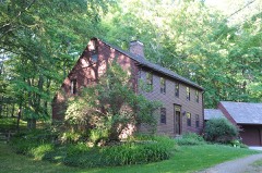 | Wickham Road Historic District | 3.2 miles | 1996 |
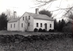 | Working Girls' Vacation Society Historic District | 3.5 miles | 1994 |
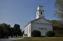 | Hadlyme North Historic District | 4.5 miles | 1988 |
| National Archives record | The nomination case file for reference 93000643 in Record Group 79. |
| Middlesex County | All 124 listed properties in this county. |