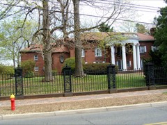
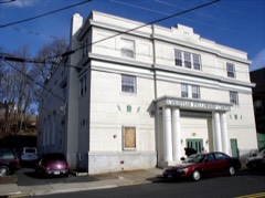
Listed on the National Register of Historic Places in 1993.
From the record
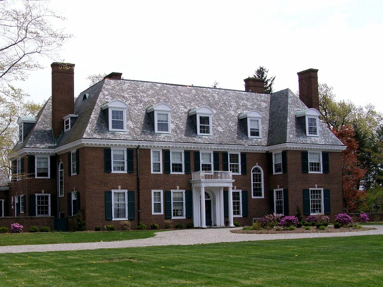
“Marlborough House is a historic private residence at 226 Grove Street in Bristol, Connecticut. Built in 1929 for a local businessman, it is a prominent local example of Georgian Revival architecture.”
Wikipedia article Marlborough House (Bristol, Connecticut), CC BY-SA 4.0.
One of 451 National Register listings published here for Hartford County · listed in 1993 · category: Building.
National Register reference number.93000906- the number the National Park Service assigned this property when it was listed, and the key its nomination file is catalogued under at the National Archives.
THE town of Bristol lies in the soutliAvestern part of Hartford County, touching Litchfield County on the west and New Haven on the southwest ; it is bounded north by Burlington, east by Farmington and Plainville, south by Southington and Wolcott, west by Plymouth. From 1806, when the Burlington parish w^as set off from this town, till 1875, when its symmetry was destroyed by the annexation to its territory of a single farm, formerly a part of Southington, it was exactly five miles square. In surface hilly, in soil rocky and somewhat unfertile, it has of necessity become a manufacturing rather than a farming town. With Fall Mountain for its southern boundary. Chippins (modernized form of Cochipianee's) Hill on the northwest, and Federal Hill occupying all the centre, there is left but a narrow valley, sloping down from the higlier land in Terryville to the eastward plains. Through this runs the Pequabuck River, furnishing power for most of tlie larger factories. On the plains, at the east side of the town, lies the village of Forestville, which has come to furnish an important part both of the population and of the business of the town.
This district of Poland was probably in tlie northeastern part of the present town of Bristol, and this record indicates a much greater antiquity to the name of Poland than has been generally ascribed to it. Popular tradition has supposed that the name, which now belongs to a little stream, Poland Brook, in East Bristol, was derived from the name of an Indian who lived upon its bank sixty years later than the date of this record. It may be sui)posed that " their farm at Paquabuck " lay within the present town of Plainville ; with the lapse oi time the name has been moved seven miles toward the west.
Regional context, not property-specific
evidence. The
federal wildfire occurrence database
lists 54 fires within 5 miles of Marlborough House
between 1994 and 2020, burning about 328 acres in total. None started naturally. 7 were recorded as arson.
Distance is straight-line from the map coordinates, so a fire counted
here may appear on a neighbouring settlement's page as well.
Reported cause
Fires
Missing data/not specified/undetermined
28
Misuse of fire by a minor
10
Arson/incendiarism
7
Recreation and ceremony
4
Debris and open burning
4
Smoking
1
The most recent of
them, most recent first, with the day each was reported and the service
that recorded it.
Regional context, not property-specific
evidence. The federal mineral resources record lists
34 workings within 5 miles of Marlborough House: 25 past producers, 6 producers, 2 unknowns, 1 occurrence.
6 still produce. What was taken out: Sand and Gravel, Construction, Stone, Dimension, Granite, Iron. Distance is straight-line from the
map coordinates, so a quarry counted here may appear on a neighbouring
settlement's page as well.
Regional context, not property-specific
evidence. The National Weather Service names
Bristol, the town this property stands in, in 23 storm reports between 1994 and 2023: 11 thunderstorm wind, 6 hail, 2 heavy rain, 2 flash flood.
The reports record 1 death. Each account below is quoted exactly as the forecast office
filed it, from the NOAA Storm Events Database, and each date
opens the federal record of that event.
Four to ten inches of heavy rain from Tropical Storm Irene resulted in the Pequabuck River overflowing its banks. This led to flooding on roads and homes along the river throughout Bristol. Flooded roads ran approximately three and a half feet deep. A 46 year old man went canoeing in floodwaters. He drowned when his canoe capsized and he was unable to make it to shore. At least 50 people were evacuated from areas around the river, and took shelter at Chippens Hill Middle School. The river flooding undermined at least 7 feet of Route 72 eastbound, washing out this portion of the road. Numerous houses and businesses were affected by the flooding. Forty high water rescues took place in Bristol.
A brief tornado touchdown occurred on the east side of Rockwell Park and had an intermittent damage path, mostly at the tree top level, to the end of High Street. Straight line winds appeared to be the main cause of damage in Bristol, however, damage from a small, brief tornado was also evident. Trees felled in different directions, tree tops twisted off, and shearing off of tree tops were the nature of tree damage viewed by NWS Storm Survey team members in the area of High and Blakeslee Streets. This is consistent with low end EF1 tornado damage. Damage was consistent with a maximum wind speed of about 90 mph. Numerous trees were downed, bringing down wires and power lines, as well as moving a garage off its foundation, blowing lawn furniture several houses down the street, and crushing an above ground pool. The Imagine Nation Museum which was very near the damage path recorded a wind gust of 67 mph on their anemometer.
In Bristol, boat rescues occurred at a small condominium complex on Main Street, along the Pequabuck River, which went out of its banks. Multiple additional roads were flooded due to the Pequabuck River.
No historic map-sheet match is published
for this property yet. That does not mean no map exists. This record needs
a coordinate-quality review before it can be joined to a sheet boundary.
Browse the county's mapped places while that work is
pending.
Listed places nearby
6 within 8 miles
Other National Register properties close
enough to walk or drive between, ordered by distance from this one. Both
positions come from the same geocoding pass that matched these properties
to their map sheets.
Listing record. National Park Service National Register of Historic Places, listed-properties dataset, current to 2026-05-22.
Map join. Address geocoded through the United States Census geocoder, then tested against the published boundary of every sheet in the USGS Historical Topographic Map Collection.
How this page is made. Listing fields come from federal records; map-sheet coverage is a labelled coordinate-to-boundary calculation, not a source-field claim.
Wildfire. Short, Karen C. 2022. Spatial wildfire occurrence data for the United States, 1992-2020 [FPA_FOD_20221014]. 6th Edition. Fort Collins, CO: Forest Service Research Data Archive. https://doi.org/10.2737/RDS-2013-0009.6 Collected with United States Government funding and usable without additional permissions or fees.
Mines and quarries. USGS Mineral Resources Data System (MRDS) https://mrdata.usgs.gov/mrds/ A work of the United States government, no copyright under 17 U.S.C. 105.
Storms. NOAA National Centers for Environmental Information, Storm Events Database https://www.ncei.noaa.gov/stormevents/ A work of the United States government, no copyright under 17 U.S.C. 105. Narratives are quoted verbatim from the National Weather Service report and are not edited or summarised.
 Block